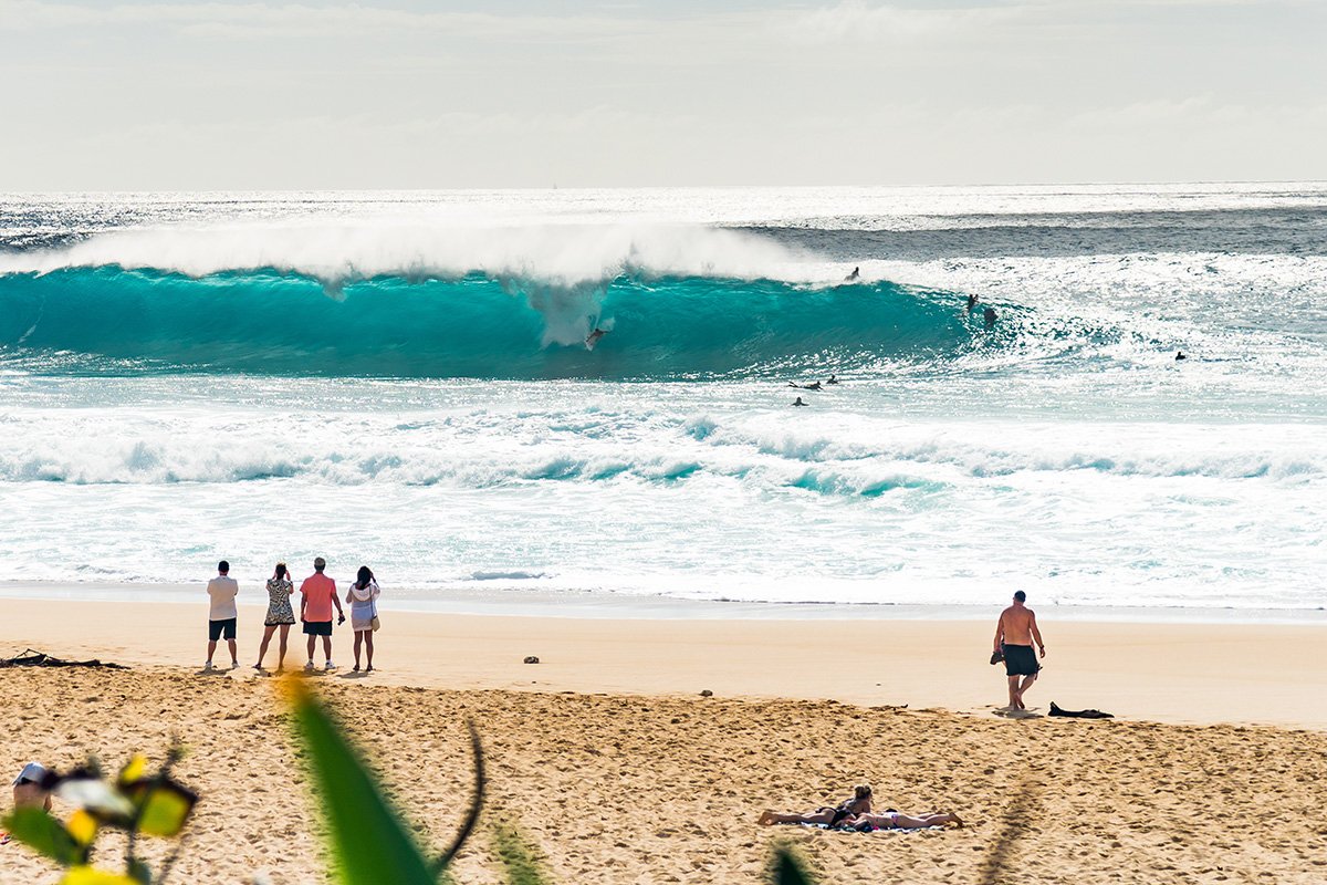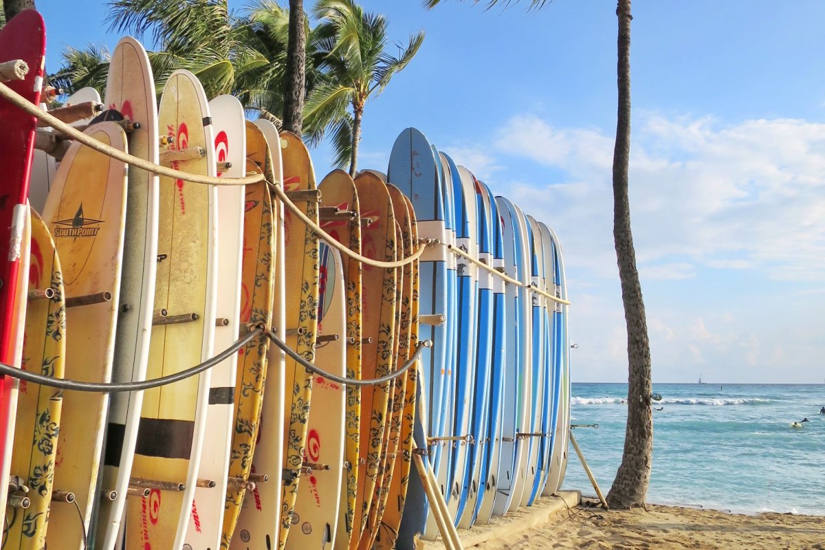

The north shores get the magazine covers in winter. In summer, the islands flip. Hawaii’s south shore surf season runs May through September, when storms thousands of miles south of the equator push swell north into south-facing coastlines that spend most of the year flat. Waikīkī Beach goes from glassy postcard to working surf zone. Ala Moana Bowls can fire for days at a stretch. Every south-facing coast comes alive, along with a few west-facing zones on the Big Island that catch the same energy. (Hawaiʻi Ocean Safety — Hawaii’s Surf Seasons) If you’re in Hawaiʻi this summer, the south swell rhythm is worth understanding even if you never plan to surf yourself. It changes which beaches are calm and which aren’t, when the morning swim window closes, where the photographers gather at sunset, and which hotel pools start looking like the safer call. The piece below is a watcher’s guide first and a surfer’s guide second.
Where summer swells actually come from
Winter surf in Hawaiʻi is a North Pacific story. Storms in the Gulf of Alaska generate the giant swells that close out Pipeline and pack Sunset Beach with pros. Summer is the mirror image. Storms in the southern hemisphere, particularly in the deep South Pacific between New Zealand and the Antarctic, send energy north across the equator. By the time those swells reach Hawaiʻi’s south shores, they have travelled 4,000 to 6,000 miles. (NWS Honolulu — Hawaii Surf Forecast) That distance changes what the waves feel like. South swells arrive in well-organized, long-period sets with sizable gaps between them. They are usually smaller than winter north swells but more consistent. The University of Hawaiʻi Sea Level Center’s Oahu surf climatology study pegs the typical south shore wave at about 5.5 feet on the face during the season, give or take a couple of feet. That is small by north shore standards and well within range for a competent surfer or attentive bodyboarder to find a fun ride. It is also more than enough to drown someone who doesn’t respect it. The other characteristic that matters: south swells often arrive without much warning at the beach itself. The water can look calm at 7 a.m. and be sending double-overhead sets through Bowls by mid-afternoon, because the swell doesn’t build through visible weather the way a winter cold front does. NWS Honolulu’s daily surf forecast and PacIOOS wave models are the right tools to check before any south-shore beach day in summer.
When south shore season peaks
South shore season runs roughly May through September, with the biggest pulses usually arriving in June, July, and August. Spring shoulder days in May can produce a few clean pulses, and September’s tail end often gives one or two solid swells before things go flat for fall. Predicting exact swell days more than a week or two out isn’t possible — the southern-hemisphere storms that generate them are still forming. What you can plan for is the seasonal window itself, and the events the islands schedule around it. Hawaiʻi Ocean Safety’s seasonal guide notes that any south-facing beach has heightened surf potential through this entire window. (Hawaiʻi Ocean Safety — Hawaii’s Surf Seasons) A few seasonal anchors land on most years’ calendar. The Hawaiʻi Adaptive Surfing Championships have typically run at Queen’s Surf Break in Waikīkī in late spring, drawing adaptive surfers from around the world; check the event’s current listing for confirmed 2026 dates. The summer’s signature event is Duke’s OceanFest, historically held over a ten-day stretch in mid-to-late August at Waikīkī’s Kūhiō Beach, with longboard heats, an ocean swim, paddle races, and a closing lei draping at the Duke Kahanamoku statue. If your trip overlaps either window, the south-shore vibe is dialed up — bigger crowds, more lifeguards on the sand, more cameras pointed at the lineup. The visitor takeaway: if you have flexibility in your itinerary, plan ocean activities that need calm water (snorkeling, beginner stand-up paddle, kids in shore breaks) for the first day or two of your stay before swells you can see in the forecast hit, and shift to beach-watching, snorkeling on a north-shore-facing reef, or a pool day on the big-swell days. South swells move through in pulses lasting several days, and the islands don’t all see them with the same intensity at the same time.
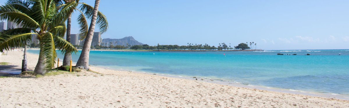
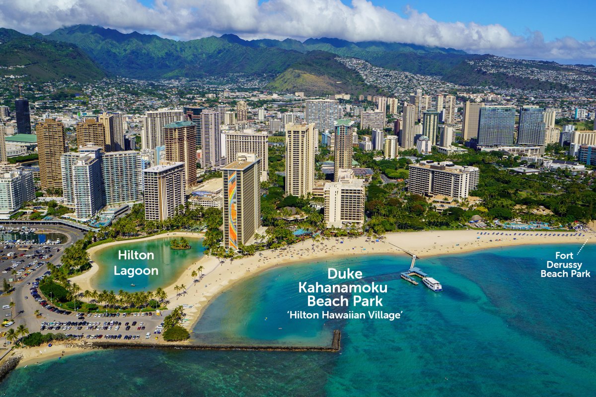
Ala Moana Beach Park sits between Waikīkī and downtown Honolulu, and the lineup just outside the breakwater — Ala Moana Bowls — is the south shore's most famous summer break.
Oʻahu — Waikīkī, Ala Moana Bowls, and the south shore's brand-name lineup
Oʻahu’s south shore is Hawaii’s most visible summer surf stage. Modern surfing took shape here in the early 1900s with Duke Kahanamoku and the Waikīkī beach boys, and that history still defines the longboard culture you see in the lineup today. The coast stretches from Diamond Head west through Waikīkī to Ala Moana and Kewalo Basin. A long string of named breaks sits inside that stretch, each with its own personality. Waikīkī’s beginner zone centers on Canoes and Queens, two reef breaks directly off Kūhiō Beach. The waves break gently over a sandy-bottom reef, the rides are long and slow, and the lineup is shared with hundreds of surf-school students every morning. Pops (just outside the Sheraton) is the longboarder’s hangout, with mellow rides over a sandy bottom that go forever. (Hawaiian South Shore — Surf Spot Guide) For visitors who want to actually try surfing, our piece on Hawaii surf lessons for beginners walks through which schools work and what a lesson costs. Ala Moana Bowls is what summer south swells were made for. The wave breaks just outside the Ala Wai Boat Harbor channel, throwing hollow, tubing rights that the magazines love. Bowls handles size better than most south-shore spots — it can hold double-overhead and still ride cleanly — and that makes it the gathering point on big days. It is decisively not a beginner break. The reef is shallow, the takeoff is sectiony, and the locals are protective of the lineup. Watch from the Magic Island side or from the grass at Ala Moana Beach Park; do not paddle out unless you actually surf at that level. Sandy Beach and Makapuʻu on the southeast corner of the island are the year-round shore-break theaters. Sandy in particular generates powerful, close-out shore-break waves that draw skilled bodyboarders and produce a steady stream of injuries. News reports and Ocean Safety warnings have long flagged Sandy Beach as one of the most dangerous beaches on the island for inexperienced swimmers. (Hawaii News Now — Sandy Beach safety) Visitors can park, watch the action, take their photos from the sand, and not go in. That is the right call. The lifeguards there make frequent rescues of people who guessed wrong about the size of the next wave.
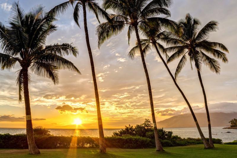
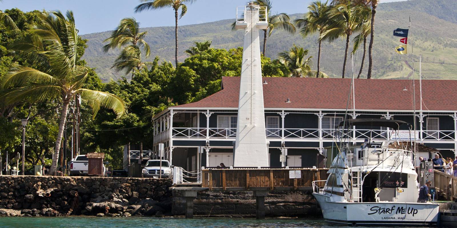
Charley Young Beach in Kīhei is the protected cove many Maui surf schools use for first-timers. The same coast lights up at Launiupoko and Olowalu when summer swells arrive.
Maui — West Maui's Launiupoko and Olowalu, plus the Kīhei coast
Maui’s south-facing coast is split between two zones. The west side runs from Lāhainā south through Launiupoko, Olowalu, and on to Mā’alaea. The south-central side runs through Kīhei and Wailea. Both light up in summer, but they have different rhythms. Launiupoko Beach Park, about 10 minutes south of Lāhainā town just past mile marker 18, is the family-friendly West Maui surf break. Long, slow, rolling waves that break both right and left over a sand-and-reef bottom. Exactly the shape that gets first-timers up on a board. Surf schools work this beach all summer. The grassy park behind the sand has bathrooms, showers, picnic tables, and shade trees, which makes a half-day trip with kids genuinely doable. (Pride of Maui — Beginner Surf Breaks) Launiupoko reopened to visitors after the August 2023 fires; for the broader picture of what’s open and not, our Lāhainā summer 2026 update walks through the current map. Olowalu, a few miles further south, runs even smaller and even mellower. It’s commonly recommended as a beginner spot for summer south swells. The break is a long way offshore over a shallow reef. Paddle out is a workout, and the wave is slow and forgiving when you get there. (Pride of Maui — Beginner Surf Breaks) The Cove at Charley Young Beach in Kīhei is the south-central counterpart. Small, protected, sandy bottom, easy paddle out. Most Kīhei surf schools operate here, and the same little cove is the right shape for kids on boogie boards on a moderate-swell afternoon. The geography of the cove filters out a lot of the energy from larger swells, which is why it stays usable for beginners on days when the more exposed breaks nearby are too big — though conditions still vary, so check the forecast and the lifeguards before you put a kid in the water. The advanced Maui breaks — places like Maʻalaea, La Pérouse, or the urchin-strewn outer reefs — are not what most visitors should be paying attention to. They are local breaks for experienced surfers, and most of them are dangerous to anyone without a board, a buddy, and a working knowledge of the spot.
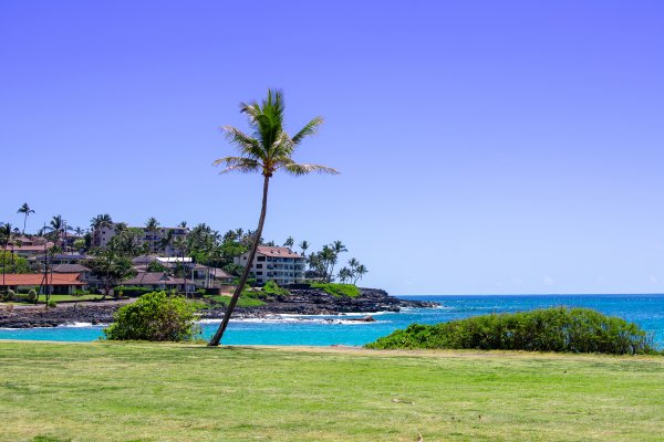
Pōʻipū Beach on Kauaʻi is the south-shore mirror to Waikīkī — a sand-bottom beginner zone inside the reef, with bigger sets reeling on the outside breaks.
Kauaʻi's south shore and Kona's west-facing surf
Kauaʻi’s south shore centers on Pōʻipū. The main beach is a sand-bottom beginner area inside the reef. Calm, shallow, and the right environment for first lessons. Outside the reef, summer south swells hit harder breaks like PK’s (in front of the Prince Kūhiō condos), Acid Drop (further out), and First Break. PK’s is intermediate-friendly. Acid Drop is not. The wave breaks shallow over urchin-coated reef, and locals will tell you so. For most visitors, Pōʻipū delivers the south-shore Kauaʻi experience without the stakes. Park at Pōʻipū Beach, watch the surf for an hour from the grass, see what the waves are doing on the outside reef, and decide from there whether you want to swim inside the protected zone or keep the day on the sand. The Big Island’s Kona coast faces west, not south, but it catches a softer slice of the same South Pacific energy when summer swells wrap around the island. That’s why it belongs in this guide. Kahaluʻu Beach Park, about five miles south of Kailua-Kona, is the de facto beginner break for this side of the island. The wave is small and the reef is well-mapped — Kahaluʻu’s snorkeling gets the headlines, but small, learnable surf rolls into the same bay through the summer months. Banyans, a short drive north along Aliʻi Drive, is the intermediate break. Pine Trees and Lymans are the locals-only spots; they’re worth driving past if you want to see what the regulars actually surf on. Big Island and Kauaʻi don’t get the swell magnitude of Oʻahu’s south shore on most summer days. But on the biggest pulses of June and August, they all come alive together, and the smaller crowds outside Waikīkī are part of the appeal.
What watchers should actually know before they get to the sand
Three things separate a satisfying south-swell day from a story you’d rather not tell. Lifeguards matter more than you think. Honolulu’s Ocean Safety division is the largest municipal lifeguard service in the United States, and the data is unambiguous: drownings happen far more often at unguarded beaches than at guarded ones. Hawaiʻi averages roughly 83 ocean drownings per year, and visitors make up more than half the victims despite being a fraction of the population. (Hawaii Department of Health — Ocean Safety Drowning Data) On a south-shore summer day with surf running, pick a beach with a lifeguard tower, and ask the lifeguards before you get in the water. They’ll tell you the truth. Currents on big swell days move where you don’t expect. South swells push water at the reef and the water comes back out somewhere — usually as a rip current that drains through a channel between break zones. At Sandy Beach, that rip is in the same place every time. At Waikīkī, it shifts depending on which break is firing. The general rule: if you’re not surfing, stay where you can stand, and if a current pulls you, swim parallel to shore until you’re out of it. Our piece on summer ocean safety in Hawaiʻi goes deeper on the mechanics. Photo spots are different from swimming spots. Some of the best summer-surf photography happens from places with no swimming access at all: the cliffs above Diamond Head, the Magic Island peninsula at sunset, the rocks at Sandy Beach. Plan to use those spots for the camera and a different beach for the swim.
The forecasting tools the locals actually use
Three sources cover the south-shore summer-surf bases. NWS Honolulu’s daily surf forecast is the official starting point. It posts twice a day and covers all the major coastline directions in feet, with the language of advisory and warning levels that drive lifeguard staffing decisions. If NWS is calling for “high surf” on the south-facing shores, treat that as the guide. PacIOOS — the Pacific Islands Ocean Observing System, based at the University of Hawaiʻi at Mānoa — publishes wave-model output and real-time buoy data for the islands. The Barbers Point buoy (CDIP 198) is a primary south-swell indicator for Oʻahu. PacIOOS data also feeds the “Surf Today” pill on every beach page on this site, which gives you a quick read for the specific spot you’re heading to. Surfline’s South Shore travel zone covers the surfer-facing read of the same data: break-by-break call, swell direction analysis, and webcams at most of the named lineups. It is paywalled at the premium tier, but the free tier covers most of what visitors need. Whichever source you pick, the variables that matter are swell direction and period. Long-period swells (16+ seconds) produce big, organized waves. Short-period swells (under 10 seconds) produce windy, choppy surf that doesn’t translate well to the beach. South-shore season is summer’s gift to the islands, and the days when the period stretches past 18 seconds are the ones the locals plan their week around.
Renting a car for south-shore days
A car helps for any south-shore tour beyond Waikīkī itself. The west Maui breaks string along Honoapiʻilani Highway south of Lāhainā town. Pōʻipū sits at the far end of Kauaʻi from Līhuʻe. Kahaluʻu is south of Kona’s main hotel strip. Discount Hawaii Car Rental is our affiliate partner. Their quoted Hawaii rates include the GET and CFC fees, so the on-screen price matches what you actually pay at the counter. (Discount Hawaii Car Rental FAQ) Compare against the airport counters before you book. For the south-shore Oʻahu loop in particular — Diamond Head to Sandy Beach to Makapuʻu to Waimānalo and back — a car earns its keep for half a day. You can chain four named breaks, three lookouts, and a windward lunch into a single circuit. The pullouts along Kalanianaʻole Highway during a big south swell put the lineup, the cliffs, and the open ocean in the same frame.
The bottom line
South-shore season in Hawaiʻi is shorter and quieter than the winter north-shore circus, and that’s part of why long-time visitors love it. The crowds spread out across four islands. The water is warm. The swells push for a few days, drop off, and push again. If your summer 2026 trip catches one of the bigger pulses, take a morning to do nothing but watch. Pick a beach, get there at sunrise, and see how the lineup fills in. It is one of the things this place does that no other place really matches. And when the swell drops, the south shores go right back to flat, glassy, postcard-perfect — which is the version most visitors picture when they book the trip in the first place.