
We may link to trusted Hawaiʻi resources at no extra cost to you.
Today’s Weather Brief · Audio · ~45s
0:00
0:54
Read the transcript
Trades are breezy right now with scattered showers on the windward side and mountains; the leeward coast stays mostly dry. Tomorrow stays breezy with the same pattern.
A tropical disturbance southeast of the islands is likely to become a tropical storm by mid-week and approach the state Thursday through Saturday. The exact track is still uncertain. If it comes closer, expect heavier rain over a longer stretch; if it stays farther out, impacts will be shorter and lighter. Winds will increase late this week, with potential gusts over 70 miles per hour on the highest summits.
Plan your leeward beach time and snorkeling for today through Tuesday. Save summit drives and offshore water sports for after Saturday, and check updates daily as this develops.
Created with AI from the official NWS forecast discussion · verify with NWS before heading out
--°
Loading…
--
Local sustained wind
--
Humidity
--
Today's Peak UV
--
–
--
Daylight
Temperature
Microclimate Conditions
Hawaii's mountains create dramatically different weather over short distances. Compare two representative visitor areas on the selected island; each card is a specific local point, not an islandwide reading.
Loading microclimate data…
Source: Open-Meteo model point estimates. Sustained wind and gusts are local, not islandwide observations; official watches and warnings take priority.
Live Weather Radar
Live precipitation radar from the National Weather Service. Start with the all-islands view, then zoom into a single island to see where rain is moving.
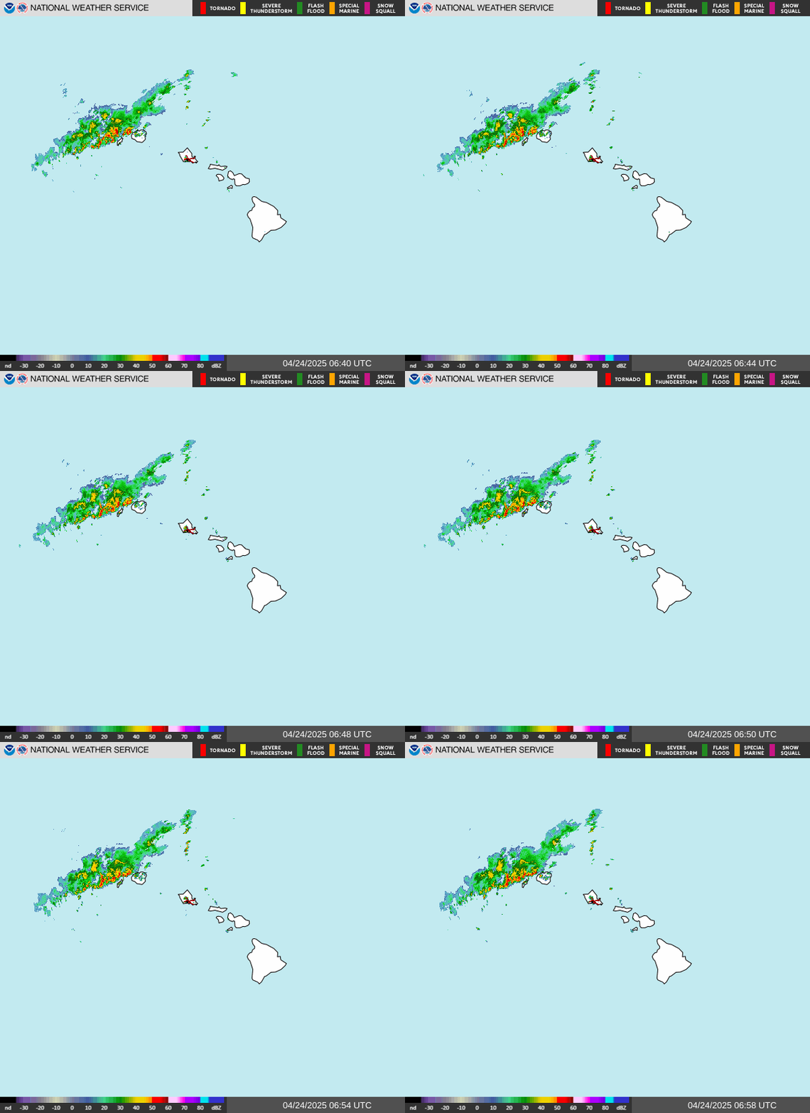
Showing: Hawaii regional composite (all islands)
Source: NOAA / National Weather Service. For zooming and panning, open the interactive NWS radar viewer.
7-Day Forecast
Loading forecast…
Source: Open-Meteo model forecast for the selected airport area. Each condition is the day's most severe modeled signal, which may be brief; it is not a whole-island forecast. Check NWS Honolulu for official watches and warnings.
What NWS Forecasters Are Watching
Plain-English summary. Created with AI from the official NWS Honolulu forecast discussion. AI can make mistakes — always double-check the official forecast before heading out.
Things to plan around
Good bet right now
Source: NWS Honolulu Area Forecast Discussion — rewritten in plain English with AI assistance.
What to Expect
Temperature
Average daytime temperatures at sea level are about 78°F in winter and 85°F in summer. Higher elevations (Haleakala, Mauna Kea) average about a 3.5°F drop per 1,000 feet. Summit temps can hit freezing in winter.
Rain Patterns
Rain is hyperlocal. It can pour in one valley while the beach a mile away stays dry. Windward slopes are generally much wetter than leeward coasts, but the difference varies sharply by island and elevation. Most showers are brief.
Trade Winds
Hawaii's prevailing northeast trade winds help keep the air comfortable. When trades die ("Kona weather"), humidity rises and skies can get hazy. Trades are generally strongest in summer.
Wet vs. Dry Season
November through April is generally wetter (with bigger surf on north shores), while May through October is generally drier. Both seasons are warm enough for the beach. With a strengthening El Niño in place for winter 2026–27, expect a drier-than-usual wet season — see our El Niño winter guide.
Island Weather Guides
Each island has its own microclimate personality. These guides cover precipitation maps, monthly climate data, and region-by-region breakdowns to help you pick the right area to stay.
Oahu Weather
Honolulu climate data, precipitation map, windward vs. leeward patterns
Maui Weather
Kahului averages, driest to wettest regions, Hana Highway rain tips
Big Island Weather
Kona vs. Hilo climates, diverse climate zones, vog conditions
Kauai Weather
Lihue averages, north vs. south shore rainfall, wettest spot on earth
Hawaii Weather Overview » — Climate patterns, hurricane season, and general travel guidance

Need help planning?
Search & Planning Chat →

Hawaiʻi Weather Forecast
Today’s Weather Brief · Audio · ~45s
0:00
0:54
Read the transcript
Trades are breezy right now with scattered showers on the windward side and mountains; the leeward coast stays mostly dry. Tomorrow stays breezy with the same pattern.
A tropical disturbance southeast of the islands is likely to become a tropical storm by mid-week and approach the state Thursday through Saturday. The exact track is still uncertain. If it comes closer, expect heavier rain over a longer stretch; if it stays farther out, impacts will be shorter and lighter. Winds will increase late this week, with potential gusts over 70 miles per hour on the highest summits.
Plan your leeward beach time and snorkeling for today through Tuesday. Save summit drives and offshore water sports for after Saturday, and check updates daily as this develops.
Created with AI from the official NWS forecast discussion · verify with NWS before heading out
Loading forecast…
Temperature
Weather data by Open-Meteo.com
Current Time in Hawaiʻi
--:----
Hawaiʻi Standard Time · UTC−10 · No Daylight Saving
You’re on Hawaiʻi timeMainland US
International
Aloha Today daily podcast →
Full HST breakdown, FAQ & DST schedule →

Get Your Free Hawaii Visitor Guide
Enter your email and we'll send you instant access to our free 2026 Hawaii Starter Guide + Summary Guidesheets.