

Today’s Weather Brief · Audio · ~45s
Read the transcript
Trades are breezy right now with scattered showers on the windward side and mountains; the leeward coast stays mostly dry. Tomorrow stays breezy with the same pattern.
A tropical disturbance southeast of the islands is likely to become a tropical storm by mid-week and approach the state Thursday through Saturday. The exact track is still uncertain. If it comes closer, expect heavier rain over a longer stretch; if it stays farther out, impacts will be shorter and lighter. Winds will increase late this week, with potential gusts over 70 miles per hour on the highest summits.
Plan your leeward beach time and snorkeling for today through Tuesday. Save summit drives and offshore water sports for after Saturday, and check updates daily as this develops.
Created with AI from the official NWS forecast discussion · verify with NWS before heading out
Current Honolulu Area Weather Snapshot
Microclimate Conditions
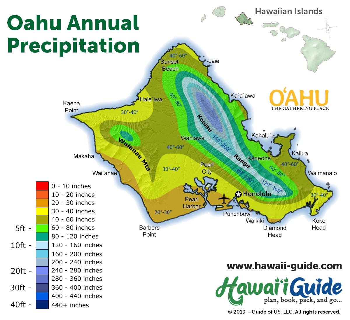
Oahu's Ko'olau mountains split the island into dramatically different microclimates. The windward (east) side around Kailua and Kaneohe gets more rain and cloud cover; the leeward (south/west) side around Honolulu and Waikiki stays drier and sunnier. Here's what each side looks like right now.
Source: Open-Meteo model point estimates. Sustained wind and gusts are local, not islandwide observations; official watches and warnings take priority.
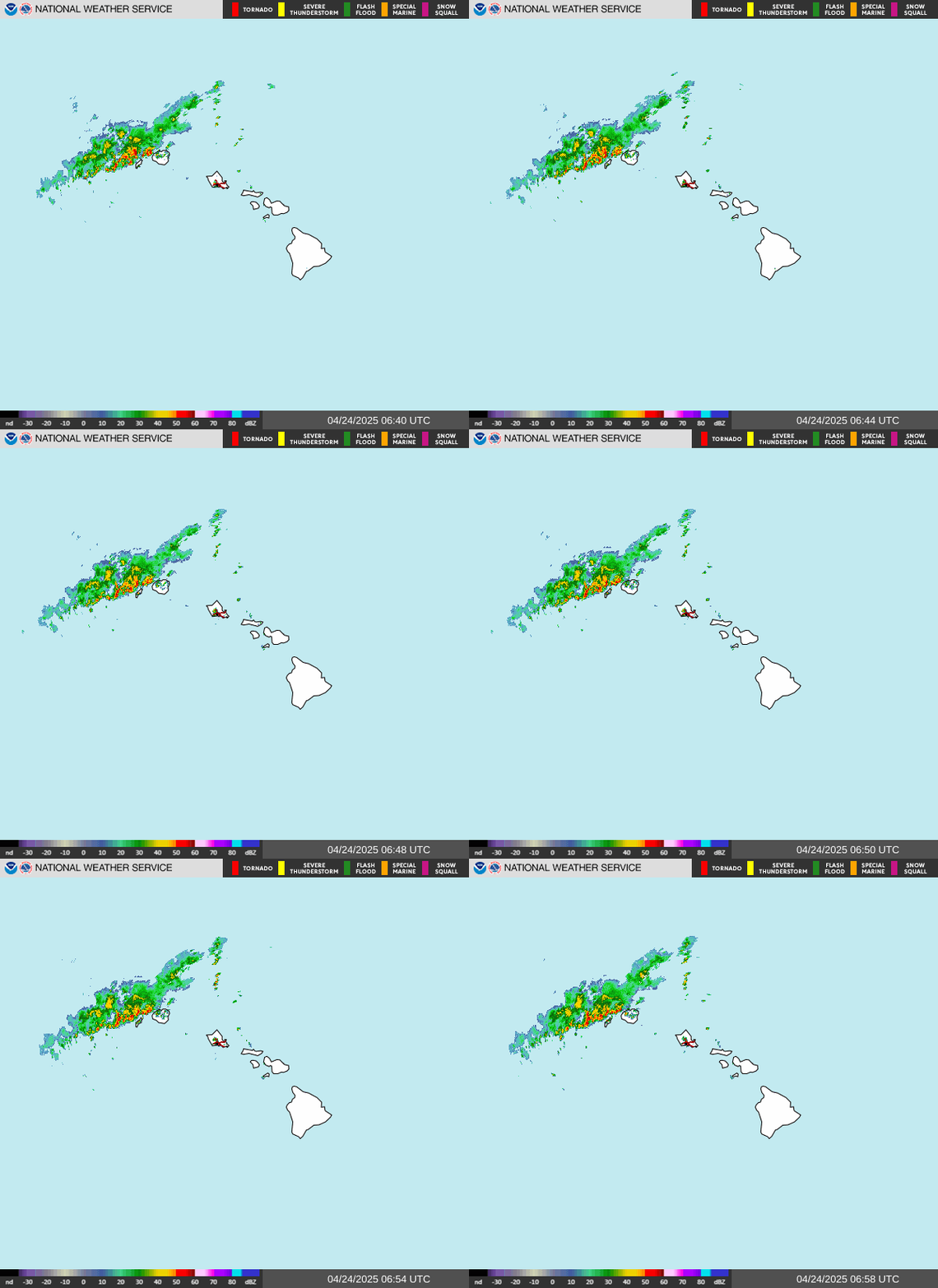
Live Weather Radar
Loading Oahu radar…
Source: NOAA / National Weather Service — loops show recent frames and refresh every 5 minutes. For zoom and pan controls, open the interactive NWS radar viewer.
7-Day Honolulu Area Forecast
Source: Open-Meteo model forecast for Honolulu (HNL). Each condition is the day's most severe modeled signal, which may be brief; it is not a whole-island forecast. Check NWS Honolulu for official watches and warnings.
Oahu Precipitation Map
Winter vs. Summer Weather
Oahu's weather varies with terrain and wind exposure. Windward slopes are generally wetter than leeward lowlands, and storm rain can affect either side. The National Weather Service recommends checking the weather forecast before leaving for outdoor trips.
That said, let's take a closer look at what the weather is like on Oahu, as this will help you decide where to stay during your vacation or trip. Our Where to Stay on Oahu article may also prove useful in helping you select a region, and for more information about when to visit the island, be sure to check out our When to Visit Oahu page.
The Honolulu and Waikiki accommodation areas are on Oahu's generally drier leeward side. The Honolulu airport normals below provide a nearby reference, not a rainfall figure for every hotel. Showers can be brief, but prolonged rain and flooding are also possible; do not assume rain will clear within minutes.
Get Your Free O'ahu Guide
Instant access — opens immediately
- Beaches, activities & top spots
- Restaurant & dining recommendations
- Maps, itineraries & insider tips
Want the full offline version? Get the Complete O'ahu Guidebook →
Average Oahu Temperature & Precipitation
Each month shows the normal daily high / low temperature and monthly precipitation at the named airport station. These are 1991–2020 climate averages, not forecasts or whole-island averages. Scroll across the table to see every month.
| Airport location | Jan | Feb | Mar | Apr | May | Jun | Jul | Aug | Sep | Oct | Nov | Dec |
|---|---|---|---|---|---|---|---|---|---|---|---|---|
| Honolulu, Oʻahu Airport station · USW00022521 |
80.5 / 66.8°F 1.84 in. | 80.5 / 67.1°F 1.94 in. | 81.2 / 68.1°F 2.36 in. | 83.1 / 70.1°F 0.77 in. | 84.8 / 71.5°F 0.82 in. | 86.9 / 73.8°F 0.50 in. | 88.1 / 75.1°F 0.52 in. | 88.8 / 75.6°F 0.84 in. | 88.4 / 74.8°F 0.88 in. | 86.9 / 73.9°F 1.51 in. | 84.1 / 71.8°F 2.25 in. | 81.8 / 69.2°F 2.18 in. |
Source: NOAA NCEI monthly normals, checked September 15, 2026 (UTC). Values retain NOAA's published precision. Rainfall and temperature can differ sharply elsewhere on each island. Use the current forecast and Travel Alerts for daily plans.
Honolulu, Oʻahu monthly climate normals
1991–2020 airport averages. Exact values and the NOAA source are in the table above.
High Low
Same rainfall scale for every airport
Oahu's windward slopes are generally wetter than its leeward lowlands. Winter fronts and Kona storms can bring heavy rain, while the northeast trade winds are generally more persistent in summer. These long-term patterns do not replace a forecast for your destination.
Hopefully you now have a good idea of what the weather is like on Oahu, and the map below should help you distinguish the wet from dry areas. It's really hard to select a "bad" area on Oahu, as each area is unique and beautiful in its own way. Hopefully, this information will help you decide the best region of Oahu to visit and when to go. Happy vacationing!
Storm planning for Oahu
Central Pacific hurricane season runs June 1 through November 30. Heavy rain and flooding can also occur outside that season, and a hurricane does not have to make landfall to disrupt a trip.
2026 context: Hawaii's September 8 response report documented Lowell-related power outages and road closures on Oahu, even though the storm's center passed to the west of Kauai.
Use Hurricane Alerts, Travel Alerts, and NWS Honolulu alongside this climate guide. Confirm access with the managing agency or your activity provider after a storm; improving weather alone does not mean roads, parks, trails, or ocean activities have reopened.
More information about Hawaii weather can be found within our Hawaii Weather and Climate Patterns article or on our new Hawaii Weather page.