
Hawaiʻi Guide · Audio Driving Tour
Coconut Coast Kauaʻi BETA
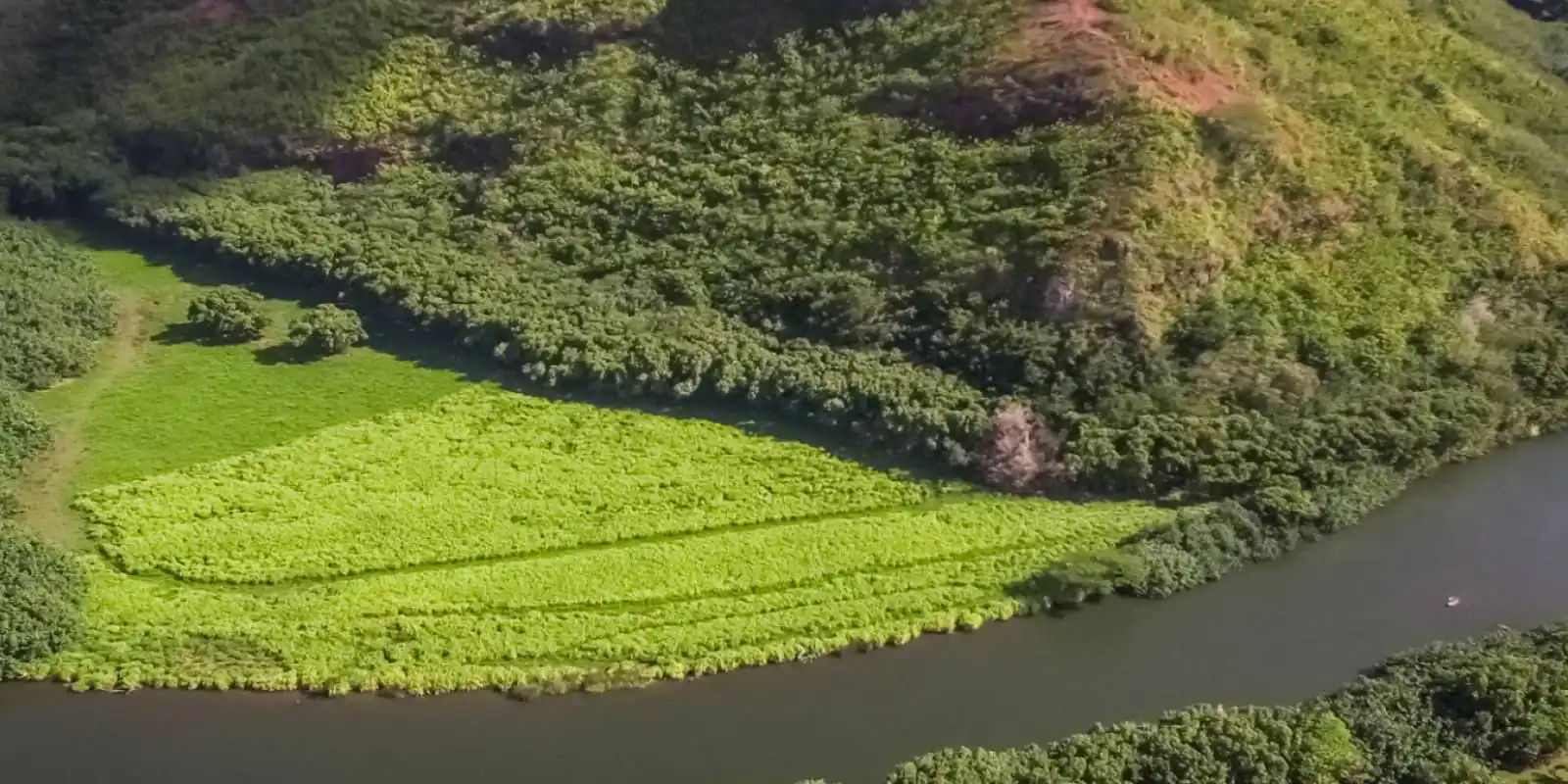
Kauaʻi's East Side — the sacred heart of the island around the Wailua River. Wailua Falls, the royal birthstones and heiau of old Wailua, the ʻŌpaekaʻa Falls overlook, the boat-only Fern Grotto, Lydgate's calm swimming ponds, and easygoing Kapaʻa town under the Sleeping Giant. More of old Hawaiʻi's sacred history than almost anywhere. Free self-guided audio tour.
16 miles
~35 min driving
6 curated stops
Free self-guided audio tour
~35 min
total driving time
16 mi
total distance
6 stops
curated stops
4-6h
suggested day
We may link to trusted Hawaiʻi resources at no extra cost to you.
Build your own route
Pick a preset or tap the ✓ Include chip on any stop below to customize.
6
of 6 stops selected
-
Intro
Intro
Show transcript
This is the Coconut Coast—the East Side of Kauaʻi, where the island's biggest river, the Wailua, meets the sea, and where ancient Hawaiʻi kept its sacred and royal heart. This was the seat of the aliʻi, the ruling chiefs; a whole complex of heiau—temples—and sacred stones lines the Wailua River, and you'll visit some of the most important ones in the islands. We'll start with a tall waterfall, climb a road past the royal sites and a second falls, then drop back to the coast for a swim and the easygoing town of Kapaʻa. A couple of things going in. This corridor is a hub with a few short inland spurs, so there's a little out-and-back driving—that's normal. The sacred sites here are real, living places, so the rule is hands off the stones and voices low; I'll remind you at each one. And two of the waterfalls are lookouts only—there are unofficial trails that have killed people, and we're not going near them. Alright—let's start up at Wailua Falls. -
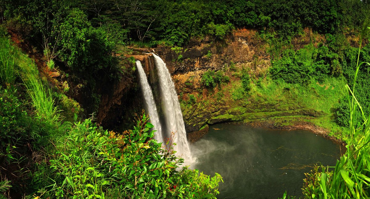
An 85-foot double-drop waterfall viewed from a roadside overlook at the top of Maʻalo Road. Lookout only — the unofficial trail to the base is dangerous and has been fatal.
Approach Cue (~12-15 sec)Show transcript
We're starting at the top of Maʻalo Road—Highway 583—which climbs a few miles inland off the main highway and dead-ends at the Wailua Falls overlook. It's an out-and-back, so we'll come right back down. As you pull in, head to the railed overlook for the view. Nonresidents pay a state park entry and parking fee at Wailua River State Park sites like Wailua Falls and ʻŌpaekaʻa, and payment is credit card only, so check the current rate before you go.Arrival Narration (~45-60 sec)Show transcript
Wailua Falls drops about eighty-five feet in a wide double cascade into a pool below—you may recognize it from the opening credits of the old Fantasy Island TV show. The view from this overlook is the stop. I want to be direct about the rest: there's an unofficial, unmaintained trail down to the base, and it is genuinely dangerous—steep, muddy, loose footing over a cliff. People have been seriously hurt there, and a hiker died after going below the lookout. The county has posted No Hiking, No Trespassing, and Danger signs in the area for a reason. So enjoy the falls from up here behind the rail, get your photo, then we'll head back down Maʻalo Road toward the river and the sacred sites. -
Connector · 56 17 min drive · 9 mi
Across the Sacred River
Show transcript
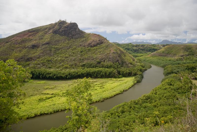
Back down Maʻalo Road and onto the main highway, we cross the Wailua River—the only navigable river in all of Hawaiʻi, and the spiritual center of old Kauaʻi. We're going to turn up Kuamoʻo Road, which climbs the north bank past a string of sacred sites. This whole area was Wailua Nui a Hoʻano—"great sacred Wailua"—and only the highest chiefs were allowed to live here. As we go up, keep in mind these aren't ruins to climb on; they're sacred to Hawaiians today. We'll take them one at a time. -
 17 min from previous stop · 9 miStop mauka
Holoholokū Heiau & Royal Birthstones
Holoholokū Heiau and the royal birthstones (Pōhaku Hoʻohānau), where aliʻi were born. A sacred, living site — hands off the stones, voices low.
Approach Cue (~12-15 sec)Show transcript
First stop up Kuamoʻo Road, a short way up on the left, is Holoholokū Heiau and the royal birthstones. Small parking area right there. Step quietly here—this is one of the most sacred spots on the island.Arrival Narration (~45-60 sec)Show transcript
This is Holoholokū, thought to be Kauaʻi's oldest heiau—temple—and beside it are the Pōhaku Hoʻohānau, the royal birthstones. For centuries, this is where the women of the highest chiefly families came to give birth, so that a child born here would carry the rank of an aliʻi; the piko, the umbilical cord, was placed at Pōhaku Piko nearby. These stones are still sacred to Native Hawaiians today, so the rule is simple: look, photograph respectfully, but don't climb on the walls, don't move or sit on the stones, and keep your voice down. You're standing in a birthplace of kings. Take it in, then we'll continue up the road. -
 1 min from previous stop · 1.2 mi
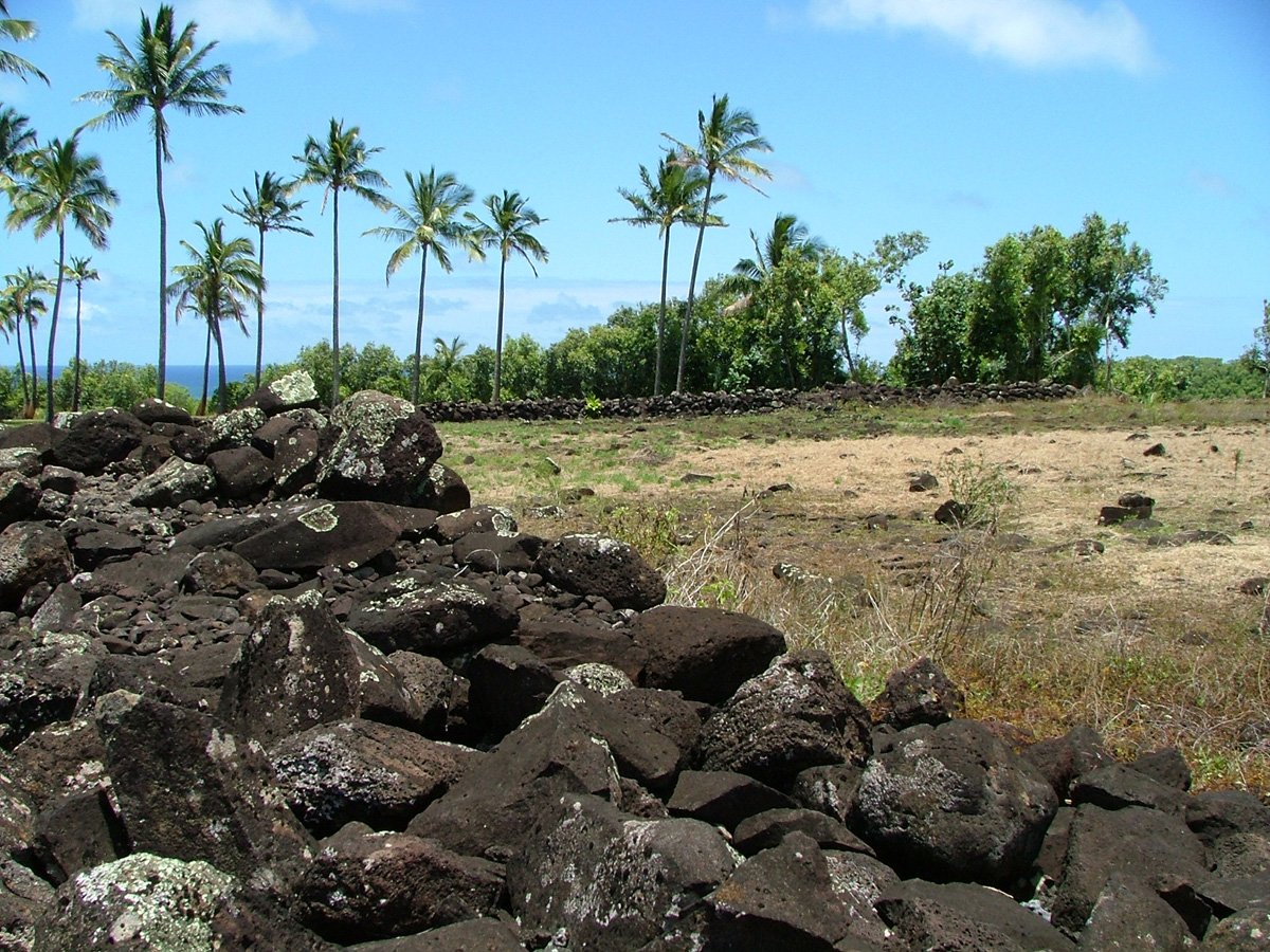
A large luakini (high) temple platform in an open clearing above the Wailua River, with a path toward old petroglyphs and the bellstone.
Approach Cue (~12-15 sec)Show transcript
Farther up Kuamoʻo Road, watch for Poliʻahu Heiau on the left—a large temple platform in an open clearing, with parking and a short walk in. Same respect applies here as below.Arrival Narration (~45-60 sec)Show transcript
Poliʻahu is a luakini heiau—the most powerful and sacred class of temple, used by the ruling chiefs for the most important rites. What survives is a big rectangular platform of stacked stones in a clearing, with a sweeping view over the Wailua River valley. A path leads downhill from near here toward old petroglyphs and the bellstone—a hollow boulder that, struck in the right place, rang out across the valley to announce a royal birth or sound a warning. As at every site along this road, this is sacred ground: don't walk on the heiau walls, don't strike or move the stones, and tread lightly. Then it's just a little farther to the falls. -
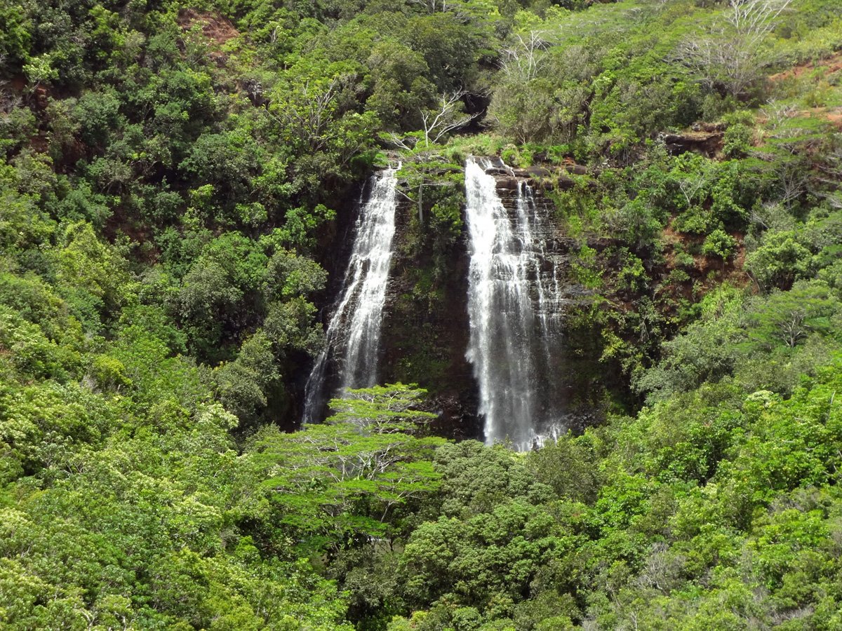 0 min from previous stop · 0.2 mi
A 150-foot falls viewed from a guardrailed pullout. Across Kuamoʻo Road, a second pullout overlooks the Wailua River valley. Stay behind the rail; the unofficial trail is closed and has been fatal.
Approach Cue (~12-15 sec)Show transcript
Just past Poliʻahu, a guardrailed pullout on the right gives you ʻŌpaekaʻa Falls. There's also a pullout across the road that looks over the Wailua River valley. Two safety notes before you stop, because both matter.Arrival Narration (~45-60 sec)Show transcript
ʻŌpaekaʻa Falls drops more than a hundred and fifty feet down a green cliff, and it flows year-round—best light is late morning. The name means "rolling shrimp," for the native shrimp that once tumbled in the stream. The falls overlook itself is completely safe, as long as you do one thing: stay behind the guardrail. There used to be an unofficial trail past the rail toward the falls, and two visitors died on it back in two thousand six—it's closed, there's no safe way down, so don't go looking for it. The second thing: the valley view is across Kuamoʻo Road, which is a real road with traffic, so if you want that view, cross slowly and carefully, looking both ways—or just enjoy the falls side. From here we head back down to the coast. -
Connector · 56 6 min drive · 3 mi
The River Mouth & Fern Grotto
Show transcript
Heading back down Kuamoʻo Road to the coast, we cross the Wailua River one more time. Down to your right, near the river mouth, is the Wailua Marina—the launch point for the boats up to the Fern Grotto. The grotto is a lava cave draped in hanging ferns, two miles up the river, and you can only reach it by boat. There's no road and no trail to it. If it calls to you, the Smith family runs the riverboat cruise from the marina, with live Hawaiian music on the way—book it as its own little outing. We're going to keep rolling up the coast to the beach and Kapaʻa town. -
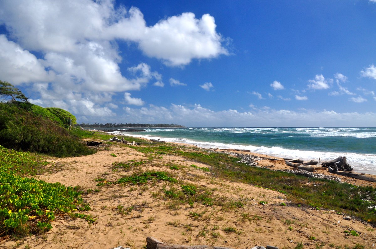 6 min from previous stop · 3 mi
Boulder-protected swimming ponds (the safest family swim on the East Side) at the Wailua River mouth, alongside the Hikinaakalā Heiau and the Hauola puʻuhonua (place of refuge).
Approach Cue (~12-15 sec)Show transcript
Just south of the river mouth, watch for Lydgate Beach Park—a great place to stop, with parking, restrooms, lifeguards, and a big playground. This is the easy, family-friendly beach break of the tour.Arrival Narration (~45-60 sec)Show transcript
Lydgate is built around two boulder-walled ocean ponds that break the surf, which makes it one of Kauaʻi's safest year-round places to swim and snorkel— gentle enough for little kids, with fish in the protected water. But it's also a deeply significant place. Right here at the river mouth stood Hikinaakalā Heiau—the name means "rising of the sun," and sunrise was traditionally welcomed here with chants and prayers—and the Hauola puʻuhonua, a place of refuge where someone who'd broken a sacred law could come to be spared. So you get a swim and a sacred site in one stop. Splash around in the ponds, then look for the markers explaining the heiau and the petroglyphs near the river. From here it's a short hop up to Kapaʻa. -
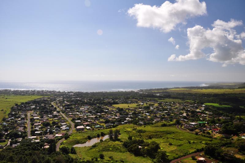 9 min from previous stop · 3.5 miStop makai
Kapaʻa Town
The walkable old plantation town that's the hub of the Coconut Coast — a restaurant-and-shop main street and the Ke Ala Hele Makalae coastal path. Nounou (Sleeping Giant) rises behind it.
Approach Cue (~12-15 sec)Show transcript
Last stop: Kapaʻa town. Park anywhere along the old main street and walk—it's the liveliest stretch on the East Side. And look mauka, toward the mountain: that long ridgeline that looks like a person lying on their back is Nounou, the Sleeping Giant.Arrival Narration (~45-60 sec)Show transcript
Kapaʻa is an old plantation town—it grew up around the pineapple canneries—and today its main street is the East Side's hub of restaurants, shops, and cafés, easy to wander on foot. The paved coastal path here, Ke Ala Hele Makalae, runs for miles along the shore if you want to walk or bike with an ocean view. Behind town stands Nounou, the Sleeping Giant; legend says a giant ate too much and lay down for a nap that never ended, and you really can pick out his head, chest, and belly along the ridge. There's a trail up him if you want to climb it another day—a couple of hours round trip with a big view at the top. I won't point you at one place to eat down here—the spots change and there are plenty— but this is a good place to end: park, wander, get something to eat, and let the Coconut Coast wind you down. -
Outro
Outro
Show transcript
That's the Coconut Coast—Wailua Falls, the royal heiau and birthstones, ʻŌpaekaʻa, the Fern Grotto river, Lydgate's calm ponds, and easygoing Kapaʻa under the Sleeping Giant. For a short drive, it holds more of old Hawaiʻi's sacred history than almost anywhere else in the islands. From Kapaʻa you can keep heading north toward Hanalei and the north shore, or turn back south toward Līhuʻe and the airport. Wherever you go next, carry a little of that respect for the river and its sites with you. Mahalo for riding along.
This tour is created with AI from HawaiiGuide route content and read by the computer-generated Mele and Kani voices. Hawaiian names and place names may occasionally be mispronounced — mahalo for your patience as we refine.

Need help planning?
Search & Planning Chat →

Hawaiʻi Weather Forecast
Today’s Weather Brief · Audio · ~45s
0:00
0:54
Read the transcript
Trades are breezy right now with scattered showers on the windward side and mountains; the leeward coast stays mostly dry. Tomorrow stays breezy with the same pattern.
A tropical disturbance southeast of the islands is likely to become a tropical storm by mid-week and approach the state Thursday through Saturday. The exact track is still uncertain. If it comes closer, expect heavier rain over a longer stretch; if it stays farther out, impacts will be shorter and lighter. Winds will increase late this week, with potential gusts over 70 miles per hour on the highest summits.
Plan your leeward beach time and snorkeling for today through Tuesday. Save summit drives and offshore water sports for after Saturday, and check updates daily as this develops.
Created with AI from the official NWS forecast discussion · verify with NWS before heading out
Loading forecast…
Temperature
Weather data by Open-Meteo.com
Current Time in Hawaiʻi
--:----
Hawaiʻi Standard Time · UTC−10 · No Daylight Saving
You’re on Hawaiʻi timeMainland US
International
Aloha Today daily podcast →
Full HST breakdown, FAQ & DST schedule →

Get Your Free Hawaii Visitor Guide
Enter your email and we'll send you instant access to our free 2026 Hawaii Starter Guide + Summary Guidesheets.