
Hawaiʻi Guide · Audio Driving Tour
Kauai North Shore Drive BETA
A ~20-mile North Shore drive from Kīlauea Town to the end of the road at Kēʻē Beach, with an optional Kīlauea Point Lighthouse spur before continuing west. Kīlauea Town, Kīlauea Lighthouse, Princeville, Hanalei Valley Overlook, Hanalei Bay, Lumahaʻi Beach, Hāʻena Beach Park, Tunnels Beach, Hāʻena State Park, and the trailhead for the Kalalau Trail above the Na Pali coast. The "must-do Kauai" pair next to Waimea Canyon. ~10 curated stops.
20 miles
~45 min driving
10 curated stops
Free self-guided audio tour
~45 min
total driving time
20 mi
total distance
10 stops
curated stops
6-8h
suggested day
We may link to trusted Hawaiʻi resources at no extra cost to you.
Build your own route
Pick a preset or tap the ✓ Include chip on any stop below to customize.
10
of 10 stops selected
-
Intro
Intro
Show transcript
The Kauaʻi North Shore run starts in Kīlauea and heads west along the highway toward Kēʻē Beach. Plan a full day if you want to swim, snorkel, or hike. Past Hanalei the road gets narrow—one lane each way, one-lane bridges. Yield to oncoming traffic, follow the five-cars-then-pull-over rule, and don't honk. Hāʻena State Park, at the end, requires an advance reservation for non-residents; $5 per person, $10 per vehicle, released thirty days out at gohaena.com and it sells out fast in summer. Bring a rain jacket—this side gets wet. Let's go. -
 560MILE23Stop · mile 23 mauka
Kīlauea Town
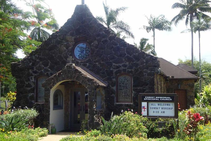
Kīlauea Town. Practical North Shore starting point near the Kolo Road / Kīlauea Road junction, with food, coffee, market stops, and the decision point for the Kīlauea Point Lighthouse spur before continuing west toward Princeville and Hanalei.
Approach Cue (~12-15 sec)Show transcript
Coming up on the mauka side in about half a mile—Kīlauea Town, right at the Kolo and Kīlauea Road junction. Grab coffee, food, or supplies here, then decide whether to swing makai to the lighthouse or continue west toward Hanalei and Princeville.Arrival Narration (~45-60 sec)Show transcript
You're at the junction where Kīlauea Road meets the highway, and this small town is your last cluster of coffee shops and supplies before the road quiets heading west. Kīlauea started as a plantation town, and that compact, practical character stuck around. If the lighthouse and wildlife refuge call to you, turn makai—toward the ocean—on Kīlauea Road. Otherwise, stay on Kūhiō Highway and continue west toward Princeville and Hanalei. Grab coffee now if you need it. The choice lands here, and what you pick shapes the next stretch of your drive. -
 6 min from previous stop · 1.6 mi560MILE22
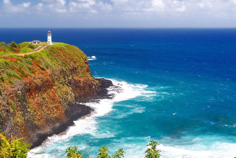
Kīlauea Point Lighthouse and National Wildlife Refuge. Optional makai spur from Kīlauea Town. $10/adult, USFWS site. Closed Sun-Mon. Excellent seabird viewing — albatross, red-footed boobies, frigatebirds, tropicbirds. Whale-watching Dec-Apr.
Approach Cue (~12-15 sec)Show transcript
Coming up on the makai side, shortly after Kīlauea Town—Kīlauea Point Lighthouse and Wildlife Refuge. Best seabird viewing on the island, and whales December through April. Ten dollars per adult, kids fifteen and under free. Closed Sundays and Mondays. Plan an hour if you stop.Arrival Narration (~45-60 sec)Show transcript
You're standing on a 200-foot bluff at the northernmost tip of Kauai—the wind here cuts sharp and clean, and if you look makai, toward the ocean, the water drops away hard beneath you. This is Kīlauea Point National Wildlife Refuge. What brings people here is the seabirds. Red-footed boobies nest in the trees. Laysan albatross wheel in from November through July. White-tailed and red-tailed tropicbirds circle overhead, and great frigatebirds with seven-foot wingspans ride the updrafts. Bring binoculars or grab a loaner at the entrance. From December through April, scan the water makai of the lighthouse for humpback whales—they come within a few hundred yards of the cliff. The gift shop has solid field guides. When you're done, head back to Kīlauea Town, rejoin Kūhiō Highway, and continue west toward Princeville. -
 17 min from previous stop · 8 mi560MILE28Stop · mile 28 mauka
Princeville
Princeville is a planned resort community on a bluff over Hanalei Bay. 1 Hotel Hanalei Bay (formerly Princeville Resort) is the flagship. Princeville Center has groceries, gas, restaurants. Last gas before Hanalei + the end-of-road.
Approach Cue (~12-15 sec)Show transcript
Coming up on the mauka side—Princeville, the resort community perched on the bluff above Hanalei Bay. Princeville Center is the shopping plaza on the highway with a grocery store, gas station, and restaurants. This is your last gas before the road ends, so grab fuel and supplies if you need them.Arrival Narration (~45-60 sec)Show transcript
You're standing on a bluff, and directly makai—toward the ocean—Hanalei Bay spreads out below you like someone laid it out on a grid. That's the view that sold Princeville when developers built this planned resort community in the late 1960s and 70s. What makes this place odd is the contrast. Mauka, toward the mountain, you've got manicured condos, golf courses, and 1 Hotel Hanalei Bay—the old Princeville Resort, rebranded in 2022 after a multi-year renovation. Down in Hanalei across the bay, the local town has a completely different character. The bluff here has the best sunset view on this stretch of the North Shore; if you're staying overnight, the lanai-view is genuinely the postcard. For a quick stop, hit Princeville Center for gas, water, and bathrooms. This is your last gas before Hanalei and the road's end. Hanalei town is three miles ahead and six hundred feet down. -
 4 min from previous stop · 1.8 mi560MILE28.5
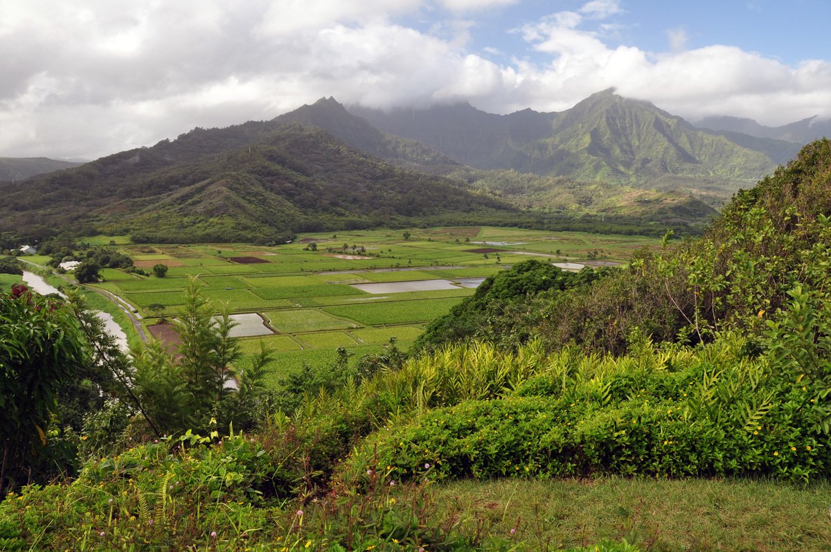
Hanalei Valley Overlook / Hanalei NWR Viewpoint. One of Kauai's best inland views: taro fields, Hanalei River, waterfalls, and endangered waterbird habitat. The newer Hanalei NWR Viewpoint is the safer, more formal public viewing area; current public hours are Tue-Sat.
Approach Cue (~12-15 sec)Show transcript
Coming up on the mauka side—Hanalei Valley Overlook, right before the road drops toward the one-lane bridge. This is the view people remember from the North Shore: taro fields, the Hanalei River, green cliffs, and waterfalls. Stop here if the weather's clear.Arrival Narration (~45-60 sec)Show transcript
See that patchwork of flooded rectangles below you? Those are loʻi kalo—taro fields—still actively farmed and central to Hanalei's food culture. This valley floor protects endangered native waterbirds as part of the Hanalei National Wildlife Refuge. You won't wander down there; visit from up here at the overlook or at the newer Hanalei NWR Viewpoint near Princeville. Bring binoculars if you have them. Hawaiian stilts, coots, ducks, and moorhens do appear below, though they're small at this distance. Spend five to ten minutes here, then head makai—toward the ocean—and you'll drop straight into Hanalei Bay. -
 7 min from previous stop · 2.8 mi560MILE31
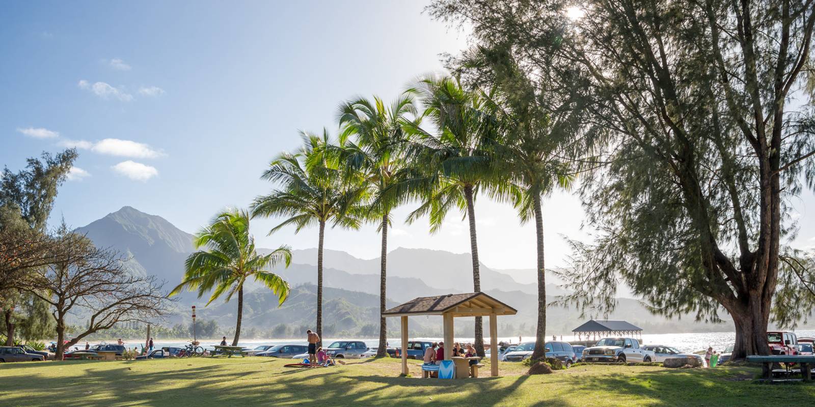
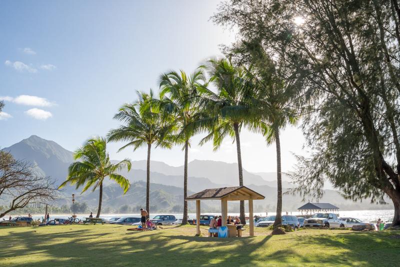
Hanalei Bay is a 2-mile crescent. Hanalei Pier (1892) at the east end, Black Pot Beach Park beside it, then Hanalei Beach Park, ending at Wai`oli Beach Park. Mountains rise 4,000 ft directly behind. Calm summer, big surf winter.
Approach Cue (~12-15 sec)Show transcript
Coming up makai in about half a mile—Hanalei Bay. Two-mile crescent of sand with 4,000-foot mountains rising straight behind it. Calm in summer, big surf in winter. Black Pot Beach Park and the Hanalei Pier are at the east end, Hanalei Beach Park is the central access, and Wai`oli Beach Park anchors the west end.Arrival Narration (~45-60 sec)Show transcript
The sand here spreads two miles in a perfect crescent, and the water right now tells you what season it is — glassy and turquoise in summer, or lumpy with the north swells that roll in come winter. Those mountains rising straight up mauka, toward the mountain, are the same Na Pali range that towers over Waimea Canyon if you've driven that rim. You're just seeing it from the opposite flank. The Hanalei Pier at the east end goes back to 1892, when it loaded rice from the valley onto steamers. It's been hammered by hurricanes and rebuilt, and it's now a photographed landmark on the island. The pier sits next to Black Pot Beach Park, where you can find SUP and yoga rentals. Hanalei Beach Park and Wai'oli Beach Park stretch along the rest of the curve. If the water looks flat and calm, this is one of the best swimming spots around. If it's rough and rolling, you're watching a serious winter swell — beautiful, but only for experienced surfers. The town of Hanalei sits just inland if you want food or coffee after. -
 1 min from previous stop · 0.3 mi560MILE31.5Stop · mile 31.5 mauka
Hanalei Town
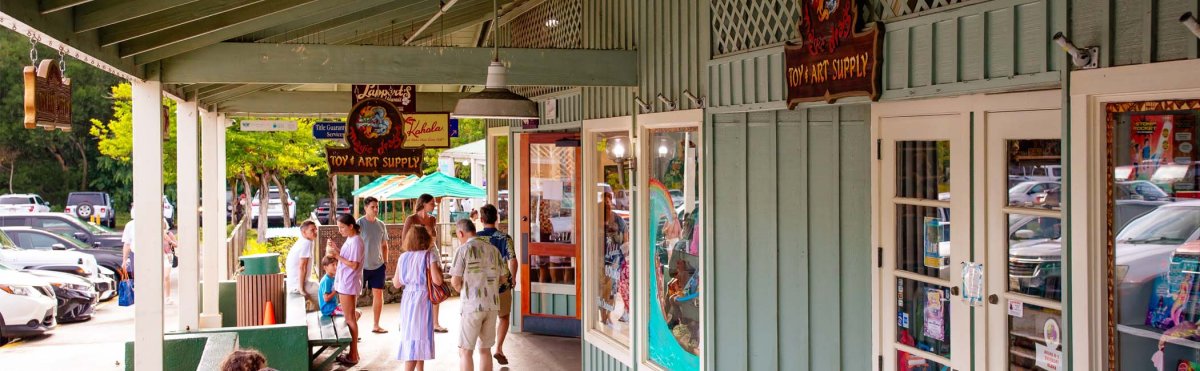
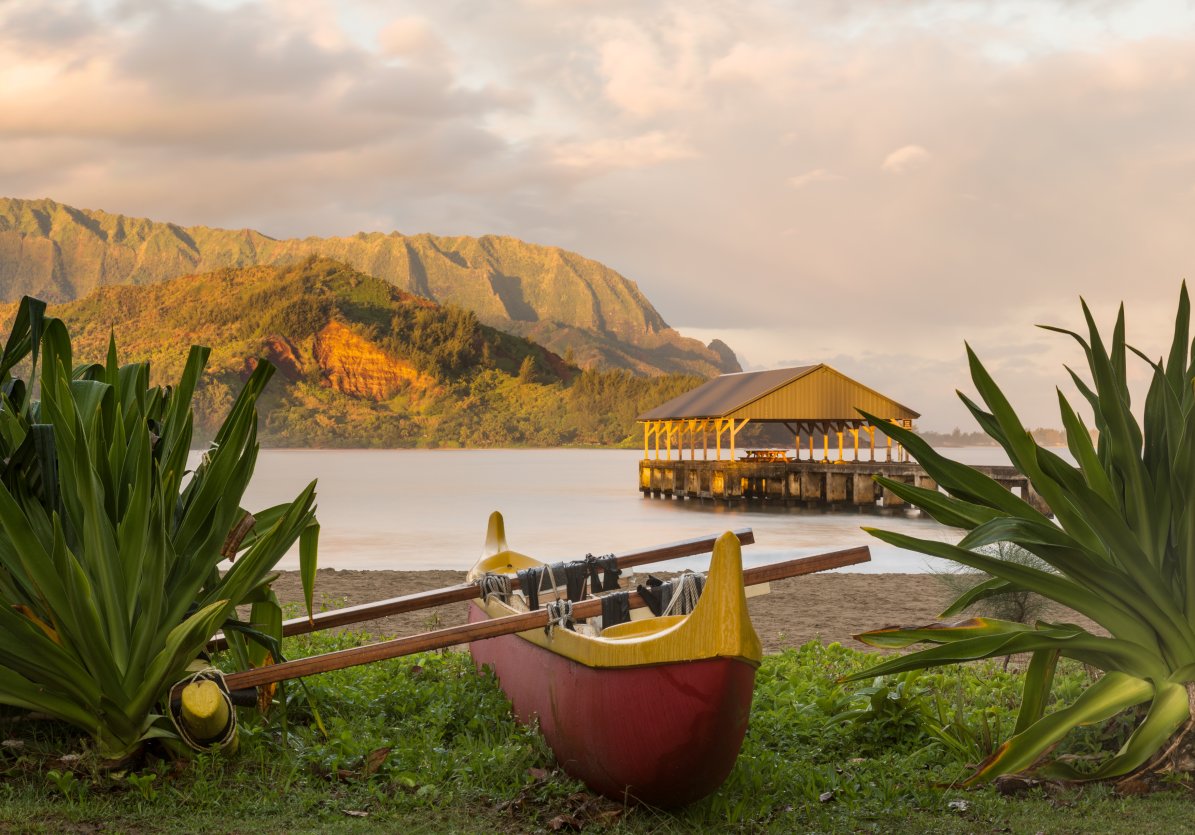
Hanalei town. Founded as a rice-and-taro valley settlement. Now a tightly-packed strip of restaurants, shops, and surf gear. Hanalei Bridge (one-lane, west end) is a famous traffic-shaper.
Approach Cue (~12-15 sec)Show transcript
Coming up on the mauka side in about half a mile—Hanalei town, a tight one-block strip of restaurants, shops, and a grocery. Park wherever you can find a spot and walk the whole thing. Try Hanalei Bread Company for breakfast, Bar Acuda for tapas in the evening, the Dolphin for fish, or Hanalei Taro for poi-and-kalua-pork plate lunch. Ching Young Village shopping center is the grocery anchor.Arrival Narration (~45-60 sec)Show transcript
The valley behind this strip of storefronts is filled with dark-green taro patches — loʻi, toward the mountain — farmed continuously for over 800 years. Those flooded fields aren't decorative. They grow taro for poi, the Hawaiian staple starch, and the National Wildlife Refuge protects them as critical habitat for endangered native birds like the Hawaiian stilt and koloa duck. The town itself has restaurants, a bread company, surf shops, a shave-ice spot. Walkable, unpretentious. Just past town sits the one-lane Hanalei Bridge, built deliberately as a traffic-throttle to keep the North Shore from sprawling. Yield to oncoming cars there. The next beach stop, Lumahaʻi, is a short drive west. -
 8 min from previous stop · 3 mi560MILE33.5
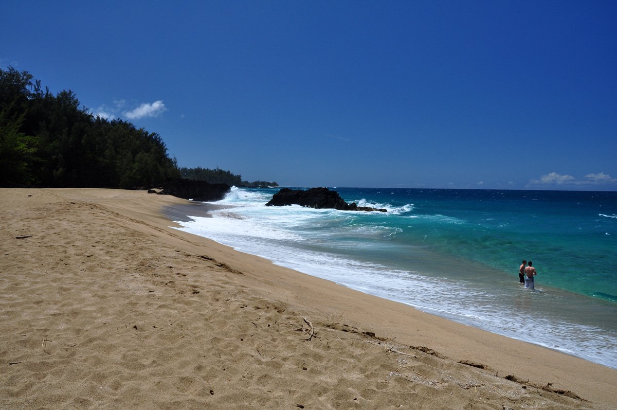
Lumahaʻi Beach. Wide, photogenic North Shore beach famous from South Pacific; no lifeguard, no reef protection, heavy shorebreak and strong currents. Best treated as a photo and beach-walk stop, not a casual swimming stop.
Approach Cue (~12-15 sec)Show transcript
Coming up on the makai side—Lumahaʻi Beach, the wide North Shore crescent where they filmed South Pacific. It's beautiful for photos and beach walks, but skip swimming here. No lifeguard, no reef protection, and the shorebreak is much stronger than it looks from the road.Arrival Narration (~45-60 sec)Show transcript
Look makai — toward the ocean — and you're seeing the wide sand and hard break that made this beach famous in South Pacific. The postcard view is real, especially from the eastern end near Kahalahala. The beach drops steeply, waves break hard on the sand, and rip currents pull straight offshore. No lifeguard, no reef to soften the hit. Walk the shoreline, take the overlook photo, and watch how the sets change. This is the wild stretch of the North Shore between Hanalei and Hāʻena—unprotected and powerful. If the water is moving with any force, stay out of it. Linger on the sand, then move on. -
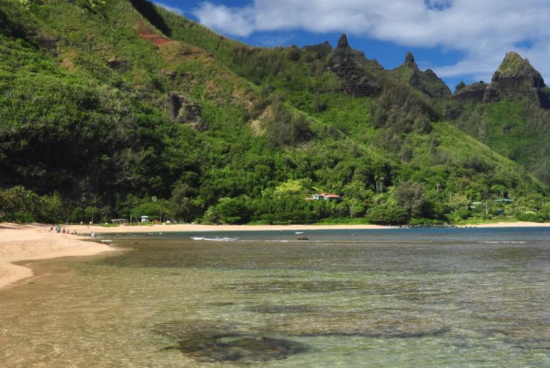 7 min from previous stop · 2.6 mi560MILE36
Tunnels Beach (Makua Beach). Best snorkeling on the North Shore in summer (May-Sep). Outside reef has lava-tube swim-throughs at depth — divers' spot. Lethal in winter swell. Parking limited; closest access is around the small beach-access lanes near mile marker 8, with Haʻena Beach Park as the practical parking fallback.
Approach Cue (~12-15 sec)Show transcript
Coming up on the makai side—Tunnels Beach, or Makua. The snorkeling is solid in summer months, May through September. Parking is tight at the small access lanes near mile marker 8. If they're full, head to Hāʻena Beach Park and walk back along the sand.Arrival Narration (~45-60 sec)Show transcript
You're looking at a reef that bends light into shifting blue-green patches—that's the inner reef where snorkelers stay. The outer reef, makai (toward the ocean), has lava tubes carved through it, ancient tunnels that divers can swim through at depth. It's named for those tubes, and they're why the reef structure here is more complex than most beaches on Kauai. Yellow tangs, butterflyfish, parrotfish, sometimes a honu move through these reefs. But only come here in summer, May through September. October to April, the swell funnels through the reef channels and creates lethal rip currents. The offshore wind makes it look calm at the sand line, which is exactly why people misjudge it. There's no lifeguard here. If the conditions feel bigger than you want to handle, don't enter. The beach itself—the walk on the sand, the waves, the cliffs behind—is worth the stop. Hāʻena Beach Park, just west of here, is the closest lifeguarded setting if you need one. -
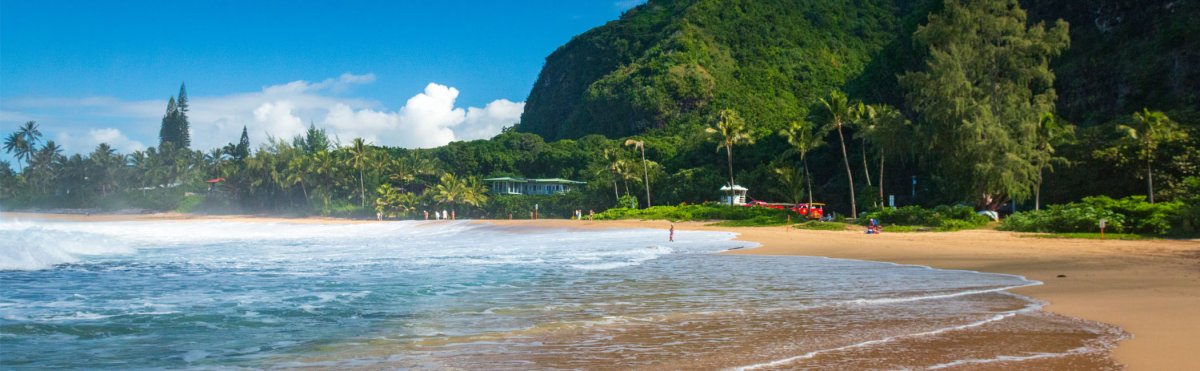 3 min from previous stop · 0.7 mi560MILE35.5
Hāʻena Beach Park. County beach park at Maniniholo Bay with views toward Mount Makana and nearby Tunnels. Lifeguards and facilities make it a practical North Shore stop after Tunnels, but winter surf and currents can be dangerous.
Approach Cue (~12-15 sec)Show transcript
Coming up on the makai side—Hāʻena Beach Park. Sand, facilities, lifeguards, and views toward Mount Makana. Winter surf and currents can get serious here, so check the lifeguard flags before you go in.Arrival Narration (~45-60 sec)Show transcript
You can see Mount Makana rising mauka—toward the mountain—that distinctive profile the old films made famous. This is a real beach park with lifeguards and facilities, which sets it apart on the North Shore. Tunnels is right there, closer to the road's end, but it has no lifeguard and almost nowhere to park. You can stretch, use the restrooms, watch the ocean, and actually decide whether Tunnels is worth the walk. Summer mornings tend calm and clear. Winter brings heavy surf and currents that lifeguards take seriously—treat it as a view unless they say otherwise. Linger as long as feels right, then decide what comes next. -
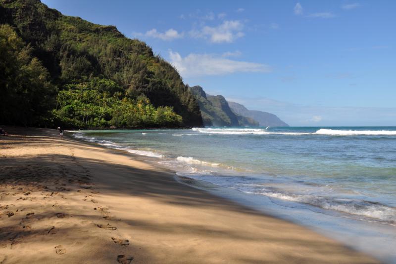 4 min from previous stop · 0.9 mi560MILE38
Hāʻena State Park / Kēʻē Beach. Reservation REQUIRED for non-residents — gohaena.com, $5/person + $10/vehicle, released 30 days out, sells out summer. Walk-in or shuttle from Hanalei available. Lifeguarded, calm summer cove, lethal winter swell. Trailhead for Kalalau Trail.
Approach Cue (~12-15 sec)Show transcript
Coming up on the makai side—Hāʻena State Park and Kēʻē Beach. Non-residents need an advance reservation from gohaena.com: $5 per person, $10 per vehicle, released 30 days ahead. Without one, you'll be turned away at the gate. The North Shore Shuttle from Princeville is $35 round trip and requires no reservation.Arrival Narration (~45-60 sec)Show transcript
You can hear the reef break against the shore here—that's the whole reason this cove stays calm. You're at Hāʻena State Park, the actual end of the road on the North Shore, and Kēʻē Beach is that small protected pocket of water makai, toward the ocean, right at the parking area's edge. In summer this place is glassy and reef-protected, with lifeguards watching and excellent reef fish populations for snorkeling. Winter flips the switch entirely—the surf fills the cove and the water becomes unsafe. Check the lifeguard flag: yellow means caution, red means stay out. The Kalalau Trail starts at the back of the lot, marked by a wooden sign. Day hikers can push two miles to Hanakāpīʻai Beach, another two up the side stream to Hanakāpīʻai Falls. The trail is muddy, root-choked, serious. Bring water, wear shoes you don't mind ruining, and skip swimming at Hanakāpīʻai; the rip currents there have killed people. Even the first quarter mile gives you cliffs dropping straight into turquoise and sea caves opening along the coast. -
Outro
Outro
Show transcript
You just drove to the end of the road. From Kīlauea Town up through Princeville, Hanalei Valley, Hanalei Bay, Lumahaʻi, Hāʻena, Tunnels, and out to Kēʻē Beach where the pavement stops. If you went to the lighthouse, you stood at the northernmost point of the main Hawaiian Islands. The only way back is the way you came—there's no road around the rest of the island from here. If you have time tomorrow, Waimea Canyon is the other must-do on Kauai. Opposite end of the island, dramatically different landscape, same sense of driving to the end of the road.
This tour is created with AI from HawaiiGuide route content and read by the computer-generated Mele and Kani voices. Hawaiian names and place names may occasionally be mispronounced — mahalo for your patience as we refine.

Need help planning?
Search & Planning Chat →

Hawaiʻi Weather Forecast
Today’s Weather Brief · Audio · ~45s
0:00
0:54
Read the transcript
Trades are breezy right now with scattered showers on the windward side and mountains; the leeward coast stays mostly dry. Tomorrow stays breezy with the same pattern.
A tropical disturbance southeast of the islands is likely to become a tropical storm by mid-week and approach the state Thursday through Saturday. The exact track is still uncertain. If it comes closer, expect heavier rain over a longer stretch; if it stays farther out, impacts will be shorter and lighter. Winds will increase late this week, with potential gusts over 70 miles per hour on the highest summits.
Plan your leeward beach time and snorkeling for today through Tuesday. Save summit drives and offshore water sports for after Saturday, and check updates daily as this develops.
Created with AI from the official NWS forecast discussion · verify with NWS before heading out
Loading forecast…
Temperature
Weather data by Open-Meteo.com
Current Time in Hawaiʻi
--:----
Hawaiʻi Standard Time · UTC−10 · No Daylight Saving
You’re on Hawaiʻi timeMainland US
International
Aloha Today daily podcast →
Full HST breakdown, FAQ & DST schedule →

Get Your Free Hawaii Visitor Guide
Enter your email and we'll send you instant access to our free 2026 Hawaii Starter Guide + Summary Guidesheets.