
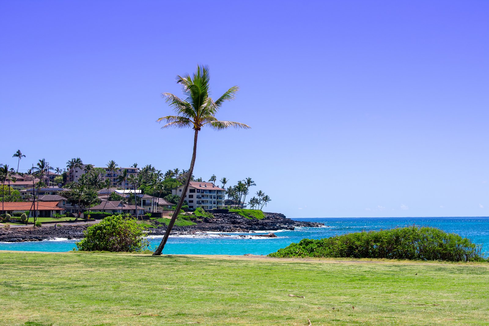
Hawaiʻi Guide · Audio Driving Tour
South Shore Kauaʻi BETA
Kauaʻi's sunny south shore, the Tree Tunnel to the wild coast at Māhāʻulepū. The mile-long eucalyptus canopy, Old Kōloa Town where Hawaiian sugar began, the Spouting Horn blowhole, Prince Kūhiō's birthplace, the easy Poʻipū beaches with their resident monk seals, and the raw cliffs at the end of the road. A short, stop-heavy drive. Free self-guided audio tour.
12 miles
~34 min driving
8 curated stops
Free self-guided audio tour
~34 min
total driving time
12 mi
total distance
8 stops
curated stops
4-6h
suggested day
We may link to trusted Hawaiʻi resources at no extra cost to you.
Build your own route
Pick a preset or tap the ✓ Include chip on any stop below to customize.
8
of 8 stops selected
-
Intro
Intro
Show transcript
Welcome to the south shore of Kauaʻi—the sunny side, where the island keeps its calmest water, its first plantation town, and a coastline that runs from manicured resort beaches to genuinely wild in the space of a few miles. We're starting at the famous Tree Tunnel and working down through Old Kōloa Town, out to the Spouting Horn blowhole, along the Poʻipū beaches, and finishing at the untamed cliffs of Māhāʻulepū. It's a short drive—under twenty miles end to end—so the time goes into the stops, not the road. Two things worth knowing up front. First, this is monk seal country; you'll likely see one asleep on the sand, and there are rules for that we'll get into. Second, if a botanical garden is on your list, the Allerton and McBryde gardens down here are spectacular, but book ahead. Allerton is guided-tour only; McBryde has self-guided and guided options, and both use the visitor-center shuttle. Treat the gardens as their own half-day, not a drive-by. Alright—let's drop into the Tree Tunnel. -
Stop mauka
Maluhia Road Tree Tunnel
A mile-long eucalyptus canopy over Maluhia Road (Highway 520) — the iconic gateway to Kauaʻi's south shore, traditionally credited to rancher Walter McBryde in 1911.
Approach Cue (~12-15 sec)Show transcript
Turn onto Maluhia Road—Highway 520—off the main highway, and watch the light change as the trees close in overhead. This is the Tree Tunnel. There's no stopping inside it; it's narrow and two-way, so ease off the gas and just drive through with your eyes up.Arrival Narration (~45-60 sec)Show transcript
You're driving through about a mile of eucalyptus planted more than a century ago—trees traditionally credited to rancher Walter McBryde back in 1911—arching together into a green tunnel over the road. It's one of the most photographed stretches of pavement on Kauaʻi. It's taken hits over the years; hurricanes thinned the canopy and it's been replanted since, but it has filled back in. Think of it as the island's front door to the south shore: you go in on the highway and come out in plantation country, with Kōloa town just ahead. -
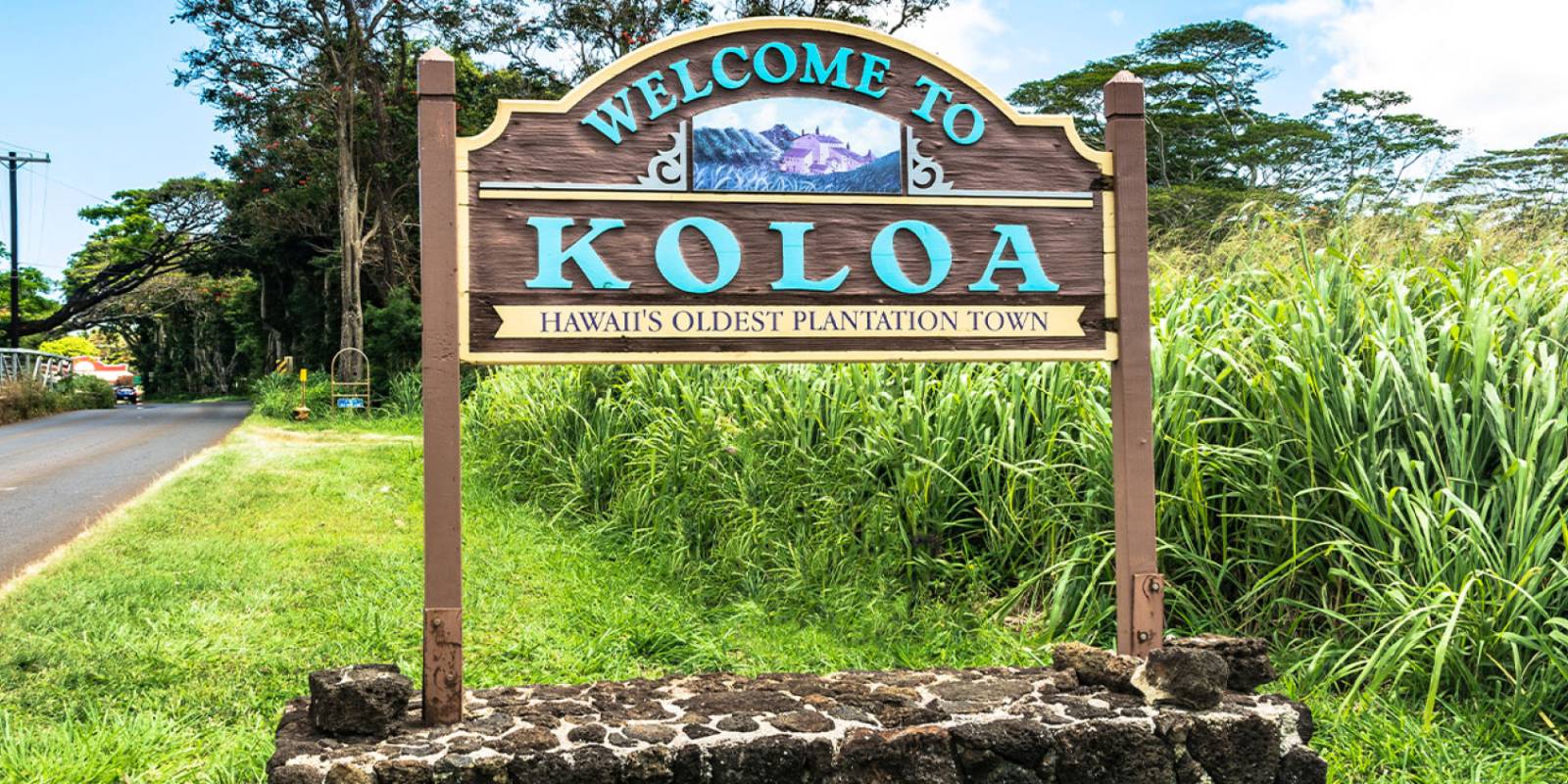 6 min from previous stop · 3.4 mi
Hawaiʻi's first sugar-plantation town, where the industry began in 1835 — now a restored, walkable historic main street and the hub of the Kōloa Heritage Trail.
Approach Cue (~12-15 sec)Show transcript
Old Kōloa Town is just ahead. There's parking along the main street and behind the storefronts. If you've got time, this is a get-out-and-walk stop—the old plantation buildings are restored and the street is an easy stroll.Arrival Narration (~45-60 sec)Show transcript
Kōloa is where Hawaiʻi's sugar industry began, back in 1835—the first successful plantation in the islands, which makes this small town the start of a chapter that reshaped Hawaiʻi for the next century and a half. The working mill is long gone, but its stone-chimney monument stands just east of town, and the old storefronts have been restored into shops and restaurants under their plantation facades, shaded by a big monkeypod tree. This is also the spine of the Kōloa Heritage Trail, a self-guided route of fourteen marked sites around the south shore. I won't point you at one place to eat—spots change hands down here—but it's a good place to grab something before the coast, where services thin out. -
Connector · 520 10 min drive · 3.4 mi
Down to the Coast & the Lāwaʻi Road Spur
Show transcript
From Kōloa the road drops the last couple of miles down to the water and the resort coast at Poʻipū. We're going to take a quick detour first—a spur west along Lāwaʻi Road to the Spouting Horn. It's a there-and-back: we'll drive out to the blowhole at the end of the road, then catch Prince Kūhiō Park on the way back before settling into the Poʻipū beaches. Keep an eye out along here— this is where the ocean really opens up in front of you. -
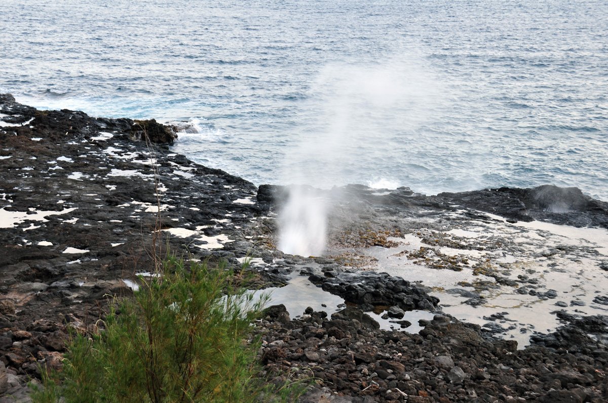 10 min from previous stop · 3.4 mi
A lava-tube blowhole on the Poʻipū coast that jets seawater up to ~50 feet at the right tide, with a low moan from a second vent. Fenced lookout — stay behind the railing.
Approach Cue (~12-15 sec)Show transcript
Spouting Horn is at the end of Lāwaʻi Road, with a dedicated lookout, parking, and usually a few vendor stalls. As you walk up to the rail, one thing matters above all: stay behind it. Do not climb down onto the lava bench for a photo.Arrival Narration (~45-60 sec)Show transcript
Watch the lava shelf below and you'll see why this is the most popular stop on the south shore—waves push into a lava tube and the pressure fires a plume of seawater up through the rock, sometimes fifty feet or more, with a deep moan from a second hole nearby. Hawaiian legend ties that sound to a giant moʻo, a lizard spirit, trapped in the tube. Now the part that matters more than the photo: the wet bench below is dangerous—a surge can sweep you into the blowhole or out to sea. The fence is there for a reason. Watch the show from behind it—the view's better from up here anyway—and then we'll head back east, catching Prince Kūhiō Park on the way. -
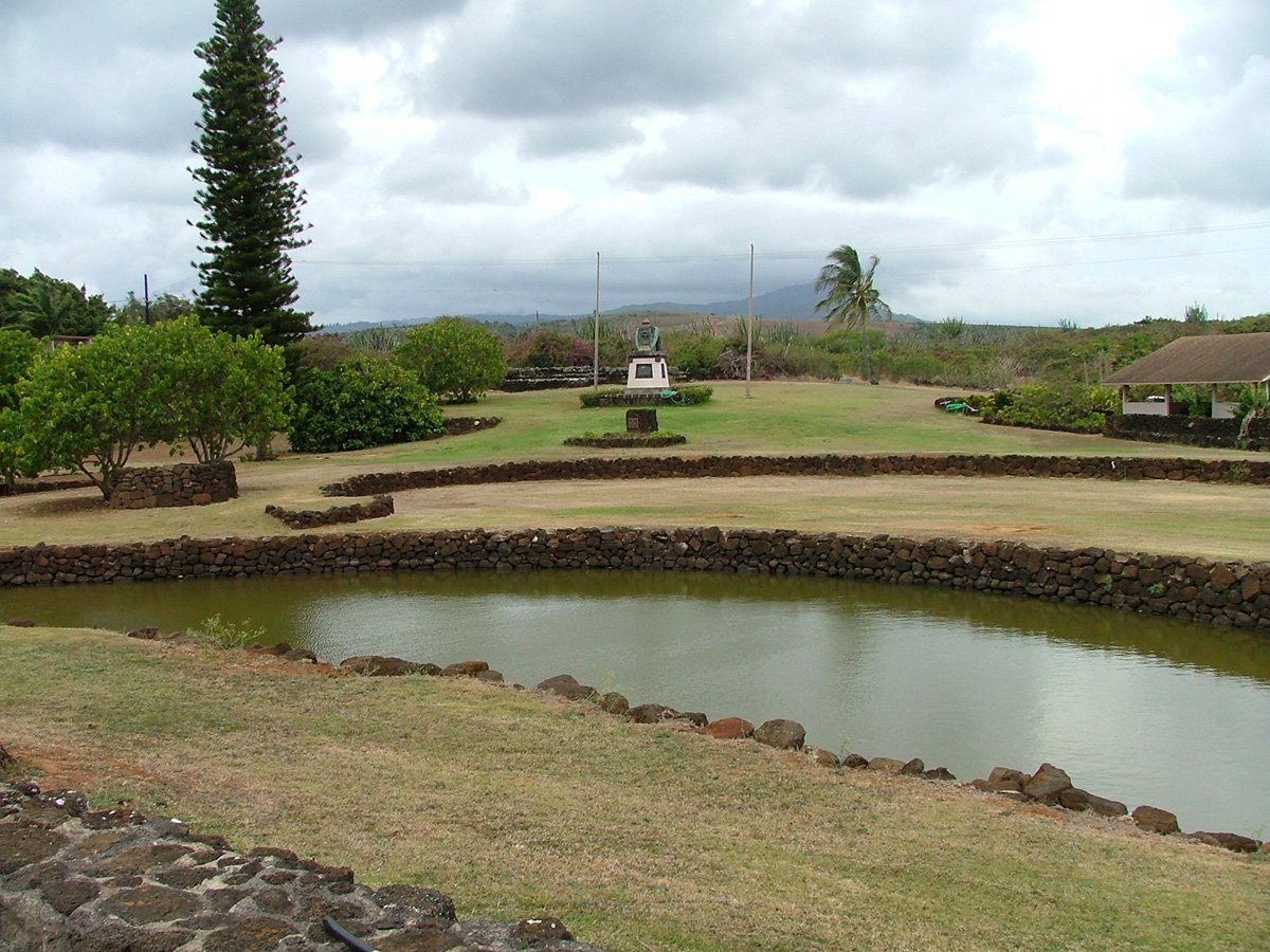 11 min from previous stop · 3.6 mi
The birthplace of Prince Jonah Kūhiō Kalanianaʻole — "the People's Prince" — a quiet memorial park with a fishpond and the remains of Hōʻai Heiau on Hōʻai Bay.
Approach Cue (~12-15 sec)Show transcript
On the way back in along Lāwaʻi Road, watch makai—toward the water—for Prince Kūhiō Park. It's a small, quiet roadside park, easy to miss, with parking right there.Arrival Narration (~45-60 sec)Show transcript
This is the birthplace of Prince Jonah Kūhiō Kalanianaʻole, born here in 1871. After the overthrow of the Hawaiian Kingdom, Kūhiō served as Hawaiʻi's delegate to the U.S. Congress for nearly twenty years, and he pushed through the Hawaiian Homes Commission Act, which set aside land for Native Hawaiians—work that earned him the name Ke Aliʻi Makaʻāinana, the People's Prince. The park is low-key on purpose: a memorial, a fishpond, and the stacked-stone remains of Hōʻai Heiau on the little bay. It's a quiet, respectful breather between the drama of the blowhole and the beaches ahead. His birthday, March twenty-sixth, is a state holiday in Hawaiʻi. -
Connector · 520 9 min drive · 3.6 mi
Into the Poʻipū Beach Core
Show transcript
Back on Poʻipū Road now, heading into the heart of the resort coast. The next few stops sit close together—you could walk between them—so this is more of a park-once-and-stroll stretch than a drive. And this is monk seal country in earnest, so before we hit the sand, let's talk about the seals you're likely to meet, because there are real rules. -
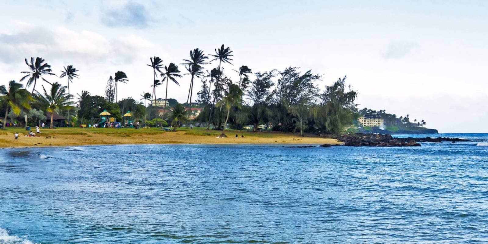 9 min from previous stop · 3.6 mi
The south shore's signature family beach — a protected swimming cove, a sandbar tombolo, reliable snorkeling, and lifeguards. Hawaiian monk seals regularly haul out here; federally protected, keep your distance.
Approach Cue (~12-15 sec)Show transcript
Poʻipū Beach Park is coming up, with a parking lot, restrooms, and lifeguards— the natural base for this whole stretch. It fills up, especially midday, so take the first spot you find and walk.Arrival Narration (~45-60 sec)Show transcript
Poʻipū is the all-around south shore beach: a sandbar reaches out to a small point and splits the water into a calm, shallow side that's gentle enough for little kids and an open side with good snorkeling along the rocks. Lifeguards, showers, shade, the works. Now the important part. This is one of the most reliable places in Hawaiʻi to see a Hawaiian monk seal—there are only around sixteen hundred of them left on Earth, and they like to haul out and sleep right here on the sand. They are federally protected. If one's on the beach, give it room: stay at least fifty feet back, and a hundred and fifty feet if it's a mother with a pup. Don't touch it, don't feed it, don't get between it and the water, and don't wake it for a photo. If a seal looks sick or tangled, call the NOAA marine wildlife hotline—eight-eight-eight, two-five-six, nine-eight-four-zero. Volunteers often rope off a resting seal; just give it space and enjoy a genuinely rare sight. -
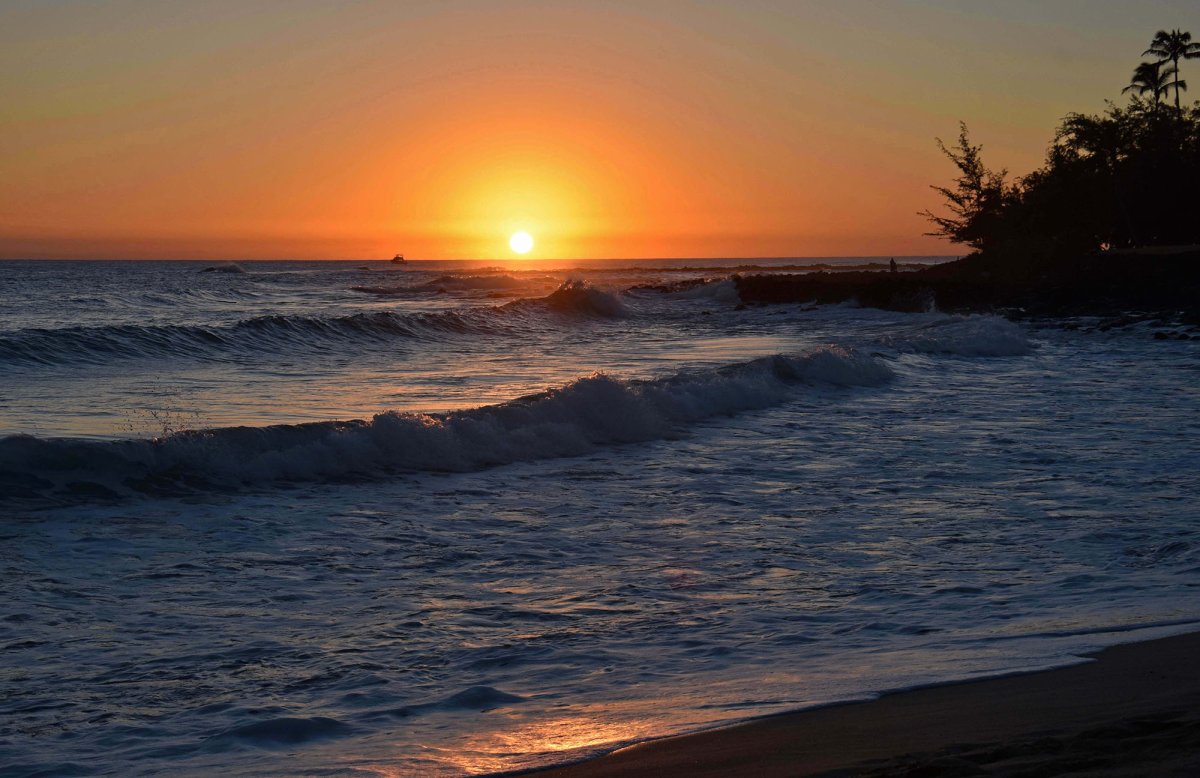 0 min from previous stop · 0.2 mi
A famous bodyboarding shorebreak just east of Poʻipū Beach Park — boogie boards and skim only, no hard surfboards in the break. Strong shorebreak; not for weak swimmers.
Approach Cue (~12-15 sec)Show transcript
Brennecke's Beach is right next door, a short walk east past the point. It has no lot of its own—you're parking back at Poʻipū Beach Park and walking over.Arrival Narration (~45-60 sec)Show transcript
Brennecke's is a legend among bodyboarders—a punchy shorebreak that peels right onto the sand, which makes it a blast on a boogie board and a bad idea on a hard surfboard. Hard boards are actually banned in the shorebreak here for safety. That same wave that's fun to ride can throw you hard, so this isn't the spot for weak swimmers or small kids, especially when the south swell is up in summer. Watch a few sets before you go in. And the monk seal rules carry right down this whole stretch of sand—seals haul out at Brennecke's too. -
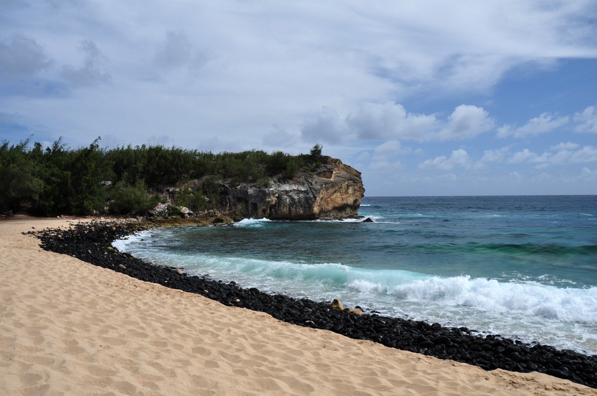 4 min from previous stop · 0.8 mi
A wide golden-sand bay (Keoneloa Bay) below the Grand Hyatt, framed by the lithified-sandstone Makawehi Bluff — and the public trailhead for the Māhāʻulepū Heritage Trail. Strong shorebreak; the bluff cliff-jump is dangerous.
Approach Cue (~12-15 sec)Show transcript
Shipwreck Beach—Keoneloa Bay—is just east, with public access and parking near the Grand Hyatt. This is also the trailhead for the wild coast walk we'll finish with, so it's a good place to stop and decide how far you want to go.Arrival Narration (~45-60 sec)Show transcript
Shipwreck Beach is a wide, open arc of golden sand, named for an old wooden boat that once rotted on the shore. At the east end, that headland of layered tan rock is the Makawehi Bluff—lithified sand dunes turned to stone, and a popular cliff-jump spot that is genuinely dangerous and has hurt people; admire it, don't follow anyone off it. The bay has a strong shorebreak and current, so it's more of a walk-and-watch beach than a casual swim. The real reason to be here is the trail: from the top of the bluff, the Māhāʻulepū Heritage Trail runs east along an undeveloped coast that's the wildest, emptiest stretch of the south shore—and that's where we're headed to finish. -
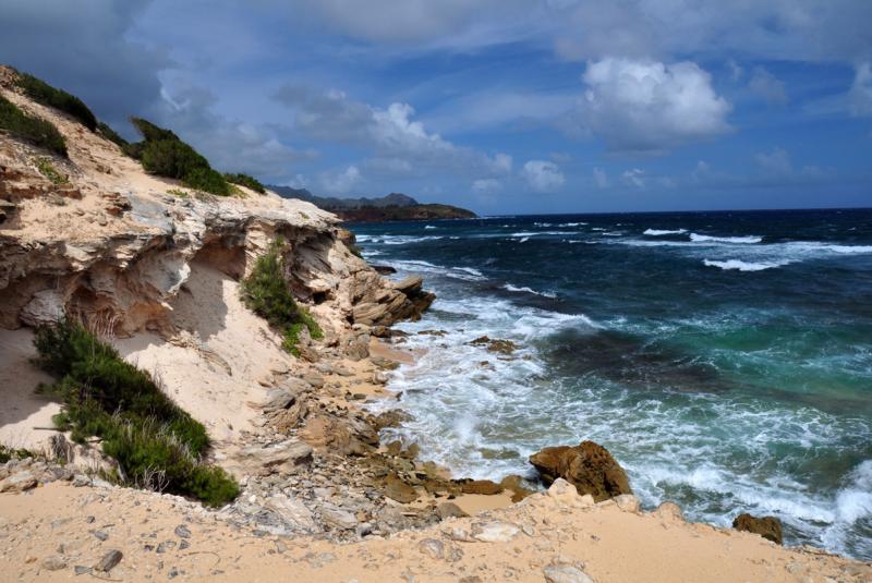 7 min from previous stop · 1.8 miStop makai
Māhāʻulepū
The wild, undeveloped southeast coast — sandstone sea cliffs, dunes, and the Makauwahi fossil sinkhole. Reached on foot via the Heritage Trail from Shipwreck Beach, or by a gated, limited-hours private dirt road. No facilities, no lifeguards.
Approach Cue (~12-15 sec)Show transcript
Māhāʻulepū is the end of the line, and how you reach it matters. The most reliable way is on foot, in daylight—the Heritage Trail from the top of Makawehi Bluff back at Shipwreck, about two miles each way along the coast. If you'd rather drive, the access road runs past the stables, but it's a rough private dirt road on Grove Farm land, with limited posted public-access hours and a gate that locks outside that window. Check Grove Farm's current gate hours before you commit, and skip it after rain. There are no facilities out here: no lifeguards, no restrooms, no services.Arrival Narration (~45-60 sec)Show transcript
This is what the south shore looked like before the resorts—a raw coastline of sandstone cliffs, dunes, and pocket beaches, with almost nothing built on it. Māhāʻulepū stayed wild because the community fought to keep it that way, and walking it feels like stepping off the map. Tucked back here is Makauwahi, a sinkhole that's one of the richest fossil sites in the islands—layers of bones and seeds that rewrote what scientists understood about old Hawaiʻi. The water is open ocean with rip currents and no lifeguards, so this is a place to walk, watch, and take photos, not to swim casually. Stand here a minute and take it in—this is the quiet, powerful end of the drive, and a good place to turn around and let the south shore go. -
Outro
Outro
Show transcript
That's the south shore of Kauaʻi—the Tree Tunnel, the first sugar town, the blowhole, the Prince's birthplace, the easy Poʻipū beaches, and the wild edge at Māhāʻulepū. For a coast you can drive in under an hour, it packs in a lot of range. From here it's a short run back up through Kōloa to the main highway and the rest of the island. And if those botanical gardens—Allerton and McBryde, just west of Spouting Horn—caught your ear, book ahead through NTBG. Allerton is guided-tour only; McBryde has self-guided and guided options, and both use the visitor-center shuttle. Mahalo for riding along the south shore. Drive safe out there.
This tour is created with AI from HawaiiGuide route content and read by the computer-generated Mele and Kani voices. Hawaiian names and place names may occasionally be mispronounced — mahalo for your patience as we refine.

Need help planning?
Search & Planning Chat →

Hawaiʻi Weather Forecast
Today’s Weather Brief · Audio · ~45s
0:00
0:54
Read the transcript
Trades are breezy right now with scattered showers on the windward side and mountains; the leeward coast stays mostly dry. Tomorrow stays breezy with the same pattern.
A tropical disturbance southeast of the islands is likely to become a tropical storm by mid-week and approach the state Thursday through Saturday. The exact track is still uncertain. If it comes closer, expect heavier rain over a longer stretch; if it stays farther out, impacts will be shorter and lighter. Winds will increase late this week, with potential gusts over 70 miles per hour on the highest summits.
Plan your leeward beach time and snorkeling for today through Tuesday. Save summit drives and offshore water sports for after Saturday, and check updates daily as this develops.
Created with AI from the official NWS forecast discussion · verify with NWS before heading out
Loading forecast…
Temperature
Weather data by Open-Meteo.com
Current Time in Hawaiʻi
--:----
Hawaiʻi Standard Time · UTC−10 · No Daylight Saving
You’re on Hawaiʻi timeMainland US
International
Aloha Today daily podcast →
Full HST breakdown, FAQ & DST schedule →

Get Your Free Hawaii Visitor Guide
Enter your email and we'll send you instant access to our free 2026 Hawaii Starter Guide + Summary Guidesheets.