
Hawaiʻi Guide · Audio Driving Tour
North Shore Drive BETA
The classic Kamehameha Highway run along Oahu's North Shore — Haleiwa Town, the green-sea-turtle beach at Laniakea, Waimea Bay, the snorkel cove at Sharks Cove, Banzai Pipeline, Sunset Beach, the resort at Turtle Bay, and the shrimp trucks of Kahuku. ~12 curated segments. Free self-guided audio tour.
17 miles
~35 min driving
9 curated stops
Free self-guided audio tour
~35 min
total driving time
17 mi
total distance
9 stops
curated stops
4-8h
suggested day
We may link to trusted Hawaiʻi resources at no extra cost to you.
Build your own route
Pick a preset or tap the ✓ Include chip on any stop below to customize.
9
of 9 stops selected
-
Intro
Intro
Show transcript
You're on the North Shore drive—seventeen miles along Kamehameha Highway, end to end. It takes about thirty-five minutes if you're just moving through, but that's not what today is. You'll stop. A lot. Figure a full day if you want to swim or snorkel, half a day if you're taking it easy. One thing before we start: if it's winter, the water here is enormous and lethal. Unless you really know what you're doing, stay out at the big breaks. The guide will call out each stop as we go. Let's go. -
 83MILE0
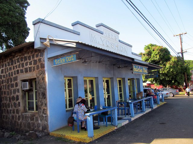
Haleiwa is the gateway to the drive. Last gas before Kahuku, full grocery + restaurant scene, surf shops, shave ice. Coordinates approximate.
Approach Cue (~12-15 sec)Show transcript
Coming up on the makai side, Haleiwa Town. This is where the drive starts. Pull in for gas, coffee, breakfast, or shave ice—Matsumoto's and Aoki's both draw crowds. It's your last gas stop before Kahuku, 17 miles ahead, so fill up if you need to.Arrival Narration (~45-60 sec)Show transcript
You're standing in a plantation town that learned to live for the ocean. The wooden storefronts along the main strip have false fronts and tin roofs, kept that way on purpose. Sugar mills and a fishing harbor built this place, but when surfing took off here in the 1960s and 70s, Haleiwa became the North Shore's hub instead. Two shave ice spots claim local loyalty: Matsumoto's, operating since 1951, and Aoki's from the 1980s. People have firm opinions. Try one and decide. The harbor sits makai — toward the ocean — at the end of Haleiwa Beach Road, where most of the boat tours launch if snorkeling or sunset sails appeal to you. For food, try poke at Joes' on the Green or Fresh Catch, plate lunch at Haleiwa Joe's, or a big breakfast at Haleiwa Beach House. Fill up at the Chevron near the bridge before you head north on Kamehameha Highway. The next main stop is about three miles ahead. -
Connector · 83 4 min drive · 2.1 mi
Haleiwa to Laniakea Connector
Show transcript
You're on the flats now, past the Anahulu Stream bridge. The land opens up here with cane fields stretching across the landscape, and the Pacific spreads out on your left. Winter swells push white water to the horizon on big days. Pua'ena Point comes up first, where you'll see surfers and swimmers working the break. Then the road runs long and straight through open country. Laniakea is coming up in about a mile—the turtle beach. Watch for the ranger waving you in. If the lot's full, they'll direct you to keep driving. -
 4 min from previous stop · 2.1 mi83MILE3
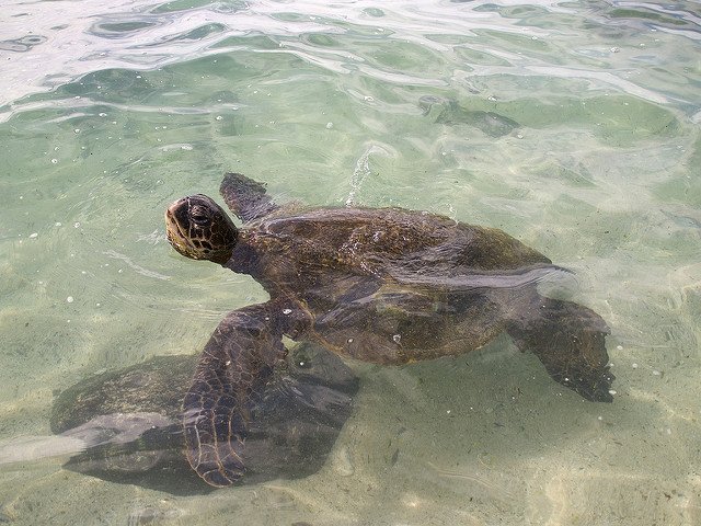
Turtle Beach. Honu basking spot. Parking is now ranger-managed (started ~2024) to fix the highway-shoulder chaos. Free.
Approach Cue (~12-15 sec)Show transcript
Coming up on the left in about a quarter mile—Laniakea Beach, the turtle beach. Green sea turtles haul out here to bask. Parking is ranger-managed now, so look for staff waving you in. It's free, but if they wave you on, the lot's full—no waiting in the lane.Arrival Narration (~45-60 sec)Show transcript
You're standing at Laniakea, where Hawaiian green sea turtles haul out on the sand to warm themselves after cold-water foraging. Usually two to ten are visible at any given time, sometimes more. The volunteers from Mālama na Honu rope off a perimeter around them — stay outside it. The federal rule is straightforward: ten feet of distance, no touching, no camera flashes. Honu are protected under the Endangered Species Act and Marine Mammal Protection Act, and fines for harassment start in the thousands. Parking is ranger-managed and free. Spend ten or fifteen minutes here watching the beach, then head north. Waimea Bay is two miles ahead. -
 6 min from previous stop · 2.8 mi83MILE5
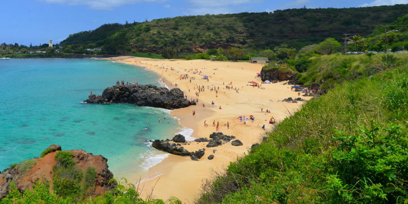
The big-wave landmark of the North Shore. Eddie Aikau Big Wave Invitational held here when surf reaches 30+ ft. Has only run ~10 times in its history (last in 2023).
Approach Cue (~12-15 sec)Show transcript
Coming up on the makai side in about half a mile—Waimea Bay on your left. Summer means calm water and great swimming; winter brings 30 to 50-foot waves and the Eddie Aikau Big Wave Invitational when surf reaches the right height. Parking fills early on summer weekends.Arrival Narration (~45-60 sec)Show transcript
You're looking at glass-flat turquoise water right now, and that's the summer version of Waimea Bay. Come back in winter and you won't recognize it — the same bay funnels north swells into waves that reach 30, 40, sometimes 50 feet. Only big-wave specialists paddle out then. The Eddie Aikau Big Wave Invitational runs here when conditions align, named after the legendary Hawaiian waterman. It's only happened about ten times in the event's forty-year history. Right now, if the water looks inviting, swim. There's a jump rock on the south point, roughly 25 feet up. People jump it regularly, and people break ankles regularly too. If you're visiting in winter, watch from the parking lot or the bluff — that water is genuinely lethal. Across the street is Waimea Valley if you want a detour into botanical gardens and a waterfall. Sharks Cove is half a mile up the road. -
 5 min from previous stop · 1 mi83MILE5.5
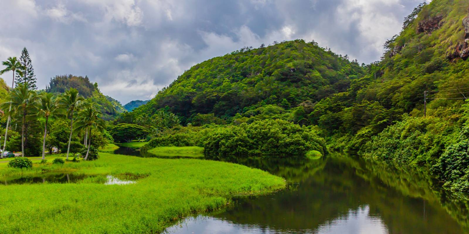
Optional side trip — a botanical garden valley with a swimmable waterfall at the end. Entry fee. Plan 2-3 hours if you go in.
Approach Cue (~12-15 sec)Show transcript
Coming up on the mauka side at the bridge: Waimea Valley. This optional side trip has a paved three-quarter-mile walk through a botanical garden ending at Waihi Falls, where you can swim under the waterfall in a lifeguarded pool. Plan two to three hours and bring cash for entry. Skip it if you're short on time.Arrival Narration (~45-60 sec)Show transcript
You're looking at the entrance to Waimea Valley — one of those stops that reveals itself once you're inside. This valley sits mauka, toward the mountain, and Hawaiian families lived here for nearly a thousand years. Today it's a 1,800-acre botanical garden with almost 5,000 tropical plant species, plus restored traditional houses and gardens organized by region: Hawaii, Tahiti, Samoa, Aotearoa. The main event is the paved trail down to Waihi Falls, a 45-foot drop into a swimming pool. The water's cold — stream-cold — and swimming under it is the heart of the visit. Plan two to three hours if you're going in. There's an entry fee and lifeguards on duty when swimming's open. Head back to the highway when you're done — Sharks Cove is just half a mile north from here. -
 10 min from previous stop · 2.5 mi83MILE6
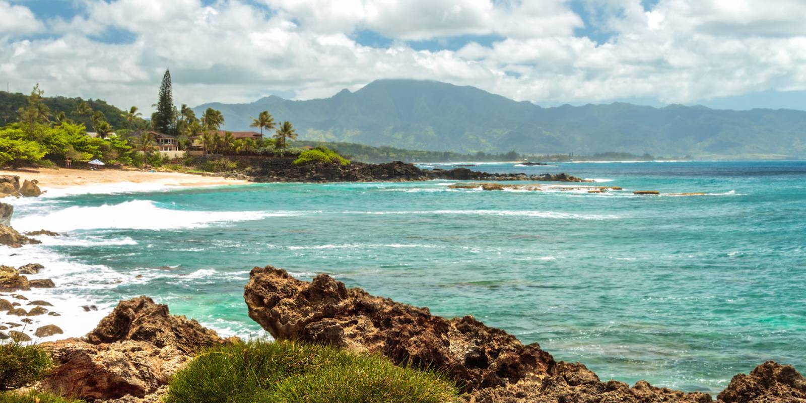
Sharks Cove is part of Pupukea Marine Life Conservation District. Best snorkeling on the North Shore — but only in summer (May-Sep). Lethal in winter.
Approach Cue (~12-15 sec)Show transcript
Coming up on the makai side in about half a mile—Sharks Cove. Great snorkeling May through September when the water's calm and you'll see reef fish and eels. October through April, heavy surf makes it unsafe. Park across the street at Pupukea Beach Park.Arrival Narration (~45-60 sec)Show transcript
The lava-rock breakwall here — mauka, toward the mountain — is what keeps this cove so flat and swimmable in summer. That's Sharks Cove, and the snorkeling works because of it on the North Shore. The whole place sits inside the Pupukea Marine Life Conservation District. Fishing's been prohibited since 1983, so the reef recovered and the fish stayed dense. You'll see yellow tangs, butterflyfish, parrotfish, moorish idols, and sometimes honu moving through. The name is misleading — sharks aren't here. Entry's from the rocks on the south end. Bring reef-safe sunscreen and water shoes; the rocks cut. Stay inside the cove. Currents outside pick up fast, and in winter — November through April — the surf closes the whole area. Don't enter the water then. If you're hungry, food trucks across the street run garlic shrimp and poke bowls. Sunset Beach is two miles ahead, with Pipeline coming up first. -
 3 min from previous stop · 1.2 mi83MILE7
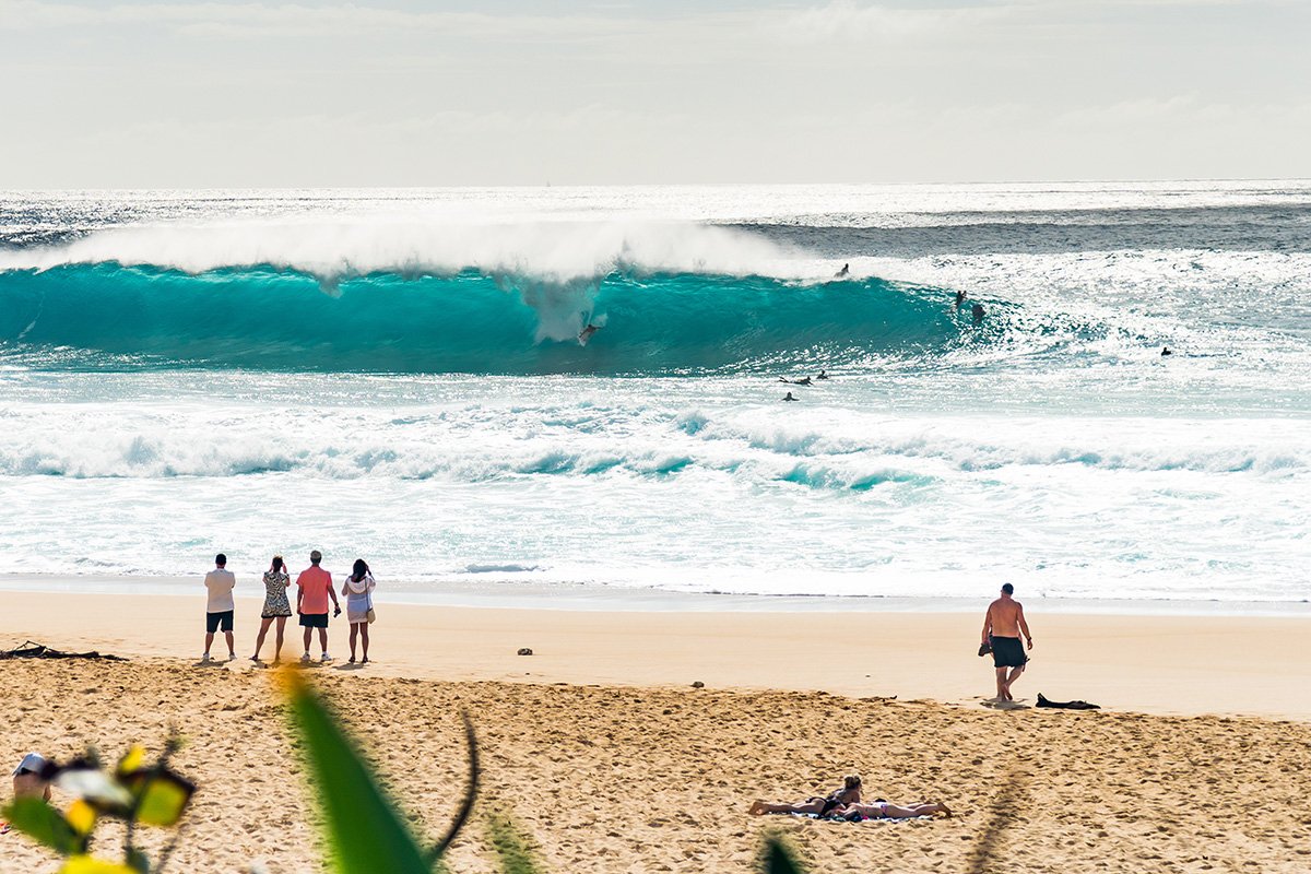
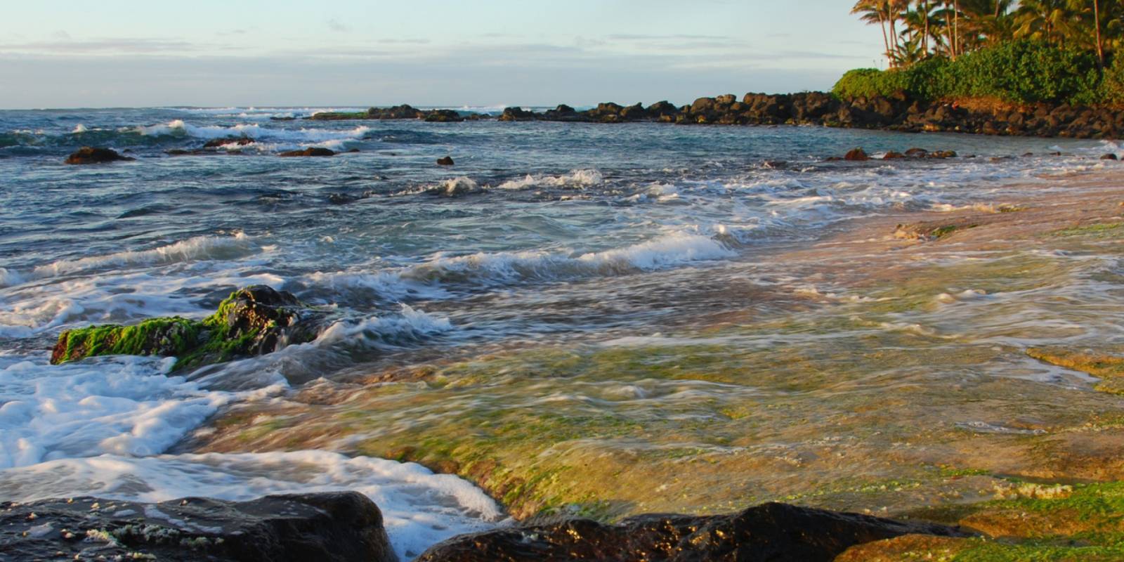
Ehukai Beach Park is the parking lot. The wave breaks offshore — that wave is Banzai Pipeline. World's most photographed surf break. The Vans World Cup of Surfing runs here in late December.
Approach Cue (~12-15 sec)Show transcript
Coming up on the makai side, Ehukai Beach Park. That offshore wave is Banzai Pipeline. In winter it breaks heavy over a shallow reef and draws crowds; summer's a wide, swimmable beach with few people. Parking fills fast when the swell's up.Arrival Narration (~45-60 sec)Show transcript
You're standing at Ehukai Beach Park, but what you're really here for is the wave offshore—the one that looks deceptively smooth until a surfer drops in and it hollows into a tube. That's Banzai Pipeline, the world's most photographed surf break. The wave breaks roughly 75 yards out on a shallow lava-rock reef, and that shallow bottom is exactly what makes it so dangerous. A 10-foot wave here is breaking in about 10 feet of water over sharp coral. Surfers have died here. If you're in winter with surf running, walk to the lifeguard tower and watch. The Vans World Cup of Surfing runs in mid-December, and the Pipe Masters runs at the end of the year—both major events on the world tour. It's free and it's one of the great spectator experiences in surfing. Summer brings a different scene: wide, soft sand, calm water, good for swimming. On the south end of the beach, you'll find the concrete bunker, half-buried in dunes, built by the U.S. military during World War II. Sunset Beach is one mile ahead. Linger if the surf's up, or move on and come back another time. -
 2 min from previous stop · 1.1 mi83MILE8
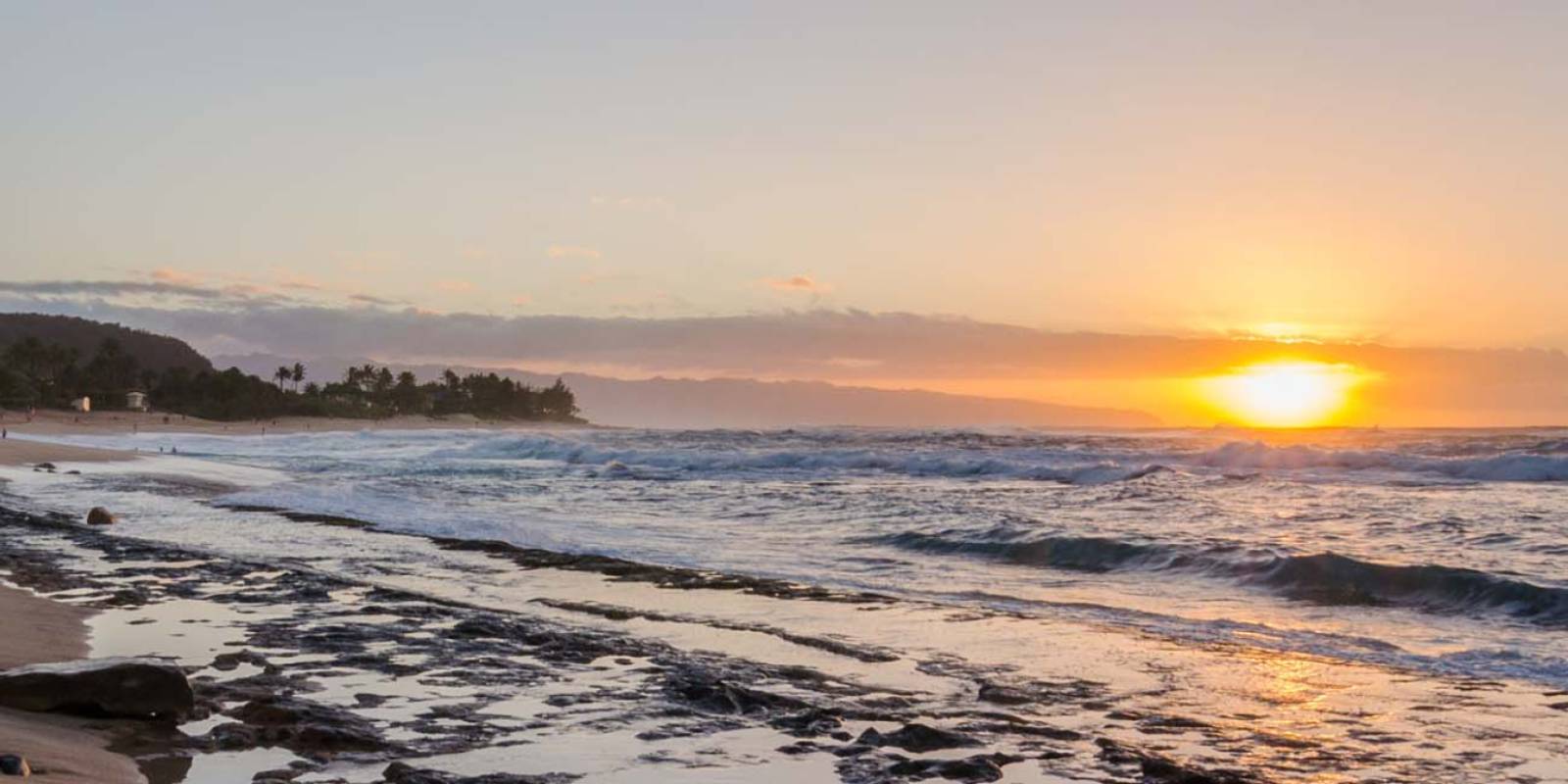
Sunset Beach is a 2-mile stretch — the parking lot for the surf break is at the south end. The Vans Triple Crown of Surfing's first event, the Hawaiian Pro, runs here in November.
Approach Cue (~12-15 sec)Show transcript
Coming up on the makai side, Sunset Beach. The parking lot for the surf break is at the south end. Winter brings 15 to 25 foot swells here, making it one of the longest waves on the North Shore. Summer flips it: calm water, good for swimming, with reliable sunsets. Cars line up on good swell days.Arrival Narration (~45-60 sec)Show transcript
You're at the south end of a two-mile crescent. The sun drops straight into the Pacific here, with Kaena Point's silhouette in the distance — that's where the name comes from. Sunset is a proving ground for competitive surfing. The Vans Triple Crown of Surfing starts here in mid-November with the Hawaiian Pro, and in bigger swells you'll watch riders take off from a wide zone and hold a single wave for a quarter mile. Summer brings smaller surf, and the beach becomes one of the best swimming spots on the North Shore — though rip currents run strong even in calm conditions. Spend some time watching the light change. Turtle Bay sits three miles ahead when you're ready to move on. -
Connector · 83 8 min drive · 4.3 mi
Sunset to Turtle Bay Connector
Show transcript
You're past Sunset now, heading toward the north tip of the island. The road curves inland through what was Kawailoa Sugar Plantation country for most of the twentieth century. You'll see polo fields and horse stables on the mauka side, with open agricultural land still in use. The highway swings back toward the coast in about a mile, and that's when Turtle Bay Resort comes into view on the makai side—the only resort on the North Shore, sitting on its own peninsula at Oʻahu's northern tip. -
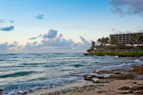 8 min from previous stop · 4.3 mi83MILE11
Property rebranded to The Ritz-Carlton Oʻahu, Turtle Bay in July 2024. Beach access is public — Kuilima Cove is the protected snorkel spot just east of the resort.
Approach Cue (~12-15 sec)Show transcript
Coming up on the makai side—Turtle Bay, now The Ritz-Carlton Oʻahu. Public beach access is here; drive in and follow signs for the public lot. Kuilima Cove just east of the resort is a protected snorkel spot, calm year-round and good for kids.Arrival Narration (~45-60 sec)Show transcript
You're standing on the only point that juts out from the North Shore, and the Pacific wraps around you in a way you won't see anywhere else on this island. The resort opened in 1972 as Kuilima Resort, became Turtle Bay in 1992, and rebranded as The Ritz-Carlton Oʻahu, Turtle Bay in July 2024 after a multi-year renovation. The draw makai — toward the ocean — is Kuilima Cove, a small protected inlet just east of the main beach. The rock outcrop blocks winter swell, so snorkeling stays reliable year-round. Summer brings calmer water to the main beach too, with soft sand and easy entry. Beach access is public—drive onto the property, follow signs to public parking, and walk down to the sand. Spend an hour here if you want to swim or snorkel. If you're hungry, the open-air restaurant has an affordable lunch menu. After this, you've got about three miles to Kahuku, the last town on the drive. -
 8 min from previous stop · 4 mi83MILE14
Kahuku is a former sugar plantation town. Shrimp trucks run along Kamehameha Highway just south of town — Giovanni's, Romy's, and Fumi's are the originals. Shrimp comes from local aquaculture ponds.
Approach Cue (~12-15 sec)Show transcript
Coming up on the mauka side—Kahuku shrimp trucks, the last town on this drive. Giovanni's has the famous graffiti truck, Romy's is the local favorite, and Fumi's is in the pink trailer. Order garlic shrimp on rice. The shrimp comes from aquaculture ponds you can see on the mauka side as you approach.Arrival Narration (~45-60 sec)Show transcript
You can smell the garlic before you see the trucks—it's the smell that tells you you're close. Kahuku used to run on sugar until the mill closed in 1971, and shrimp farming moved in to fill the gap. Those aquaculture ponds you passed on the mauka side (toward the mountain) as you drove in supply the shrimp you're about to eat. The classic move is garlic shrimp served head-on, shells-on, over white rice with a slice of pineapple. Eat it with your hands. Giovanni's, the white truck covered in graffiti at the south end, is the famous one. Romy's just down the road runs slightly cheaper with bigger portions and a shorter line. Fumi's, the pink family-run trailer, is every bit as good. Locals will fight you on which is best. Budget twenty or thirty minutes for the wait and the meal. -
Outro
Outro
Show transcript
That's the North Shore—Haleiwa, Laniakea, Waimea, Sharks Cove, Pipeline, Sunset, Turtle Bay, Kahuku. You saw the breaks, the reef, the sand, the turtles. Now you know why people come back to this stretch. Two ways home: retrace the coast through Haleiwa and take H-2 south through the central plains, or head east on Kamehameha, drop through Hauʻula and Kāneʻohe, then climb over the Koʻolau on Likelike or Pali. Both routes take about an hour and fifteen minutes back to Waikīkī. The Windward way is prettier. The freeway's faster. Tomorrow, try the East Side or Pali Highway—both are shorter and very different.
This tour is created with AI from HawaiiGuide route content and read by the computer-generated Mele and Kani voices. Hawaiian names and place names may occasionally be mispronounced — mahalo for your patience as we refine.

Need help planning?
Search & Planning Chat →

Hawaiʻi Weather Forecast
Today’s Weather Brief · Audio · ~45s
0:00
0:54
Read the transcript
Trades are breezy right now with scattered showers on the windward side and mountains; the leeward coast stays mostly dry. Tomorrow stays breezy with the same pattern.
A tropical disturbance southeast of the islands is likely to become a tropical storm by mid-week and approach the state Thursday through Saturday. The exact track is still uncertain. If it comes closer, expect heavier rain over a longer stretch; if it stays farther out, impacts will be shorter and lighter. Winds will increase late this week, with potential gusts over 70 miles per hour on the highest summits.
Plan your leeward beach time and snorkeling for today through Tuesday. Save summit drives and offshore water sports for after Saturday, and check updates daily as this develops.
Created with AI from the official NWS forecast discussion · verify with NWS before heading out
Loading forecast…
Temperature
Weather data by Open-Meteo.com
Current Time in Hawaiʻi
--:----
Hawaiʻi Standard Time · UTC−10 · No Daylight Saving
You’re on Hawaiʻi timeMainland US
International
Aloha Today daily podcast →
Full HST breakdown, FAQ & DST schedule →

Get Your Free Hawaii Visitor Guide
Enter your email and we'll send you instant access to our free 2026 Hawaii Starter Guide + Summary Guidesheets.