We may earn a commission when you book or buy through links on this page.
Hawaii State Art Museum (HISAM)
Located within the Waikiki & Honolulu Region on Oahu
Oahu Art Museum
Waikiki & Honolulu Sight
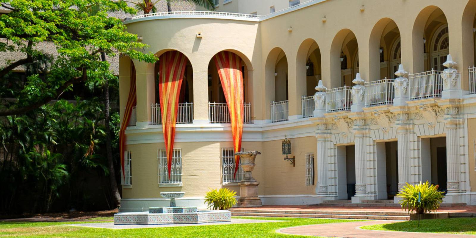
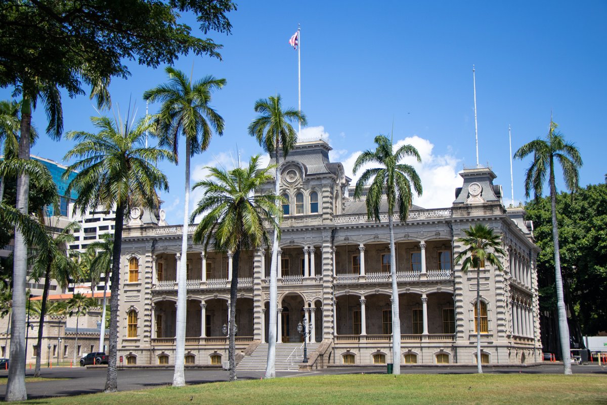
The Hawaii State Art Museum, also known as Capitol Modern, is home to intriguing artifacts, stunning landscapes, and so much more. The museum is located in downtown Honolulu at 250 South Hotel Street in the historic No. 1 Capitol District Building.
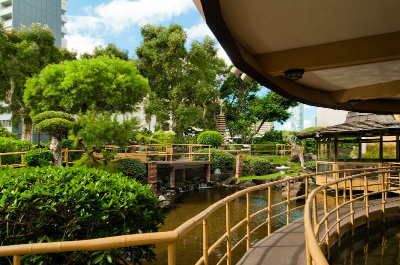
The museum’s HISAM Sculpture Garden serves as a refreshing and relaxing oasis filled with lush greenery in place of the building’s original pool.
Exhibits at the Hawaii State Art Museum continue to evolve and rotate, making it always a unique experience, even for recurring visitors. Check their website for current exhibits and programming.
Relax and take in all the historical information at the artisanal cafe located within the museum. The cafe is a great place for an afternoon break, with coffee beverages as well as breakfast and lunch options that feature local ingredients and cuisines.
Of course, you can take home a piece of your experience by stopping in the Hawaii State Art Museum gift shop, which is filled with interesting contemporary artworks and other pieces from local vendors and artists.
Fortunately, the Hawaii State Art Museum doesn’t charge admission, making it a great activity for a larger group or family without the need to make it a full day affair. The museum is open Wednesday through Saturday, 10:00 a.m. to 4:00 p.m. (closed Sunday through Tuesday). For more information about the Hawaii State Art Museum and what exhibits are currently featured at the museum, visit the state website here.
Explore smarter
Turn this stop into a better day plan.
Use maps, timing, access checks, and current conditions before adding another stop to the route.
Founder & certified Hawai'i travel expert with 20+ years in Hawai'i tourism, University of South Carolina climate-research training, and NOAA weather-station experience.
Trades are breezy right now with scattered showers on the windward side and mountains; the leeward coast stays mostly dry. Tomorrow stays breezy with the same pattern.
A tropical disturbance southeast of the islands is likely to become a tropical storm by mid-week and approach the state Thursday through Saturday. The exact track is still uncertain. If it comes closer, expect heavier rain over a longer stretch; if it stays farther out, impacts will be shorter and lighter. Winds will increase late this week, with potential gusts over 70 miles per hour on the highest summits.
Plan your leeward beach time and snorkeling for today through Tuesday. Save summit drives and offshore water sports for after Saturday, and check updates daily as this develops.
0:000:53
Voice
Read the transcript
Trade winds are pushing across Maui right now and staying breezy through tomorrow. Windward slopes and peaks will see scattered showers; the leeward side stays mostly dry. Rough seas mean a Small Craft Advisory is in effect through Tuesday evening.
A tropical disturbance southeast of the islands is likely to become a tropical storm by mid-week and approach the state Thursday through Saturday. The track remains uncertain. Late this week, winds will increase across Maui, with summit gusts potentially exceeding 70 mph on Haleakala. The Big Island—especially Hilo and Puna—faces the highest risk of heavy rain and flooding if the storm tracks close.
Leeward beaches and snorkeling work best today through Tuesday. Avoid summit hikes and offshore water sports Thursday through Saturday.
0:000:55
Voice
Read the transcript
Trades are kicking today with moderate wind and rough seas. Windward slopes will see scattered showers; the leeward side stays mostly dry. A Small Craft Advisory is in effect through Tuesday evening.
A tropical disturbance southeast of the islands is likely to become a tropical storm by mid-week and approach the state Thursday through Saturday. The track remains uncertain, but the Big Island faces the highest risk of heavy rain and flooding, especially in the Hilo and Puna areas. Summit winds could exceed 70 mph late in the week. Check forecasts daily as the situation develops.
Leeward snorkeling and beach time work well through Tuesday. Save summit drives and windward hikes for today or tomorrow, and avoid offshore water sports and high elevations Thursday through Saturday.
0:000:58
Voice
Read the transcript
Trades are steady now with scattered showers on the windward side and ridges; the leeward coast stays mostly dry. Through Tuesday it stays breezy with rough seas around Maui and the Big Island, where a Small Craft Advisory is in effect through Tuesday evening.
A tropical disturbance southeast of the islands is likely to become a tropical storm by mid-week and approach the state Thursday through Saturday. The exact track is uncertain. Winds will increase across the eastern islands late this week, with potential for summit gusts over 70 mph on Maui and the Big Island if the storm intensifies.
Get your beach and snorkel time in today and tomorrow on the leeward coast. Avoid summit hikes and offshore water sports Thursday through Saturday as conditions deteriorate. The track could shift significantly—check updates daily.
Created with AI from the official NWS forecast discussion · verify with NWS before heading out