
Hawaiʻi Guide · Audio Driving Tour
Saddle Road & Mauna Kea Drive BETA
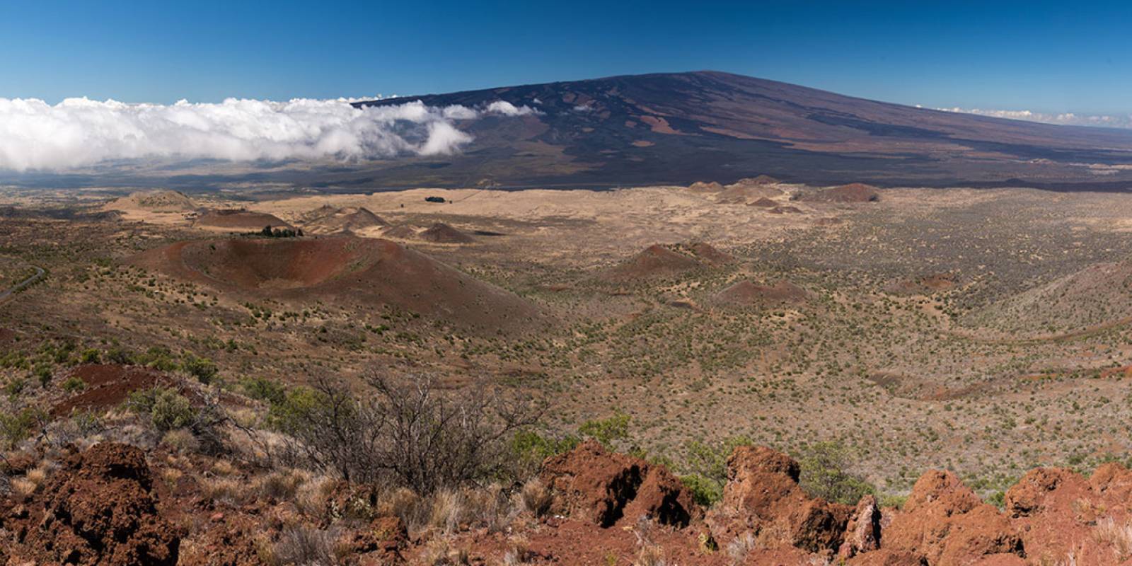
A 55-mile drive across the saddle between Mauna Kea and Mauna Loa on the Daniel K. Inouye Highway (Hwy 200) — recent lava fields, the Mauna Kea Visitor Information Station at 9,200 feet, panoramic views of Hawaii's two biggest volcanoes, and ranchland descent into Waimea (Kamuela). ~6 curated stops.
55 miles
~1h 45min driving
4 curated stops
Free self-guided audio tour
~1h 45min
total driving time
55 mi
total distance
4 stops
curated stops
3-4h
suggested day
We may link to trusted Hawaiʻi resources at no extra cost to you.
Build your own route
Pick a preset or tap the ✓ Include chip on any stop below to customize.
4
of 4 stops selected
-
Intro
Intro
Show transcript
You're about to cross the spine of the Big Island on Saddle Road—the Daniel K. Inouye Highway. Plan an hour and forty-five minutes from Hilo to Waimea at a relaxed pace, longer if you branch up Mauna Kea. The road's been completely rebuilt since 2013. One thing: there's no gas between here and Waimea, fifty-five miles with elevation gain to 6,600 feet. Fill your tank before we start. And if you're heading up to the Visitor Information Station, grab a fleece—it gets twenty-five degrees colder up there. Let's go. -
 200MILE0Stop · mile 0 makai
Hilo Start
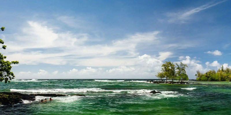
Hilo. Wettest city in the US (~127 in/yr). Last gas before Waimea on Hwy 200. The Hwy 200 turn-off is at the intersection with Hwy 11 / Kanoelehua Ave on the west side of town.
Approach Cue (~12-15 sec)Show transcript
Coming up makai side in Hilo, your launch point. Last gas before Waimea, 55 miles ahead with no station in between, so top off now at any station on Kanoelehua Avenue. Bring a 7AM coffee and a snack. If it's Saturday or Wednesday morning, the Farmers Market on Mamo Street has tropical fruit. Highway 200 is well signed when you're ready to head out.Arrival Narration (~45-60 sec)Show transcript
You're standing at the edge of Hilo in rain that's already falling or about to—this side of the Big Island catches about 127 inches of rain a year, one of the wettest cities in the US. That's why everything mauka—toward the mountain—looks impossibly green. The town is a working historic Pacific port with restored 1920s storefronts downtown. The Hilo Farmers Market runs Wednesdays and Saturdays at Mamo and Kamehameha, with locally-grown tropical fruit, flowers, and crafts. Hilo Coffee Mill and Lava Java are reliable stops if you need coffee before you go. From here, Highway 200 climbs steadily west through ʻōhiʻa forest for about 20 miles. Around the third mark, the forest opens to lava fields with Mauna Kea and Mauna Loa rising on either side. The Mauna Kea Access Road junction is roughly 28 miles ahead. Fill your tank now—it's the last gas before Waimea. -
Connector · 200 48 min drive · 36.1 mi
Hilo Side Saddle Climb Connector
Show transcript
You're climbing now through country that remembers fire. The first twenty miles out of Hilo move through wet ʻōhiʻa forest, then open up into lava fields as you cross four thousand feet. Most of this black rock came from Mauna Loa—the 1881 flow that stopped just a mile short of downtown Hilo, and the 1855 flow that came even closer. The older flows are vegetated now, covered in ʻōhiʻa, while the younger ones still show raw black pāhoehoe with little vegetation. Halfway across the saddle you'll cross the 1935 Mauna Loa flow. The Air Force tried bombing it to save Hilo. The lava stopped anyway, but the bomb craters are still visible from the air. The Mauna Kea Access Road comes up at mile twenty-eight. -
 48 min from previous stop · 36.1 mi200MILE28
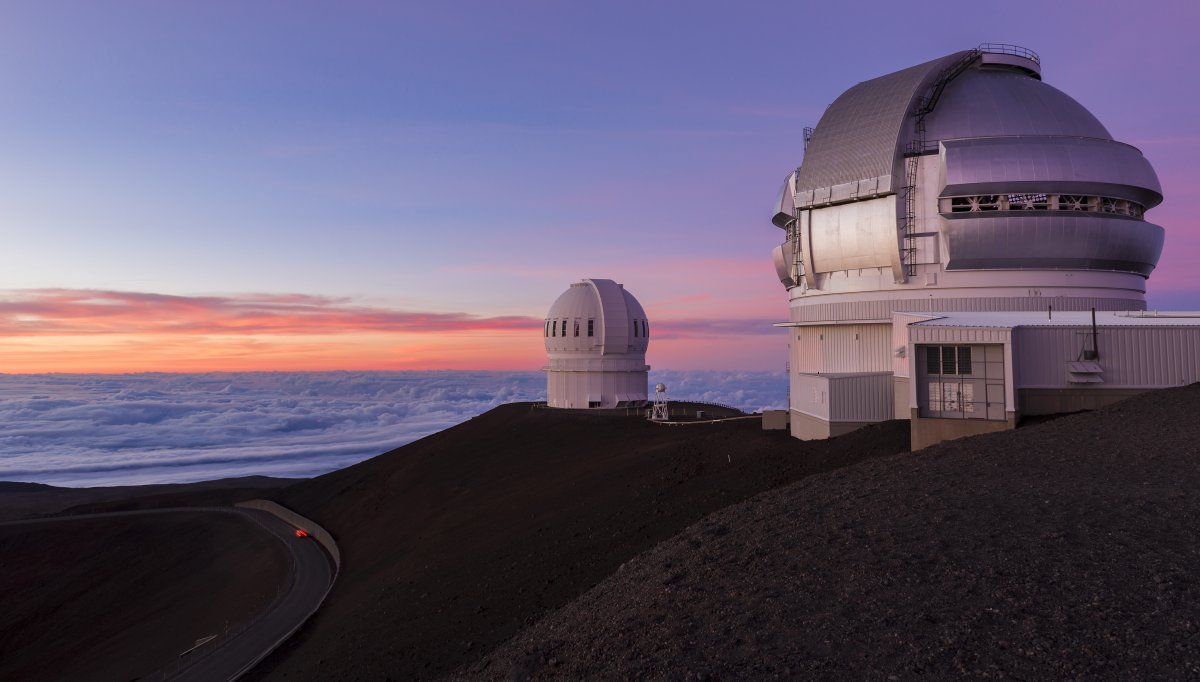
Mauna Kea Access Road junction (Hwy 200 at MM 28). Junction signed "Mauna Kea Access Rd" / "Onizuka Center for International Astronomy." Drive 6 paved miles up to the VIS at 9,200 ft. Past the VIS = 4WD only, rental cars prohibited. Stargazing program at VIS most evenings, free.
Approach Cue (~12-15 sec)Show transcript
Coming up on the mauka side at mile 28—the Mauna Kea Access Road junction. Turn right and drive six paved miles up to the Visitor Information Station at 9,200 feet. The road past the VIS requires 4WD and is off-limits to rental cars.Arrival Narration (~45-60 sec)Show transcript
You're standing at 9,200 feet, and the air around you is thin and cold — notice how quiet everything is up here, how the light feels different. This is the Mauna Kea Visitor Information Station, formally the Onizuka Center for International Astronomy, named for Ellison Onizuka, a Big Island astronaut who died in the Challenger disaster in 1986. Most evenings, weather permitting, volunteers set up portable telescopes outside starting around 6 PM and run the program until 10 PM — free, no reservation needed. You'll see Saturn, Jupiter, the Andromeda galaxy, the Pleiades. Even without the formal program, the VIS sits above most cloud cover, and the parking lot has Milky Way views. The white domes uphill are the summit observatory complex, operated by thirteen countries with optical telescopes. Bring layers — fleece, windbreaker, warm hat. Temperature drops below 40 degrees regularly, and wind makes it colder. If you're heading back toward Waimea, you'll descend through open ranchland with Kohala mountain views. -
 22 min from previous stop · 13.9 mi200MILE31
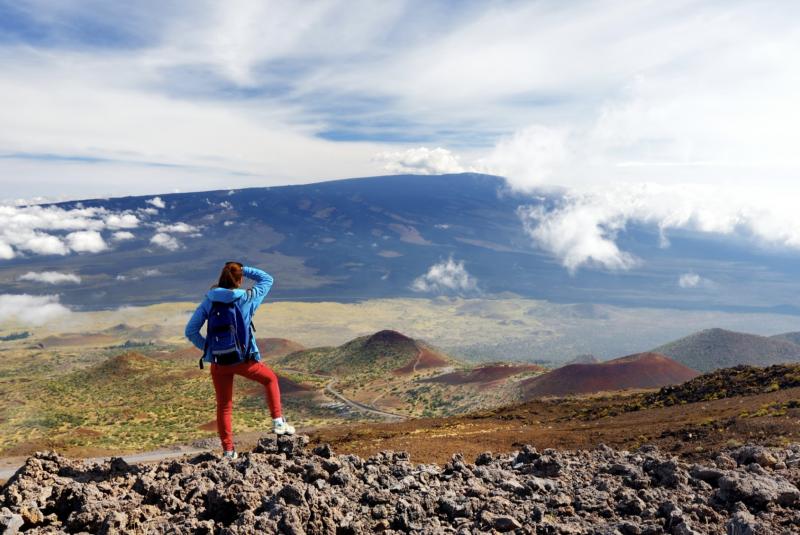
Mauna Loa Observatory Road junction is roughly mid-saddle. Road is paved but rental agreements vary. NOAA atmospheric observatory at 11,135 ft. Most travelers just enjoy the view of Mauna Loa from the highway pull-offs.
Approach Cue (~12-15 sec)Show transcript
Coming up on the makai side in about half a mile—pull-offs for a view of Mauna Loa volcano. The Observatory Road junction is just ahead if your rental allows driving partway up for a closer look, but most travelers just stop at the highway pull-offs.Arrival Narration (~45-60 sec)Show transcript
See that broad slope rising toward the horizon, gentle and almost ordinary-looking? That's Mauna Loa — it's the largest active volcano on Earth by volume, 19,000 cubic miles of basalt stacked from a seafloor base 30,000 feet down to a 13,679-foot summit. Most of it sits underwater. The western flank you're looking at now erupted 33 times since the 1840s, most recently in 2022, when lava ran down and stopped 1.7 miles short of this road. That narrow paved road climbing mauka — toward the mountain — leads to the NOAA atmospheric observatory at 11,135 feet, where the Keeling Curve has tracked global atmospheric CO₂ continuously since 1958. Saddle Road continues west another 24 miles of open country before it starts down toward Waimea. Stay as long as you like. -
Connector · 200 35 min drive · 25.2 mi
Waimea Side Descent Connector
Show transcript
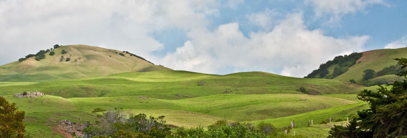
The lava fields are breaking up now, and the land is opening into pasture. You're crossing the island's rain shadow — the wet side behind you, the dry side ahead. By 4,000 feet you're in Parker Ranch territory, founded in 1847 by John Palmer Parker, a New England sailor who married into the Hawaiian royal family. Those cattle you see scattered across the grassland are descended from longhorns gifted to King Kamehameha I in 1793. The paniolo, the cowboys here, started about 30 years before the Texas cowboys did. Mauna Kea's up to your right now, Kohala further out. Waimea's about eight miles ahead. -
 35 min from previous stop · 25.2 mi200MILE55
Waimea, also called Kamuela. Parker Ranch headquarters. Big Island's paniolo (cowboy) town. Merriman's flagship restaurant. Cool elevation (~2,700 ft), often misty mornings. Hwy 19 to Kona / Kohala coast, Hwy 250 to Hāwī.
Approach Cue (~12-15 sec)Show transcript
Waimea coming up on the makai side, in about half a mile. The town goes by two names—Waimea and Kamuela, the Hawaiian form of Samuel Parker, an early ranch owner. You're at 2,700 feet here, so expect it to be 15 to 20 degrees cooler than the coast, with morning mist common. Highway 19 heads south to Kona and the Kohala coast; Highway 250 goes north to Hāwī.Arrival Narration (~45-60 sec)Show transcript
You can feel the elevation here — the air's cooler and often misty in the mornings. This is Waimea, also called Kamuela, the center of Big Island ranch country. The paniolo — Hawaiian cowboys — were working these slopes before the American West had its tradition. Mexican vaqueros came to Hawaii in 1832 to teach cattle handling, and the word "paniolo" itself comes from "español." Parker Ranch, founded here in 1847, is one of the largest privately-owned ranches in the country. The Parker Ranch Center on the highway has a store and a small historical exhibit. For a plate lunch, the Hawaiian Style Cafe is the local counter. Merriman's, on Opelo Plaza on the south side of town, is one of Hawaii's most acclaimed restaurants. From here, Highway 19 south takes you 30 minutes to the Kohala Coast resorts or 50 minutes to Kona. Highway 250 north goes over the mountains toward Hāwī and the island's northern tip. -
Outro
Outro
Show transcript
You just crossed five climate zones in 55 miles — rainforest, lava fields, mountain slopes, Parker Ranch grassland. That's what makes this drive special. Most people overlook it, rushing between coasts. Now you're in Waimea with choices: south to the sunny resort beaches, north to Kohala and the Pololū overlook, or back to Hilo. The fast way back is across Saddle Road, about an hour and a half. The scenic way takes you south through Kona, around to South Point, and up the east side — a full day. If you have another day on the Big Island, Chain of Craters Road in the national park is worth it. Different volcano, different mood. Check the site to plan what's next.
This tour is created with AI from HawaiiGuide route content and read by the computer-generated Mele and Kani voices. Hawaiian names and place names may occasionally be mispronounced — mahalo for your patience as we refine.

Need help planning?
Search & Planning Chat →

Hawaiʻi Weather Forecast
Today’s Weather Brief · Audio · ~45s
0:00
0:54
Read the transcript
Trades are breezy right now with scattered showers on the windward side and mountains; the leeward coast stays mostly dry. Tomorrow stays breezy with the same pattern.
A tropical disturbance southeast of the islands is likely to become a tropical storm by mid-week and approach the state Thursday through Saturday. The exact track is still uncertain. If it comes closer, expect heavier rain over a longer stretch; if it stays farther out, impacts will be shorter and lighter. Winds will increase late this week, with potential gusts over 70 miles per hour on the highest summits.
Plan your leeward beach time and snorkeling for today through Tuesday. Save summit drives and offshore water sports for after Saturday, and check updates daily as this develops.
Created with AI from the official NWS forecast discussion · verify with NWS before heading out
Loading forecast…
Temperature
Weather data by Open-Meteo.com
Current Time in Hawaiʻi
--:----
Hawaiʻi Standard Time · UTC−10 · No Daylight Saving
You’re on Hawaiʻi timeMainland US
International
Aloha Today daily podcast →
Full HST breakdown, FAQ & DST schedule →

Get Your Free Hawaii Visitor Guide
Enter your email and we'll send you instant access to our free 2026 Hawaii Starter Guide + Summary Guidesheets.