

03-25-2026
New Oahu State Park
We may earn a commission when you book or buy through links on this page.
New Oahu State Park
Oahu's Newest State Park — Now Official

President & certified Hawaii travel expert with 15+ years of experience in Hawaii tourism.
We may earn a commission when you book or buy through links on this page.
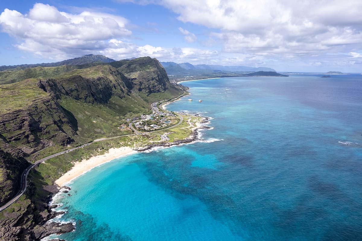
Hawaii has over 50 state parks spread across its main islands. As of its official designation by the Hawaii Division of Land and Natural Resources (DLNR), Kaiwi State Scenic Shoreline is among them.
The park spans the southeast Oahu coastline between Sandy Beach and Makapuu — a stretch that has drawn visitors, surfers, and hikers for decades. It’s now formally managed and protected as a state park.
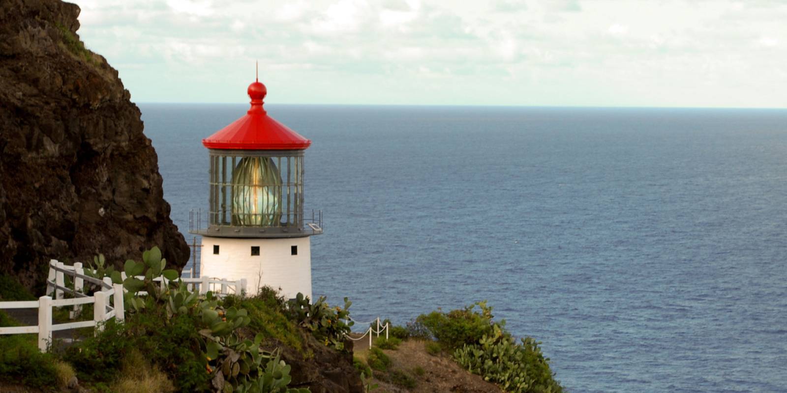
The Makapuu Point Lighthouse Trail is the primary access point. It’s a paved, 1.2-mile out-and-back trail that climbs to a panoramic overlook above the lighthouse. Popular at sunrise. Free admission as of 2026. The trail is well-maintained and accessible to most fitness levels, though the final stretch has a real grade to it.

Why This Coastline?
The Ka Iwi Coastline has been under conservation pressure for years. Heavy tourism left its marks — rental cars crossing sand dunes for informal parking, bonfires trampling ground that holds real archaeological weight.
The cultural stakes here are high. Many historians and Native Hawaiian practitioners believe this stretch of southeast Oahu is where the first Polynesian voyagers made landfall on the island. That’s not a footnote. It’s the reason the area’s protection has been a long-running priority for local advocates.
The Ka Iwi Coastline had already been designated a conservation area before the state park status came through. The DLNR designation formalized those protections and gave the area the management structure needed to enforce them.
What the Designation Changes
State park status means the area is now subject to DLNR state park rules, with staffing, enforcement, and a framework for handling access. The park includes plans to expand its boundaries further over time.
Fees for parking or reservations may apply — consistent with how other protected Hawaii sites have been managed. Check the DLNR site for current requirements before visiting.
The Kaiwi designation is a good outcome for one of Oahu’s most ecologically and culturally significant coastlines. The formal state park status gives DLNR the authority and funding mechanisms to manage access, maintain trails, and protect the land in a way that a loose conservation designation couldn’t.
If you’re planning a visit, the Makapuu Lighthouse Trail is your starting point. Go early — sunrise crowds at Makapuu are real, but the views at first light are hard to argue with. Check the DLNR state parks page for current hours, parking details, and any fee or reservation requirements in effect.
Explore More of Oahu
More guides to Oahu sights, activities, and adventures.
Get Your Free Hawai'i Guide
Instant access — opens immediately
- Beaches, activities & top spots
- Restaurant & dining recommendations
- Maps, itineraries & insider tips
Want the full offline version? Get the Complete Hawai'i Guidebook →
Published by: Tori C. Derrick
President & certified Hawai'i travel expert with 15+ years of experience in Hawai'i tourism.
Affiliate Disclosure: We may earn a commission when you book or buy through links on this page. See our Ad Disclosures & Standards.

Need help planning?
Search & Planning Chat →

Hawaiʻi Weather Forecast
Today’s Weather Brief · Audio · ~45s
0:00
0:47
Read the transcript
Breezy trade winds are in place with windward and inland showers expected tonight and early morning through Monday. South-facing beaches have high surf through Saturday evening—avoid them if rough water concerns you. East-facing shores will see building swell Sunday as Tropical Storm Fausto approaches. Tuesday and Wednesday the storm moves in with heavy rain, gusty winds, and rough seas on the windward side. Forecasters are still narrowing down the exact track, so check updates this weekend. By Thursday normal trades return.
Leeward beaches work through Monday if you stay clear of the high surf. Plan indoor activities or protected bays for Tuesday and Wednesday when the storm passes through.
Created with AI from the official NWS forecast discussion · verify with NWS before heading out
Loading forecast…
Temperature
Weather data by Open-Meteo.com
Current Time in Hawaiʻi
--:----
Hawaiʻi Standard Time · UTC−10 · No Daylight Saving
You’re on Hawaiʻi timeMainland US
International
Aloha Today daily podcast →
Full HST breakdown, FAQ & DST schedule →

Get Your Free Hawaii Visitor Guide
Enter your email and we'll send you instant access to our free 2026 Hawaii Starter Guide + Summary Guidesheets.