
Hawaiʻi Guide · Audio Driving Tour
Reverse Road to Hāna BETA
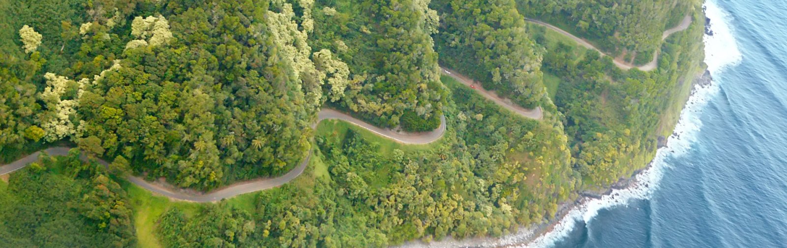
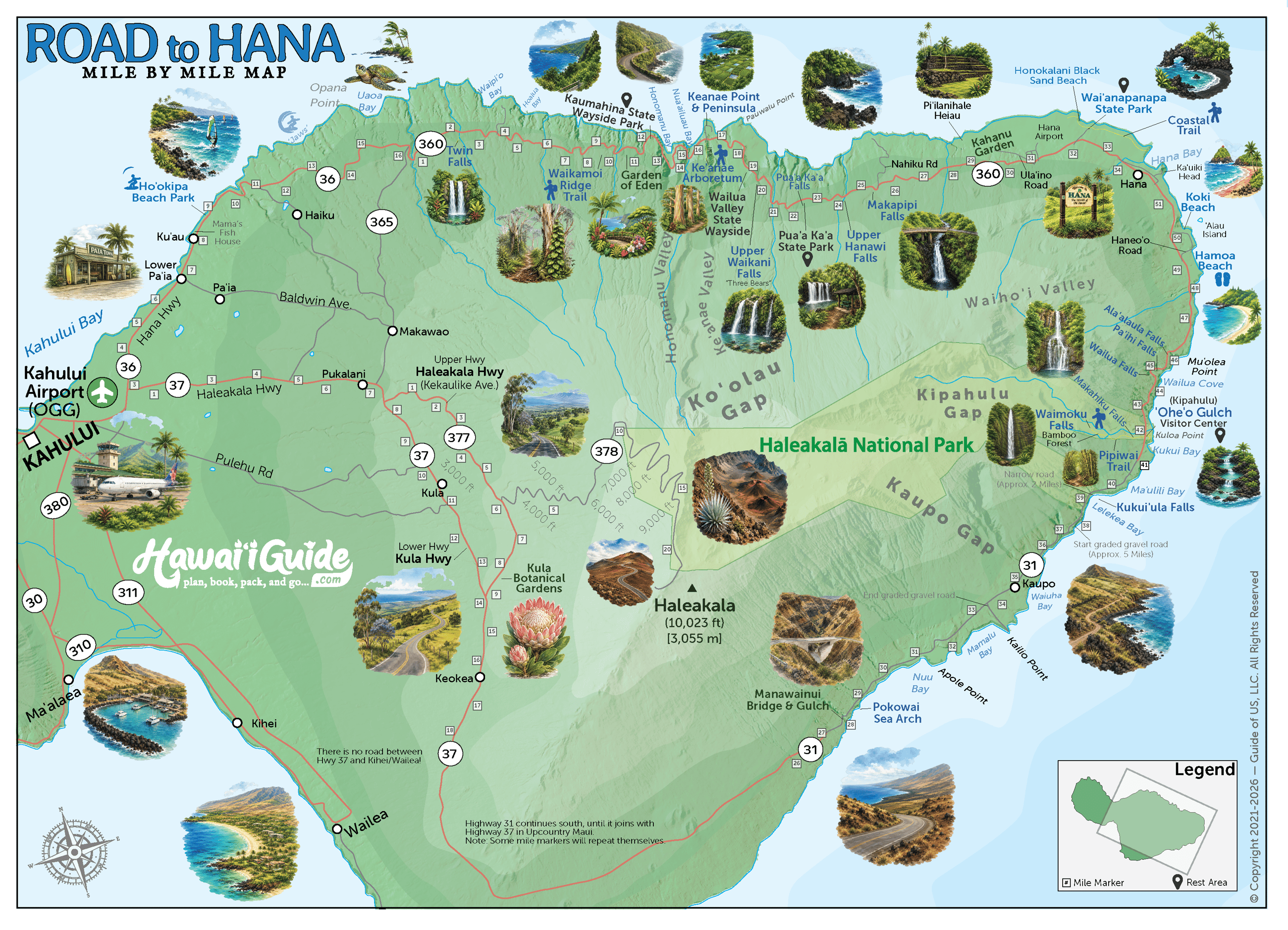
The paved return-direction companion to the Road to Hāna, starting at ʻOheʻo and Pīpīwai in Kīpahulu, passing Hāna, and following the rainforest highway west to Pāʻia. Includes an alternate Hāna Town joining point. Free self-guided audio tour.
50 miles
~2h 20min driving
19 curated stops
Free self-guided audio tour
~2h 20min
total driving time
50 mi
total distance
19 stops
curated stops
7-10h
suggested day
We may link to trusted Hawaiʻi resources at no extra cost to you.
Build your own route
Pick a preset or tap the ✓ Include chip on any stop below to customize.
19
of 19 stops selected
-
Intro
Intro
Show transcript
You're heading back out the way you came—same rainforest corridor, just in reverse. This is an easy drive if you're not rushing it. Travel while it's light, and pull over at a safe spot when faster traffic comes through. Confirm the park and highway alerts before you start. The guide will tell you when each stop's coming up. Let's go. -
 HI-360MILE42
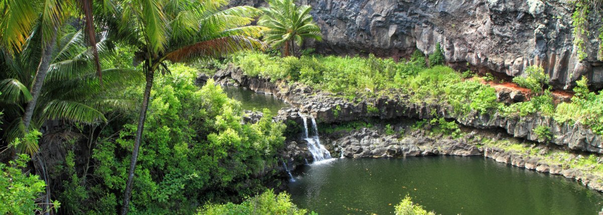
Kīpahulu District of Haleakalā National Park; Kūloa Point Trail provides views of ʻOheʻo Gulch; entering the stream or pools is prohibited; check current NPS alerts before arrival; this is the primary route start.
Approach Cue (~12-15 sec)Show transcript
Coming up on the makai side in about half a mile—ʻOheʻo Gulch and those famous pools. You can't swim in them, but the Kūloa Point Trail gives you views. Check the NPS alerts before you go in.Arrival Narration (~45-60 sec)Show transcript
You can hear the stream before you see it—that low roar coming up makai, toward the ocean, through the trees. This is ʻOheʻo Gulch, in the Kīpahulu District of Haleakalā National Park. The name "Seven Sacred Pools" is tourism shorthand, but the stream holds more pools than that. The Kūloa Point Trail loops out from here past hala trees and cultural sites with views over the gulch. The water looks inviting, but the park prohibits swimming in the stream and pools—currents at Kūloa Point makai are severe. Check the NPS alerts before you walk; weather and flooding close trails fast. If you haven't visited the Pīpīwai Trail yet, go there before you head west. -
 0 min from previous stop · 0.1 miHI-360MILE42
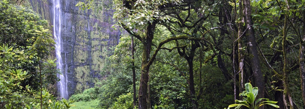
Pīpīwai Trail is a 4-mile round trip that passes an overlook of the nearly 200-foot Makahiku Falls, a large banyan tree, bamboo forest, and 400-foot Waimoku Falls; check current National Park Service alerts before hiking.
Approach Cue (~12-15 sec)Show transcript
Coming up on the mauka side, the Pīpīwai Trail trailhead. This four-mile round trip hits Makahiku Falls, a large banyan tree, bamboo forest, and Waimoku Falls at 400 feet. Bring water, mosquito protection, and suitable footwear. Check the park alert for trail status before you go, especially after heavy rain.Arrival Narration (~45-60 sec)Show transcript
You can hear the stream running mauka — toward the mountain — even from the parking area, and that sound tells you the trail ahead is alive with water. This is the Pīpīwai trailhead on the east side, and the hike spans four miles round trip. You'll climb a half mile to an overlook of Makahiku Falls, then pass a large banyan tree before entering a bamboo forest where boardwalks cross the wetter ground. Waimoku Falls drops 400 feet from the cliff near the trail's end. Rain can change things fast here, so check for any closures and respect the barriers. Bring water and give yourself several hours. When you're done, head back to your car and continue west on Highway 31 toward Wailua Falls, Hāna, and eventually Pāʻia. -
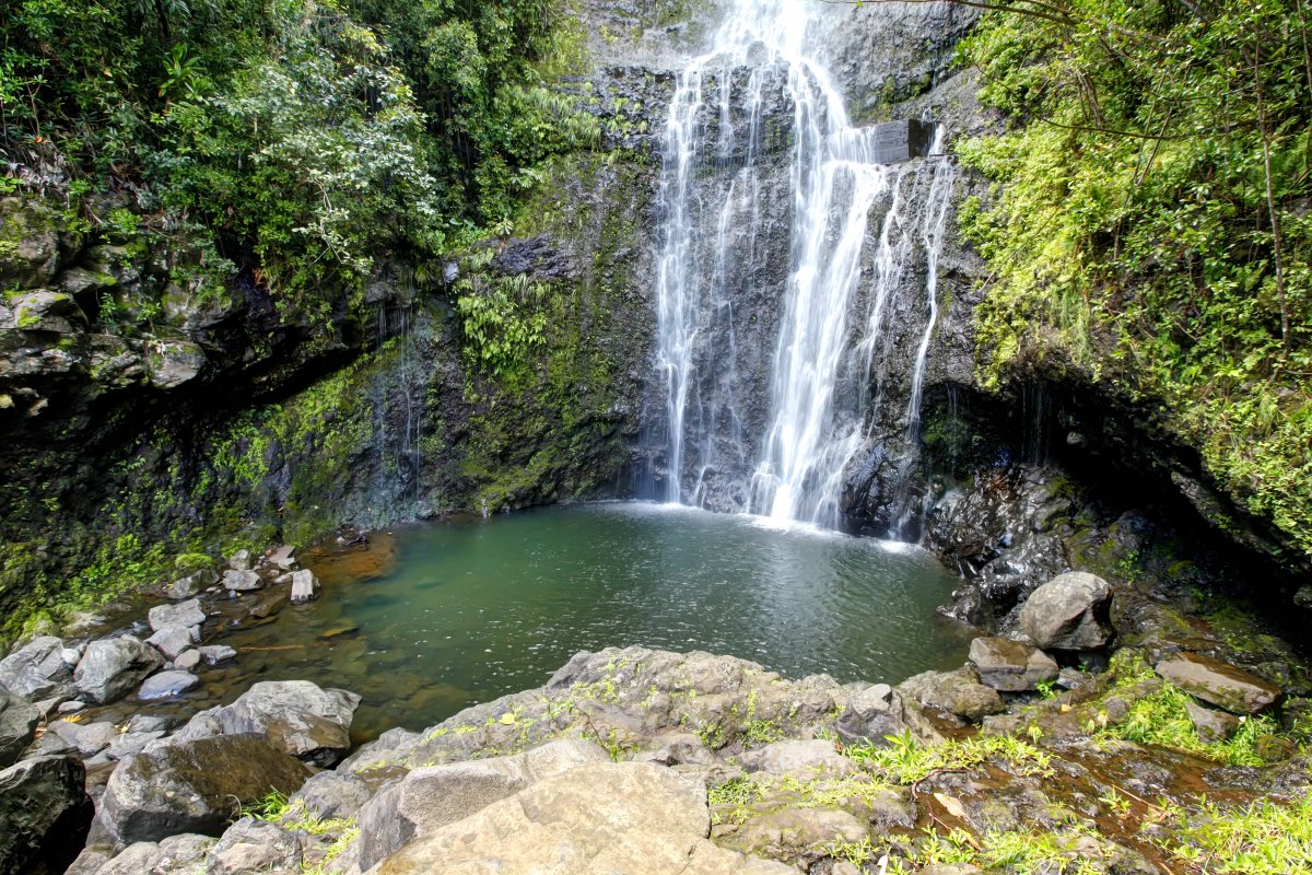 10 min from previous stop · 2.7 miHI-360MILE45
80-foot roadside waterfall on Honolewa Stream (not Wailua stream, despite the name); small parking lot makai right after the bridge; short path to the base — slick when wet
Approach Cue (~12-15 sec)Show transcript
Coming up on the makai side near mile marker 45—Wailua Falls, an 80-foot waterfall right by the road. There's a small pullout after the bridge, but only pull in if there's safe, legal parking. The path to the base gets slick when wet.Arrival Narration (~45-60 sec)Show transcript
You can hear the water before you see it—that constant roar cutting through the trade wind noise. This is Wailua Falls, an eighty-foot drop on the makai side of the highway (toward the ocean). The stream feeding it is actually Honolewa, not Wailua. The bridge carries the Wailua name, but the waterfall is on Honolewa Stream. The main cascade is visible from where you're standing; most people don't need more than five or ten minutes. There's a short path down to the base if you want closer—just know the rocks and slope stay slick after rain. Continue west toward Hāmoa Beach and Hāna Town. -
Connector · HI-360 14 min drive · 4.7 mi
Wailua Falls to Hāmoa Connector
Show transcript
You're on Highway 31 now, heading toward Hāmoa. This stretch pulls between the green slopes inland and the coast opening up ahead. You'll notice access points along here, but not every one works. Some cross private property, others have no safe parking. The road bends through this area and reaches Hāneoʻo Road before Hāmoa Beach shows up. That's your next stop, then Kōkī and Hāna Town after. Stick with the established access points—they're the ones that make sense for the drive. -
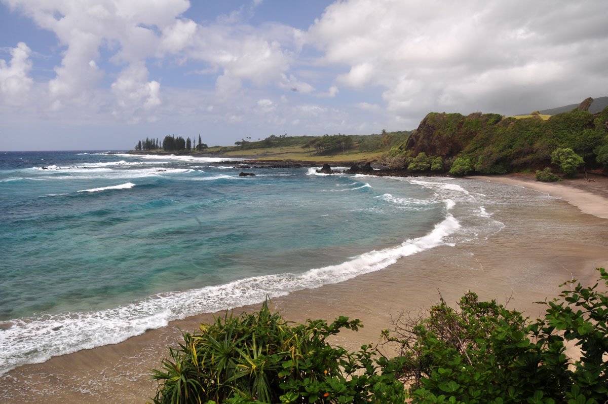 14 min from previous stop · 4.7 miHI-360MILE49
1,000-foot gray-sand beach surrounded by cliffs and lush vegetation; good swimming and bodysurfing; facilities maintained by adjacent hotel are available to visitors; unprotected, big surf in winter
Approach Cue (~12-15 sec)Show transcript
Coming up on the makai side—Hāmoa Beach off Hāneoʻo Road. A thousand-foot gray-sand beach with good swimming and bodysurfing when conditions are right. Park above on the roadside, take the stairs down. No reef protection here, so check the water before you go in and respect any posted warnings.Arrival Narration (~45-60 sec)Show transcript
You're standing on gray sand curved between cliffs, with vegetation spilling down the slopes. This is Hāmoa Beach, and what sets it apart is the unprotected shore break. There's no reef here to soften incoming swell, so the water can turn powerful without warning, especially in winter. The beach itself is public, though the land around it is privately owned—respect that boundary. Facilities are available to visitors. Watch the water before you go in. If conditions look rough, stay on shore and take in the view. When you're ready, head back to Hāneoʻo Road, continue toward Kōkī Beach, then rejoin Highway 31 toward Hāna Town. -
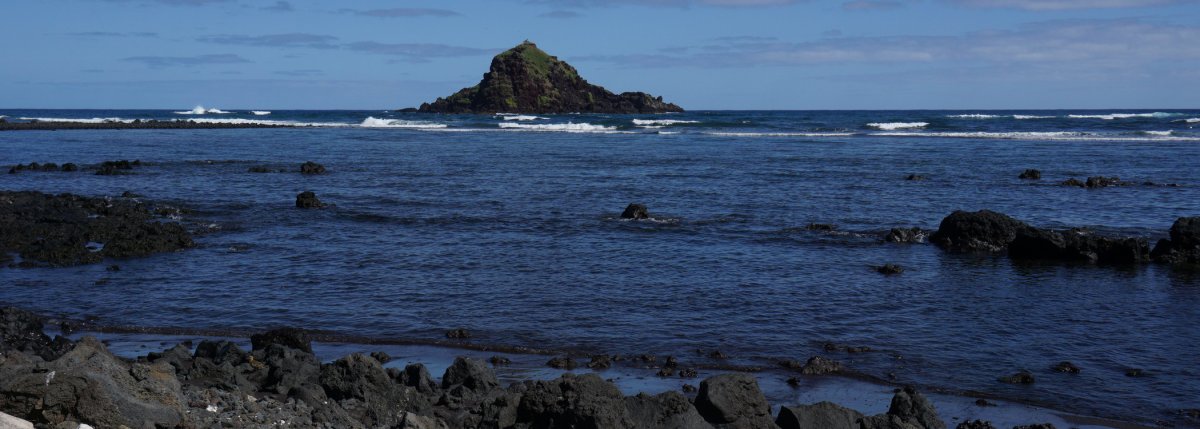 3 min from previous stop · 0.8 miHI-360MILE50.5
Red-sand beach below the Ka Iwi o Pele eroding cinder cone; views of Alau Island and offshore sea arch; strong currents — use caution swimming
Approach Cue (~12-15 sec)Show transcript
Makai side coming up—Kōkī Beach. Red-sand shoreline below Ka Iwi o Pele with views out to Alau Island. Strong currents and uneven conditions make this primarily a scenery stop. Use designated access and keep clear of local driveways.Arrival Narration (~45-60 sec)Show transcript
See that rusty-colored sand under your feet? It's not dirt—it's the cinder cone Ka Iwi o Pele breaking down grain by grain. Across the water sits Alau Island, and if you look close at the shoreline makai, you'll spot the low stone walls of old fishponds built here generations back. The currents run hard through this stretch and the bottom's uneven, so if you wade in, watch the water first and don't push it. Head back to the main road when you're ready and continue west into Hāna Town. -
Connector · HI-360 7 min drive · 3.2 mi
Kōkī to Hāna Connector
Show transcript
You're heading back toward Hāna now, leaving the Kīpahulu coast behind. This stretch brings you from the quieter eastern side toward actual town—a shift you'll feel. The mile markers will help you track where you are; stick with the paved public route and you'll be fine. Hāna itself is your practical anchor point. Gas up, grab food, check road conditions before you commit to that long drive back west. If you stayed the night in town, you can pick up the reverse tour from the Hāna Town segment. Either way, once you leave Hāna, Highway 360 takes you toward Waiʻānapanapa and Keʻanae on your way to Pāʻia. -
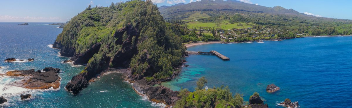 7 min from previous stop · 3.2 miHI-360MILE34
Alternate route joining point for travelers staying in Hāna; practical fuel, food, restroom, and conditions-check stop before the westbound drive to Pāʻia.
Approach Cue (~12-15 sec)Show transcript
Coming up on the makai side—Hāna Town. Grab fuel, food, water, and check road conditions before you head west on Highway 360. This is your last stop before the long drive.Arrival Narration (~45-60 sec)Show transcript
You're standing in a small East Maui community that has stayed itself rather than becoming a resort town. Hāna Bay sits makai—toward the ocean—if you want to stretch your legs, but the services you need are scattered through town itself. Before you leave, fill your tank, use a restroom, and confirm any reservation timing. If you stayed overnight here or already finished the Kīpahulu section, this is where you reset before the westbound drive. From here Highway 360 carries you west toward Pāʻia. Waiʻānapanapa comes first as your next major stop, followed by the rainforest highway through Keʻanae. Take what time you need. -
Connector · HI-360 8 min drive · 2.3 mi
Hāna to Waiʻānapanapa Connector
Show transcript
Heading back toward Pāʻia, the mile markers count down on Highway 360. Waiʻānapanapa State Park is coming up next. The park requires advance entry and parking reservations—there's no same-day purchase at the entrance. If your reservation doesn't match your timing, continue on rather than stopping on the roadside. The established turnoff is just ahead. -
 8 min from previous stop · 2.3 miHI-360MILE32
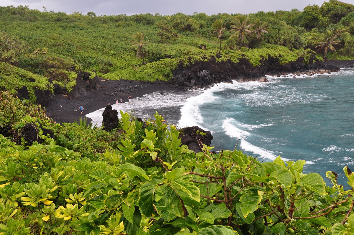
Honokalani black-sand beach at Waiʻānapanapa State Park; non-Hawaiʻi residents need advance entry and parking reservations through the official Hawaiʻi State Parks reservation system; same-day purchases are not available at the park; check current fees and access before visiting.
Approach Cue (~12-15 sec)Show transcript
Coming up on the makai side near mile marker 32—Waiʻānapanapa State Park, home to Honokalani black-sand beach. Non-Hawaiʻi residents need advance reservations through the official Hawaiʻi State Parks system; same-day entry isn't available. If you don't have a reservation, keep going.Arrival Narration (~45-60 sec)Show transcript
Black sand stretches underfoot—volcanic rock broken down over time. This is Honokalani Beach at Waiʻānapanapa State Park, makai of the road, where the landscape speaks to how geologically young this island is. Lava cliffs, sea stacks, caves carved into rock, and native hala trees line the shore. The ocean here has dangerous shore break and strong currents, so unless conditions look genuinely calm, stay back from the water and treat this as a viewing spot. Keep to the established paths and respect any closed or protected areas. You needed advance reservations to get in—both entry and parking—so if you're here now, you're set. Head back to Highway 360 and continue west toward Kahanu Garden and the rainforest section ahead. -
 11 min from previous stop · 3.3 miHI-360MILE31
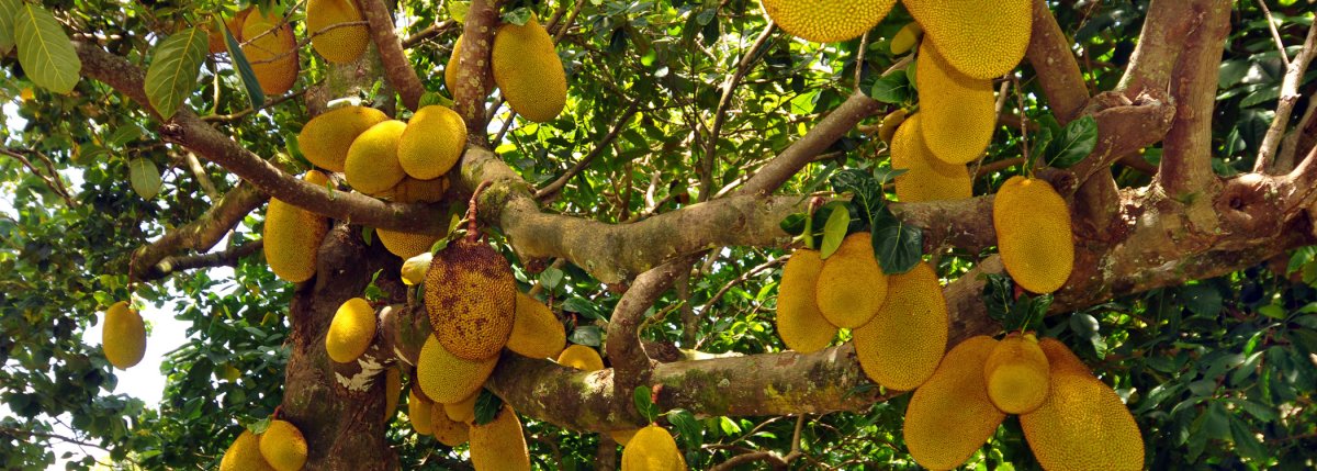
Kahanu Garden on ʻUlaʻino Road is home to Piʻilanihale Heiau; check the official National Tropical Botanical Garden schedule and current ʻUlaʻino Road access before visiting.
Approach Cue (~12-15 sec)Show transcript
Coming up makai side, near mile marker 31—Kahanu Garden turnoff on ʻUlaʻino Road. The garden protects native Hawaiian and Polynesian plants around Piʻilanihale Heiau. Road conditions change after rain, so check the garden's current opening schedule and access notice before you turn in.Arrival Narration (~45-60 sec)Show transcript
You can hear the trade winds moving through the palms here at Kahanu Garden, makai—toward the ocean. At its center sits Piʻilanihale Heiau, a massive lava-rock temple platform. You won't walk on it; the trail keeps respectful distance. But standing here and seeing the scale of those stones gives you a sense of why this place held meaning. The garden preserves plants connected to Pacific island life and culture, and that connection is what sets it apart from other botanical stops. Spend real time here if you can. Before you visit, check the National Tropical Botanical Garden's current schedule and road access on ʻUlaʻino Road—things change. When you're ready, head back to Highway 360 and keep west toward Puaʻa Kaʻa and Keʻanae. -
Connector · HI-360 28 min drive · 9.9 mi
Kahanu to Puaʻa Kaʻa Connector
Show transcript
The rainforest closes in on both sides and the road keeps twisting through stream valleys. This stretch gets water from everywhere. Waterfalls show up constantly along here, but the shoulders are tight and the curves come fast without much warning. A lot of people try to pull over for photos at unmarked spots, but it's dangerous ground. The established places—like where you're heading at Puaʻa Kaʻa—exist for good reason. You'll cross a bunch of short bridges as the mile markers tick down. Stay patient and stick to the pullouts built for it. -
 28 min from previous stop · 9.9 miHI-360MILE22
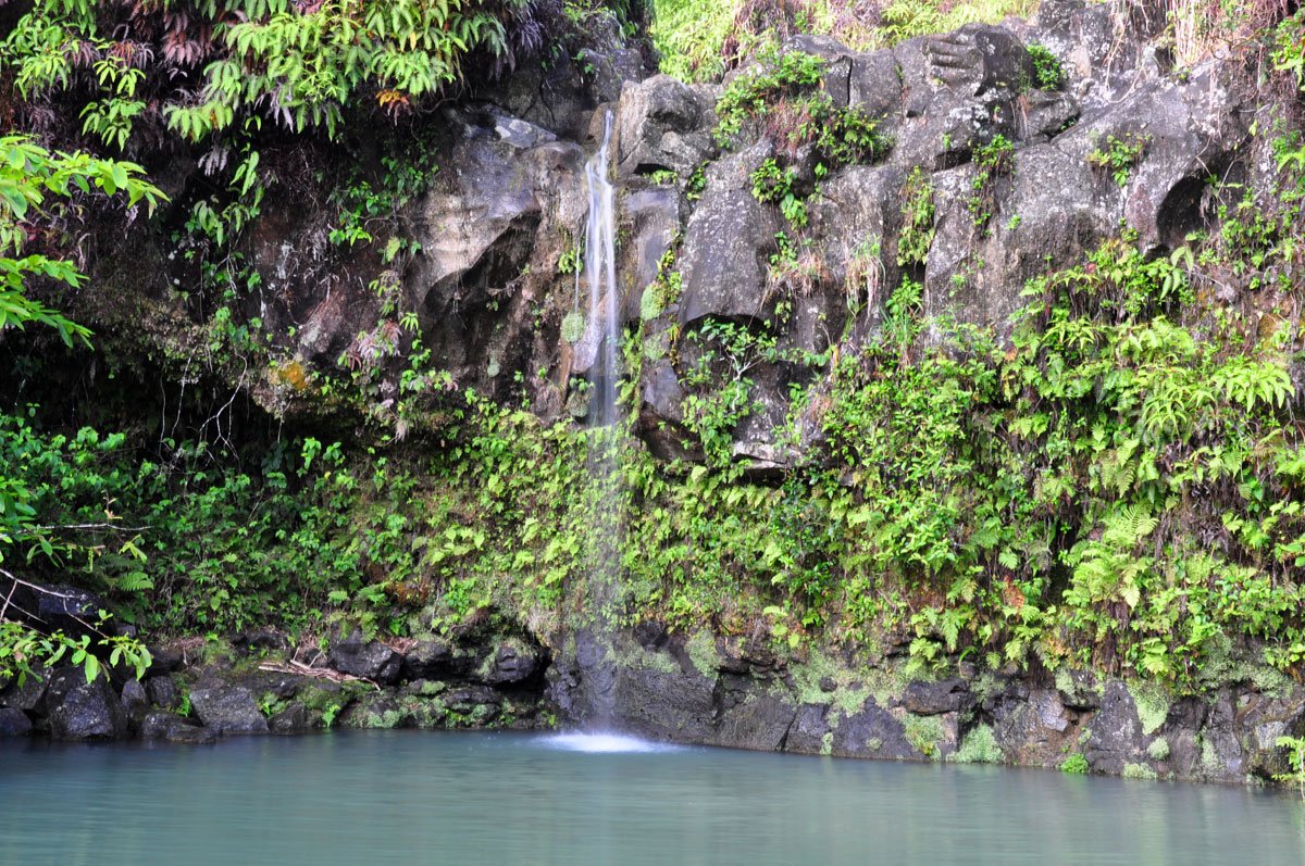
State wayside with paved trail to small falls, picnic tables, and restrooms; large paved parking lot makai
Approach Cue (~12-15 sec)Show transcript
Coming up on the mauka side—Puaʻa Kaʻa State Wayside at mile marker 22. Short paved path to small falls, picnic tables, and restrooms. Park in the large paved lot on the makai side. Watch for posted warnings about water conditions after rain.Arrival Narration (~45-60 sec)Show transcript
You're standing in thick rainforest, and you can hear water running somewhere close. That's Puaʻa Kaʻa—a state wayside tucked mauka, toward the mountain, where a short paved path drops down to small cascades. What makes it useful on this drive is simpler than the falls themselves: real restrooms, picnic tables in shade, and a chance to step out of the car. Watch the water before you go down—freshwater here moves fast and can carry health risks, so if conditions look off or there's a warning sign, skip it. When you're ready, head west toward Wailua and Keʻanae. -
Connector · HI-360 14 min drive · 5.2 mi
Puaʻa Kaʻa to Halfway Connector
Show transcript
The road crosses stream valleys now, each one cut by water and marked by roadside cascades. Upper Waikani Falls is visible near the road. The valleys open in places, and from certain angles you can see across to the ocean and Haleakalā's green northeast slope. This is narrow country where faster local traffic moves regularly. Don't brake suddenly for an unplanned pullout—continue to the next safe place and let them pass. The Halfway to Hāna stand and the Keʻanae turnoffs are coming up. Pull over only where every wheel sits completely clear of the lane. -
 14 min from previous stop · 5.2 miHI-360MILE17Stop · mile 17 makai
Halfway To Hana
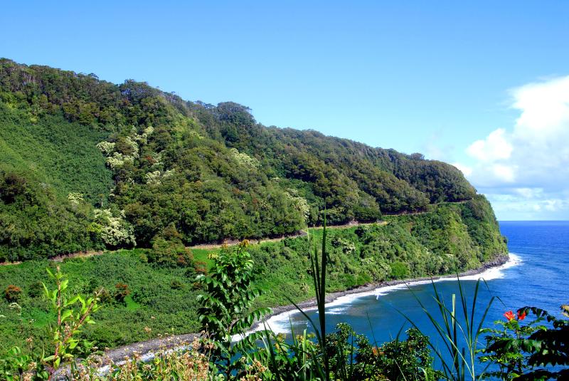
Roadside banana bread stand roughly halfway between Paia and Hana; cash preferred; hours variable
Approach Cue (~12-15 sec)Show transcript
Coming up on the makai side near mile marker 17—the Halfway to Hāna banana bread stand. Cash preferred, hours shift around, so don't count on it being open. If there's parking without blocking the road, worth a quick stop.Arrival Narration (~45-60 sec)Show transcript
See the small stand just makai—toward the ocean—from the road here? That's your banana bread spot, roughly halfway between Pāia and Hāna. The menu changes day to day, and hours aren't fixed, so what's here depends on what's available when you arrive. Cash works best if you've got it. The banana bread is why people stop, but treat it as a bonus rather than a guarantee. This is a good place to pause for a few minutes, grab something if it's open, then continue back to the main road. From here the Keʻanae Peninsula turnoff comes up soon—keep an eye out for it. -
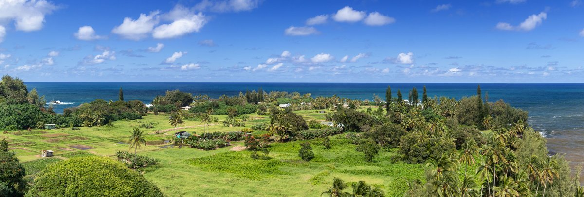 3 min from previous stop · 1.2 miHI-360MILE16.5
Living village on a lava delta; 1946 tsunami history; taro fields, hala trees, seabird sanctuary offshore
Approach Cue (~12-15 sec)Show transcript
Coming up on the makai side near mile marker 16—Keʻanae Peninsula, a living village on a lava delta with taro fields and a seabird sanctuary offshore. Park only where marked, stay off private driveways, and return to Highway 360 when you're done.Arrival Narration (~45-60 sec)Show transcript
See how the ocean's broken that lava shelf into a jagged black line—that's makai, toward the water. You're standing on a lava delta where families have been growing taro for generations. The stone church mauka survived the 1946 tsunami, while the fields and homes around it stayed part of this living community. The taro's still being worked today. This isn't a museum, so keep to the public road, stay out of the water, and move through quietly. Head back up the same road to Highway 360 and continue west to Keʻanae Arboretum. -
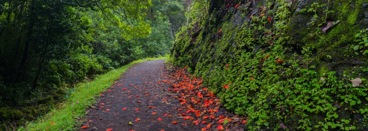 3 min from previous stop · 0.6 miHI-360MILE16
Free state-run arboretum with paved 0.6-mile walkway, taro fields, and painted bark eucalyptus; no facilities
Approach Cue (~12-15 sec)Show transcript
Coming up on the mauka side at mile marker 16—Keʻanae Arboretum. Free state arboretum with a short paved walkway through taro fields and painted bark eucalyptus. Small parking lot on the makai side, so cross carefully when you can see around the curve. No facilities here.Arrival Narration (~45-60 sec)Show transcript
You'll see the rainbow eucalyptus trees first — their bark painted in streaks of orange and cream and pale green. Keʻanae Arboretum sits mauka, toward the mountain, on land that's been worked and planted for centuries. A short paved path, about 0.6 miles, loops through labeled tropical plants and brings you close to these trees. The garden sits among taro fields that still produce crops. There are no restrooms, drinking water, or trash service here, so carry out everything you bring. Spend time on the walk at your own pace, then cross the highway with care and head west toward Honomanu and Kaumahina. -
Connector · HI-360 8 min drive · 2.8 mi
Keʻanae to Honomanu Connector
Show transcript
You're climbing away from Keʻanae now, heading inland through steep, wet terrain as the highway bends back toward the coast. The road narrows through country that catches rain from the trade winds. You'll pass a few viewpoints tucked around blind curves—only pull in if there's real room for the whole vehicle. Honomanu Bay is ahead as a proper stopping point. After that, Kaumahina State Wayside gives you more space to pause before Garden of Eden and Waikamoi. The stretch here moves through some of the island's wettest terrain, so expect moisture on the windshield and green pressing in from both sides. -
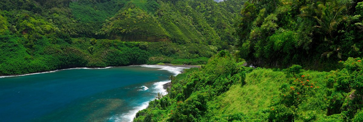 8 min from previous stop · 2.8 miHI-360MILE13
Quick roadside pullout with a view down into Honomanu Bay and back toward Keanae Peninsula
Approach Cue (~12-15 sec)Show transcript
Coming up on the makai side—Honomanu Lookout, a small roadside pullout with a view down into Honomanu Bay and back toward Keanae Peninsula. Only pull in if there's space and you can clear the road completely.Arrival Narration (~45-60 sec)Show transcript
Honomanu Bay drops away makai—toward the ocean—between steep valley walls, dark shoreline and open-ocean swell visible from where you stand. The rough dirt tracks you see descending toward the bay aren't part of this visitor route. They'll conflict with rental agreements, and safer access is from here at the established overlook. Take in the view, then head west to Kaumahina State Wayside, the next stop. -
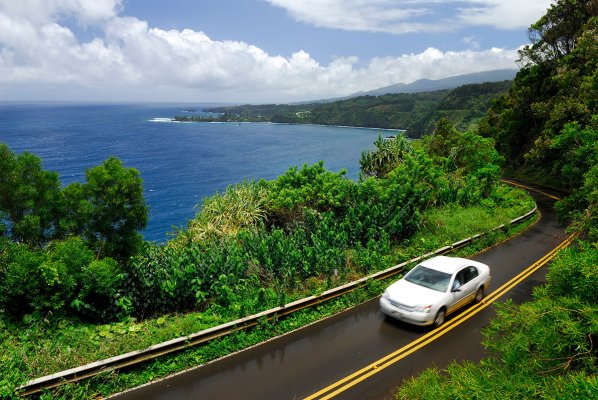 7 min from previous stop · 2.1 miHI-360MILE12.3
Roadside state park with bathrooms, picnic tables, and a viewpoint of Keanae Peninsula
Approach Cue (~12-15 sec)Show transcript
Coming up on the mauka side—Kaumahina State Wayside. Pull in for restrooms, picnic tables, and a short overlook path with views of Keanae Peninsula. Good break before Garden of Eden and Waikamoi.Arrival Narration (~45-60 sec)Show transcript
You can feel the road's been working your shoulders—this pullout has benches and real bathrooms, which matters on the Hāna route. A short path climbs mauka, toward the mountain, and opens up views back down to the Keʻanae Peninsula, that dark lava delta you passed below. You get actual rest here instead of just grabbing the wheel again. Spend a few minutes taking it in. Then head back to your car and continue west toward Garden of Eden and the Waikamoi section of Highway 360. -
Connector · HI-360 8 min drive · 2 mi
Kaumahina to Garden Connector
Show transcript
You're driving along the windward slope of Haleakalā, where the mountain pulls moisture from the trade winds. The forests here are wet. Rain feeds the streams crossing beneath the highway—the same streams that have supported East Maui communities and agriculture for generations. What you're on is a modern road, but it follows a much older movement corridor around the island, a path people traveled long before any pavement existed. Stay focused on the narrow pavement ahead. The one-lane bridges require attention. Garden of Eden Arboretum is on the mauka side just ahead. -
 8 min from previous stop · 2 miHI-360MILE10
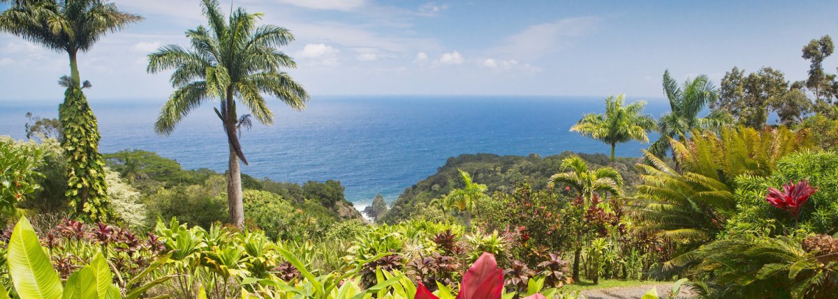
Private 26-acre botanical arboretum with ocean views and a Keopuka Rock lookout; paid admission.
Approach Cue (~12-15 sec)Show transcript
Coming up on the mauka side near mile marker 10—Garden of Eden Arboretum, a private botanical garden with 26 acres, ocean views, and a Keopuka Rock lookout. Paid admission. The walking loop takes time, so check current hours and prices before you head in.Arrival Narration (~45-60 sec)Show transcript
You're standing in a 26-acre botanical garden tucked mauka — toward the mountain — from the highway, and the air already feels thicker with green. The place layers itself: labeled tropical plants give way to cultivated gardens, then you climb to overlooks where the view opens toward the ocean. One viewpoint frames Keopuka Rock, that distinctive formation you might recognize from Jurassic Park's opening shots. This is private land with an admission fee, so check the garden directly for current hours and what's open when you visit. The overlooks reward the climb. When you head back to the car, you're pushing west toward Waikamoi Ridge Trail and Twin Falls next. -
 6 min from previous stop · 1.3 miHI-360MILE9
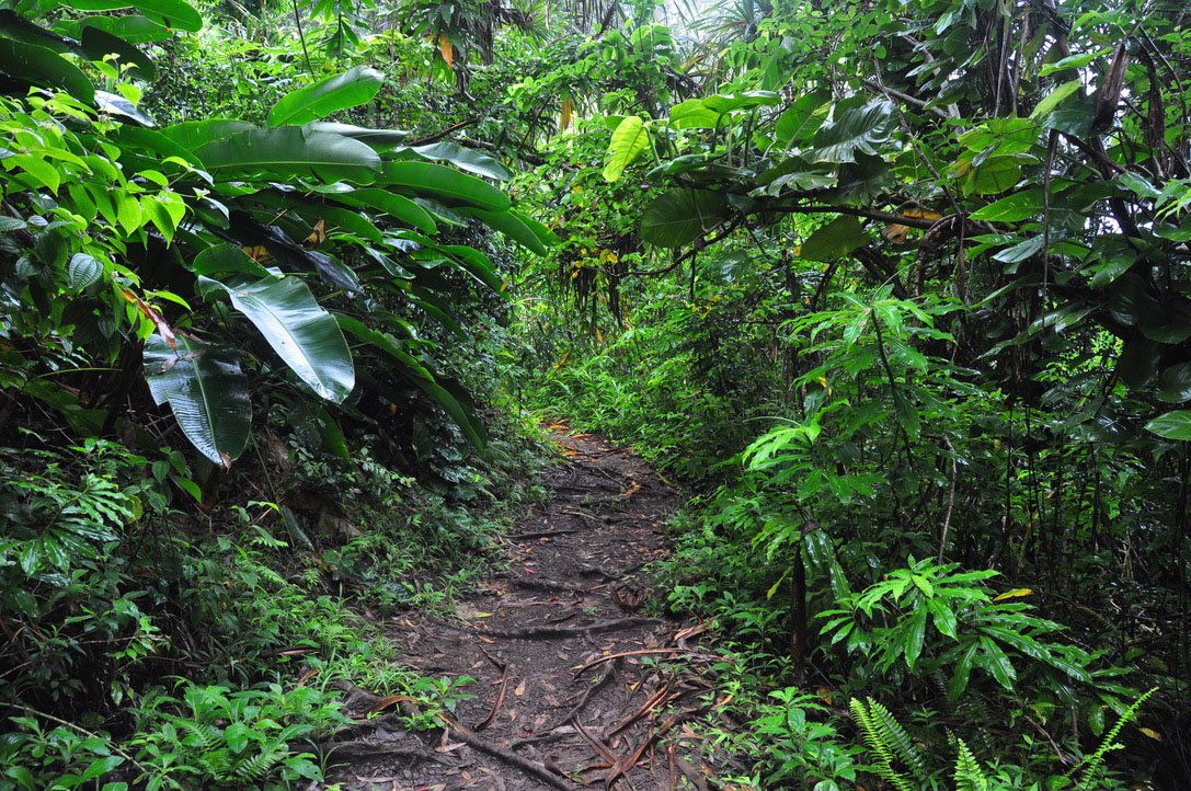
Free rainforest nature walk with picnic shelter at trailhead; no facilities; bug spray recommended
Approach Cue (~12-15 sec)Show transcript
Coming up on the mauka side near mile marker 9—the Waikamoi Ridge Trail. This free rainforest walk has a picnic shelter, but the small parking area sits near a curve, so slow down and skip the stop if there's no safe legal space. The trail gets muddy and rooty after rain with no dependable visitor services. Bring bug spray.Arrival Narration (~45-60 sec)Show transcript
You're standing at the edge of a rainforest wall, all dripping ferns and bamboo crowding the mauka side—toward the mountain. This is Waikamoi Ridge Trail, a short walk through planted forest on this wet slope above the road. The mud and exposed roots make the footing more demanding than the distance suggests, especially after rain. The trail is free, there's a picnic shelter at the trailhead, and no other facilities. Bring bug spray. Mosquitoes thrive in this climate. Take your time on the uneven ground, watch your step, and pack out anything you pack in. When you head back to the highway, Twin Falls is your next major stop, followed by the Highway 360-to-36 transition and Hoʻokipa. -
Connector · HI-360 21 min drive · 7.4 mi
Waikamoi to Twin Falls Connector
Show transcript
You're passing through country where the forest opens as you descend toward Highway 360. The eucalyptus trees with their painted bark break up the roadside green, mixed in with patches of cultivated land. They're not native to Hawaii, but they're what you see here now. The road still has its quirks—blind curves and narrow shoulders. If traffic collects behind you, pull over at one of the proper turnouts and let them pass. Twin Falls is the final major rainforest stop on this route. After that, you're heading toward Hoʻokipa and Pāʻia, where the landscape shifts character entirely. -
 21 min from previous stop · 7.4 miHI-360MILE2Start of Hāna Highway (HI-360) · MM 2
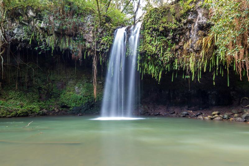
Twin Falls is on private Wailele Farm property; parking, operating hours, and trail access can change, so check current official visitor information before arriving.
Approach Cue (~12-15 sec)Show transcript
Coming up on the mauka side near mile marker 2—Twin Falls, a privately operated farm stop with a waterfall. Parking and access change seasonally, so verify conditions before you arrive. Skip it if the lot's full or staff have closed entry.Arrival Narration (~45-60 sec)Show transcript
You're hearing water before you see it—that's the first sign you're in the right place. Twin Falls sits on private farm land mauka of the road, toward the mountain. The freshwater cascades and trail draw people here, though conditions shift with rain. The current can surprise you, and freshwater carries its own health risks, so follow staff directions and watch for posted closures. This is the last rainforest stop before the highway transitions and the road starts opening toward the coast. Point west for Hoʻokipa Beach Park when you leave. -
Connector · HI-36 17 min drive · 9.6 mi
Twin Falls to Hoʻokipa Connector
Show transcript
You're leaving the rainforest now as Route 360 merges into Route 36 heading west. The tight curves are loosening out, and the landscape opens into what used to be agricultural land. You can feel the North Shore getting closer—the terrain's shifting beneath you. This is former plantation country, though most of that's long gone. The highway's maintained and straightforward now, a different rhythm than what you've been driving. Hoʻokipa Beach Park is just ahead with its overlook above the surf. Pāʻia follows shortly after that, marking the end of this route. -
 17 min from previous stop · 9.6 miHI-36MILE9
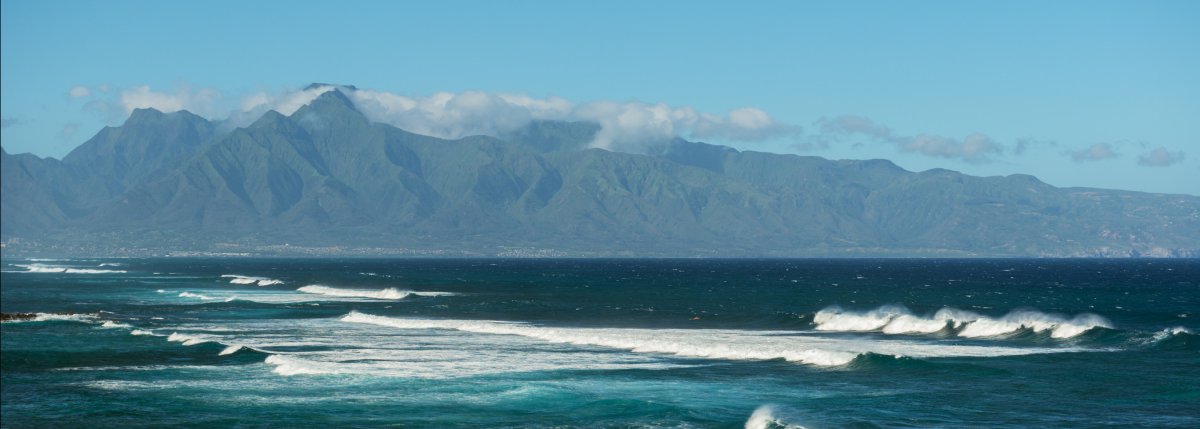
Windsurfing and surfing hotspot on Maui's North Shore; overlook at the east end of the park is the easy visit, beach access below is a surfer hangout
Approach Cue (~12-15 sec)Show transcript
Coming up on the makai side, Hoʻokipa Beach Park—a windsurfing and surfing hotspot on the North Shore. The overlook at the east end is the quick visit, or head down to the beach below. Watch for traffic in and out of the park, and use marked parking rather than the highway shoulder.Arrival Narration (~45-60 sec)Show transcript
You're standing above one of Maui's best-known windsurfing and surfing breaks, and if the wind's up, you'll see riders carving across the water. This overlook—makai, toward the ocean—gives you the broadest view without requiring a beach visit. What stops most people short is the green sea turtles. They haul out on the sand to rest, and you can watch them from where you stand. Never approach or touch them. Take your time here if the swell's working. When you're ready, head west on Highway 36. Lower Pāʻia is about two miles ahead and closes the route. -
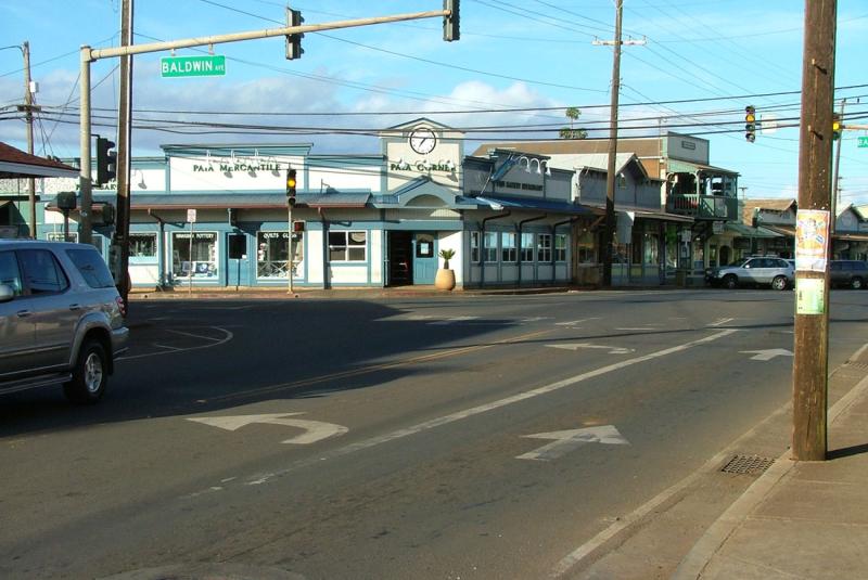 6 min from previous stop · 2.1 miHI-36MILE7Stop · mile 7 makai
Lower Paia Town
Reverse route endpoint with fuel, food, and services; use Lower Pāʻia as the transition back to Central, South, or West Maui.
Approach Cue (~12-15 sec)Show transcript
Coming up on the makai side, Lower Pāʻia marks the end of the Road to Hāna reverse. Traffic and pedestrians pick up fast through town—slow down and find legal parking if you're stopping for food or fuel. Highway 36 heads toward Kahului from here.Arrival Narration (~45-60 sec)Show transcript
You can smell the salt air here—that's the shift from the Hāna Highway trades. Lower Pāʻia grew from a plantation town into a North Shore hub for food, shops, surfing, and wind sports. It's your practical transition point back to Central Maui. You've completed the paved return-direction route from Kīpahulu and Hāna. Stop for food or fuel if it fits your day, or continue toward Kahului and your lodging area. The makai side of town—toward the ocean—holds most of what you'll need. -
Outro
Outro
Show transcript
You've just driven the road in reverse—same rainforest, but the timing and views shift when you go the other way. From Pāʻia, head toward Kahului, South Maui, or West Maui based on your plans. Check Hawaii Guide for current conditions before your next drive.
This tour is created with AI from HawaiiGuide route content and read by the computer-generated Mele and Kani voices. Hawaiian names and place names may occasionally be mispronounced — mahalo for your patience as we refine.

Need help planning?
Search & Planning Chat →

Hawaiʻi Weather Forecast
Today’s Weather Brief · Audio · ~45s
0:00
0:54
Read the transcript
Trades are breezy right now with scattered showers on the windward side and mountains; the leeward coast stays mostly dry. Tomorrow stays breezy with the same pattern.
A tropical disturbance southeast of the islands is likely to become a tropical storm by mid-week and approach the state Thursday through Saturday. The exact track is still uncertain. If it comes closer, expect heavier rain over a longer stretch; if it stays farther out, impacts will be shorter and lighter. Winds will increase late this week, with potential gusts over 70 miles per hour on the highest summits.
Plan your leeward beach time and snorkeling for today through Tuesday. Save summit drives and offshore water sports for after Saturday, and check updates daily as this develops.
Created with AI from the official NWS forecast discussion · verify with NWS before heading out
Loading forecast…
Temperature
Weather data by Open-Meteo.com
Current Time in Hawaiʻi
--:----
Hawaiʻi Standard Time · UTC−10 · No Daylight Saving
You’re on Hawaiʻi timeMainland US
International
Aloha Today daily podcast →
Full HST breakdown, FAQ & DST schedule →

Get Your Free Hawaii Visitor Guide
Enter your email and we'll send you instant access to our free 2026 Hawaii Starter Guide + Summary Guidesheets.