
Oahu Beaches
Yokohama Bay (Keawaʻula)
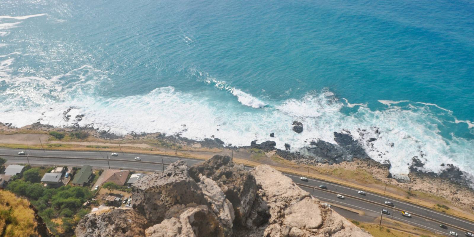
Yokohama Bay (Keawaʻula) lies on Oʻahu's Waiʻanae Coast in the Keawaʻula section of Kaʻena Point State Park. DLNR's park page describes a comfort-station parking lot for normal access. Its October 29 notice says Kaʻena vehicle access has closed because roads are saturated; that older route description does not establish that the lot can now be reached. Check current section-specific controls before planning a drive.
The Hawaiian name is Keawaʻula ("the red harbor"), a reference to schools of red squid that historically gathered offshore. A NOAA-hosted cultural guide traces the "Yokohama" name to an old railroad worker known as Yokohama who walked to this switching point; plantation-camp residents accompanied him to fish, and the place became known first as Yokohama's Switch and later as Yokohama Beach.
Book Water Activities on Oahu
Free cancellation on most tours. Real pricing and verified traveler reviews.
Check Availability & Pricing Browse all Oahu tours
Yokohama Bay sits at the literal end of Farrington Highway on Oahu's far west coast.
What to expect when you get there
This is a remote beach; confirm current lifeguard staffing and facilities before entering the water. DLNR’s October 29 notice closes Kaʻena vehicle access because of saturated roads; Keawaʻula Trail remains closed. The reopened comfort station does not establish that the lot or beach is reachable. Confirm current access before planning a visit, and follow posted controls.
Swimming and surf
The water at Yokohama is genuinely beautiful — clear turquoise on calm summer days. But the conditions here are not casual. The bay sits exposed to north and west swells. From late fall through early spring, surf regularly runs head-high and bigger, and the shore break can be punishing. Currents along this stretch of the Waianae Coast are strong year-round; do not enter the water unless conditions and posted safety guidance support it.
Treat it like a beach for experienced ocean-goers. Summer mornings give the calmest windows for a swim. If the surf is up at all, stay on the sand. The break draws skilled bodyboarders and a few surfers who know the spot — watch them for a while before you decide to enter the water.
Wildlife
Yokohama is one of the most reliable spots on Oahu to see Hawaiian monk seals, an endangered native species. They haul out to rest on the sand fairly often. Stay back at least 50 feet — they're protected by federal law, and well-meaning tourists getting too close has caused real problems. Volunteers from NOAA and the Hawaiian Monk Seal Research Program will sometimes rope off a section of beach when a seal is resting; respect the cordons.
Green sea turtles (honu) also frequent the bay. Humpback whales pass through Hawaiian waters from November into May, with peak viewing typically from January through March; the cliffs above Kaena Point can provide a land-based vantage on Oahu.
The drive out
Only after DLNR confirms vehicle and lot access, use its current park directions and posted signs to plan a drive to Keawaʻula. The October 29 Kaʻena closure notice does not establish a usable route to the beach.
DLNR’s October 29 notice closes Kaʻena vehicle access due to saturated roads and keeps Keawaʻula Trail closed. It does not confirm that the Keawaʻula comfort-station lot is reachable. Do not assume roadside or trailhead parking is available; check current controls before driving.
Combining it with Kaena Point
Keawaʻula Trail remains closed. When it reopens, the Kaena Point Trail is roughly five miles round trip, depending on the exact turnaround, along an old dirt roadway to the westernmost tip of Oahu. The trail leads through a federally protected seabird preserve where Laysan albatross nest seasonally and ends at a windswept point with sweeping views back along both the Waianae and North Shore coastlines. There's no shade and no water along the way; bring at least a liter per person and start early to beat the midday heat. Check DLNR before planning a hike.
If DLNR confirms access for a future visit, a short beach stop can be planned separately from the Keawaʻula Trail, which remains closed under its October 29 notice.
Get Your Free O'ahu Guide
Instant access — opens immediately
- Beaches, activities & top spots
- Restaurant & dining recommendations
- Maps, itineraries & insider tips
Want the full offline version? Get the Complete O'ahu Guidebook →