
Hawaiʻi Guide · Audio Driving Tour
Windward Coast Drive BETA
Oʻahu's windward coast, Nuʻuanu Pali to Kahuku — the Koʻolau cliffs on one side, turquoise bays on the other. A gateway lookout, Kailua and Lanikai, the Byōdō-In Temple, the Mokoliʻi islet, the Kualoa film valleys, the Polynesian Cultural Center, and quiet beaches most visitors miss. ~14 curated segments. Free self-guided audio tour.
50 miles
~2h driving
12 curated stops
Free self-guided audio tour
~2h
total driving time
50 mi
total distance
12 stops
curated stops
5-8h
suggested day
We may link to trusted Hawaiʻi resources at no extra cost to you.
Build your own route
Pick a preset or tap the ✓ Include chip on any stop below to customize.
12
of 12 stops selected
-
Intro
Intro
Show transcript
You're starting at the top of the Pali with the whole eastern side of Oʻahu spread out in front of you. From here we're heading roughly fifty miles north to Kahuku at the island's top corner. Keep the Koʻolau cliffs on your left—that wall of green, fluted mountains stays with you the whole way—and the water on your right. This is the lush, rainy side of the island. The windward side catches the trade winds, so it stays green. Settle in, ease off the gas, and let the coast set the pace. We're not in a hurry today. Let's go. -
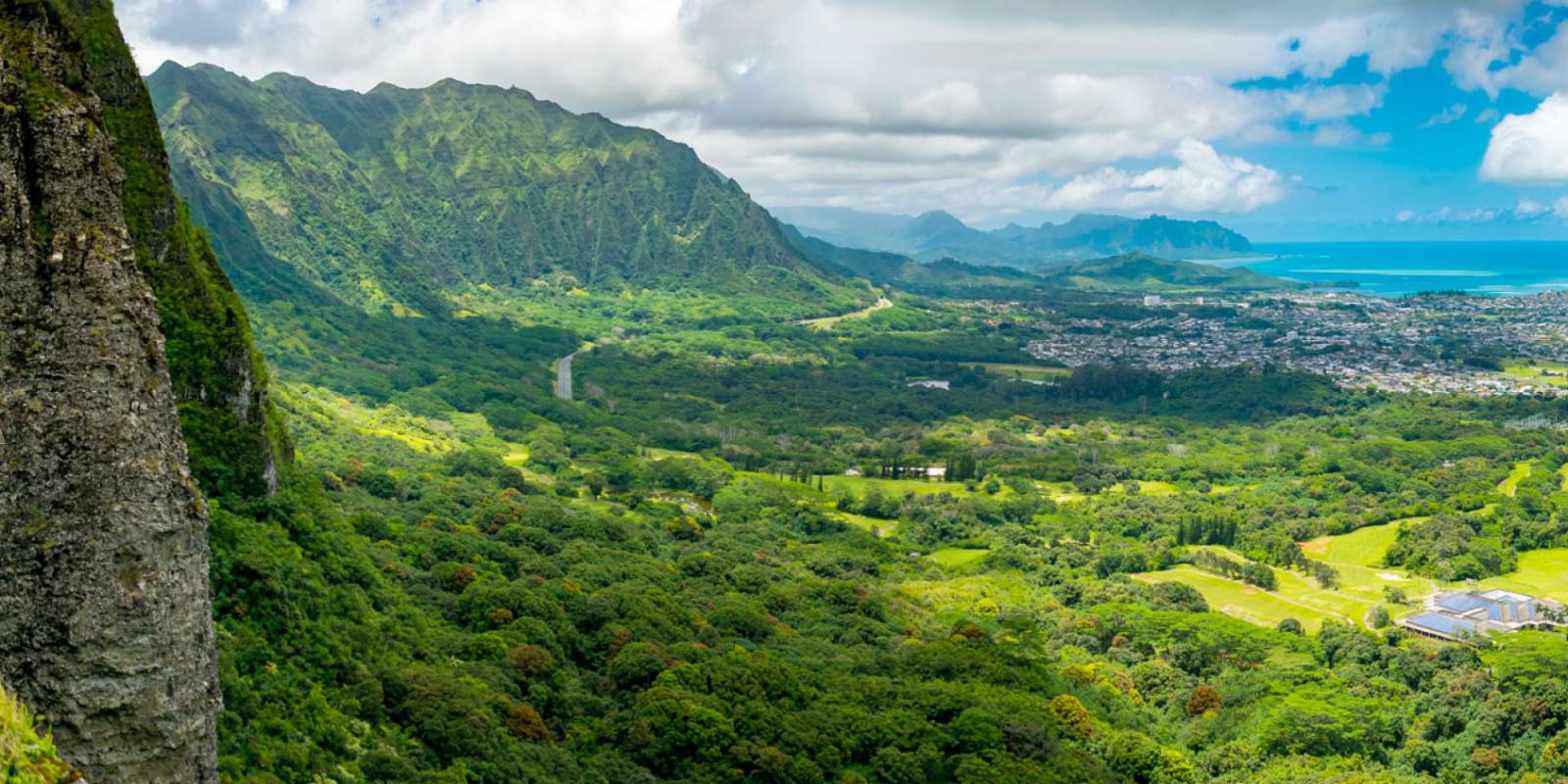
The gateway overlook to the windward coast, atop the Koʻolau range, where Kamehameha won the 1795 Battle of Nuʻuanu — and a fierce wind still rips across the cliff edge.
Approach Cue (~12-15 sec)Show transcript
Coming up on the mauka side in about half a mile — the Nuʻuanu Pali Lookout on Route 61. This is your first real view of the entire windward coast before you drop down into Kailua and Kāneʻohe. The wind gusts hard up here, so hold onto your hat and phone when you step out.Arrival Narration (~45-60 sec)Show transcript
Feel that wind hitting you? That's the Koʻolau ridge. Mauka — toward the mountain — is inland, and makai toward the ocean spreads out before you: rainforest, Kāneʻohe Bay in turquoise below, and on clear days, Mokoliʻi island way off in the distance. This overlook marks something heavier than the view. In 1795, Kamehameha the Great routed Oʻahu's warriors right off these cliffs during the Battle of Nuʻuanu. The plaques around you tell that story. Take the views in, read a plaque or two, then get ready to descend toward the coast. One thing to know — it's noticeably colder and windier up here than it'll be once you drop down to the beach, so bring a jacket if you have one. -
 14 min from previous stop · 6.2 mi
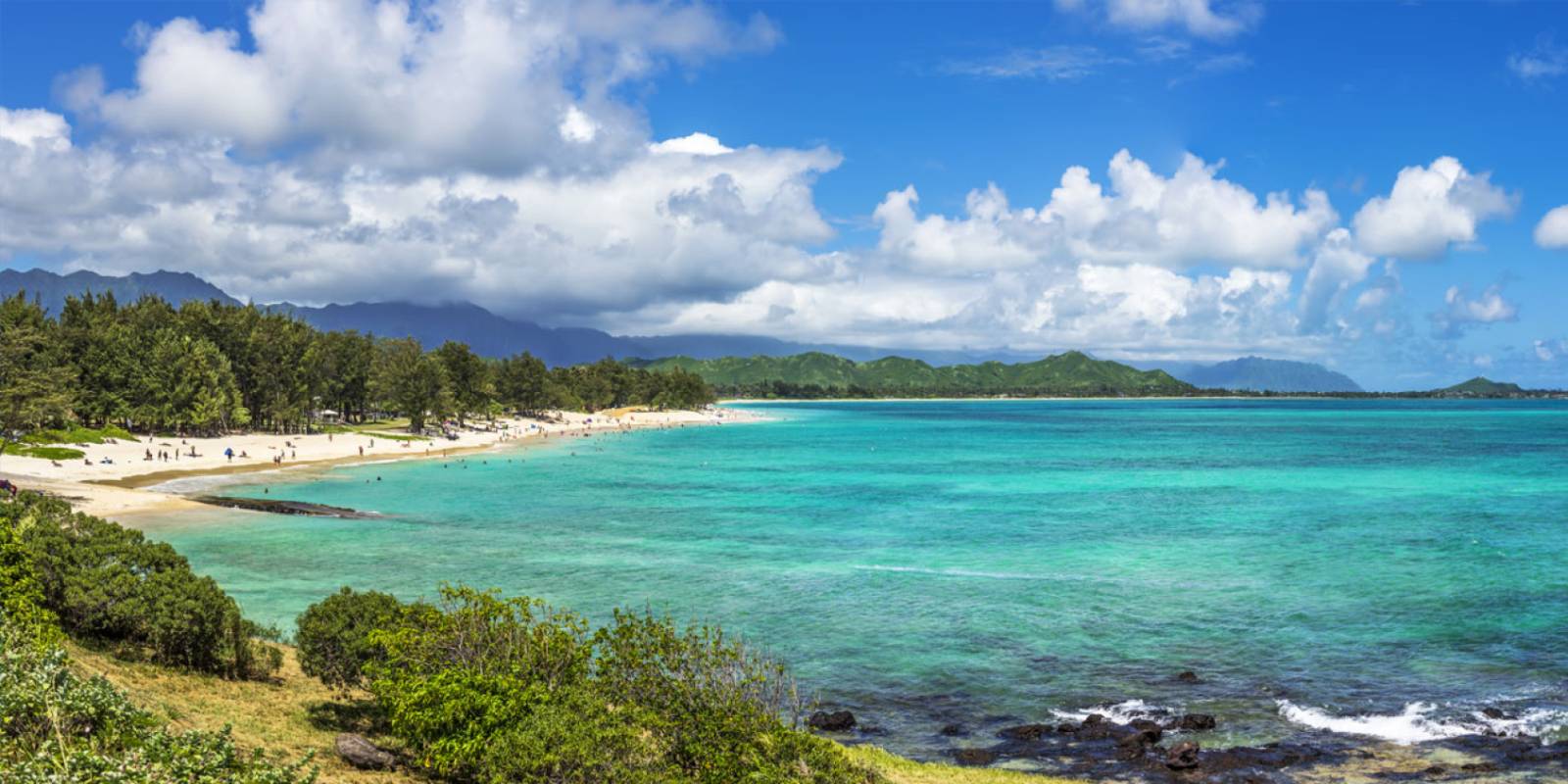
A 2.5-mile stretch of soft white sand on the windward side — kayaking, windsurfing, paddling, swimming — and the launch point for the Mokulua Islands.
Approach Cue (~12-15 sec)Show transcript
Coming up on the makai side as you enter Kailua town — Kailua Beach Park, one of the island's best all-around beaches. Two-and-a-half miles of soft white sand with swimming and kayaking. Full facilities here: parking, restrooms, showers, lifeguards. Parking lots fill up fast on weekends and holidays.Arrival Narration (~45-60 sec)Show transcript
You're standing at two and a half miles of white sand on this side of the island, with ironwood trees behind you and that turquoise water dead ahead. This is Kailua — and you picked the windward shore, which means the morning light and calm surface you're seeing right now won't last. Trade winds pick up hard in the afternoon, which is exactly why windsurfers camp here. The beach splits by vibe. The calmer water down by the boat ramp on the south end — makai, toward the ocean — is where families and lifeguards cluster. Head north and you'll find the best water for paddlers and wind sports. Those two islands you see offshore, Moku Nui and Moku Iki, are the Mokulua Islands. This beach is the official launch point for kayaking out to them. You can rent gear in Kailua town nearby. Walk the stretch, feel the sand, then decide if you're staying to paddle or moving on. One thing to know — you needed your own car to get here. Tour buses can't drop people at the park. -
 4 min from previous stop · 1.1 mi
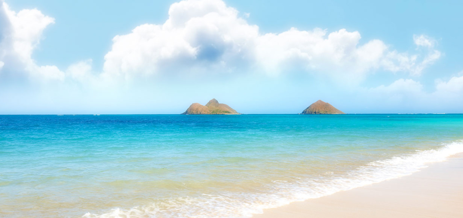
A half-mile of postcard white sand with calm, reef-protected turquoise water and the two Mokulua Islands offshore — but a residential dead-end with no lot, no restrooms, no lifeguards.
Approach Cue (~12-15 sec)Show transcript
Coming up makai in about half a mile—Lanikai Beach, a short detour off Kailua Road onto Mokulua Drive. Half a mile of white sand and reef-protected turquoise water with the Mokulua Islands offshore. No parking lot, only street parking, and they ticket or tow illegally parked cars. Leave your car at Kailua Beach Park and walk or bike the mile in instead.Arrival Narration (~45-60 sec)Show transcript
The turquoise water in front of you is held calm by an offshore reef, and those two islands sitting just offshore — 'The Mokes' — are what make this beach unmistakable. Half a mile of white sand, narrow especially at high tide because the seawall's been eroding, and the water stays gentle enough for swimming year-round. There's no lifeguard, so you're watching your own group. This is a residential dead-end, and the people who live mauka — toward the mountain — have gotten protective about it. Use the marked public access paths and treat it like someone's front yard, because it is. The sunrise here ranks among the island's best. If you want to kayak out to Moku Nui, the bigger island, you'll need to launch from Kailua Beach Park instead. -
Connector · 83 28 min drive · 11.1 mi
Kāneʻohe Bay / Heʻeia Connector
Show transcript
On your right is Kāneʻohe Bay, the largest sheltered bay on Oʻahu. It holds the only true barrier reef in the main Hawaiian Islands, which is why the water here stays so flat. Tucked along the shoreline is the Heʻeia Fishpond, a centuries-old Hawaiian loko iʻa — a walled coastal pond built to raise fish. This is how Hawaiians farmed the ocean long before anyone called it farming. The pond is being actively restored right now, and the crews bringing it back are reviving both the structure and the practices that sustained it for centuries. -
 28 min from previous stop · 11.1 mi
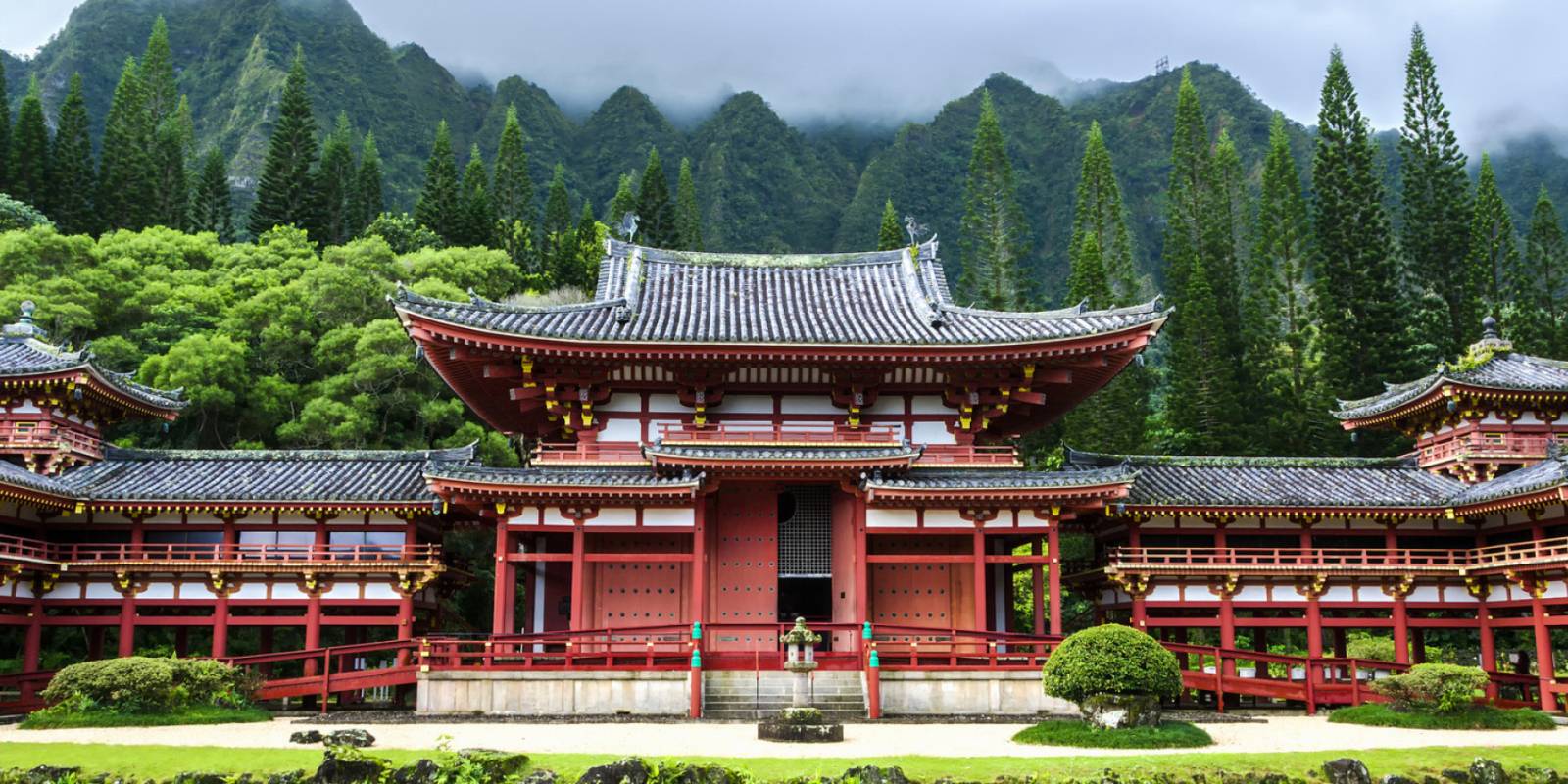
A faithful replica of the 900-year-old Byōdō-In temple in Uji, Japan, against the Koʻolau Mountains, built in 1968 to mark 100 years of Japanese immigration to Hawaiʻi.
Approach Cue (~12-15 sec)Show transcript
Coming up on the mauka side—watch for the Valley of the Temples Memorial Park turnoff. The Byōdō-In Temple sits back in a green valley at the foot of the Koʻolau range. It's a replica of a roughly 900-year-old temple from Uji, Japan. Drive slow through the quiet memorial park and follow the road back toward the mountains.Arrival Narration (~45-60 sec)Show transcript
See those cliffs rising straight up mauka—toward the mountain—behind the temple? The sheer rock face frames a 1968 replica of a 900-year-old temple from Uji, Japan, built here to mark a century of Japanese immigration to Hawaiʻi. The name means Temple of Equality. Walk the grounds and you'll find koi ponds full of big Japanese carp and black swans gliding around, all laid out as a traditional Japanese garden. There's a seven-ton bronze bell at the entrance, cast in Osaka, that visitors ring to clear their mind before entering. There is an entrance fee and daytime hours only—it closes mid-afternoon, so check the current times before you go. -
 11 min from previous stop · 4.9 mi
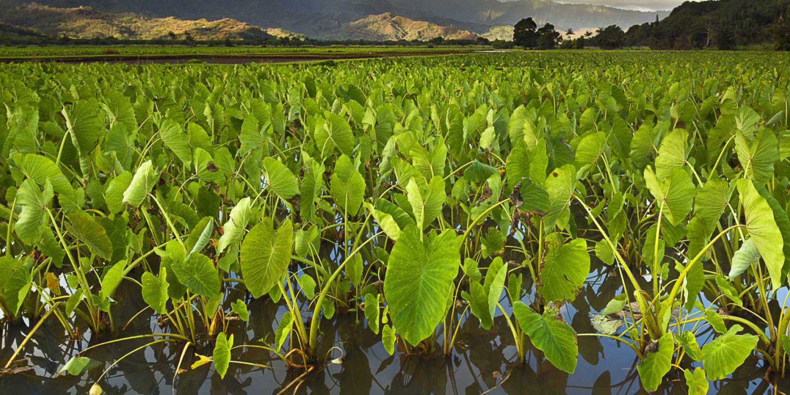
A family-run roadside spot in Waiāhole making poi on-site since 1905 and serving traditional Hawaiian plate food.
Approach Cue (~12-15 sec)Show transcript
Coming up on the mauka side in Waiāhole—watch for the Waiāhole Poi Factory, it's easy to miss. They've been making poi on-site since 1905 and serve Hawaiian plate lunches. Good spot to break up a string of beach stops.Arrival Narration (~45-60 sec)Show transcript
You're looking at a weathered storefront mauka — set back from the road toward the mountain — that's been making poi since 1905. The Hoe family has run it since 1971, and they pound the kalo root on-site to keep it fresh. Kalo is taro, and what comes out of that work tastes nothing like what sits on grocery shelves. The menu keeps it simple: combo plates with kalua pig, squid lūʻau, beef lūʻau, lomi salmon, haupia. Pair the poi with the meat — it's mild and faintly sweet, and the salt and smoke make sense of it. They also make traditional instruments and run workshops in bamboo nose flutes and ipu if you want to stay longer. -
 8 min from previous stop · 4.2 mi
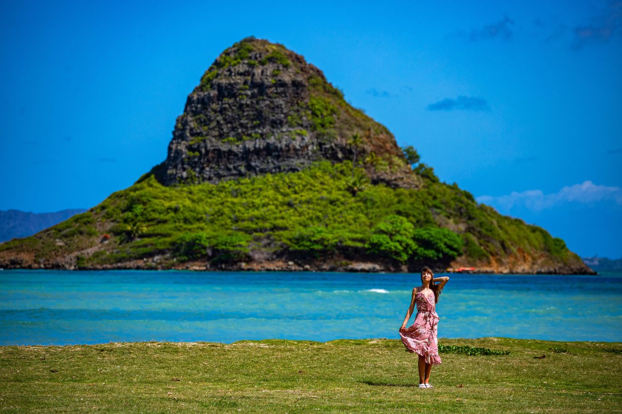
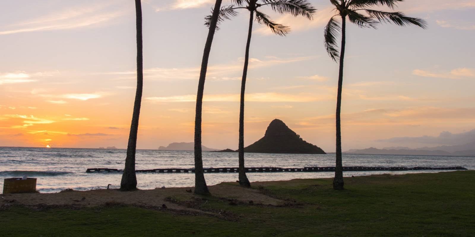
A quiet windward county beach park at the north end of Kāneʻohe Bay with the classic head-on view of Mokoliʻi islet offshore.
Approach Cue (~12-15 sec)Show transcript
Coming up on the makai side, Kualoa Regional Park. That pointed island offshore is Mokoliʻi, the one people call Chinaman's Hat. It's a quiet county beach with white sand and open lawn, and the highway hugs the mountains here so you escape the traffic noise. Pull over if you want a break from the road.Arrival Narration (~45-60 sec)Show transcript
That pointed rock offshore — Mokoliʻi — is what you came for. It sits just a few hundred yards out, a perfect cone rising from calm, warm water. The reef a half-mile makai keeps the bay protected, and this thin strip of white sand stays low-key even on peak days. The Koʻolau Mountains curve around behind you, framing everything, and on a clear day you can trace the coast all the way toward Kailua. This ground held sacred meaning in old Hawaiian tradition. You've got a big lawn with shade trees mauka if you want to sit awhile, and the flat water here draws kayakers who paddle straight out to Mokoliʻi. The park rarely gets crowded, so if you want to feel the bay without the noise, this is where you linger. -
 3 min from previous stop · 0.7 mi
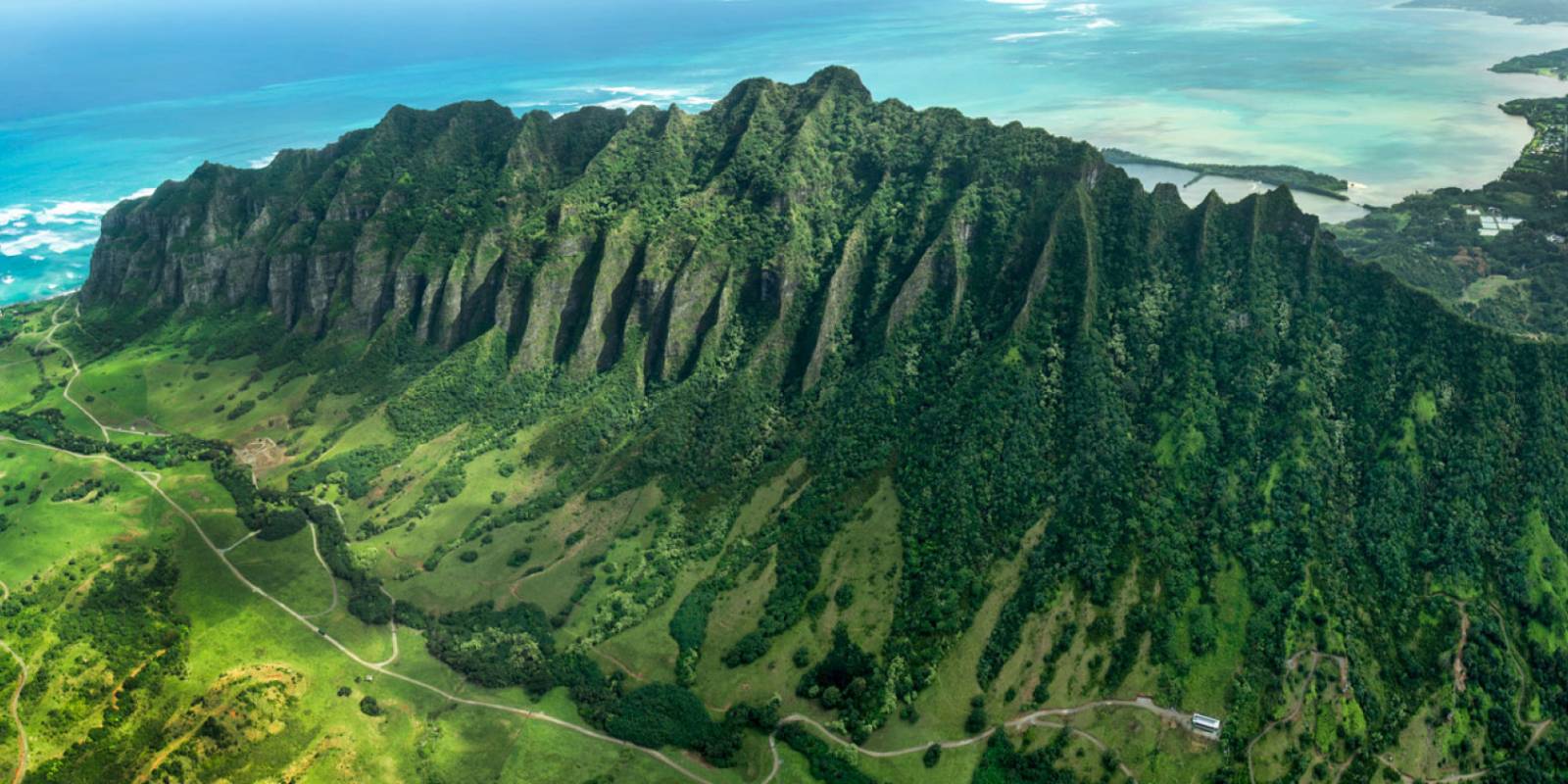
A 4,000-acre private working ranch and film location on the mauka side — the Jurassic Park valley — with paid tours you book ahead.
Approach Cue (~12-15 sec)Show transcript
Coming up on the mauka side—Kualoa Ranch entrance. Four thousand acres of working ranch and the Jurassic Park valley. Tours are paid and require booking ahead, but if you're just driving by, the valley behind it is the one you've seen on screen.Arrival Narration (~45-60 sec)Show transcript
You're standing at Kualoa Ranch, 4,000 acres backed by the jagged Koʻolau ridgeline. Look mauka — toward the mountain — and you'll recognize those cliffs and valley. They've been the backdrop for Jurassic Park, Lost, Kong: Skull Island, 50 First Dates, and Hawaii Five-0. This kaʻaʻawa valley was sacred to ancient Hawaiians as a place of refuge. Now it's a working ranch with a dozen tours: the open-air movie-sites tour is the signature experience, plus ATV, ziplining, horseback riding, ocean voyages, and Secret Island, a private beach families love. Most tours run one to a couple of hours, and people stack two or three together into a half or full day. This is a book-ahead, paid experience — not a quick pullover. Arrive early to beat the midday heat. Check kualoa.com for current tour options and rates so you can plan accordingly. -
 10 min from previous stop · 4.5 mi
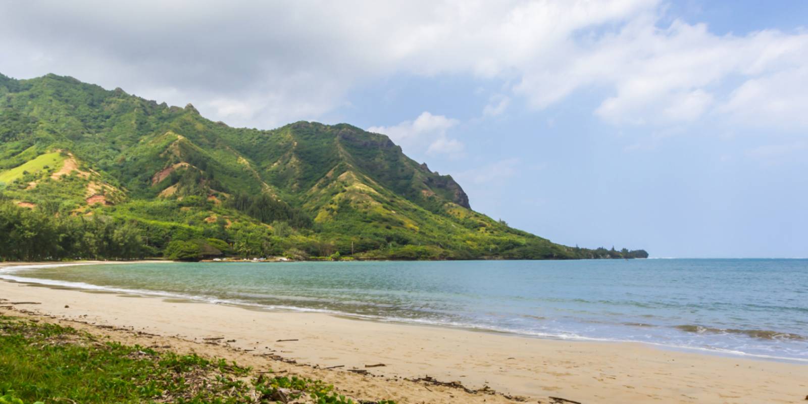
A golden-sand cove backed by the green Koʻolau Mountains and sheltered by the bay's shape, across from Ahupuaʻa ʻO Kahana State Park.
Approach Cue (~12-15 sec)Show transcript
Coming up on the makai side—Kahana Bay, a calm, golden-sand cove backed by the Koʻolau Mountains. Pull in for a swim or a breather from the road. Parking's right there.Arrival Narration (~45-60 sec)Show transcript
See those ironwood trees framing the curve of sand? The bay's shape keeps the water calm enough for paddleboards and kayaks, even for people just starting out. Golden sand, steep green walls of the Koʻolau range rising mauka — toward the mountain — and on a weekday, you'll have most of it to yourself. What makes this place specific: there's an ancient fishpond here, the Huilua Fishpond, one of only a handful left on Oʻahu. Local families fill the beach on weekends. Restrooms and showers sit at the north end. No lifeguards watch this beach, so know your limits in the water. Summer brings the clearest water; winter rains muddy it. The bay's sheltered shape makes it forgiving, but swim within what you know. -
 17 min from previous stop · 7.9 mi
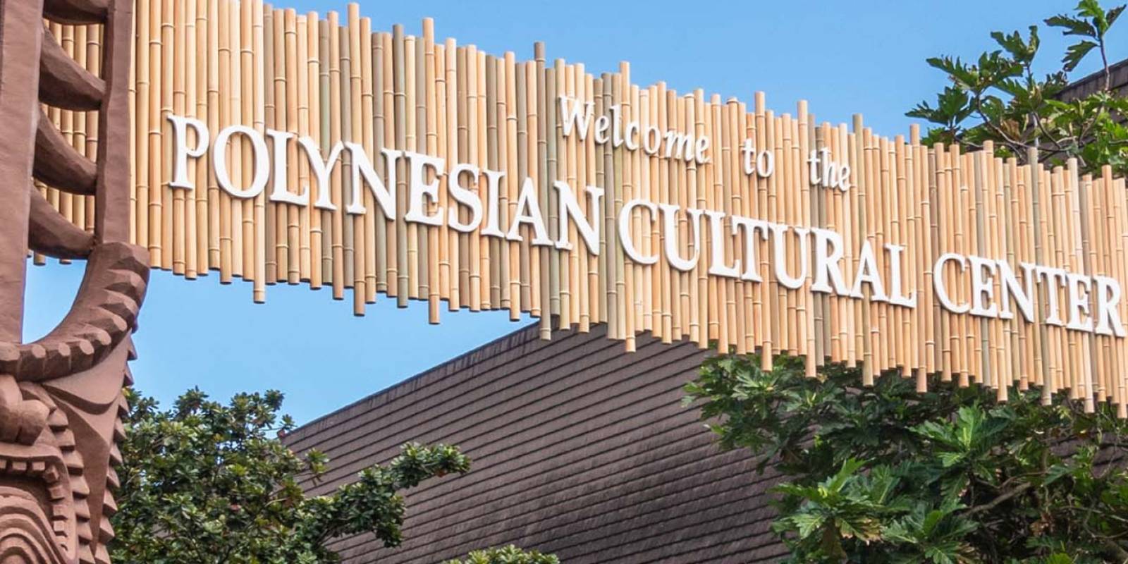
A 42-acre cultural attraction in Lāʻie where you walk six Pacific Island villages, capped by the evening show HA: Breath of Life.
Approach Cue (~12-15 sec)Show transcript
Coming up on the makai side in Lāʻie — the Polynesian Cultural Center. It's a 42-acre site with six Pacific Island villages and hands-on activities. This needs tickets booked ahead and usually fills your whole afternoon into the evening.Arrival Narration (~45-60 sec)Show transcript
You're standing at the entrance to 42 acres of working Pacific island villages — and the sound you hear right now, that's real: demonstrations happening in each of the six islands spread across the grounds. You walk through Samoa, Tonga, Fiji, Aotearoa, Tahiti, and Hawaiʻi as living spaces. In Samoa they're climbing trees and making fire. In Tonga, drummers are working. The Māori are carving and dancing with poi balls. There's a canoe pageant on the water, a full-size double-hull sailing canoe called Iosepa on display, and the Hukilau Marketplace for shops and food. The Center has run since 1963 as a nonprofit owned by The Church of Jesus Christ of Latter-day Saints, with proceeds funding scholarships at Brigham Young University–Hawaiʻi. Plan to spend most of the day here. Most people finish with the evening show, HA: Breath of Life. Book your package online before you go in, and bring water and sunscreen for the open-air villages. -
 4 min from previous stop · 1.2 miStop makai
Lāʻie Point
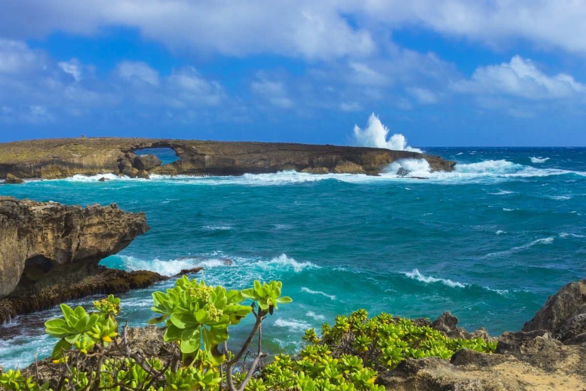
A small state wayside at the end of a Lāʻie residential street with a sea-cliff view and an offshore islet, Kūkuihoʻolua, with a natural hole through it.
Approach Cue (~12-15 sec)Show transcript
Coming up on the makai side—Lāʻie Point. Turn onto the residential side street toward the ocean to reach a small state wayside at the end of the road. You'll get a dramatic sea-cliff view and an offshore islet with a natural hole through the middle.Arrival Narration (~45-60 sec)Show transcript
You're standing on a low sea cliff, and the wind off the ocean hits different here—you can hear the waves working the rocks below. Out in front of you sits a small offshore islet, Kūkuihoʻolua, often called Puka Rock because puka means 'hole,' and there's a natural arch worn clean through the stone. A Hawaiian moʻolelo, a traditional legend, ties to this place: a story about a giant lizard, a moʻo, that was cut into pieces, with this islet said to be one of them. Spend a few minutes taking in the cliffs and the view. This is a residential street, so keep it quiet and respectful on your way through. -
 8 min from previous stop · 3.1 mi
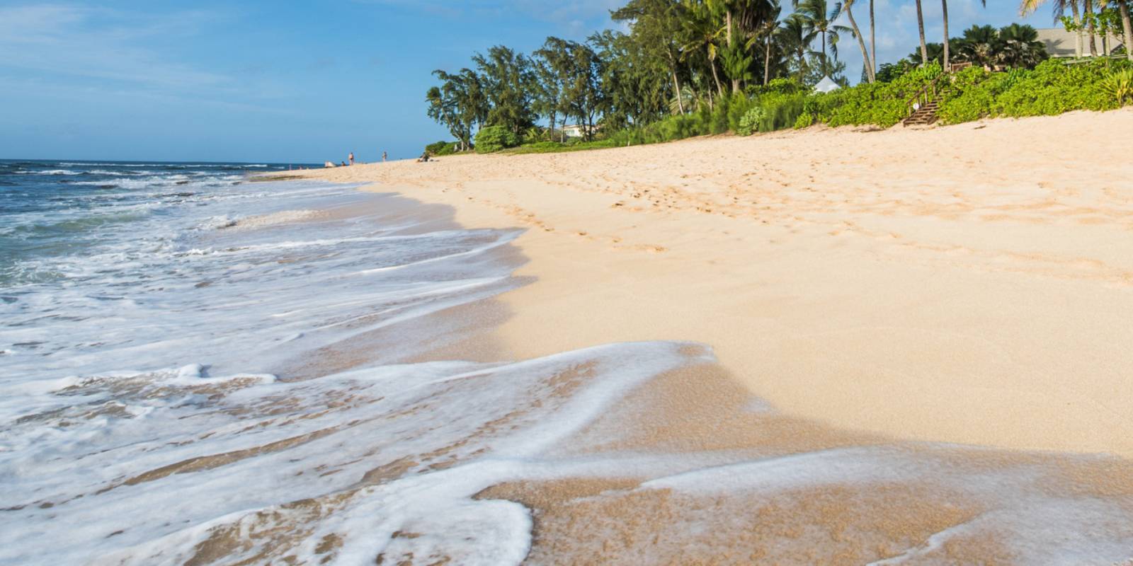
A long, uncrowded white-sand beach between Lāʻie and Kahuku in a state recreation area, with Mokuʻauia (Goat Island) — a seabird sanctuary — offshore.
Approach Cue (~12-15 sec)Show transcript
Coming up on the makai side—Mālaekahana State Recreation Area. Long white-sand beach, barely crowded, with a seabird sanctuary island offshore. The entrance is easy to miss, so slow down and watch for it. Short walk through the trees to reach the sand.Arrival Narration (~45-60 sec)Show transcript
The sand here is bright and fine, and you'll have most of it to yourself. This is Mālaekahana, a local beach tucked in a state recreation area between Lāʻie and Kahuku. The water is calm most days and good for swimming, though there's no lifeguard, so watch your group. Straight out makai—toward the ocean—you'll see Mokuʻauia, what most people call Goat Island. At low tide you can wade across in sturdy water shoes, but the bottom is coral and rock that'll cut bare feet. It's a seabird sanctuary with nesting birds and green sea turtles, so move quiet and give them space. Parking and restrooms are free, there's an outdoor shower, but nothing fancy. Bring water and snacks. Plan to stay a while—this is the kind of place that opens up the longer you linger. -
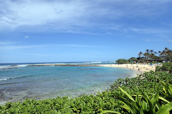 10 min from previous stop · 4.7 miStop makai
Turtle Bay / Kuilima Cove
The route's endpoint at Oʻahu's northern corner — Kuilima Cove, a reef-sheltered swim-and-snorkel cove by the Turtle Bay resort, with quiet Kawela Bay just to the west.
Approach Cue (~12-15 sec)Show transcript
Coming up on the makai side—the turnoff to Turtle Bay. It's a reef-sheltered cove for swimming and snorkeling at the island's northern corner. You're nearly at the end of the line.Arrival Narration (~45-60 sec)Show transcript
You can see the reef line right there makai—toward the ocean—running just offshore, that darker band of coral that keeps the water calm behind it. That's Kuilima Cove, where the Windward Coast Drive ends at Oʻahu's northern corner. The reef makes it one of the more protected places to swim or snorkel up here. Water conditions change fast, so read the posted signs before you get in. Kawela Bay sits just west—quieter and undeveloped, backed by old shade trees and worth a walk if you've got time. Park and stretch your legs. You've earned it after fifty miles of coastline. -
Outro
Outro
Show transcript
You're at the top corner of Oʻahu now, where the windward coast hands off to the North Shore. That's the full run behind you — from the Pali down through Kualoa, past those quiet bays most people miss entirely. You took the slow road, and it showed you things. Mahalo for riding along — enjoy the rest of your day up here.
This tour is created with AI from HawaiiGuide route content and read by the computer-generated Mele and Kani voices. Hawaiian names and place names may occasionally be mispronounced — mahalo for your patience as we refine.

Need help planning?
Search & Planning Chat →

Hawaiʻi Weather Forecast
Today’s Weather Brief · Audio · ~45s
0:00
0:54
Read the transcript
Trades are breezy right now with scattered showers on the windward side and mountains; the leeward coast stays mostly dry. Tomorrow stays breezy with the same pattern.
A tropical disturbance southeast of the islands is likely to become a tropical storm by mid-week and approach the state Thursday through Saturday. The exact track is still uncertain. If it comes closer, expect heavier rain over a longer stretch; if it stays farther out, impacts will be shorter and lighter. Winds will increase late this week, with potential gusts over 70 miles per hour on the highest summits.
Plan your leeward beach time and snorkeling for today through Tuesday. Save summit drives and offshore water sports for after Saturday, and check updates daily as this develops.
Created with AI from the official NWS forecast discussion · verify with NWS before heading out
Loading forecast…
Temperature
Weather data by Open-Meteo.com
Current Time in Hawaiʻi
--:----
Hawaiʻi Standard Time · UTC−10 · No Daylight Saving
You’re on Hawaiʻi timeMainland US
International
Aloha Today daily podcast →
Full HST breakdown, FAQ & DST schedule →

Get Your Free Hawaii Visitor Guide
Enter your email and we'll send you instant access to our free 2026 Hawaii Starter Guide + Summary Guidesheets.