
Hawaiʻi Guide · Audio Driving Tour
Chain of Craters Road BETA
A one-way 18.8-mile descent inside Hawaiʻi Volcanoes National Park, dropping 3,700 feet from the summit of Kīlauea to the coast. Pit craters, rift-zone lava fields, a pali descent with 2,000-foot drops, ancient petroglyphs, and a sea arch near the dead end where lava repeatedly covered the former road. ~17 curated segments.
18.8 miles
~45 min driving
9 curated stops
Free self-guided audio tour
~45 min
total driving time
18.8 mi
total distance
9 stops
curated stops
2-3h
suggested day
We may link to trusted Hawaiʻi resources at no extra cost to you.
Build your own route
Pick a preset or tap the ✓ Include chip on any stop below to customize.
9
of 9 stops selected
-
Intro
Intro
Audio is temporarily paused while the mileage narration is refreshed to match the current 18.8-mile NPS figure. -
 HAVOMILE0.4
First of four pit craters in the opening 1.5 miles. Covers the pit-crater primer and previews Puhimau (0.9), thermal hotspot (1.3), and Koʻokoʻolau (1.5) so the driver doesn't need a separate trigger for each.
Audio is temporarily paused while the crater-dimension narration is refreshed to use the current metric and imperial figures. -
 2 min from previous stop · 1.2 miHAVOMILE2
Side-trip stop. User explicitly wants it included because the lookout is genuinely good, but framed honestly as a 30-minute detour each way.
Audio paused while the vehicle closure is active -
1 min from previous stop · 0.6 miHAVOMILE2.2
Small roadside pullout, unfenced 150×165 ft pit. Arrival narration previews Hiʻiaka (MM 2.5) and Pauahi (MM 3.1) so those don't need their own triggers.
Approach Cue (~12-15 sec)Show transcript
Coming up on the right in about a quarter mile, Devil's Throat—a small roadside pullout. Park on the shoulder, cross the road to a dirt path, and walk carefully to the edge of a 165-foot pit. No guardrails, crumbling edges.Arrival Narration (~45-60 sec)Show transcript
You're standing at the edge of a pit, and the ground just ends. Devil's Throat is 150 feet wide and 165 feet deep—a collapse crater where magma drained and the earth fell in on itself. No fence, no railing, just air between you and the bottom. The edges aren't stable, so stay back from the lip. You're standing on the East Rift Zone of Kīlauea. The craters along this road—Hiʻiaka at mile 2.5, Pauahi at 3.1—line up like beads on a string, each one marking a point where magma pushed up or collapsed. This entire stretch sits on top of an active rift. Pauahi is the massive one, with a boardwalk that gives you a real view of its scale. Mauna Ulu comes up at mile 3.6. Stay back from the lip here, and keep moving makai—toward the ocean—down the road. -
 4 min from previous stop · 1.8 miHAVOMILE3.6
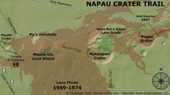
Spur road off the main drive, half a mile to a parking lot with restrooms. Hike to Puʻu Huluhulu is 1 mi one-way, legitimately interesting. Full Nāpau trail requires a permit.
Approach Cue (~12-15 sec)Show transcript
Mauna Ulu turnoff coming up on the left in about a quarter mile. Short spur road to a parking lot with a restroom. The Puʻu Huluhulu hike is one mile one-way and gives you a real sense of what fresh lava fields look like up close.Arrival Narration (~45-60 sec)Show transcript
You're standing on volcanic ground that's still young—the black lava field around you came from Mauna Ulu, a vent that erupted between 1969 and 1974. That eruption built a 400-foot shield and pushed flows all the way down to the coast, erasing six miles of the old Chain of Craters Road beneath stone. The one-mile walk to Puʻu Huluhulu, a small cinder cone mauka of here (toward the mountain), crosses both sharp aʻā and smooth pahoehoe from those '74 flows. Watch for kīpukas—pockets of forest the lava split around instead of burying. You'll end on top of the cone with views toward Puʻu ʻŌʻō, the vent that kept Kīlauea erupting for 35 years starting in 1983. The trail markers are reflective because the path isn't always obvious on black rock. Pack water; there's no shade out here. When you head back to the car, Mau Loa O Mauna Ulu is the next stop, about two and a half miles down the road. -
Connector · HAVO 2 min drive · 1.1 mi
Mauna Ulu to Mau Loa Connector
Show transcript
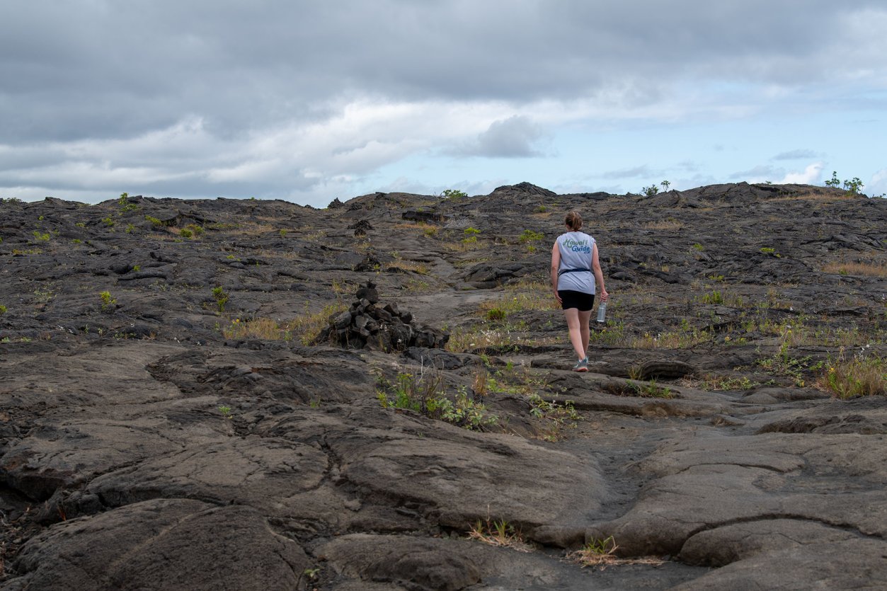
You're driving through the Mauna Ulu flows from '69 to '74. Forest used to grow here—now you're on a ribbon of asphalt cutting through black lava. The pahoehoe surface tells you the story if you watch it. Where it's ropy and twisted, the flow was still moving under a skin that had already cooled. Smooth sheets mean it spread out flat and solidified. See those dead tree trunks poking up? Those are lava trees. A flow wrapped around a living trunk, the wood burned away, and the lava kept the shape. Everything around you arrived here in living memory. -
 2 min from previous stop · 1.1 miHAVOMILE6.2
Roadside pullout overlooking the 1969–74 pahoehoe field. Also the trailhead for the Keauhou Trail (8 mi to the coast, most visitors skip it).
Audio is temporarily paused while the village-history narration is refreshed to match current NPS wording. -
Connector · HAVO 10 min drive · 5.6 mi
Mau Loa to Kealakomo Connector
Show transcript
You're heading into the pali descent now—pali means cliff in Hawaiian, and you're about to drop about two thousand feet from where you are down to the shoreline. The road cuts across the face of Hōlei Pali in switchbacks, so take it slow. The grade is steeper than it looks and there's almost no shoulder out here. As you get lower, the forest opens up and you'll see the coast spread out below you, ocean all the way to the horizon. You don't want to be the person tailgating a rental car that has just realized it's on a cliff. -
 10 min from previous stop · 5.6 miHAVOMILE9.6
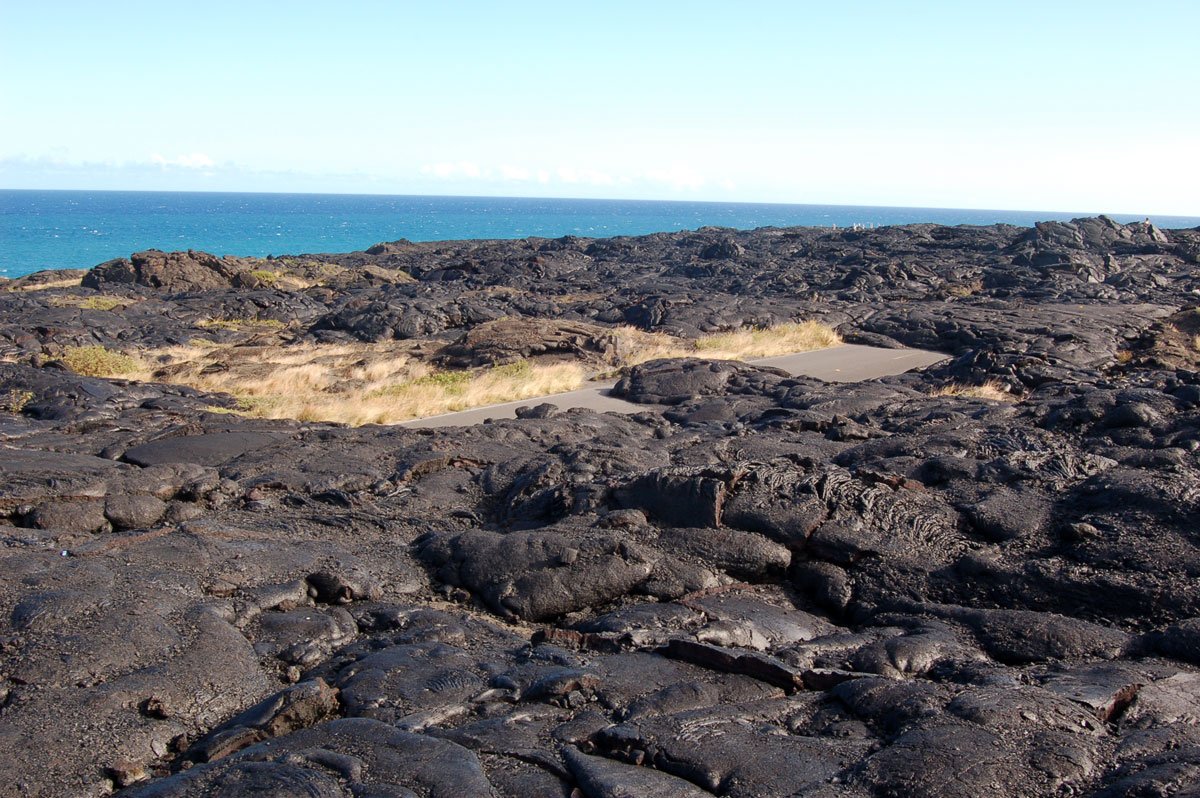
Wooden pavilion perched 2,000 ft above the sea at the top of Hōlei Pali. Handicapped-accessible. The pali descent starts seriously after this point.
Approach Cue (~12-15 sec)Show transcript
Coming up on the mauka side in about a half mile: Kealakomo Overlook. You'll see a wooden pavilion right on the edge of the pali, perched 2,000 feet above the sea. Handicapped-accessible. The serious descent starts after this point, so pull in and take a look.Arrival Narration (~45-60 sec)Show transcript
You're standing 2,000 feet above the sea, and the wind up here will knock you off balance—strong enough that it's a better place to lose your lunch than eat it. Look makai, toward the sea, and you're staring at black lava frozen mid-pour, the flow visible in actual waves down the pali face. Underneath all that rock is the former Kealakomo village site, covered by Maunaulu flows during the 1969–1974 eruption. The Naulu Trail starts here and connects to the Nāpau Crater Trail if you want a long day-hike. Most people spend ten minutes taking in the scale and moving on. Back on the road, you're about to start the real descent, and the hairpin turn at mile 11.5 catches people off guard, so take it slowly. -
Connector · HAVO 7 min drive · 4.2 mi
Kealakomo to Alanui Kahiko Connector
Show transcript
You're coming down Hōlei Pali now, dropping fast. That hairpin at mile 11.5 is sharp—brake well before you hit it. By mile 12, you've dropped to about 1,000 feet and the landscape dries out noticeably. The road swings close to the ocean here. You'll see pullouts with coastal views along this stretch. If steam's rising offshore and the park's posted active lava alerts, that's where lava is entering the ocean. Most days it's just blue water against black rock cliffs. Alanui Kahiko pullout is at mile 13.7—that's where the old road shows through. -
 7 min from previous stop · 4.2 miHAVOMILE13.7
Arrival narration covers both the Alanui Kahiko pullout (MM 13.7 — buried old road) and Hōlei Pali lookout (MM 14.4 — cliff-face view) as one beat. Those two pullouts are close enough that a second GPS trigger would clutter the playback.
Audio is temporarily paused while the lava-flow attribution is refreshed to match current USGS wording. -
Connector · HAVO 3 min drive · 2.5 mi
Alanui Kahiko to Puʻuloa Connector
Show transcript
You're on the coastal bench now—flat ground between the pali and the ocean. Everything around you is young lava, flows from the last few hundred years. Keep your eyes open for nēnē, the state bird. They're endangered and they don't understand cars very well, so slow down if you see them near the road. The petroglyph trailhead is coming up on your right. -
 3 min from previous stop · 2.5 miHAVOMILE15.9
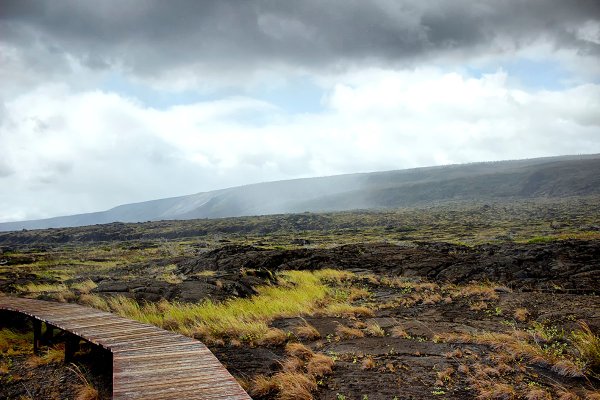
Approximately 23,000 ancient Hawaiian petroglyphs. The 1.4-mile round-trip trail reaches a boardwalk at the main site. Piko holes are the most common image. Vog risk at dusk.
Audio is temporarily paused while the trail-distance narration is refreshed to reflect the current 1.4-mile round trip. -
Connector · HAVO 3 min drive · 2.2 mi
Puʻuloa to Sea Arch Connector
Show transcript
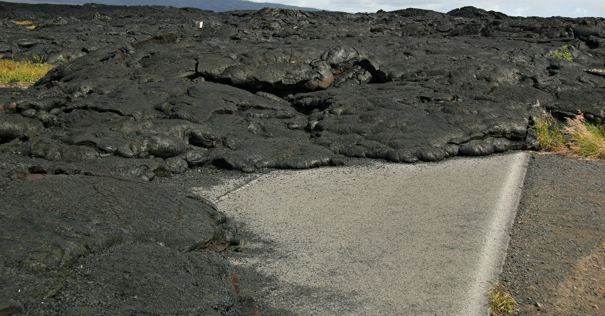
This last stretch is different. Ocean's on your right now, and what you see on the left is young lava. You may see fresh-looking cracks in the pavement from recent ground settlement. The coastal bench here is still moving. That's not old geology; that's something happening now. The road ends at a ranger station near a sea arch. That's your turnaround. The pavement literally stops there because lava buried it. -
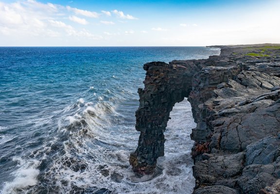 3 min from previous stop · 2.2 miHAVOMILE18.8
End-of-road stop. No active lava right now; the real draw is walking past the gate on hardened pāhoehoe where Puʻuʻōʻō-era flows repeatedly covered the former road. User explicitly called this out as the signature experience at this stop.
Audio is temporarily paused while the sea-arch narration is refreshed to correct the arch's 90-foot height. -
Outro
Outro
Show transcript
You're headed back up now, and the drive back always feels faster once you've seen it once. The light's going to shift on you though — afternoon sun hitting the pali differently, shadows stretching across the rift zone. You'll probably see more steam rising off the summit caldera as things cool down. When you reach Crater Rim Drive, you've got options. Kīlauea Iki trailhead is right there if you've got energy left. The summit caldera overlooks and the old Jaggar Museum site are within a few miles, along with the Thurston Lava Tube. You covered about two percent of Hawaiʻi Volcanoes National Park today. Not bad work at all.
This tour is created with AI from HawaiiGuide route content and read by the computer-generated Mele and Kani voices. Hawaiian names and place names may occasionally be mispronounced — mahalo for your patience as we refine.

Need help planning?
Search & Planning Chat →

Hawaiʻi Weather Forecast
Today’s Weather Brief · Audio · ~45s
0:00
0:54
Read the transcript
Trades are breezy right now with scattered showers on the windward side and mountains; the leeward coast stays mostly dry. Tomorrow stays breezy with the same pattern.
A tropical disturbance southeast of the islands is likely to become a tropical storm by mid-week and approach the state Thursday through Saturday. The exact track is still uncertain. If it comes closer, expect heavier rain over a longer stretch; if it stays farther out, impacts will be shorter and lighter. Winds will increase late this week, with potential gusts over 70 miles per hour on the highest summits.
Plan your leeward beach time and snorkeling for today through Tuesday. Save summit drives and offshore water sports for after Saturday, and check updates daily as this develops.
Created with AI from the official NWS forecast discussion · verify with NWS before heading out
Loading forecast…
Temperature
Weather data by Open-Meteo.com
Current Time in Hawaiʻi
--:----
Hawaiʻi Standard Time · UTC−10 · No Daylight Saving
You’re on Hawaiʻi timeMainland US
International
Aloha Today daily podcast →
Full HST breakdown, FAQ & DST schedule →

Get Your Free Hawaii Visitor Guide
Enter your email and we'll send you instant access to our free 2026 Hawaii Starter Guide + Summary Guidesheets.