
Hawaiʻi Guide · Audio Driving Tour
Puna Lava Coast BETA
The Big Island's youngest, wildest corner — lower Puna's lava country. Old Pāhoa town, the eerie Lava Tree molds, the path of the 2018 Kīlauea eruption, the easternmost point at Cape Kumukahi, the brand-new black-sand beach at Pohoiki, the jungle Red Road, and Kalapana, where a village met the lava. The island being born and reborn on one short drive. Free self-guided audio tour.
46 miles
~1h 32min driving
8 curated stops
Free self-guided audio tour
~1h 32min
total driving time
46 mi
total distance
8 stops
curated stops
4-6h
suggested day
We may link to trusted Hawaiʻi resources at no extra cost to you.
Build your own route
Pick a preset or tap the ✓ Include chip on any stop below to customize.
8
of 8 stops selected
-
Intro
Intro
Show transcript
Welcome to Puna—the Big Island's wild, raw, ever-changing east corner, where the land is the youngest in Hawaiʻi and Kīlauea is always rewriting the map. This is lava country in every sense. We'll start in the old plantation town of Pāhoa, drive out through the path of the 2018 eruption—one of the most destructive in modern Hawaiian history—visit the island's easternmost point, stand on a black-sand beach that didn't exist a few years ago, and finish where the village of Kalapana met the lava in 1990. A word on tone before we go, because this route is different. Much of what you'll see is recent and real: in 2018, Kīlauea's lower East Rift opened up right here, and the lava destroyed around seven hundred homes, swallowed whole neighborhoods, and reshaped the coastline. People lost everything. So we drive this with respect—we stay on public roads, we don't treat anyone's loss as a photo op, and we keep out of the neighborhoods where people are still living and rebuilding. One practical note: the lava out here is sharp and the new land is unstable, so wear closed-toe shoes, stay on marked paths, and never turn your back on the ocean at these young beaches—the currents are killers. Alright. Let's go see what the volcano made. -
 Stop mauka
Pāhoa Town
The plantation-era gateway town to lower Puna — last reliable gas, food, and restrooms before the lava country.
Approach Cue (~12-15 sec)Show transcript
We're starting in Pāhoa, the funky old plantation town that's the hub of lower Puna. Fuel up here, grab water and a snack, and use the restroom—services thin out fast once we head into the lava.Arrival Narration (~45-60 sec)Show transcript
Pāhoa has a one-block wooden boardwalk of a main street, false-front buildings from the sugar days, and a laid-back, off-the-grid Puna character all its own. It's also a town that's lived under the volcano's shadow more than once—a 2014 lava flow crept right up to the edge of town before it stalled, and the 2018 eruption a few miles away tested the whole community. It's the natural starting point and resupply town for everything ahead. Take a quick look around if you like, then we head east on Highway 132 toward the 2018 flow. -
 7 min from previous stop · 3 mi
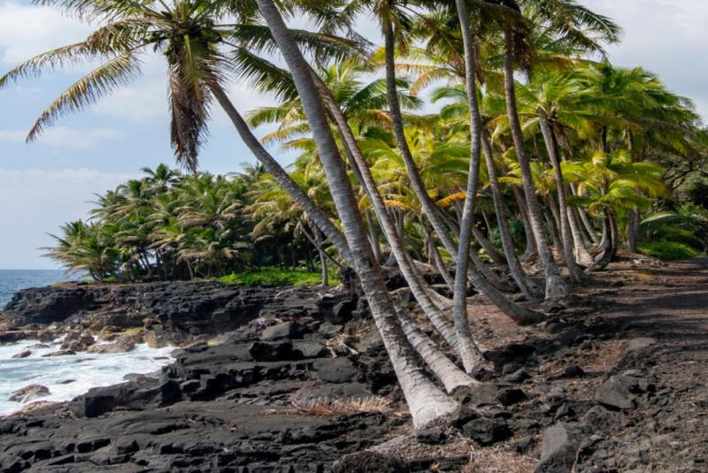
Eerie lava "molds" of an ʻōhiʻa forest, cast when a 1790 flow swept through and hardened around the wet tree trunks. Easy paved loop.
Approach Cue (~12-15 sec)Show transcript
Just east of Pāhoa on Highway 132, watch for Lava Tree State Monument on the right. There's a small parking area and an easy paved loop—a good, gentle first stop.Arrival Narration (~45-60 sec)Show transcript
These strange standing pillars are lava trees, and they're exactly what they look like. Back around 1790, a fast lava flow poured through an ʻōhiʻa forest here. The lava hardened around the wet tree trunks, and when the molten rock drained away, it left these hollow stone molds standing where the trees were— some of them ten or twelve feet tall. The trees themselves burned away long ago; what you're walking through is their shape, frozen in stone. It's an easy, shaded loop, maybe twenty minutes, and a quiet introduction to what this whole district is about: a place built and rebuilt by lava, over and over. -
Connector · 137 15 min drive · 7.6 mi
The Path of the 2018 Eruption
Show transcript
As we continue east on Highway 132, look closely—the road you're driving on is new. In the summer of 2018, this is where Kīlauea's lower East Rift Zone tore open. Two dozen fissures cracked across the ground, and one of them, Fissure 8—now given the Hawaiian name Ahuʻailāʻau—became a roaring fountain of lava that built a cone roughly one hundred and eighty feet tall and sent a river of molten rock racing to the sea. It buried this highway, Kapoho, the famous Kapoho tide pools, Green Lake, Ahalanui Warm Pond, Vacationland, and whole subdivisions—around seven hundred homes in all—over three months. The cone itself sits back in the Leilani Estates neighborhood, on private community roads, and it is not a self-drive stop—people live here, and reaching the cone is for residents and legitimate guided tours only. So we're seeing this from the public road, where the fresh black lava spreads out on both sides of the rebuilt highway. Drive slowly, don't stop in the lanes, and take in the scale of what happened here just a few years ago. -
 15 min from previous stop · 7.6 mi
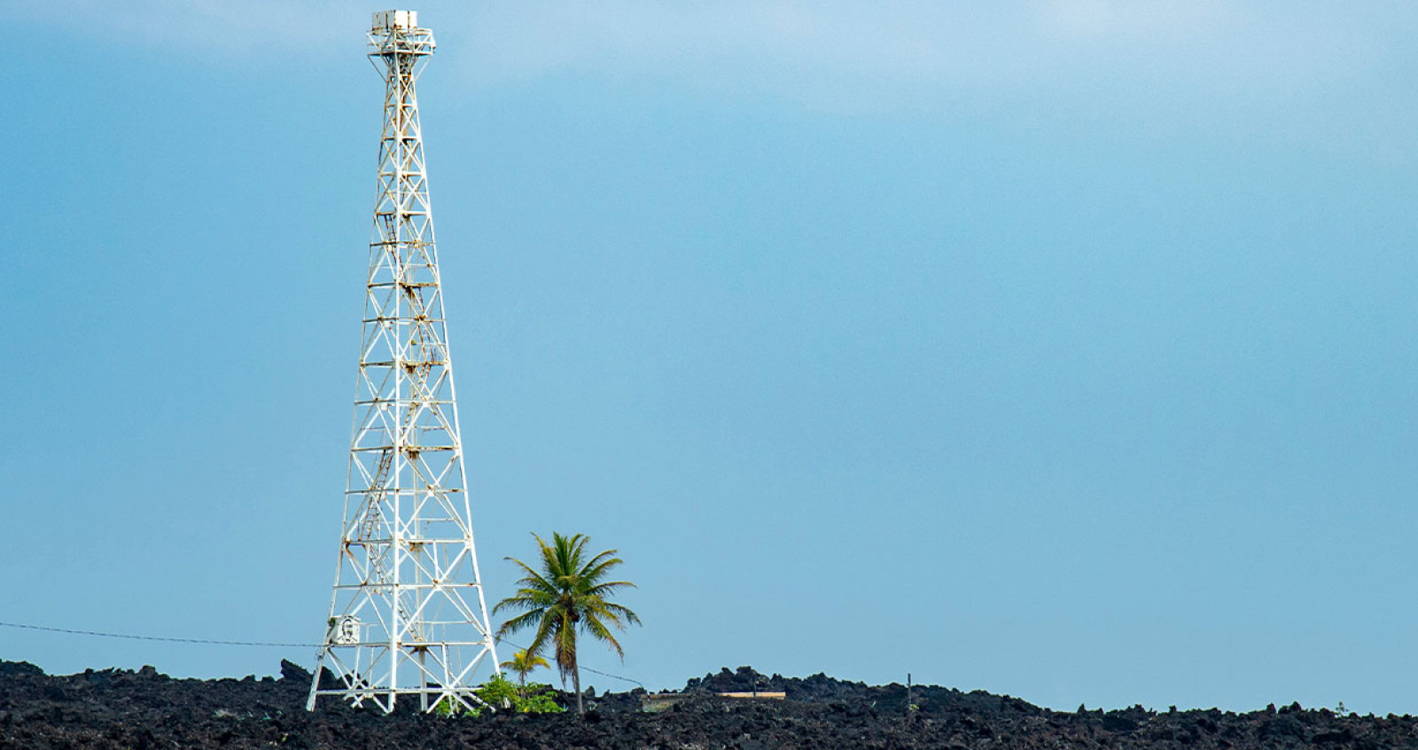
The easternmost point of Hawaiʻi, where a 1960 lava flow split and spared the lighthouse. The lighthouse itself is a long hike over rough lava — not a drive-up.
Approach Cue (~12-15 sec)Show transcript
Out past Kapoho is Cape Kumukahi—the easternmost point in all of Hawaiʻi. Quick, honest heads-up: the actual lighthouse is not a drive-up. Reaching it means hiking over rough, sharp, jagged lava, and conditions change, so most people take in the area and the story from the road's end without making that trek.Arrival Narration (~45-60 sec)Show transcript
Cape Kumukahi is the closest land in Hawaiʻi to the sunrise—"Kumukahi" means "first beginning," and in Hawaiian tradition this is a sacred place tied to the origins of the islands. The lighthouse out here has its own legend: in 1960, a lava flow from Kīlauea poured down and wiped out the nearby town of Kapoho, but when it reached the lighthouse, the flow split and passed around it on both sides, leaving it standing on a little island of spared ground. Whether you hike out over the lava to see it or just take in the wide, raw coastline from here, you're standing at the edge of the newest, most active land in the country. From here we turn south toward the coast and the new beach the 2018 eruption left behind. -
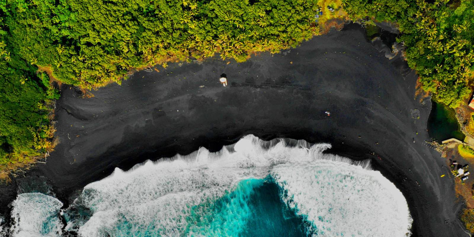 44 min from previous stop · 22.7 mi
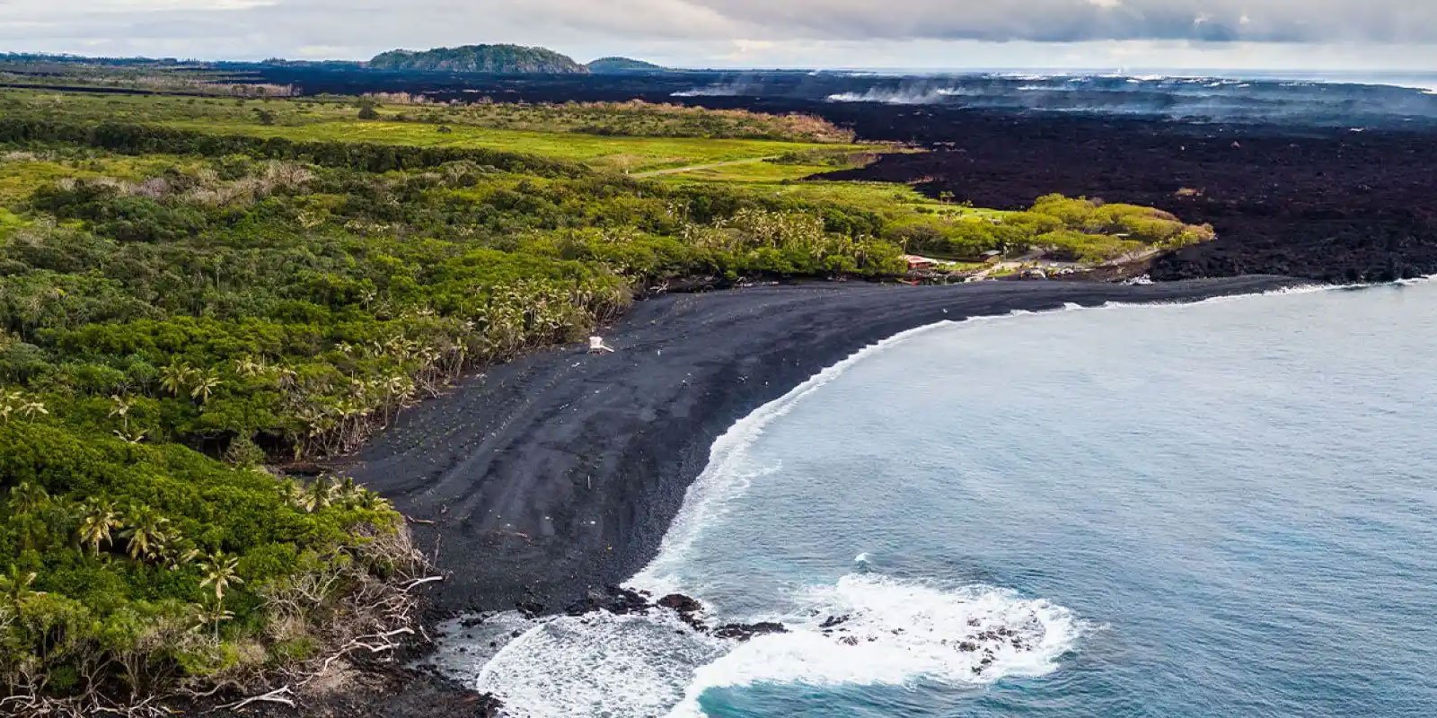
A brand-new black-sand beach formed by the 2018 eruption, plus a boat ramp and a geothermally warmed pond. Strong, dangerous currents — not a casual swim.
Approach Cue (~12-15 sec)Show transcript
Coming up is Isaac Hale Beach Park, at Pohoiki. This place tells the 2018 story better than almost anywhere, so we'll stop. The park reopened after a long closure, but hours and access can change, so it's worth confirming before a special trip. And a real safety note: the water here has strong, dangerous currents—this is a look-and-wade spot, not a swim.Arrival Narration (~45-60 sec)Show transcript
Before 2018, Pohoiki was Puna's main boat ramp with a rocky shore. Then the eruption changed everything. The lava pouring into the ocean nearby generated so much new black sand that the currents pushed it right into this bay, and a wide black-sand beach appeared where there had never been one—built in a matter of weeks. The same event nearly sealed off the boat ramp and left a warm pond, geothermally heated, tucked behind the new sand. It's a genuinely remarkable place: a beach younger than your phone. But the ocean here is rough and the currents are powerful, so admire it, wade at the edge only if it's calm, and don't swim out. Take a minute to grasp it—you're standing on land and sand the volcano made in your own lifetime. -
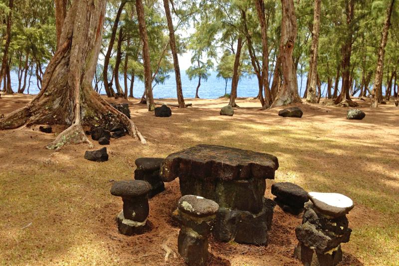 7 min from previous stop · 3 miStop makai
MacKenzie State Recreation Area
An ironwood-shaded sea-cliff park on the Red Road, with dramatic cliff views and an old lava tube. No swimming — sheer cliffs, strong surf, people have been swept off the rocks.
Approach Cue (~12-15 sec)Show transcript
Now we're on Highway 137, the "Red Road"—a narrow, canopy-shaded coastal lane that's one of the prettiest drives on the island. First stop along it is MacKenzie State Recreation Area, on the makai side. Slow down; the Red Road is not a place to hurry.Arrival Narration (~45-60 sec)Show transcript
MacKenzie is a cool, shady grove of tall ironwood trees right on the edge of low sea cliffs, with the surf crashing below. There's an old lava tube here you can peer into, and the cliff-top views up and down the coast are dramatic. It's a peaceful, local kind of spot. But it comes with a serious warning: these are sheer, undercut sea cliffs with powerful surf and no beach access, and people have been swept off these rocks. So enjoy the shade and the view, but stay well back from the edge, especially when the surf's up. Then we continue down the Red Road. -
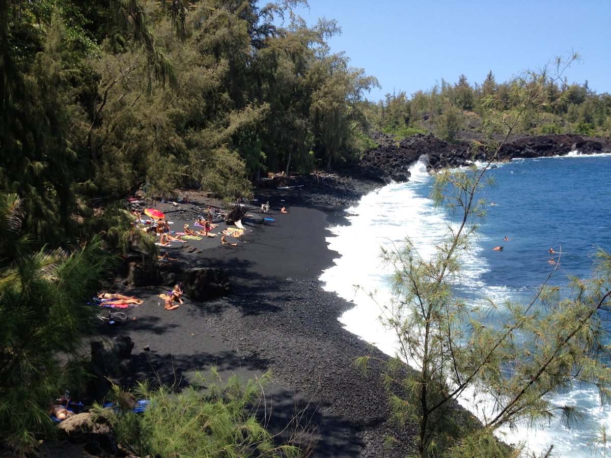 10 min from previous stop · 4.7 mi
A pocket black-sand beach below a Red Road pullout, reached by a short steep scramble. Powerful shore break and rip currents; a longtime locals' and clothing-optional spot.
Approach Cue (~12-15 sec)Show transcript
A little farther down the Red Road is Kehena Beach. It sits at the bottom of a short but steep, rocky scramble down from a roadside pullout—watch for cars parked along the road. Two heads-ups: the trail down is genuinely steep and a bit sketchy, and the surf here is powerful. For a lot of people this is a look-from-above stop.Arrival Narration (~45-60 sec)Show transcript
Kehena is a pretty pocket of black sand backed by palms and lava cliffs, and it's long been a gathering spot for the Puna community—you may find a drum circle here on Sundays, and it's a traditionally clothing-optional beach, so that's the local custom to be aware of. It's beautiful, but the ocean is the catch: Kehena has a strong shore break and serious rip currents, with no lifeguard and a hard climb back out, so the water here has gotten people into real trouble. Take in the scene from the top, and if you do go down, treat the ocean with respect and don't turn your back on it. From here it's a short run to the end of the road at Kalapana. -
Connector · 137 5 min drive · 3.4 mi
Down the Red Road
Show transcript
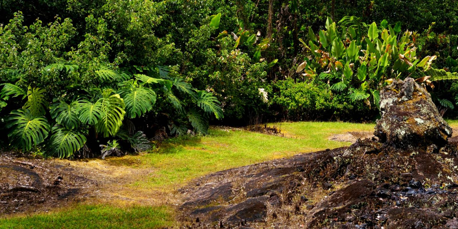
This last stretch of the Red Road winds through some of the lushest, most jungle-draped country on the island, the ocean flashing through the trees on your left. You're driving toward Kalapana, the end of the line—the place where, in 1990, Kīlauea's lava came down and buried a whole village. The contrast on this drive is the whole story of Puna: thick green jungle one minute, black lava desert the next, the island endlessly destroying and remaking itself. Ease up and let it unfold. -
 5 min from previous stop · 3.4 mi
The village largely buried by 1990 Kīlauea lava flows, where Chain of Craters Road was overrun. The emotional heart of the older-flows story.
Approach Cue (~12-15 sec)Show transcript
We're coming into Kalapana, where the road meets the lava. This is the end of the line on this side—up ahead, the highway simply disappears under hardened lava. There's parking near the end; we'll take it in from here.Arrival Narration (~45-60 sec)Show transcript
Kalapana was a beloved Hawaiian fishing village—it had a famous black-sand beach at Kaimū, a historic church, homes that had stood for generations. Then, starting in 1990, Kīlauea sent slow rivers of lava down to the sea, and over the following months they buried almost all of it: the beach, the church, the houses, and the highway that used to connect this coast to Hawaiʻi Volcanoes National Park. That road, Chain of Craters Road, dead-ends in lava on both sides to this day. Standing here, you're looking at one of the most powerful examples anywhere of living with an active volcano—not a disaster from the past, but an ongoing fact of life. And yet people came back. Just ahead is the new Kaimū beach and a community that rebuilt right next to the flow. -
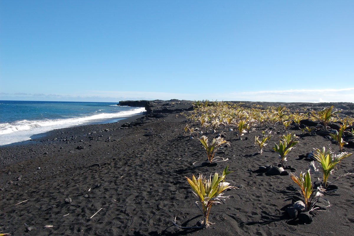
 0 min from previous stop · 0.1 mi
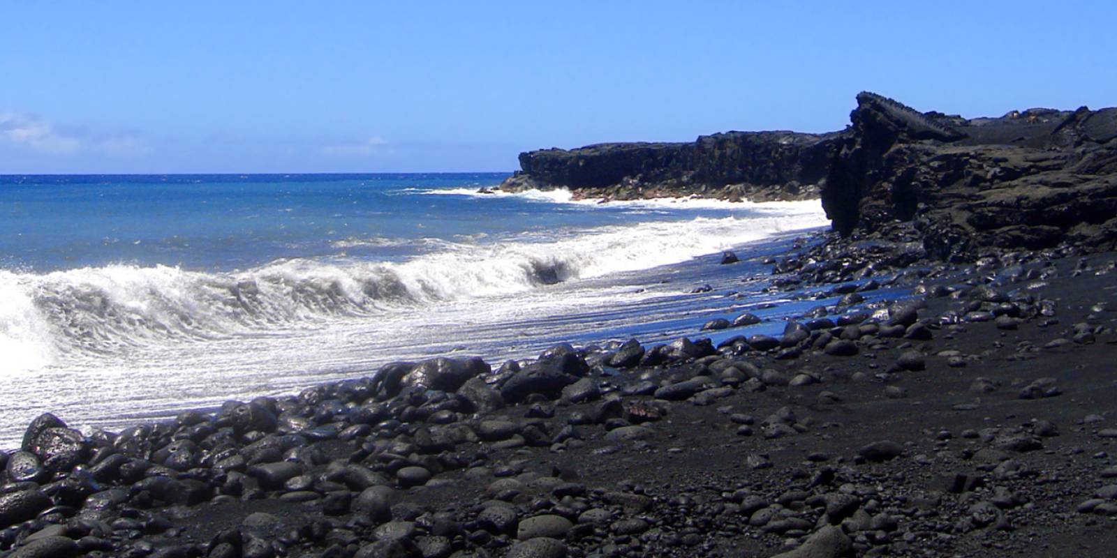
The new Kaimū black-sand beach formed atop the 1990 lava, where former residents replanted coconut palms, plus Uncle Robert's Awa Bar and Wednesday night market. Swimming is extremely dangerous.
Approach Cue (~12-15 sec)Show transcript
Last stop: the new Kaimū beach, and Uncle Robert's, right at the end of the road. Park here and take the short walk across the lava to the beach. If it's a Wednesday evening and the market is running, you've got a good bonus stop here.Arrival Narration (~45-60 sec)Show transcript
When the lava buried old Kaimū beach in 1990, the community didn't give up on it. Former residents and volunteers walked out onto the new, still-cooling lava and planted coconut sprouts, and over the years a new black-sand beach has formed at the water's edge—young, jet-black, lined with the palms they planted by hand. It's a short walk across the lava to reach it. The water is far too rough and the currents far too strong to swim, so this is a place to stand and look, not to get in. And right at the trailhead is Uncle Robert's Awa Bar—a family-run gathering place in this rebuilt community, with ʻawa, or kava, and, when the Wednesday night market is running, local food, music, and crafts. It's a strong place to end this drive: proof that even where the volcano takes everything, people put down roots again. That's Puna. Mahalo for riding out to the edge with us. -
Outro
Outro
Show transcript
That's the Puna lava coast—Lava Tree, the path of the 2018 eruption, the easternmost point, the brand-new beach at Pohoiki, the Red Road, and the rebuilt community at Kalapana. There's nowhere else in Hawaiʻi where you can see the island being born and buried and reborn all on one short drive. On your way back to Pāhoa up Highway 130, keep an eye out for the Star of the Sea Painted Church—the little hand-painted chapel that congregants towed out of the path of the 1990 lava just ahead of the flow, and saved. It's a fitting last image for this corner of the island: in Puna, people and the volcano have been writing the story together for a very long time. Take it easy out there, and mahalo.
This tour is created with AI from HawaiiGuide route content and read by the computer-generated Mele and Kani voices. Hawaiian names and place names may occasionally be mispronounced — mahalo for your patience as we refine.

Need help planning?
Search & Planning Chat →

Hawaiʻi Weather Forecast
Today’s Weather Brief · Audio · ~45s
0:00
0:54
Read the transcript
Trades are breezy right now with scattered showers on the windward side and mountains; the leeward coast stays mostly dry. Tomorrow stays breezy with the same pattern.
A tropical disturbance southeast of the islands is likely to become a tropical storm by mid-week and approach the state Thursday through Saturday. The exact track is still uncertain. If it comes closer, expect heavier rain over a longer stretch; if it stays farther out, impacts will be shorter and lighter. Winds will increase late this week, with potential gusts over 70 miles per hour on the highest summits.
Plan your leeward beach time and snorkeling for today through Tuesday. Save summit drives and offshore water sports for after Saturday, and check updates daily as this develops.
Created with AI from the official NWS forecast discussion · verify with NWS before heading out
Loading forecast…
Temperature
Weather data by Open-Meteo.com
Current Time in Hawaiʻi
--:----
Hawaiʻi Standard Time · UTC−10 · No Daylight Saving
You’re on Hawaiʻi timeMainland US
International
Aloha Today daily podcast →
Full HST breakdown, FAQ & DST schedule →

Get Your Free Hawaii Visitor Guide
Enter your email and we'll send you instant access to our free 2026 Hawaii Starter Guide + Summary Guidesheets.