
Hawaiʻi Guide · Audio Driving Tour
West Maui Loop BETA
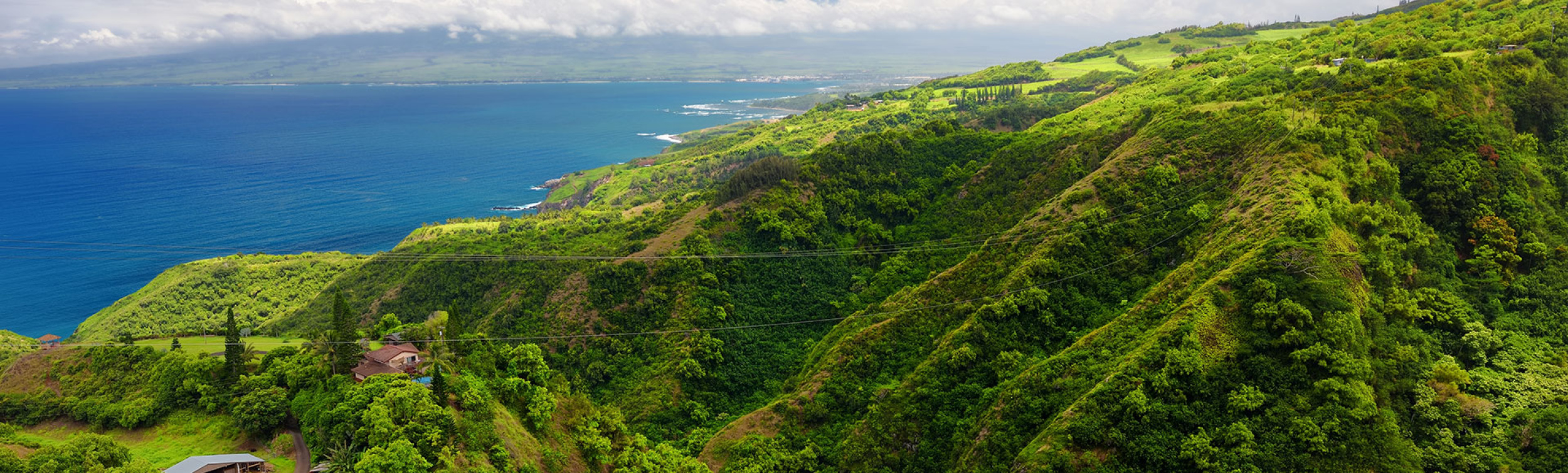
West Maui's wild back side — the one-lane Kahekili Highway around the island's rugged northwest tip. Kapalua and Honolua Bay, the Nakalele blowhole, a sacred bellstone, the Olivine Pools overlook, the green monolith of Kahakuloa Head, a banana-bread village frozen in time, and the Waiheʻe ridge. This is an advanced scenic drive, not a casual road trip — narrow, exposed, and unforgettable. Free self-guided audio tour.
31 miles
~1h 54min driving
9 curated stops
Free self-guided audio tour
~1h 54min
total driving time
31 mi
total distance
9 stops
curated stops
5-7h
suggested day
We may link to trusted Hawaiʻi resources at no extra cost to you.
Build your own route
Pick a preset or tap the ✓ Include chip on any stop below to customize.
9
of 9 stops selected
-
Intro
Intro
Show transcript
You're about to drive the Kahekili Highway, Route 340, around the wild northwest corner of West Maui — and "highway" is generous. For long stretches it narrows to a single lane with two-way traffic, blind curves, no guardrail, and a cliff dropping straight to the ocean on one side. Many rental agreements restrict this stretch or exclude coverage or towing if you drive it. Check your own contract before you go. Drive it in daylight, in good weather, in a vehicle you're comfortable with. Skip it in rain, fog, or after dark. If backing up on a one-lane ledge to let oncoming traffic pass makes your stomach drop, that will happen more than once. If you're good with all that, you'll see what most visitors don't. We're going clockwise, Kapalua to Wailuku. Take it slow. There's no prize for speed out here. Let's go. -
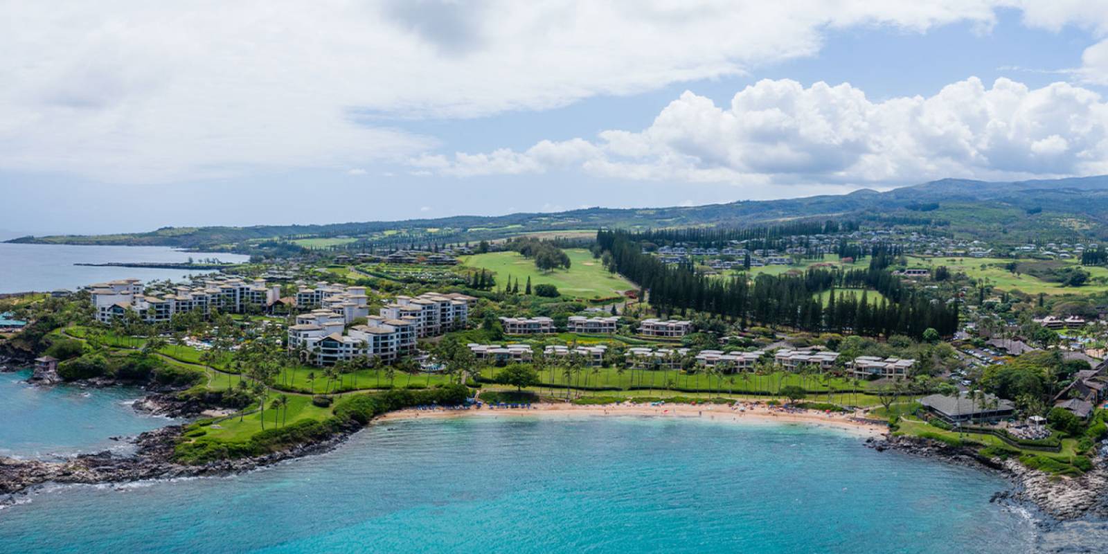
A gold-sand crescent sheltered by two lava points, twice named America's Best Beach — the last easy resort beach before the road turns wild.
Approach Cue (~12-15 sec)Show transcript
Makai side, coming up in about half a mile. Kapalua Bay is a gold-sand crescent twice named America's Best Beach—your last easy stop before the road turns wild. The parking lot fills early, so grab it if you see it. Use the restrooms here if you need them, and make sure gas and water are handled before you leave Kapalua or Nāpili.Arrival Narration (~45-60 sec)Show transcript
See that gold sand curved like a smile between two dark lava points? That's your first real clue you're in the right place. The water in front of you stays flat and clear even when the rest of the coast is getting torn up by waves — those two points block everything and hold the bay calm like cupped hands. This is a calm swim and snorkel spot on the West Maui shore. The reef along the lava points draws turtles and reef fish close to the surface. Morning is when to be here: the water's still glass, parking's easy, and you haven't burned yourself out yet. If you want to get in the water, do it now. After this, the resorts disappear fast. The road climbs mauka — toward the mountain — and West Maui gets wild. -
 9 min from previous stop · 3.6 mi
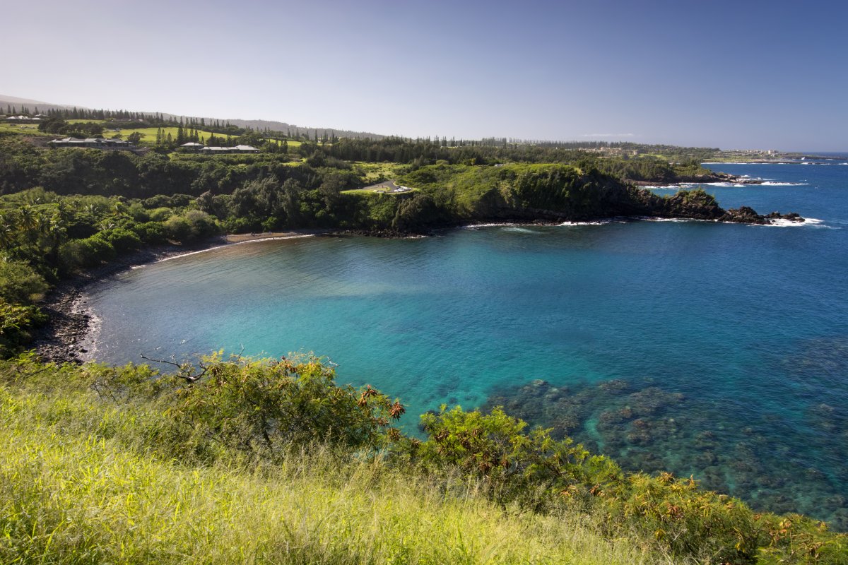
A marine life conservation district — world-class snorkeling in summer's calm, world-class surf in winter's swell — reached by a short walk through old jungle.
Approach Cue (~12-15 sec)Show transcript
Coming up on the makai side—Honolua Bay, a marine life conservation district where protection means the snorkeling is genuinely good. Parking lines both shoulders, so pull all the way off. A short, flat path through old jungle gets you to the water.Arrival Narration (~45-60 sec)Show transcript
The water here is either glassy and clear, or heaving with swell, depending on the season. Honolua Bay is a marine conservation district, which means the reef and fish stay protected. Summer brings perfect snorkeling conditions and schools of fish along the right side of the bay. Winter turns it into a serious surf break where experienced riders take the point while the water's too rough to swim. Either way, no fishing, no collecting, no standing on coral. The entry is rocky with boulders, so reef shoes help. Linger as long as conditions allow. Once you leave here, the pavement roughens and the real Kahekili Highway begins. -
Connector · 340 14 min drive · 6 mi
Where the Road Turns Wild
Show transcript
Past Honolua, the road climbs onto open cliffs and the pavement starts shrinking. The centerline disappears. You'll feel the highway narrow under you, especially through the curves. From here on, it's one rule: slow down, hug the inside, and watch ahead for oncoming traffic. In plenty of spots, only one car fits. Whoever's closer to a wide shoulder backs up or pulls over—an unwritten courtesy that works as long as everyone moves slowly. The payoff is what's coming: coastline opens into red-dirt cliffs and wide-open ocean, some of the most dramatic, least-developed scenery in the islands. Far fewer visitors come this way. -
 14 min from previous stop · 6 mi
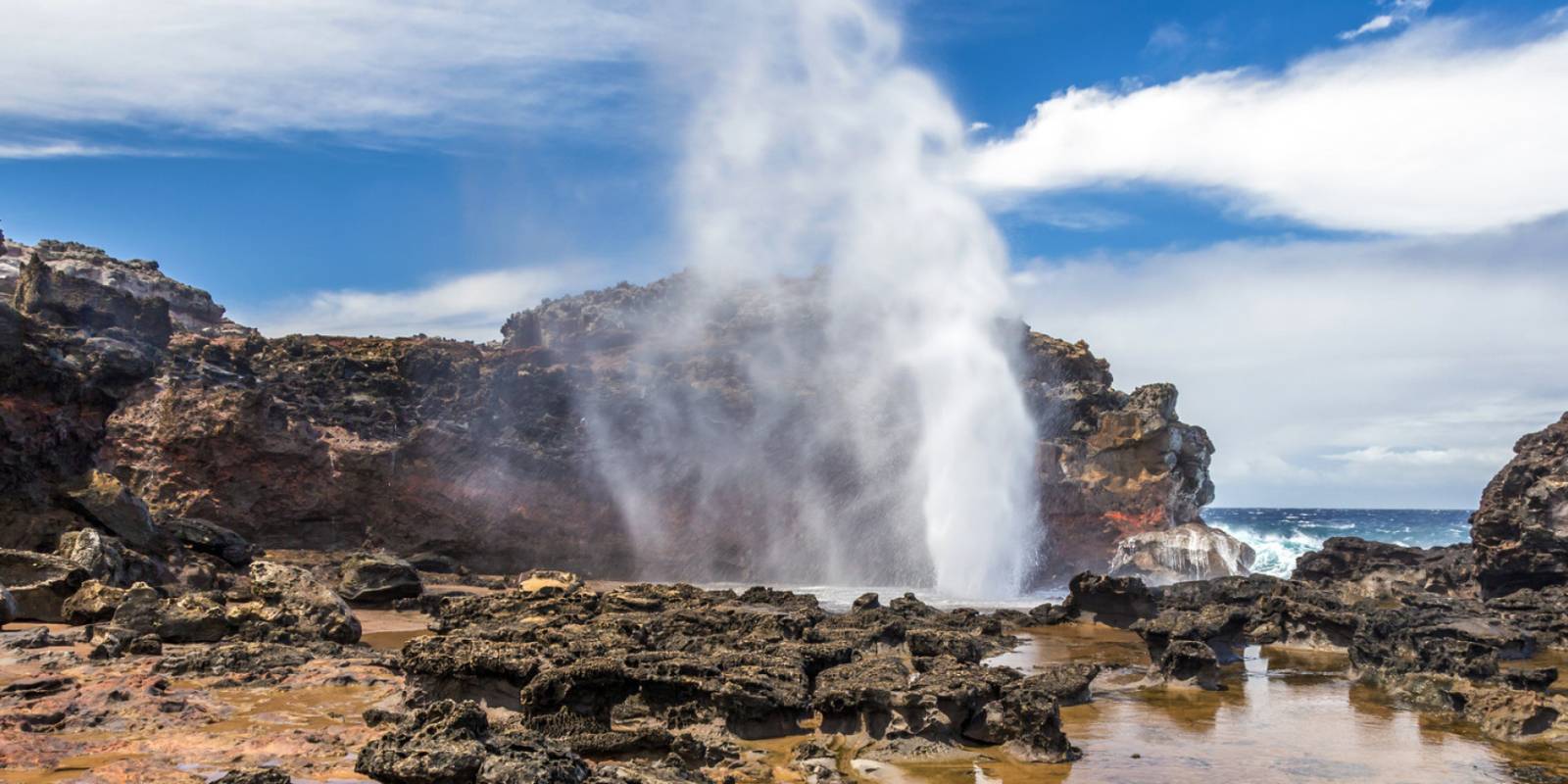
A sea-cliff blowhole that fires spray up to 100 feet through a lava tube — plus a wind-carved "heart-shaped rock" — at Maui's northernmost point. The shelf has swept people in; watch from above.
Approach Cue (~12-15 sec)Show transcript
Coming up on the makai side—Nakalele Point, Maui's northernmost tip. The blowhole fires spray up to a hundred feet through a lava tube. The shelf around it is wave-swept, and people have been swept off this coastline and killed—so treat this as a watch-from-a-safe-distance stop, not a get-close one. If you do walk down the rough lava trail toward it, wear real shoes, stay well back, and never put yourself between the blowhole and the open ocean. Honestly, the view from the higher ground gives you the show without the risk.Arrival Narration (~45-60 sec)Show transcript
You can probably hear it before you see it — that boom of water hitting the lava shelf and shooting straight up through the blowhole. On the right swell and tide, it fires spray that can reach sixty, even a hundred feet. Nearby, wind and water carved a heart-shaped hole clean through the cliff face, framing the ocean like a window. This shelf is slick and wet, and rogue waves have swept people off it into the sea. Never stand between the blowhole and open water, never turn your back on the ocean, and keep kids well back. The view from higher ground is nearly as good and far safer — you get the show from up top without the risk. Watch a few sets come through, then head back to the car. -
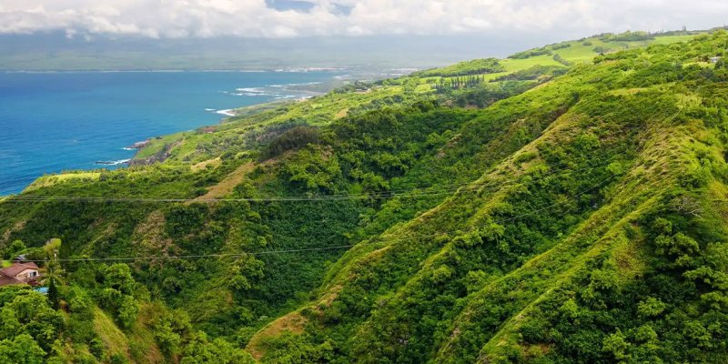 10 min from previous stop · 4.1 miStop mauka
Pohaku Kani (Bellstone)
A large sacred basalt boulder — a wahi pana, a storied place — that rings with a bell-like tone when struck. On-site signage asks visitors not to hit, rub, or deface it. Look, don't touch.
Approach Cue (~12-15 sec)Show transcript
Coming up on the mauka side just before mile marker sixteen—Pohaku Kani, the bellstone. It's a sacred basalt boulder that rings like a bell when struck, but the sign's clear: look, don't touch. Pull fully off the road if you stop; shoulder's narrow here.Arrival Narration (~45-60 sec)Show transcript
You hear that wind moving down the valley? That's the same corridor where a deep, hollow bell-tone used to travel. This is Pohaku Kani, a basalt boulder mauka of the road—toward the mountain—that rings like a bell when struck in the right spot. For Native Hawaiians this is a wahi pana, a sacred place where that sound once carried signals across the district. The signage here asks you not to strike it, rub it, or throw rocks at it. Older guidebooks told visitors the opposite. You came to understand something sacred, not to wear it down. Stand with it a few minutes, let the wind speak instead, and leave it exactly as you found it. Look, don't touch. -
0 min from previous stop · 0 miStop makai
Olivine Pools (Overlook Only)
Green-tinged tide pools on an exposed lava bench below the road. People have died here — rogue waves sweep the shelf without warning. This is an overlook-only stop. Do not climb down.
Approach Cue (~12-15 sec)Show transcript
Coming up on the makai side, you'll see a pullout near mile sixteen for the Olivine Pools — green-tinged tide pools on the lava shelf below. Pull over and walk to the edge of the bluff to look, but don't climb down. Rogue waves sweep across that shelf without warning, and people have died here.Arrival Narration (~45-60 sec)Show transcript
You can see them from here — those green-tinted pools sitting flat against the lava bench, right where the ocean hits. The north coast opens up behind them, and yeah, they're beautiful. That's exactly why people used to treat this place like a secret swimming hole. But people have died at the Olivine Pools. The bench sits completely exposed to the open ocean with no reef to slow the swell down, and rogue waves wash across that shelf without warning — even on calm days. Visitors have been swept into the water and never recovered. Stay up here at the overlook. Take the photo, admire what you're seeing, and don't climb down, don't walk onto that shelf, don't get in the water. The view from where you're standing right now keeps you safe. -
8 min from previous stop · 2.3 miStop makai
Kahakuloa Head (Puʻu Kahekili)
A 636-foot green monolith standing over Kahakuloa Bay, named for the chief Kahekili, who is said to have cliff-dived from its top. View from the highway pullout — no climb, private land.
Approach Cue (~12-15 sec)Show transcript
Coming up on the makai side—a pullout with a view of Kahakuloa Head, that tall green peak rising straight out of the bay. Pull fully onto the shoulder here; it's one-lane and blind, so get completely off the road before you stop.Arrival Narration (~45-60 sec)Show transcript
That green monolith is Kahakuloa Head—its Hawaiian name is Puʻu Koaʻe, "tropical bird hill," rising roughly six hundred and forty feet straight up over the bay. Local tradition ties it to Kahekili, an eighteenth-century chief of Maui, who legend says leaped from its cliff into the sea far below—a feat called lele kawa—which is why a spot here is nicknamed Kahekili's Leap. Standing here, you can see why it became a place of mana; the sheer vertical thrust of it commands your attention in a way few landforms do. You can take the whole thing in from where you're standing. The cliffs are private land and genuinely dangerous, so there's no climbing it. Below and ahead, tucked into the valley at the foot of the head, is Kahakuloa village—our next stop. -
2 min from previous stop · 0.8 miStop makai
Kahakuloa Village
A tiny, remote Hawaiian village in a green valley — taro patches, one church, a one-lane road through the middle, and a couple of family banana-bread stands. A living community; visit gently.
Approach Cue (~12-15 sec)Show transcript
Coming up on the makai side—Kahakuloa Village. The road narrows to one lane straight through a living community, so crawl. Kids, dogs, chickens are around; pull into a tiny pullout if you stop, don't block the road. Bring cash for the banana-bread stands to be safe.Arrival Narration (~45-60 sec)Show transcript
You're standing in a green valley with the gulch walls rising on every side. This is Kahakuloa, one of the most isolated Hawaiian villages on Maui. A handful of homes, a small church, one-lane road through the middle. Taro patches still worked in the valley. People live here—a living community. The reward for the white-knuckle drive is the banana bread. Julia's Best Banana Bread runs the lime-green stand; the official site currently lists it open weekdays, Monday through Friday—but hours out here change, so treat it as a bonus, not a guarantee, and bring cash just in case. The bread is warm and dense. There's sometimes a second family stand nearby; hours out here are hit or miss, so it's first come, first served. Buy something, be friendly, keep your voice low. You're a guest in a real place. Then head back onto the road. The hardest part of your drive is done. -
Connector · 340 31 min drive · 8.7 mi
Climbing Out Toward Waiheʻe
Show transcript
You're past the toughest part now. The pavement steadies, the cliffs ease back, and your shoulders can drop a little. The West Maui Mountains rise up on your right—green and folded, cut by deep valleys. After rain you'll see waterfalls threading down them. You're rounding toward Waiheʻe now and starting the long descent toward the central valley. The road still has a few one-lane pinches ahead, but nothing like what you just drove. Keep your eye uphill—there's a waterfall tucked into the mountains worth watching for as you go. -
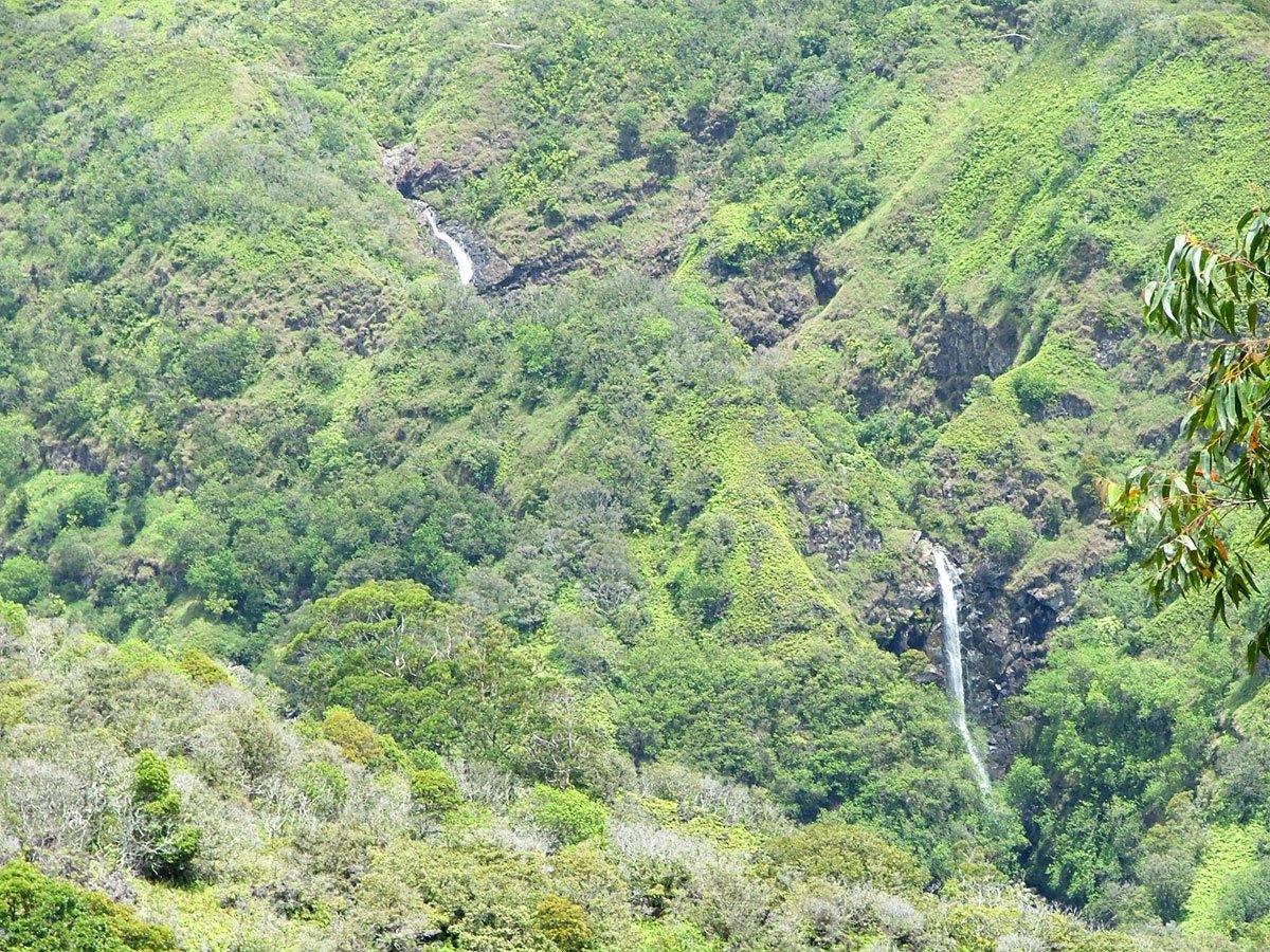 31 min from previous stop · 8.7 mi
A tall valley waterfall on Makamakaʻole Stream, seen from the highway and best from the Waiheʻe Ridge Trail. The old "Swinging Bridges" route crosses posted/private land — admire from the road, not by trespassing.
Approach Cue (~12-15 sec)Show transcript
Coming up on the mauka side—Makamakaʻole Falls, a tall waterfall dropping down the valley wall into Makamakaʻole Stream. It runs strongest after rain. If you stop, find a safe wide spot fully off the road, never on a blind curve.Arrival Narration (~45-60 sec)Show transcript
You can see the water threading down the mountainside in layers—that's Makamakaʻole Falls dropping off the stream on the mauka side, toward the mountain. The waterfall sits deep in the valley, framed by green, and you're viewing it from the highway. There's an old trail people talk about called the Swinging Bridges route. Don't go looking for it. That path crosses posted and private land, and access has been closed. The best view is actually from higher up on the Waiheʻe Ridge Trail, our last stop coming up. The view from here works well, especially on a clear day after rain when the water's running full. Take in what you're seeing, then head on. The ridge trail will give you a different angle from above. -
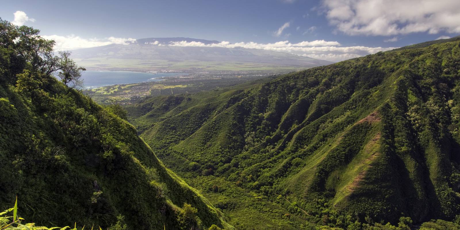 1 min from previous stop · 0.3 mi
A 5-mile round-trip ridge hike climbing into the West Maui Mountains for big valley and waterfall views — and the natural end of the loop before the easy run into Wailuku.
Approach Cue (~12-15 sec)Show transcript
Coming up on the mauka side—Waiheʻe Ridge Trail. Turn onto Maluhia Road toward the Boy Scout camp; the trailhead's up that access road with a small parking lot. It's a 5-mile round-trip ridge hike with valley and waterfall views. You've made it through the hard part of the loop—this is the natural end before the easy run down to Wailuku.Arrival Narration (~45-60 sec)Show transcript
You're looking at the entry to the West Maui Mountains, and that spine rising mauka — toward the mountain — is where this trail goes. The Waiheʻe Ridge Trail climbs about five miles round trip with real elevation gain, a couple of hours of work if you take it on. You get the inside view of this range you've been skirting all day: deep green valleys, ridgelines stacking into clouds, waterfalls including a high-up look at Makamakaʻole. The trail gets muddy and the top is often socked in with cloud, so go early for the clearest shot. Whether you hike the full ridge or just take in the view from here, this is the right place to end the loop. From here it's a short, easy drive down into Waiheʻe and Wailuku — pavement, gas, and a cold drink close at hand. -
Outro
Outro
Show transcript
That's the West Maui Loop. You drove the Kahekili Highway end to end—the one-lane ledges, the blowhole, the bellstone, the green tower of Kahakuloa Head, banana bread in a living village. This drive demands your full attention and gives you scenery for it. From Waiheʻe it's a quick, easy run into Wailuku, where you'll find food, gas, and your way to wherever's next—ʻĪao Valley is up the road if it's open—worth a quick status check before you add it. Take it easy on the descent. You earned this one.
This tour is created with AI from HawaiiGuide route content and read by the computer-generated Mele and Kani voices. Hawaiian names and place names may occasionally be mispronounced — mahalo for your patience as we refine.

Need help planning?
Search & Planning Chat →

Hawaiʻi Weather Forecast
Today’s Weather Brief · Audio · ~45s
0:00
0:54
Read the transcript
Trades are breezy right now with scattered showers on the windward side and mountains; the leeward coast stays mostly dry. Tomorrow stays breezy with the same pattern.
A tropical disturbance southeast of the islands is likely to become a tropical storm by mid-week and approach the state Thursday through Saturday. The exact track is still uncertain. If it comes closer, expect heavier rain over a longer stretch; if it stays farther out, impacts will be shorter and lighter. Winds will increase late this week, with potential gusts over 70 miles per hour on the highest summits.
Plan your leeward beach time and snorkeling for today through Tuesday. Save summit drives and offshore water sports for after Saturday, and check updates daily as this develops.
Created with AI from the official NWS forecast discussion · verify with NWS before heading out
Loading forecast…
Temperature
Weather data by Open-Meteo.com
Current Time in Hawaiʻi
--:----
Hawaiʻi Standard Time · UTC−10 · No Daylight Saving
You’re on Hawaiʻi timeMainland US
International
Aloha Today daily podcast →
Full HST breakdown, FAQ & DST schedule →

Get Your Free Hawaii Visitor Guide
Enter your email and we'll send you instant access to our free 2026 Hawaii Starter Guide + Summary Guidesheets.