
Hawaiʻi Guide · Audio Driving Tour
Hāmākua Coast BETA
The Big Island's lush green coast — Hilo north to the Valley of the Kings. The Pepeʻekeo jungle scenic drive and Onomea Bay, the 442-foot ʻAkaka Falls, the Laupāhoehoe tsunami memorial, native upland rainforest at Kalōpā, old Honokaʻa town, and the dramatic Waipiʻo Valley Lookout. Waterfalls, gulches, and one-lane bridges. Free self-guided audio tour.
57 miles
~1h 40min driving
6 curated stops
Free self-guided audio tour
~1h 40min
total driving time
57 mi
total distance
6 stops
curated stops
5-8h
suggested day
We may link to trusted Hawaiʻi resources at no extra cost to you.
Build your own route
Pick a preset or tap the ✓ Include chip on any stop below to customize.
6
of 6 stops selected
-
Intro
Intro
Show transcript
This is the Hāmākua Coast—the lush, green, waterfall side of the Big Island, running north from Hilo along the old sugar coast to the great valley at Waipiʻo. It's about fifty miles of cliffs, gulches, and one-lane bridges, the ocean on your right the whole way and rainforest climbing the slopes on your left. We're starting just north of Hilo on a scenic loop off the highway, then a famous waterfall, a tsunami memorial that'll stop you cold, an old plantation town, and a finish at one of the most dramatic overlooks in all of Hawaiʻi. A few notes before we roll. This coast is wet—some of the rainiest country in the islands, which is exactly why it's so green—so expect showers and slick roads. The old belt-road sections are narrow with one-lane bridges, so slow down and take turns. And the grand finale, Waipiʻo Valley, is a lookout stop only—the road down into the valley is closed to visitors, and we'll get into why when we're there. Settle in; this is a half-day if you do it right. Let's head up the coast. -
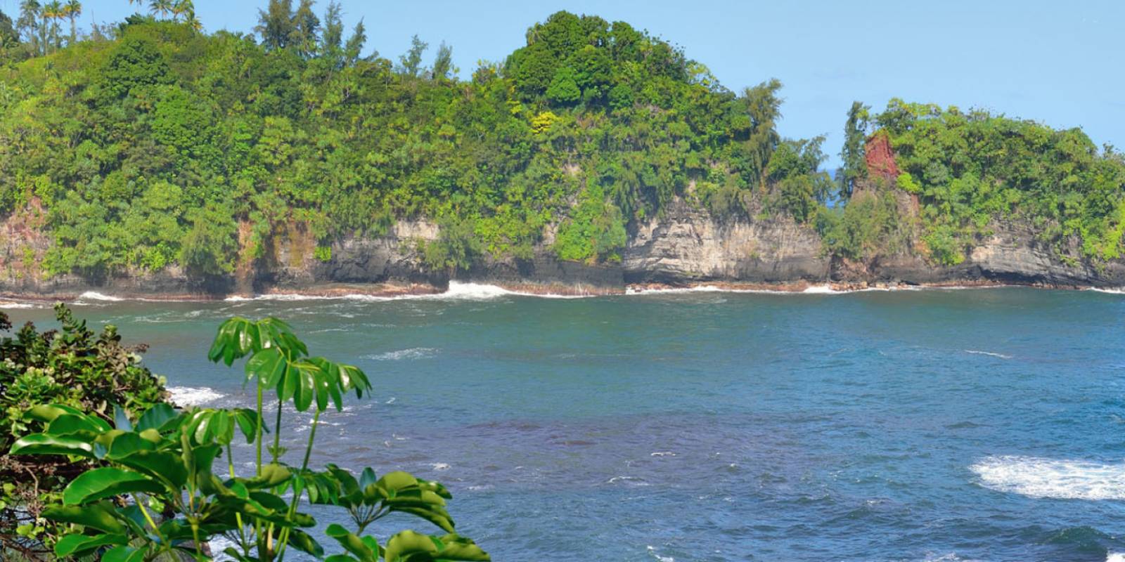
The 4-mile Pepeʻekeo Scenic Drive (Old Māmalahoa Highway) just north of Hilo — a jungle tunnel of old belt road past Onomea Bay and the Hawaiʻi Tropical Bioreserve & Garden.
Approach Cue (~12-15 sec)Show transcript
A few miles north of Hilo, watch for the marked turnoff onto the Pepeʻekeo Scenic Drive—the old Māmalahoa Highway. It's a four-mile loop off Highway 19 that drops you into deep jungle. Fair warning before you turn: it's narrow, twisting, with several one-lane bridges, so slow right down and yield to oncoming cars at the bridges.Arrival Narration (~45-60 sec)Show transcript
This little loop is the best stretch of old road on the coast—a green tunnel of mango and African tulip trees and stream crossings, jungle pressing in on both sides. About halfway along you'll reach Onomea Bay, a gorgeous little cove with a sea arch, and the Hawaiʻi Tropical Bioreserve and Garden dropping through the ravine toward the water. The garden is a paid, self-guided stop—no reservation needed for regular admission, open daily, currently thirty-five dollars for adults, so check the current rate before you go—and it's one of the great gardens in the islands if you've got the time. Even if you don't go in, the drive itself, with its glimpses of the bay through the trees, is worth the detour. Take it slow and enjoy the green. -
 14 min from previous stop · 7.5 mi
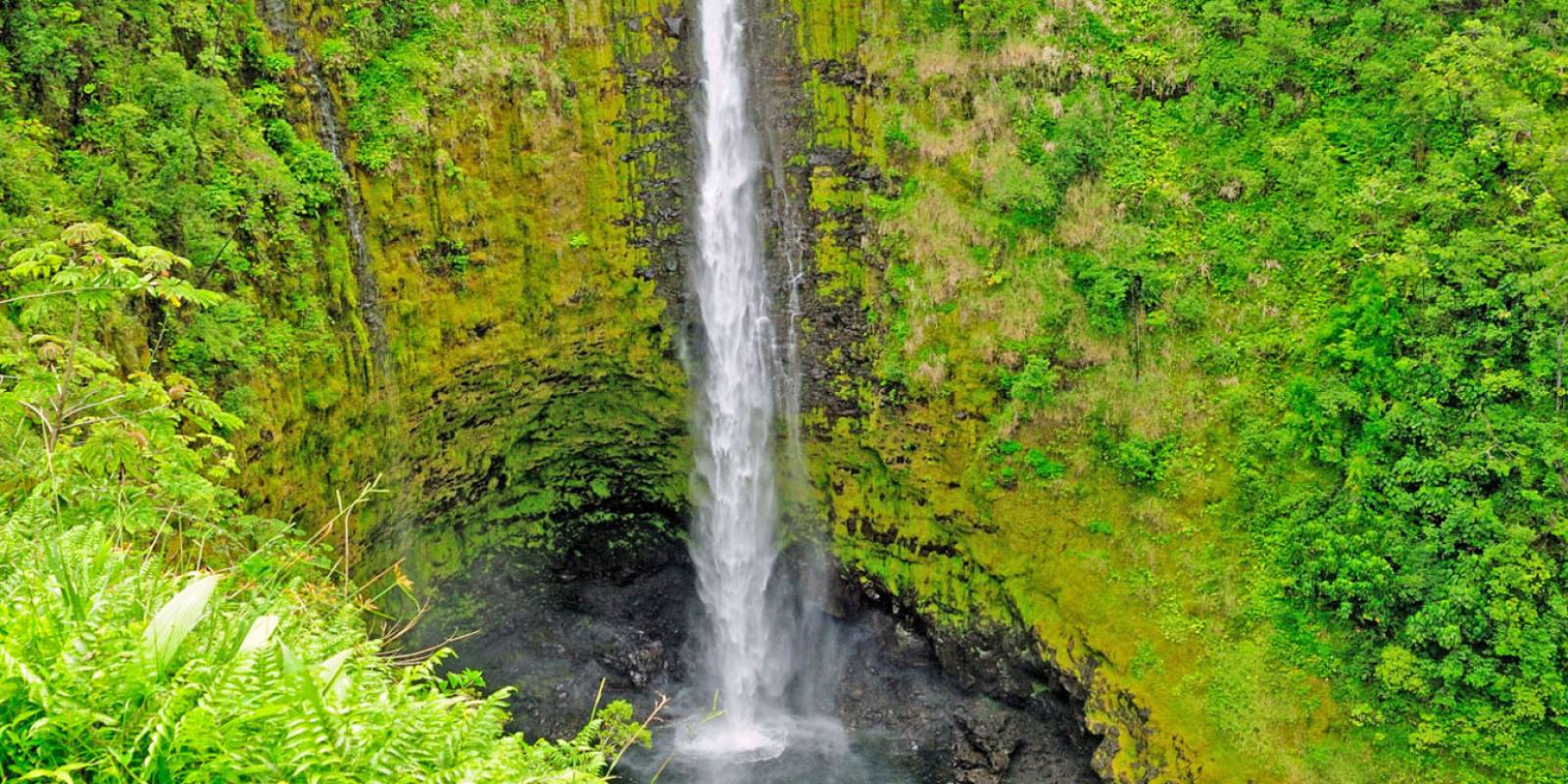
A 442-foot waterfall on an easy paved 0.4-mile loop, reached through the small plantation town of Honomū. Non-resident fee, credit-card only, spotty cell signal.
Approach Cue (~12-15 sec)Show transcript
Coming up is the turnoff for ʻAkaka Falls, which climbs up through the little town of Honomū—a few galleries and snack spots worth a quick look. Heads up on the park: there's a fee, it's credit-card only, and cell signal is spotty, so it's smart to pay online before you arrive. As of now it runs ten dollars a vehicle plus five dollars a person for non-residents—check the current rate.Arrival Narration (~45-60 sec)Show transcript
ʻAkaka Falls drops four hundred and forty-two feet in a single sheer plunge into a gorge, and you reach it on an easy paved loop—less than half a mile— through jungle thick with bamboo, ferns, and wild orchids. The loop also passes a second, smaller falls called Kahūnā. This is one of the most accessible big waterfalls in Hawaiʻi—no scramble, just a paved path—so it gets busy, but it earns the crowd. Walk the loop in either direction; the full circuit is maybe twenty minutes at a stroll. Then it's back down through Honomū and on up the coast. -
Connector · 19 29 min drive · 18.7 mi
The Old Sugar Coast
Show transcript
This next stretch up toward Laupāhoehoe is the heart of the old Hāmākua sugar country. For more than a century this whole coast was wall-to-wall cane—the plantations cut flumes and rail lines into these gulches to move it, and towns like Honomū, Paʻauilo, and Honokaʻa grew up around the mills. The last Hāmākua sugar mill closed in the nineteen-nineties, and the cane's gone now, replaced by eucalyptus, pasture, and small farms—but the bones of that era are everywhere. Notice how the highway keeps crossing deep gulches on tall bridges; each one is a stream pouring off Mauna Kea down to the sea. -
 29 min from previous stop · 18.7 mi
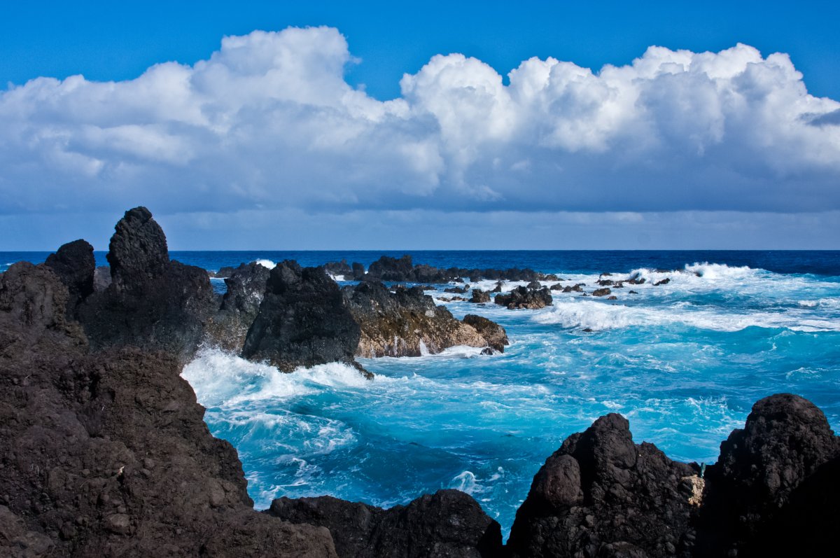
A lava peninsula reached by a steep road off Highway 19 — and the site of the April 1, 1946 tsunami that killed schoolchildren and teachers. A stone memorial lists 24 names.
Approach Cue (~12-15 sec)Show transcript
Just ahead, a steep, winding road drops off the highway down to Laupāhoehoe Point—a flat lava peninsula right at the water. It's a beautiful, windswept spot, but I want to set the tone before you get out, because this is a place of remembrance, not just a scenic pull-off.Arrival Narration (~45-60 sec)Show transcript
On the morning of April first, nineteen forty-six, a tsunami set off by a huge earthquake near Alaska struck this point with almost no warning. A school stood here then, down at sea level, and the waves swept away students and teachers—twenty-four names are carved into the stone memorial here. That disaster is the reason Hawaiʻi built the tsunami warning system that protects the islands today. So walk out, read the names, take in the raw beauty of the point—the black rock, the pounding surf, the cliffs behind you—but treat it as the memorial it is. And stay well back from the water; this is an exposed, dangerous shoreline with rogue waves, the same ocean that came ashore that morning. -
 27 min from previous stop · 16.8 miStop mauka
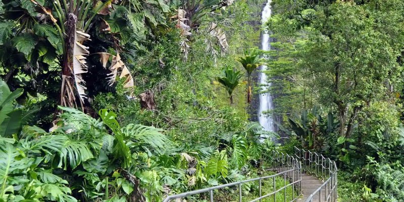
Kalōpā State Recreation Area
A cool, 2,000-foot native ʻōhiʻa rainforest with an easy 0.7-mile nature loop. Free, open daytime — a quiet upland contrast to the coastal stops.
Approach Cue (~12-15 sec)Show transcript
A little farther on, a short detour mauka—toward the mountain—brings you to Kalōpā State Recreation Area. It's an easy one to skip, but if you've got half an hour and want to stretch your legs in real native forest, it's a gem. Free entry, open daytime.Arrival Narration (~45-60 sec)Show transcript
Up here around two thousand feet, the air turns cool and misty and you're standing in native Hawaiian rainforest—tall ʻōhiʻa trees, giant tree ferns, birdsong. There's an easy nature loop, less than a mile, that winds through the forest with the trees labeled, so it's a quiet, shaded walk and a complete change of pace from the coast. This is close to what these slopes looked like before the cane and the cattle. If you're moving fast and keeping your eyes on Waipiʻo, you can skip it—but it's a peaceful, uncrowded stop if you've got the time. -
12 min from previous stop · 5.3 miStop mauka
Honokaʻa Town
The historic sugar-and-paniolo town that's the gateway to Waipiʻo — a walkable early-1900s main street and the last real services before the lookout.
Approach Cue (~12-15 sec)Show transcript
Honokaʻa is just ahead—the biggest town on this stretch, and your last stop for gas, food, and a restroom before the Waipiʻo lookout. It's worth pulling off to walk the main street even if you don't need anything.Arrival Narration (~45-60 sec)Show transcript
Honokaʻa is an old sugar and paniolo town—paniolo being the Hawaiian cowboy— and its main street is a row of wood-front buildings from the early nineteen-hundreds that have aged into galleries, shops, and local eateries. It once ran one of the largest sugar mills on the island, and it's still the hub for this whole upper coast. This is the place to fuel up and grab a bite, because past here the services basically end. I won't send you to one particular spot—the businesses change—but the street's short and easy to browse. When you're ready, it's about ten more miles out to the end of the road. -
Connector · 19 14 min drive · 8.5 mi
Out to the Rim
Show transcript
From Honokaʻa, Highway 240 runs the last stretch out toward Waipiʻo, rolling through green pastureland and small farms with the coastline dropping away on your right. You'll pass a few tiny communities, and then the road just…ends, at the rim of the valley. Take these last miles easy. You're driving out to one of the most sacred and storied places on the island, and the view at the end is the kind of thing people remember for the rest of their lives. -
 14 min from previous stop · 8.5 mi
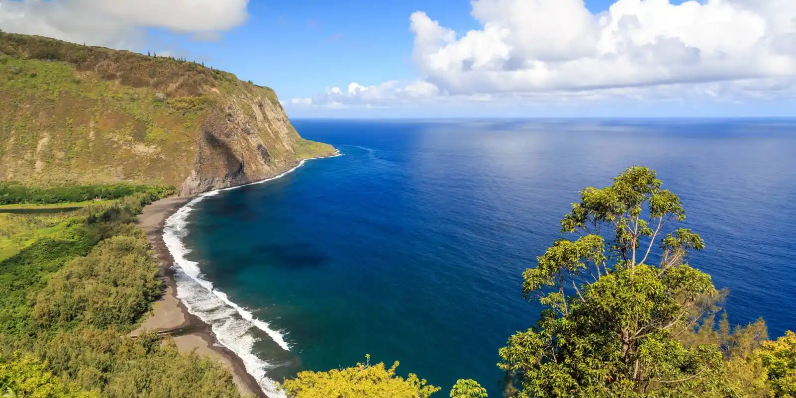
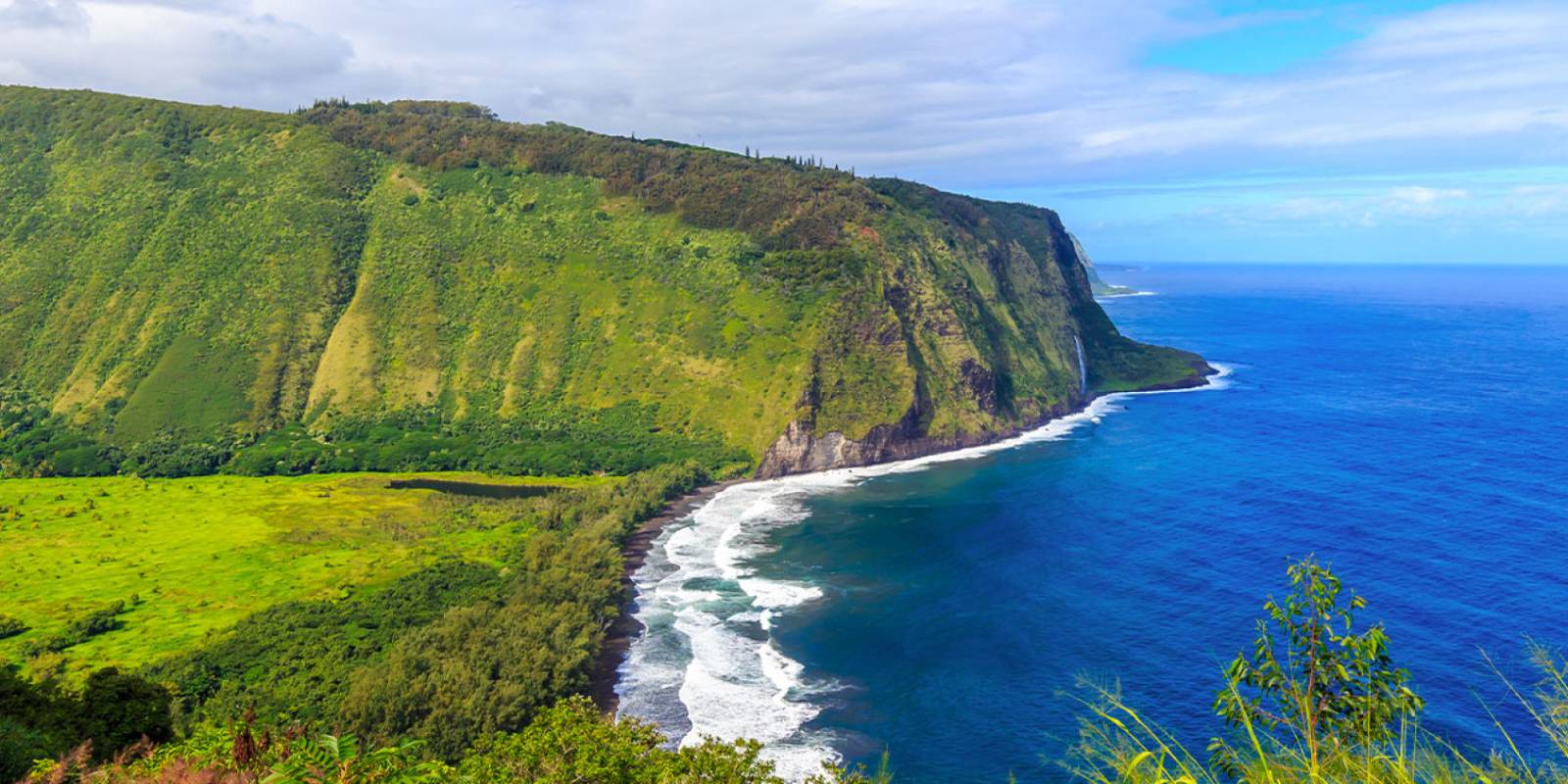
The Waipiʻo Valley Lookout — a 2,000-foot-walled "Valley of the Kings" with a black-sand beach far below. Lookout only; the valley road is closed to visitors. Free, with parking.
Approach Cue (~12-15 sec)Show transcript
This is the end of the road—the Waipiʻo Valley Lookout. There's parking and a viewing area right at the rim. One thing to be clear about before you get out: this is a lookout stop. The road down into the valley is closed to visitors, so we're taking this in from the top—and honestly, the view from up here is the experience.Arrival Narration (~45-60 sec)Show transcript
Waipiʻo means "curved water," and you're looking into the Valley of the Kings—walls nearly two thousand feet high, a wide black-sand beach where the river meets the sea, and taro patches and jungle spread across the valley floor far below. On a clear day you can pick out Hiʻilawe Falls threading down the back wall, one of the tallest waterfalls in Hawaiʻi. This was a sacred center of old Hawaiʻi—home to thousands of people and to several aliʻi, the ruling chiefs—and it still feels powerful and apart. Now, the road down: it's one of the steepest in the country, a twenty-five percent grade, four-wheel- drive only, and it's been closed to visitor vehicles—the county restricted it for safety and access keeps changing—so the rim is where the tour ends. Don't try to drive or walk down; respect the closures and the families who farm the valley. Just stand here and take it in. This is the finish—the green heart of the Hāmākua Coast. -
Outro
Outro
Show transcript
That's the Hāmākua Coast—the scenic drive and the gardens, ʻAkaka Falls, the Laupāhoehoe memorial, old Honokaʻa town, and the great valley at Waipiʻo. This is the green, soulful side of the Big Island, the part that rewards slowing down. From here you can backtrack to Honokaʻa for a meal, head back down the coast toward Hilo, or cut across the saddle toward Waimea and the Kona side. However you go, take the wet roads easy. Mahalo for riding the coast with us.
This tour is created with AI from HawaiiGuide route content and read by the computer-generated Mele and Kani voices. Hawaiian names and place names may occasionally be mispronounced — mahalo for your patience as we refine.

Need help planning?
Search & Planning Chat →

Hawaiʻi Weather Forecast
Today’s Weather Brief · Audio · ~45s
0:00
0:54
Read the transcript
Trades are breezy right now with scattered showers on the windward side and mountains; the leeward coast stays mostly dry. Tomorrow stays breezy with the same pattern.
A tropical disturbance southeast of the islands is likely to become a tropical storm by mid-week and approach the state Thursday through Saturday. The exact track is still uncertain. If it comes closer, expect heavier rain over a longer stretch; if it stays farther out, impacts will be shorter and lighter. Winds will increase late this week, with potential gusts over 70 miles per hour on the highest summits.
Plan your leeward beach time and snorkeling for today through Tuesday. Save summit drives and offshore water sports for after Saturday, and check updates daily as this develops.
Created with AI from the official NWS forecast discussion · verify with NWS before heading out
Loading forecast…
Temperature
Weather data by Open-Meteo.com
Current Time in Hawaiʻi
--:----
Hawaiʻi Standard Time · UTC−10 · No Daylight Saving
You’re on Hawaiʻi timeMainland US
International
Aloha Today daily podcast →
Full HST breakdown, FAQ & DST schedule →

Get Your Free Hawaii Visitor Guide
Enter your email and we'll send you instant access to our free 2026 Hawaii Starter Guide + Summary Guidesheets.