



Waipio Valley Lookout Sign
 Been here? Tap to stamp
Waipio Valley Lookout
Big Island Hamakua Sights
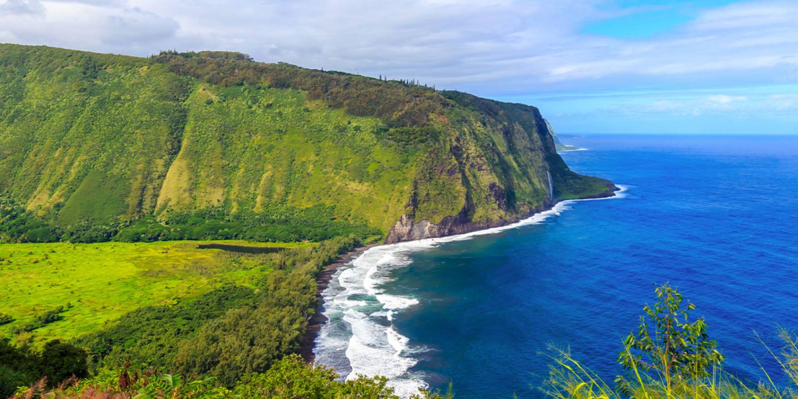
Waipiʻo Valley is on the Hāmākua Coast, with steep green cliffs, taro fields and a black-sand beach at its mouth.
Time and nature's elements have carved an unimaginably massive valley filled with deep green-encrusted cliffs cut by plunging waterfalls. Its floor is carpeted with forests and neatly formed taro patches interspersed with the homes of its few residents.
Plan your sightseeing stop around the Waipio Valley Lookout and follow posted controls.
Valley road and Waimanu camping restrictions
Waimanu camping is closed because of an impassable landslide past Helipad 1. DLNR says Waipiʻo Valley Access Road is the only access to the Muliwai trailhead and is closed to all pedestrian use.
Do not walk down from the lookout or plan a Waimanu camping trip while these restrictions remain in effect. Check DLNR’s current notice before making plans. Read DLNR’s Waimanu camping and access notice.

Waipio Valley
Waipio Valley History
Historical Significance of Waipio Valley
For the Hawaiian people, Waipio is more than just a beautiful place, it holds deep spiritual significance. Often called the "Valley of the Kings," Waipio was home to many ali'i (ruling class). King Kamehameha received a statue of his war god, Ku, here and was told he would one day rule the islands.
Because of its fertility, Waipio became a rich farming area, producing abundant taro and bananas. Oral histories of Waipio claim that anywhere between 4,000 and 10,000 people inhabited the valley before the arrival of Captain Cook in 1778. So many generations of Hawaiians have lived and died in Waipio that it is considered to be full of their mana (spiritual power). In fact, the cliffs of the valley were often used as burial sites for rulers and chiefs. The spiritual quality of Waipio is further enhanced by the presence of several heiaus, including a place of refuge similar to Pu'uhonua o Honaunau on the south part of the island.
The population of the valley was diversified in the late 1800s when Chinese immigrants moved in and began farming rice in great quantities. It may be hard to imagine, but at one point this valley had schools, restaurants, churches, and even a hotel and post office.
However, in 1946, life on the Big Island changed when a devastating tsunami hit this side of the island. It completely washed out the valley, although miraculously, none of the residents perished. The tsunami did not claim lives in the valley, it did however change it.
Respect residents and posted access controls. Do not plan an independent walk down Waipio Valley Road.
Get Your Free Big Island Guide
Instant access — opens immediately
- Beaches, activities & top spots
- Restaurant & dining recommendations
- Maps, itineraries & insider tips
Want the full offline version? Get the Complete Big Island Guidebook →

Entrance into Waipio Valley
Inside Waipio Valley
Planning a valley visit
DLNR says Waipiʻo Valley Access Road is the only access to the Muliwai trailhead and is closed to all pedestrian use. Do not treat the lookout as a trailhead for a walk into the valley. Confirm current vehicle-access rules with Hawaiʻi County before arranging any visit below the lookout.

Hi'ilawe Falls
Hiʻilawe Falls
Do not follow old walking directions into the valley or onto private land. The photograph here is not an invitation to hike to the falls.

Waipio Valley Beach
Waipio Beach
Do not walk down the access road to reach Waipio Beach. Follow current access controls and do not cross private land.

View from 'Z-Trail' on the Muliwai Trail
Muliwai Trail access
The Muliwai Trail climbs the western wall of Waipiʻo Valley and continues to Waimanu Valley. DLNR lists the trail as 7.6 miles one way, or 15.2 miles round trip from the trailhead. The trailhead is across Waipiʻo Valley from the lookout; this is not a short rim walk from the parking area.
DLNR says Waipiʻo Valley Access Road is the only access to the Muliwai trailhead and is closed to all pedestrian use.
Questions before booking a tour
Ask the operator to confirm its current route and authorization before booking. Do not assume a ride into the valley permits an independent hike to Waimanu; Waimanu camping is closed because of an impassable landslide past Helipad 1.

Hike into Waimanu Valley
Waimanu camping closure
Waimanu camping is closed because of an impassable landslide past Helipad 1. DLNR says Waipiʻo Valley Access Road is the only access to the Muliwai trailhead and is closed to all pedestrian use.
Do not walk down from the lookout or plan a Waimanu camping trip while these restrictions remain in effect. Check DLNR’s current notice before making plans. Read DLNR’s Waimanu camping and access notice.
See our Muliwai Trail access guidance for the route context.



