
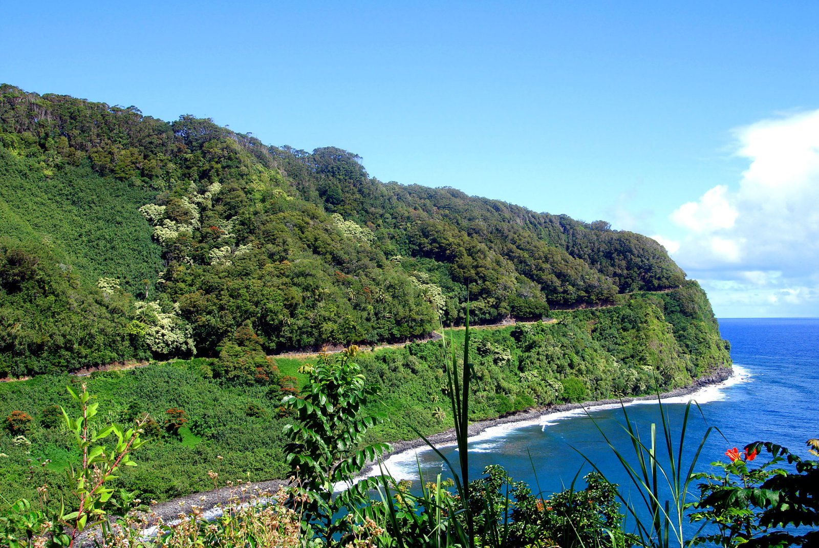
Hawaiʻi Guide · Audio Driving Tour
Road to Hana BETA
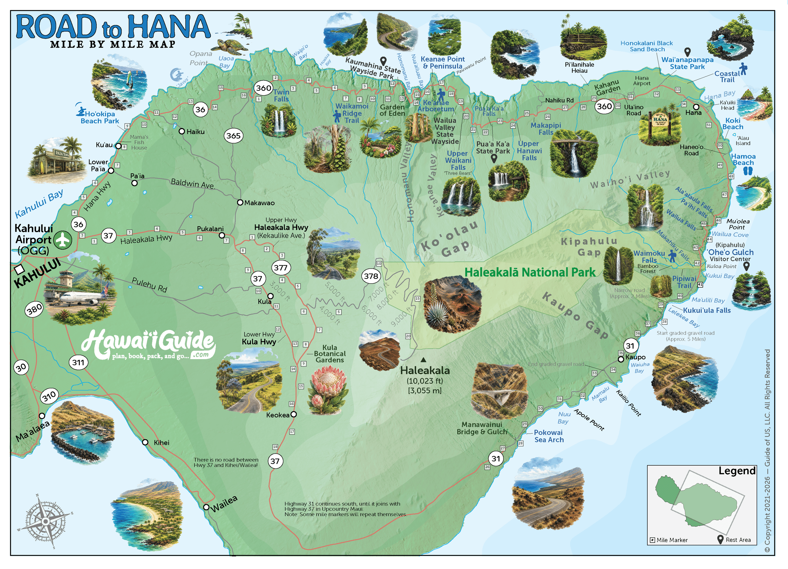
The slow drive from Paia through Hana to Kipahulu — waterfalls, black-sand beaches, bamboo forest, the Seven Sacred Pools, and the Pipiwai Trail to Waimoku Falls. 30+ curated segments. Free self-guided audio tour.
64 miles
~3h 30min driving
20 curated stops
Free self-guided audio tour
~3h 30min
total driving time
64 mi
total distance
20 stops
curated stops
8-10h
suggested day
We may link to trusted Hawaiʻi resources at no extra cost to you.
Build your own route
Pick a preset or tap the ✓ Include chip on any stop below to customize.
20
of 20 stops selected
-
Intro
Intro
Show transcript
This road from Pāʻia to Hāna is about 64 miles, but the highway's 600 curves and dozens of one-lane bridges make it feel much longer. The point isn't to reach Hāna quickly—it's the waterfalls, black-sand beaches, bamboo forest, and sea cliffs you pass along the way. Plan a full day, leave early, and fill your gas tank in Pāʻia. Bring water, snacks, rain gear, and mosquito spray. Use the pullouts to let local traffic pass. The guide will announce each stop as you approach. Let's go. -
 HI-36MILE7Stop · mile 7 makai
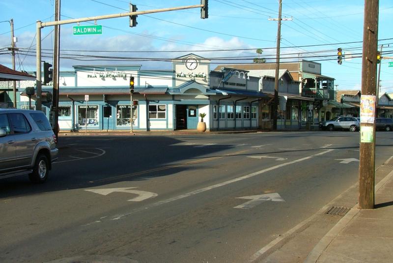
Lower Paia Town
Practical last stop before Hana — gas, coffee, snacks, bathrooms, and a quick reset before the road gets narrow. Use Lower Pa'ia as a provisioning stop, not a morning town detour; Shell has the last easy gas before Hana Town, and Mana Foods is good for road snacks.
Approach Cue (~12-15 sec)Show transcript
Coming up on the makai side in about half a mile: Lower Paia Town. Last real stop before Hana—gas up here, the next easy fuel is in Hana Town. Grab snacks at Mana Foods, a plate lunch at Paia Fish Market, and use the bathroom before you leave.Arrival Narration (~45-60 sec)Show transcript
You're standing in a strip of small wooden buildings housing cafes, surf shops, and boutiques—Lower Paia, a plantation-era sugar town that became a windsurfing hub in the 1980s. The Shell station at the main intersection is your last easy gas before Hana Town, so top off even if you think you don't need to. Pa'ia Fish Market on the corner serves fresh-caught fish at picnic tables. Mana Foods across the street has trail snacks and drinks for the road. Five or ten minutes is enough if you're prepared, thirty if you're grabbing food. Bathrooms are available inside any cafe or market if you order something. Back on Highway 36 east, Ho'okipa Beach Park is about two miles ahead. -
 5 min from previous stop · 2.3 miHI-36MILE9
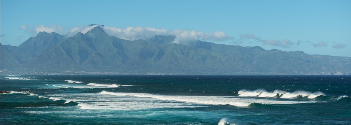
Windsurfing and surfing hotspot on Maui's North Shore; overlook at the east end of the park is the easy visit, beach access below is a surfer hangout
Approach Cue (~12-15 sec)Show transcript
Coming up on the makai side in about a quarter mile—Ho'okipa Beach Park. Pull into the overlook at the east end, not the beach parking below. The overlook is the quick stop. World-class windsurfing spot: on a windy afternoon you'll see thirty or forty sails on the water at once. If it's still morning, you'll see surfers instead.Arrival Narration (~45-60 sec)Show transcript
You're standing above one of the most photographed stretches of shoreline on Maui. Watch the water makai — toward the ocean — and you'll likely spot windsurfers carving through the breaks, their sails bright against the blue. Ho'okipa hosts windsurfing events every year, and on any afternoon the pros and locals are out there threading the same lines. The beach itself below is rocky and crowded, a surfer hangout rather than a swimming spot. Stay up here at the overlook for the better view. Green sea turtles haul out on the sand most afternoons to rest — they're federally protected, so keep your distance and just watch from up here. Ten or fifteen minutes at this overlook is plenty. Restrooms and picnic tables are below if you need them, then head back to the highway for the real drive ahead. -
Connector · HI-36 17 min drive · 10.1 mi
Hookipa to Twin Falls Connector
Show transcript
You're climbing into the Ko'olau Forest Reserve now, one of the wettest rainforest belts in the Hawaiian Islands. Rainfall jumps from sixty, eighty inches on the coast to two hundred, three hundred inches a thousand feet up the slope of Haleakala. That's why everything is about to turn suddenly, aggressively green. In a few minutes you'll hit Highway 360 where the mile markers reset to zero and the real drive begins. Most of what you're seeing is EMI property—private, off-limits. The Hawaiian Ditch System cuts through this reserve: seventy-five miles of tunnels and flumes built over a century ago to move water from the wet side of the island to the dry side. Stay on the road and the marked stops. Twin Falls is just ahead. -
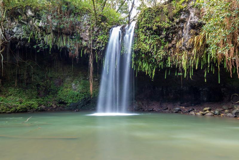 17 min from previous stop · 10.1 miHI-360MILE2Start of Hāna Highway (HI-360) · MM 2
First major stop on Hana Highway; private farm with limited paid parking, first-come access, and an on-site farm stand; check the official site for current rules
Approach Cue (~12-15 sec)Show transcript
Coming up on the mauka side just past mile 2—Twin Falls, the first stop after the Highway 36-to-360 transition. Private farm with limited paid parking, first-come basis. Short walk to the lower falls, longer one to the upper pool if you want to swim. Footwear matters since it gets muddy after rain.Arrival Narration (~45-60 sec)Show transcript
You hear water before you see it—that low rumble underneath the road noise. This is a private family farm mauka, toward the mountain, and they've been letting travelers through for decades. The lower falls are a ten-minute walk on flat ground through banana and passionfruit trees, and the pool below is swimmable and wide enough for a small crowd. If you've got another fifteen minutes and don't mind a bit of climbing, the upper falls are quieter—most people turn back at the lower pool. The water's fresh, so after rain the current runs strong, and leptospirosis does live in Hawaiian freshwater, so skip the swim if you have any open cuts. Even if you bypass the falls entirely, hit the smoothie stand out front. They grow the fruit right here on the property. Spend twenty minutes to half an hour and you'll have time for the falls, the stand, or both before heading on. -
Connector · HI-360 21 min drive · 7.4 mi
Twin Falls To Garden Connector
Show transcript
The road tightens here. One-lane bridges start showing up, so you're sharing tight spaces with whoever's coming the other way. Most of the traffic behind you is locals heading home from work. If you've got a line building, use the next pullout to let them through. It's the right thing to do and it makes the whole drive easier for everyone. Between mile markers 6 and 7, there's a small grove of painted bark eucalyptus trees on the makai side. The trunks have patches of red, purple, and green that look almost painted on by hand. You can spot them from your window, but there's no real pullout, so just take them in as you pass. You'll see the same species later at Keanae Arboretum if you want a closer look. -
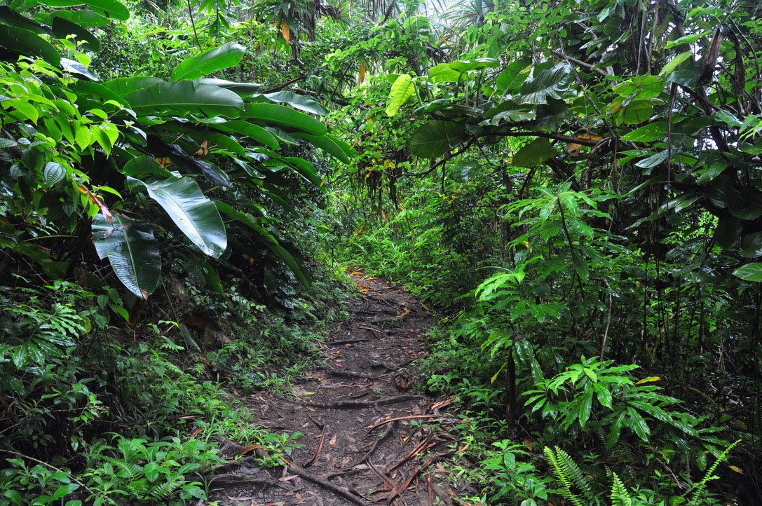 21 min from previous stop · 7.4 miHI-360MILE9
Free rainforest nature walk with picnic shelter at trailhead; no facilities; bug spray recommended
Approach Cue (~12-15 sec)Show transcript
Coming up on the mauka side just past mile marker 9—Waikamoi Ridge Trail. Easy rainforest loop through bamboo and ferns with two overlooks, takes thirty minutes to an hour. Parking's around a bend, so watch for it. Bring bug spray—no bathrooms out there.Arrival Narration (~45-60 sec)Show transcript
You're standing where the Road to Hana gets quiet. Listen—that's the sound of rainforest canopy, thick and dripping. The picnic shelter at the trailhead marks the start of a short walk on this drive. Two trails branch from here. The loop runs about eight tenths of a mile, done in half an hour, and it's rooty, muddy, lush with bamboo and painted eucalyptus. Go right at the trailhead to walk it counterclockwise—easier on the feet that way. If you want more, the extension pushes out to a grassy overlook where you can see back down the highway and out makai toward the ocean. Mosquitoes love this place, so bring bug spray. No facilities, no trash service. The picnic shelter is a good spot if you packed lunch. The trail surface gets slick after rain, so watch your footing. -
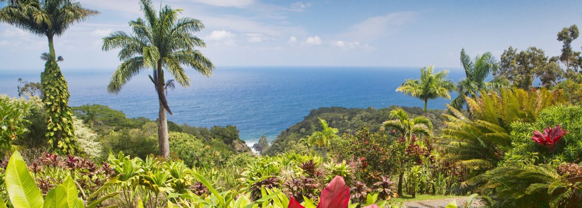 5 min from previous stop · 1.3 miHI-360MILE10
Private 25-acre botanical arboretum with ocean views, Keopuka Rock lookout, 500+ labeled plants; paid admission
Approach Cue (~12-15 sec)Show transcript
Coming up on the mauka side in about half a mile—Garden of Eden Arboretum, just past mile marker 10. Twenty-five acres of labeled plants with ocean views and a lookout where you can spot Keopuka Rock from Jurassic Park. Twenty dollars for adults, ten for kids five to sixteen. Open daily 8am to 4pm, no reservation needed. Plan on an hour.Arrival Narration (~45-60 sec)Show transcript
You're standing in a 25-acre arboretum mauka — inland from the road — and the loop path winds through both native plants and tropical species layered in from around the world. The owners started restoring this ecosystem in 1991, and today more than 500 labeled plants grow here, including Hawai'i's most extensive Ti plant collection. What makes this place specific: the Keopuka Rock lookout was filmed for the opening of Jurassic Park, and you can see Upper and Lower Puohokamoa Falls from inside the garden. Peacocks, chickens, and horses roam the property. Admission is twenty dollars for adults, with discounts for military, students, AAA, and Kama'aina. The garden is open daily from 8am to 4pm. Budget time to walk the loop at your own pace. -
Connector · HI-360 6 min drive · 2 mi
Garden of Eden to Kaumahina Connector
Show transcript
You're in the eastern slope of Haleakalā now, one of the wettest rainforest belts in the Hawaiian Islands. Some places get over 300 inches of rain a year. Most of what you see isn't native—those big trees with peeling bark are rainbow eucalyptus, planted by Territorial Forestry in the 1920s as a watershed experiment. The ferns are mostly uluhe, native to Hawaii but aggressive. When the canopy thins to narrow breaks, you'll catch glimpses of ocean through those gaps. They're old Hawaiian trails, cut generations before the paved road arrived in the 1920s. Before that, Hana was reachable only by canoe from West Maui or a two-day walk through this same terrain. The road you're on is far younger than the paths it replaced. -
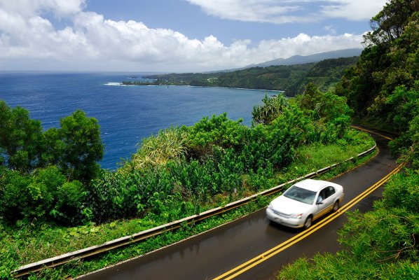 6 min from previous stop · 2 miHI-360MILE12.3
Roadside state park with bathrooms, picnic tables, and a viewpoint of Keanae Peninsula
Approach Cue (~12-15 sec)Show transcript
Coming up on the mauka side in about a quarter mile—Kaumahina State Wayside. Best restrooms for the next thirty miles, plus a short walk uphill to views of Keanae Peninsula. Small parking lot and picnic area under tall trees.Arrival Narration (~45-60 sec)Show transcript
You can hear the trade wind cutting through the trees here, and if you walk mauka — that's toward the mountain — a short path climbs up to a railed overlook. What you're looking at makai across the water is Keanae Peninsula, a flat green lava delta created by a lava flow from Haleakalā into the ocean around a thousand years ago. The village down there was destroyed by tsunami in 1946 and rebuilt, and you can spot Ihiihi o Iehova ona Kaua, the 19th-century stone church, standing on the point. This wayside has actual bathrooms, which makes it one of the few real rest stops on the Hana drive. Eat your lunch, stretch your legs, and let the cars behind you pass before the road gets even tighter ahead. -
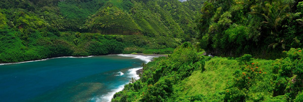 7 min from previous stop · 2.1 miHI-360MILE13
Quick roadside pullout with a view down into Honomanu Bay and back toward Keanae Peninsula
Approach Cue (~12-15 sec)Show transcript
Coming up on the makai side just past Kaumahina—Honomanu Lookout. It's a quick pullout with a view down into Honomanu Bay and back toward Keanae Peninsula from a different angle than Kaumahina. Thirty seconds to a minute is all you need.Arrival Narration (~45-60 sec)Show transcript
You're looking straight down into Honomanu Bay — black sand, steep walls on both sides, waves rolling straight in without a reef to break them. This is what you see right now. Most people pull in here thinking they should hike down to the beach. Don't. The access roads are rough, they'll void your rental agreement, and the view from up here is better than being down there. The water churns year-round — surfers come in winter when the swells peak, but swimming is risky. Scan makai — toward the ocean — and you'll spot Keanae Peninsula jutting out in the distance. The actual Keanae turnoff is a few miles ahead on the road. -
Connector · HI-360 8 min drive · 2.8 mi
Honomanu to Keanae Connector
Show transcript
You're in a section where the road opens up in stretches, giving you views back along the coast the way you came. Around mile marker 14, there's a pullout overlooking Honomanu Bay behind you—a good spot if you want another photo. A bit further on, a pullout sits on top of a steep embankment with the last wide view of the highway before the road curves inland toward Keanae. Don't feel like you have to stop at all of them. Around mile marker 16, Nua'ailua Bay opens on your left. The walls here are steeper than Honomanu, and the waves channel straight in. You'll know it when you see it. The road curves inland from there, so those coast views you've been getting are about to disappear. -
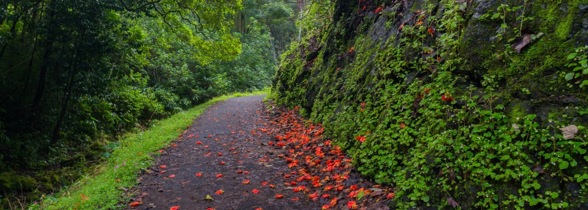 8 min from previous stop · 2.8 miHI-360MILE16
Free state-run arboretum with paved 0.6-mile walkway, taro fields, and painted bark eucalyptus; no facilities
Approach Cue (~12-15 sec)Show transcript
Coming up on the mauka side, about half a mile past mile marker 16—Keanae Arboretum, a free state-run arboretum with a paved walkway through taro fields and tropical plants. Parking's on the makai side, so you'll cross the road on foot. Watch for cars coming around the curve.Arrival Narration (~45-60 sec)Show transcript
You're standing on land that Hawaiians terraced hundreds of years ago to grow taro — and those foundations still support this arboretum. Walk the paved loop, about six tenths of a mile along the stream, and you'll pass roughly 150 tropical plants. Many are labeled. Fruit trees, ornamentals, and timber species came from across the tropics. The upper section shows plants Hawaiians cultivated for food and other uses. You'll also get your best close look at the painted bark eucalyptus you glimpsed earlier on the drive. There are no facilities here — no bathrooms, no water — so bring what you need. Thirty minutes is plenty if you're moving through Hana in one day. -
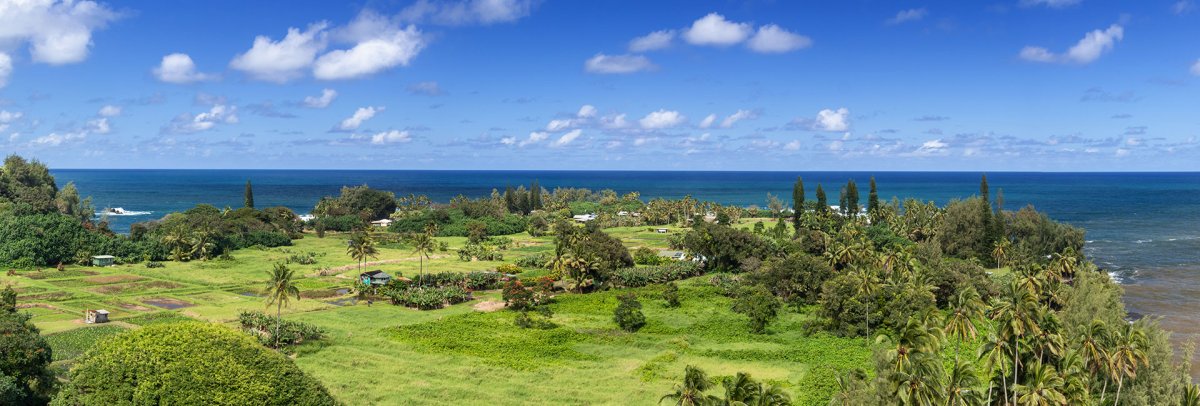 3 min from previous stop · 0.6 miHI-360MILE16.5
Living village on a lava delta; 1946 tsunami history; taro fields, hala trees, seabird sanctuary offshore
Approach Cue (~12-15 sec)Show transcript
Coming up on the makai side, right after the Arboretum—look for the Keanae Peninsula sign. Drive down about three quarters of a mile to park by the church. This is a living village on a lava delta. Respect the community: stay off private driveways and out of the taro fields.Arrival Narration (~45-60 sec)Show transcript
You're standing on a lava delta—that hard, flat green platform under your feet is where molten rock from Haleakala poured into the ocean and cooled. The hala trees clinging to this jagged coastline are about the only thing tough enough to survive here. This peninsula has lived through hard things. The 19th-century stone church you see—Ihi'ihi o Iehowa o na Kaua, Keanae Congregational—stood alone after the April 1, 1946 tsunami crossed this point and destroyed the school, killing students and teachers. It's still standing. You'll also see taro fields, a ball field, a few houses. Offshore, that little island is Moku Mana, a seabird sanctuary. Walk the point and take in the view. The water here runs violent, so stay out of it. When you're ready, head back to the highway and continue on. -
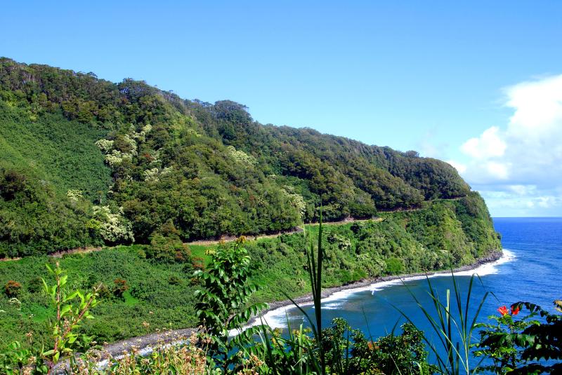 5 min from previous stop · 1.2 miHI-360MILE17Stop · mile 17 makai
Halfway To Hana
Roadside banana bread stand roughly halfway between Paia and Hana; cash preferred; hours variable
Approach Cue (~12-15 sec)Show transcript
Coming up makai side around mile marker 17, a small roadside stand selling banana bread and coconut candy, sometimes with coffee and fruit. Cash preferred. Quick five or ten minute stop.Arrival Narration (~45-60 sec)Show transcript
You're standing in front of a small roadside stand with the smell of banana bread baking—that warm, dense sweetness cutting through the trade-wind humidity. Loaves come out of the oven most mornings in small batches, wrapped in foil while still steaming. Sometimes there's fresh smoothie, fruit, or coconut candy depending on what came together that morning. Cash runs the whole operation. Other banana-bread stands dot this road, and people have their favorites. This one has loyal regulars for a reason—it's been selling to Road to Hana travelers for decades. Pull up a picnic table if you want to eat now, or grab a loaf for the next leg. Either way, bring cash. You're roughly halfway between Paia and Hana, so pace yourself accordingly. -
Connector · HI-360 15 min drive · 5.3 mi
Wailua Town Waikani Connector
Show transcript
You're driving through Wailua now. Three quick waterfall moments come up in this stretch—Lower Waikani near mile 18, Upper Waikani with its three spouts around mile 19, and another dropping just under the roadway near mile 21. Upper Waikani runs seventy feet tall, and the flow changes with rainfall. Winter brings high water that's too rough to approach; spring and summer is when you get the classic view. You don't have to stop at every one. Pick the ones that catch your eye as you pass. The road's moving fast here, and there's always another moment waiting around the curve. -
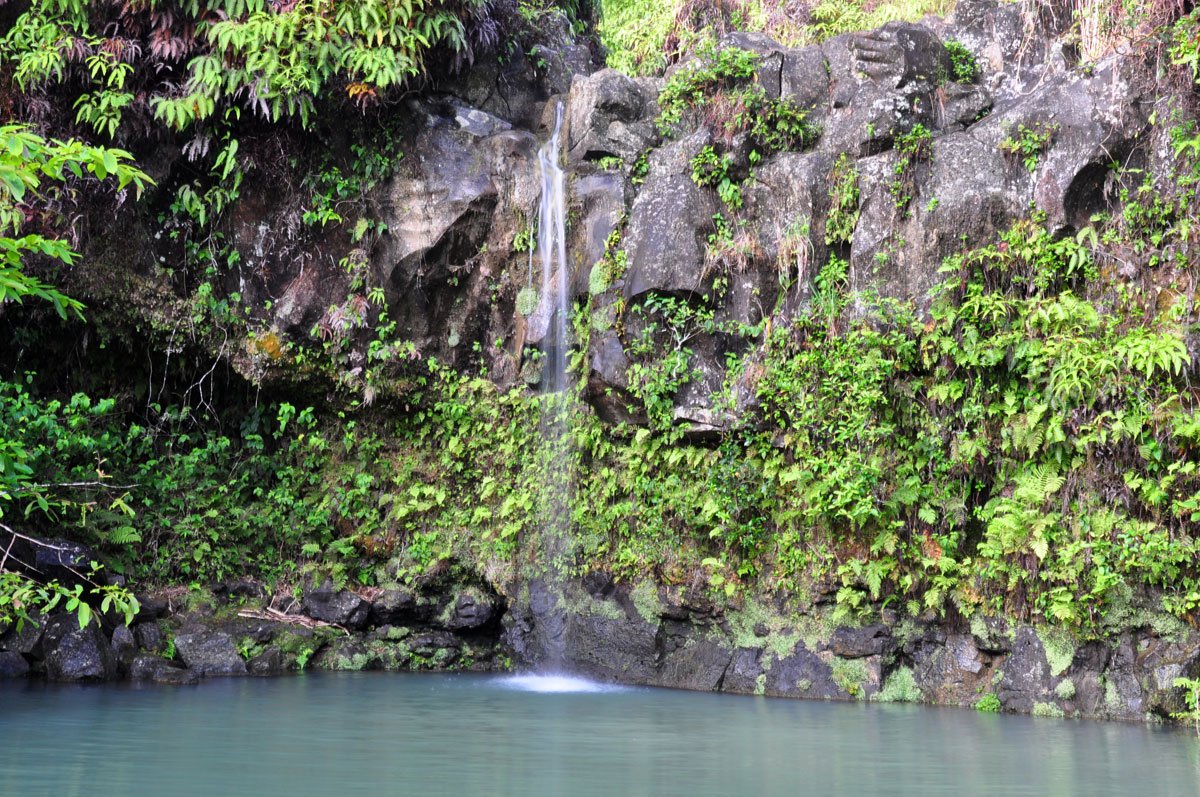 15 min from previous stop · 5.3 miHI-360MILE22
State wayside with paved trail to small falls, picnic tables, and restrooms; large paved parking lot makai
Approach Cue (~12-15 sec)Show transcript
Coming up on the mauka side, about a half-mile past mile marker 22—Pua'a Ka'a State Wayside. Short paved trail leads to a couple of small falls and pools, plus restrooms and picnic tables. Large paved parking lot on the makai side.Arrival Narration (~45-60 sec)Show transcript
You can hear the stream running through here even before you spot the water. This is Puaʻa Kaʻa—a state wayside tucked into the jungle mauka, toward the mountain—and it's the breather point most people need by mile twenty-two. There's a paved trail that takes fifteen or twenty minutes to reach a pair of small waterfalls and pools you can swim in. They're modest compared to what's behind you and what's ahead, but the jungle closes in around the water in a way that feels earned after the drive. The flat path means no scrambling over rocks. Watch the pavement as you walk—mongooses dart across it sometimes. Someone brought them here a century ago to kill rats; they killed the native ground birds instead and stuck around. Jungle fowl hang in the picnic area too, pecking for scraps. Leave them alone. Bathrooms are across the parking lot. Sit here, swim if the mood strikes, then head back to the car. -
Connector · HI-360 29 min drive · 9.9 mi
Puaakaa To Kahanu Connector
Show transcript
You're driving through the thick of the Road to Hana now. Between mile marker 22 and 31, you'll pass several small waterfalls and bridges. Upper Hanawi Falls near mile 24 is spring-fed, so it flows even in dry months — the bridge is the safest spot to view it if parking allows. Makapipi Falls around mile 25 drops into a blue pool right under the bridge, worth stopping for if you have time. You'll notice a steep road down to Nahiku village near mile 25, and Ula'ino Road further ahead leading to what some call Blue Pool. Both used to draw visitors, but Nahiku Road is too crowded now and the community is frustrated. Blue Pool's the same story — the beach is technically public, but access crosses private property and residents have reached a breaking point. Skip both. Around mile 30 the rainforest canopy opens up. That's when you'll see Haleakala's northeast face and the open Pacific for the first time. You're close now. -
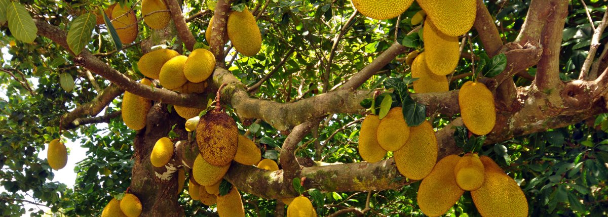 29 min from previous stop · 9.9 miHI-360MILE31
Kahanu Garden on ʻUlaʻino Road is home to Piʻilanihale Heiau; check the official National Tropical Botanical Garden schedule and current ʻUlaʻino Road access before visiting.
Approach Cue (~12-15 sec)Show transcript
Coming up on the makai side near mile marker 31—Kahanu Garden turnoff on ʻUlaʻino Road. The access road can be rough and may be affected by rain, so check conditions before you head in. The garden is home to Piʻilanihale Heiau. Never cross a flooded section.Arrival Narration (~45-60 sec)Show transcript
You're standing in a place where the trade winds carry the salt smell of the coast, and the ground beneath you is all black lava rock—unforgiving, ancient, and honest. This is Kahanu Garden, home to Piʻilanihale Heiau, a vast lava-rock structure built by hand generations ago. The heiau rises from the landscape makai—toward the ocean—stacked stone by stone. You'll walk a designated trail to see it, and the garden around it holds Hawaiian and Pacific plants in a coastal setting. The heiau requires respect; stay on the path and off the stone structure itself. Before you head in, confirm the hours and admission directly with the National Tropical Botanical Garden—weather closures happen. When you're done, return to Highway 360 and continue toward Waiʻānapanapa State Park. -
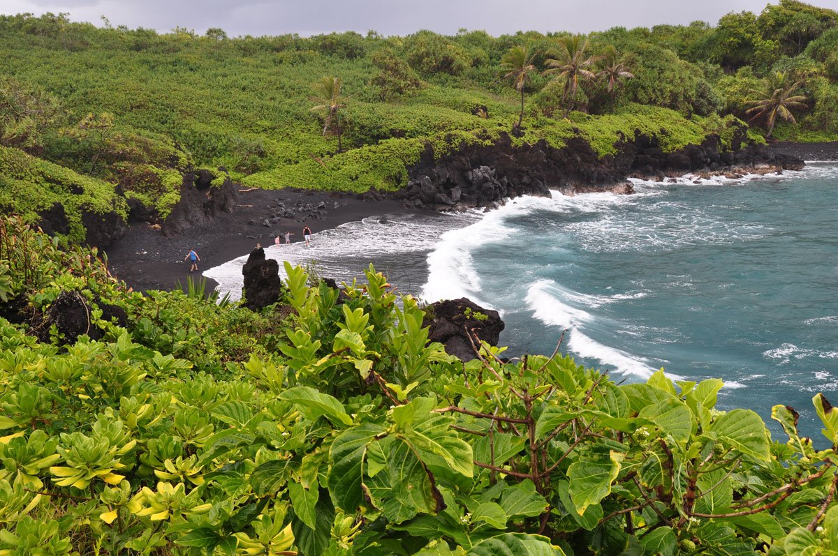 11 min from previous stop · 3.3 miHI-360MILE32
Honokalani black-sand beach at Waiʻānapanapa State Park; non-Hawaiʻi residents need advance entry and parking reservations through the official Hawaiʻi State Parks reservation system; same-day purchases are not available at the park; check current fees and access before visiting.
Approach Cue (~12-15 sec)Show transcript
Coming up on the makai side near mile marker 32—Waiʻānapanapa State Park with its black-sand Honokalani beach. Non-Hawaiʻi residents need advance reservations through the official Hawaiʻi State Parks system; same-day purchases aren't available. If you don't have one booked, skip it and keep driving.Arrival Narration (~45-60 sec)Show transcript
The black sand under your feet here is volcanic, and it's not the only sign of the geology around you. Honokalani Beach sits on a coastline cut by lava cliffs, sea stacks, and caves, all part of Waiʻānapanapa State Park. Native hala trees grow on the shore. The water looks inviting, but the shore break and currents here are genuinely dangerous. Treat this as a place to stand, look, and walk the established paths—not to swim. If you're a nonresident visitor, you need advance reservations through the official state parks system to enter; you can't buy same-day access at the gate. Spend time with the volcanic landscape, then head back to Highway 360 when you're ready. Hāna Town is still ahead. -
Connector · HI-360 8 min drive · 2.3 mi
Waianapanapa To Hana Connector
Show transcript
The rainforest opens up here. Landscape shifts from dense green to rolling pasture and coastal cliffs. This is Hana Ranch land, cattle country since the 1930s when Paul Fagan bought out the old sugar operation and turned it to grazing. Highway 360 ends at the fork coming into town. Left takes you to Hana Bay. Right goes into Hana itself and connects to Highway 31, which heads south toward Kipahulu and Oheo Gulch. We're taking the right fork. -
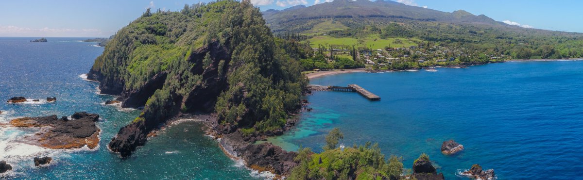 8 min from previous stop · 2.3 miHI-360MILE34
Small East Maui town with restaurants, stores, the Hāna Cultural Center, and Hāna Bay; check the cultural center directly because access information has changed
Approach Cue (~12-15 sec)Show transcript
Coming up on the makai side—Hana Town in about half a mile. Small, quiet place with three restaurants, a few shops, and a gas station. Fill up here if you need fuel before Kipahulu. Plan 30 to 45 minutes to walk around, longer if you head down to Hana Bay.Arrival Narration (~45-60 sec)Show transcript
The bay makai—toward the ocean—spreads before you with black sand and usually decent swimming, though you should ask a local about conditions before going in. You've arrived in Hana town, about 1,200 people on land that's cycled through sugar plantations and cattle ranches before landing in the hands of locals and mainlanders who stayed. Three restaurants, a couple of markets, and the Hāna Cultural Center are scattered through town. Contact the cultural center directly about current access before you plan a visit. The pier at the bay's far end offers a different view of town. A trail heads up Ka'uiki Hill for 200 yards to a small red sand pocket beach. Take a break here, eat something, fill your tank. The payoff miles are past town in Kipahulu. -
Connector · HI-360 7 min drive · 3.2 mi
Hana To Kipahulu Connector
Show transcript
You're on Highway 31 now, the South Hana Highway. Watch the mile markers—they count backward from here. You'll pass 51, 50, 49, all the way down to 42 at Oheo Gulch. The road narrows and the one-lane bridges come back. Cattle pasture and coastal bluffs, then the green closes in again. This is the quiet stretch. Fewer people make it past Hana Town, so if you've come this far you're driving with half the traffic. The first turnoff ahead is Koki Beach on Haneo'o Road, just after mile 51. -
 7 min from previous stop · 3.2 miHI-360MILE50.5
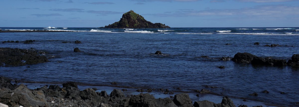
Red-sand beach below the Ka Iwi o Pele eroding cinder cone; views of Alau Island and offshore sea arch; strong currents — use caution swimming
Approach Cue (~12-15 sec)Show transcript
Coming up on the makai side, about half a mile past mile marker 51—Haneo'o Road down to Koki Beach. The red-sand beach sits below Ka Iwi o Pele, an eroding cinder cone with good views of Alau Island offshore. Strong currents here, so use caution if you swim.Arrival Narration (~45-60 sec)Show transcript
You're standing above a rust-colored beach, and that reddish sand comes from Ka Iwi o Pele, a 400-foot cinder cone that's slowly collapsing into the ocean. Offshore, Alau Island floats there with its palms, close enough to seem reachable but it's not. Scan makai—toward the ocean—along the rocky cliffs and you'll spot a sea arch carved into the rocks. The currents here run strong and the bottom's uneven, so most people come for the view rather than the water. Before you drive on to Hamoa Beach down Haneo'o Road, watch the shore for low stone walls—those are the Haneo'o fishponds, ancient structures built by Hawaiians for aquaculture. Head back to the car when you're ready. Hamoa is just a few hundred yards ahead. -
 3 min from previous stop · 0.8 miHI-360MILE49
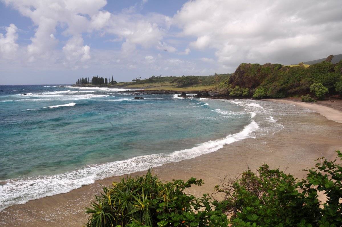
1,000-foot gray-sand beach surrounded by cliffs and lush vegetation; good swimming and bodysurfing; facilities maintained by adjacent hotel are available to visitors; unprotected, big surf in winter
Approach Cue (~12-15 sec)Show transcript
Coming up on the makai side, Hamoa Beach. Park at the top, take the stairs down to this 1,000-foot gray-sand beach surrounded by cliffs and lush vegetation. Good for swimming and bodysurfing. Restrooms, showers, and picnic tables are maintained by the adjacent resort but open to visitors. Plan an hour, longer if you swim.Arrival Narration (~45-60 sec)Show transcript
That gray sand stretching out below you, framed by cliffs—that's Hamoa, a thousand feet of it, salt-and-pepper colored and ringed by dense vegetation that grows right down to the water. The view stops most people mid-drive. The land around it belongs to a hotel, but the beach is public. You can use their restrooms, showers, and picnic tables. The water here has no reef protecting the shore, so winter swells roll in heavy and unimpeded. Respect big surf when you see it. Most of the year, though, swimming is good, and bodysurfing is excellent especially in winter. Decent snorkeling and scuba when the ocean's calm. Take your time if the water looks manageable. When you head back to Highway 31, a right turn keeps you toward Oheo Gulch, with the mile markers counting down. -
Connector · HI-360 13 min drive · 4.7 mi
Hamoa To Wailua Falls Connector
Show transcript
You're on Highway 31 now, heading south toward Wailua Falls. There's Waioka Pond coming up near mile marker 48—you'll see it mentioned in guides, sometimes called Venus Pool. It's on private land, and residents have been pushed past patience with visitors crossing their property. Ticketing isn't uncommon. Skip it. Around mile marker 46, you'll cross Ala'alaula Bridge with a small falls next to it. Skip that too. Paihi Falls is right there as well, drops about fifty feet right next to the road. A quick glance from the car if you want, but not worth pulling over. Wailua Falls is a mile ahead. Save your legs for that one. -
 13 min from previous stop · 4.7 miHI-360MILE45
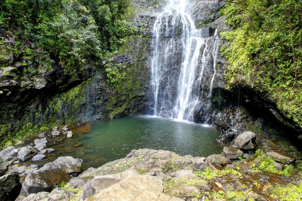
80-foot roadside waterfall on Honolewa Stream (not Wailua stream, despite the name); small parking lot makai right after the bridge; short path to the base — slick when wet
Approach Cue (~12-15 sec)Show transcript
Coming up on the makai side just past mile marker 45—Wailua Falls, a roadside waterfall right off the road. Small parking pullout right after the bridge. Short path to the base if you want a closer look, but the rocks are slick when wet.Arrival Narration (~45-60 sec)Show transcript
You're looking at eighty feet of water falling off a fern-covered cliff right next to the highway. The waterfall's called Wailua, but it's actually on Honolewa Stream, not Wailua Stream. The bridge you crossed is named Wailua; the falls upstream belong to a different watershed entirely. A short path drops down to the pool at the base, but it's steep and the rocks stay slick year-round, so wear real shoes and move carefully. The flow changes with the rain, but water usually runs through here all year. Don't cross the stream or climb the rocks near the base — people get hurt here every year. Five or ten minutes is enough. Head back to the car when you're ready; Oheo Gulch is three miles south on the road. -
 9 min from previous stop · 2.6 miHI-360MILE42
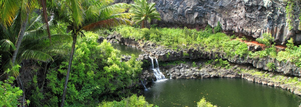
Kīpahulu District of Haleakalā National Park; Kūloa Point Trail provides views of ʻOheʻo Gulch; entering the stream or pools is prohibited; check current NPS alerts before arrival.
Approach Cue (~12-15 sec)Show transcript
Coming up on the makai side—ʻOheʻo Gulch at mile 42 in the Kīpahulu District. The Kūloa Point Trail has views of the gulch, but the stream and pools are off-limits. Check NPS alerts before you arrive, park in the official lot, and watch for posted closures.Arrival Narration (~45-60 sec)Show transcript
You're standing at the edge of a ravine where water slides down in a long white ribbon—that's ʻOheʻo Gulch, and the sound carries all the way up here. The pools stack below you in layers. That "Seven Sacred Pools" label you've heard was created for tourism; the gulch actually holds more than seven, and this whole area is the coastal Kīpahulu District of Haleakalā National Park. The Kūloa Point Trail loops from the visitor-center area toward the coast, past hala trees and cultural sites, with views straight down into the gulch. The park prohibits entering the stream and pools—enjoy them from the trail instead. The ocean makai, toward the seaward side, has severe currents at Kūloa Point, so stay on solid ground. Check National Park Service alerts before you came; flooding and weather can close trails and sections of this district. The Pīpīwai Trail starts from the same parking area if you want more to explore. -
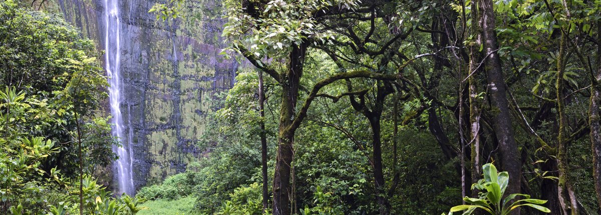 0 min from previous stop · 0.1 miHI-360MILE42
Pīpīwai Trail — 4 miles round trip; passes the Makahiku Falls overlook, giant banyan tree, bamboo forest, and Waimoku Falls; check current NPS trail conditions before hiking
Approach Cue (~12-15 sec)Show transcript
Coming up mauka side in about half a mile—the Pīpīwai Trail trailhead, right past the stream bridge. Four miles round trip through a bamboo forest to Waimoku Falls. Bring water and mosquito spray, wear real shoes, and skip it if there's been heavy rain.Arrival Narration (~45-60 sec)Show transcript
You're standing at the trailhead of the best hike on this whole drive. The first half mile climbs gently to an overlook of Makahiku Falls, where the pool appears to spill straight off the cliff. When the stream's flowing strong, it stops you. Past the overlook you'll find a giant banyan tree, a single organism with dozens of aerial roots you can walk beneath, then the trail opens into a bamboo forest—30-foot culms that knock together in the wind, dark and cool and loud, a stretch that feels older than the rest of the island. Boardwalks carry you above the mud. You'll cross the stream a couple of times on foot bridges and stepping stones, and at the end Waimoku Falls drops 400 feet into a shallow pool. Don't cross the stream at the base if it's rained recently; the current's stronger than it looks. Plan four hours start to finish. Check current NPS trail conditions before you head in. -
4 min from previous stop · 1.3 miHI-360MILE41Stop · mile 41 makai
Lindbergh Grave
Charles Lindbergh's grave behind Palapala Hoʻomau Church, built in 1864; limited parking; coastal views beyond the grave.
Approach Cue (~12-15 sec)Show transcript
Coming up on the makai side near mile marker 41—Palapala Hoʻomau Church, where Charles Lindbergh is buried. Parking is limited and the turn is easy to miss, so slow down. Keep the visit quiet and respectful.Arrival Narration (~45-60 sec)Show transcript
The stone church sits makai—toward the ocean—above the cliffs. This is Palapala Hoʻomau Church, built in 1864, and behind it lies Charles Lindbergh, the aviator who crossed the Atlantic solo in 1927. He spent his final years on this coast and designed his own grave before he died in 1974: plain lava rock border, flat stone slab, his name and dates beneath a Java plum tree. Most people come for Lindbergh's name, but what opens up beyond the grave is why you're really here. Coastal cliffs drop straight into the Pacific with no railings, no development. The Lindberghs chose this view for a reason. Be respectful of the space. The road south deteriorates from here, so most travelers return north toward Kahului on the loop road. -
Outro
Outro
Show transcript
You covered real ground today — past Hana Town, through Kipahulu, to the pools at Oheo, up the Pipiwai Trail to Waimoku Falls, and out to Lindbergh's grave at Palapala Ho'omau Church. The road south deteriorates fast from here, so most travelers head back the way they came, retracing Highway 31 to Hana Town and Highway 360 to Paia. The return will feel shorter once you know the curves. Plan two and a half to three hours for the drive back, less if you're not stopping. Most single-car accidents on this highway happen on the return leg, when drivers are tired and pushing it — so keep that in mind. Tomorrow, check the Haleakala summit drive or the Upcountry loop. Both are shorter, both very different.
This tour is created with AI from HawaiiGuide route content and read by the computer-generated Mele and Kani voices. Hawaiian names and place names may occasionally be mispronounced — mahalo for your patience as we refine.

Need help planning?
Search & Planning Chat →

Hawaiʻi Weather Forecast
Today’s Weather Brief · Audio · ~45s
0:00
0:54
Read the transcript
Trades are breezy right now with scattered showers on the windward side and mountains; the leeward coast stays mostly dry. Tomorrow stays breezy with the same pattern.
A tropical disturbance southeast of the islands is likely to become a tropical storm by mid-week and approach the state Thursday through Saturday. The exact track is still uncertain. If it comes closer, expect heavier rain over a longer stretch; if it stays farther out, impacts will be shorter and lighter. Winds will increase late this week, with potential gusts over 70 miles per hour on the highest summits.
Plan your leeward beach time and snorkeling for today through Tuesday. Save summit drives and offshore water sports for after Saturday, and check updates daily as this develops.
Created with AI from the official NWS forecast discussion · verify with NWS before heading out
Loading forecast…
Temperature
Weather data by Open-Meteo.com
Current Time in Hawaiʻi
--:----
Hawaiʻi Standard Time · UTC−10 · No Daylight Saving
You’re on Hawaiʻi timeMainland US
International
Aloha Today daily podcast →
Full HST breakdown, FAQ & DST schedule →

Get Your Free Hawaii Visitor Guide
Enter your email and we'll send you instant access to our free 2026 Hawaii Starter Guide + Summary Guidesheets.