
Hawaiʻi Guide · Audio Driving Tour
East Oahu Coastal Drive BETA
A 25-mile half-day drive along Kalanianaʻole Highway and around the southeast tip of Oahu — Diamond Head, Hanauma Bay, Halona Blowhole, Sandy Beach, Makapuʻu Lookout, Waimānalo, Lanikai. Ends at one of the most photographed beaches in Hawaii. ~7 curated stops.
25 miles
~45 min driving
7 curated stops
Free self-guided audio tour
~45 min
total driving time
25 mi
total distance
7 stops
curated stops
3-4h
suggested day
We may link to trusted Hawaiʻi resources at no extra cost to you.
Build your own route
Pick a preset or tap the ✓ Include chip on any stop below to customize.
7
of 7 stops selected
-
Intro
Intro
Show transcript
You're about to drive Kalanianaʻole Highway from Diamond Head around the southeast tip and up the Windward side to Lanikai — about 25 miles that'll take three to four hours if you stop at a few overlooks, longer if you want to swim or hike. Before you go: gas up now. The next reliable station is in Hawaiʻi Kai, about eight miles in. If you're planning Hanauma Bay, you need an advance reservation released 48 hours out. The bay is closed Mondays and Tuesdays. Let's go. -
 72MILE0
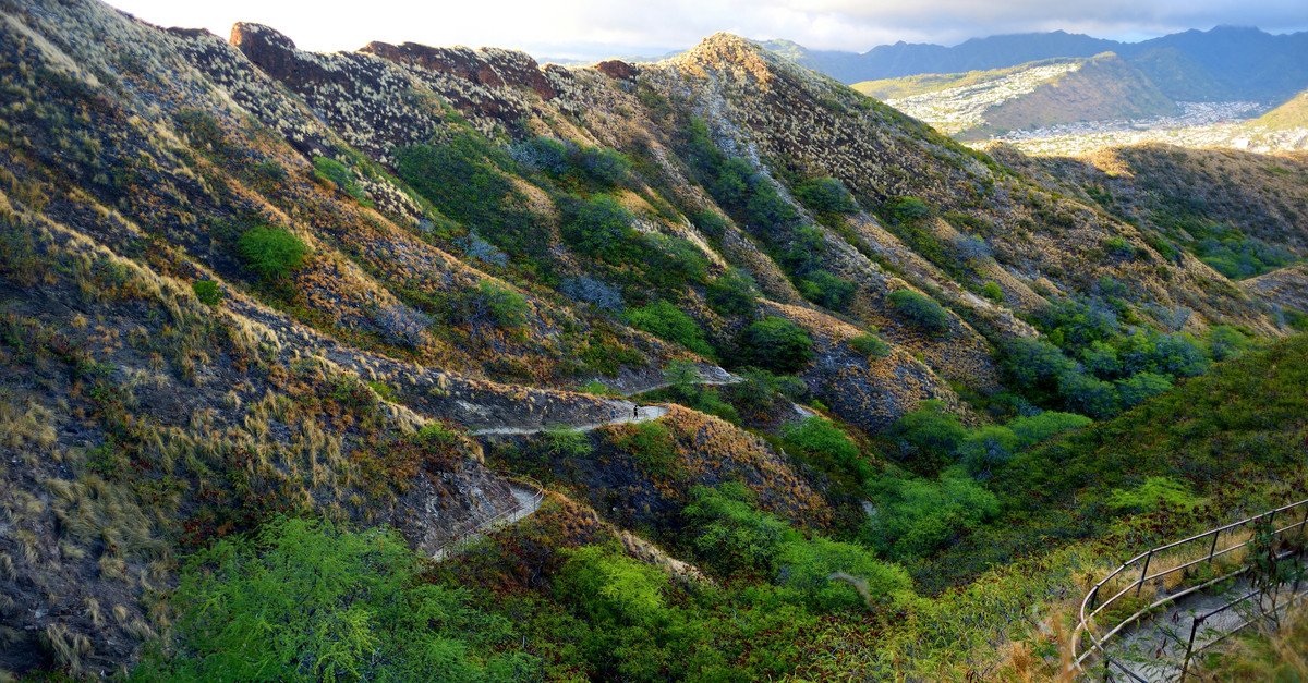
Diamond Head State Monument. Reservation required for the trail (non-residents). The road pull-off on the south side is outside the crater trail entrance. The volcanic tuff cone is roughly 300,000 years old.
Approach Cue (~12-15 sec)Show transcript
Coming up on the makai side—Diamond Head, the volcanic tuff cone defining Waikīkī. Pull off at the lookout for the classic exterior view. The trail to the summit is a separate entrance with a steep 0.8-mile climb each way and needs advance reservation.Arrival Narration (~45-60 sec)Show transcript
See that volcanic cone rising from the ridge? That's Lēʻahi, Diamond Head. It's the rim of a tuff cone formed about 300,000 years ago when magma met seawater at the surface and the steam blew the whole thing up. British whalers spotted calcite crystals in the lava back in the 1800s and mistook them for diamonds, and the name never left. From down here at the pull-off, you're looking at the iconic view — Waikīkī sprawling to the west, the cone rising sheer above it. If you've got a reservation and trail tickets, the 0.8-mile climb is paved at first, then a series of WWII-era concrete stairs and a tunnel to a bunker at the summit. Bring water and closed shoes, and plan an hour for it. The skyline view from up there is the best in Honolulu. If you're just driving through, what you're seeing right now is the photograph people remember. Hanauma Bay is eight miles east on Highway 72 when you're ready to move on. -
 24 min from previous stop · 8.9 mi72MILE8
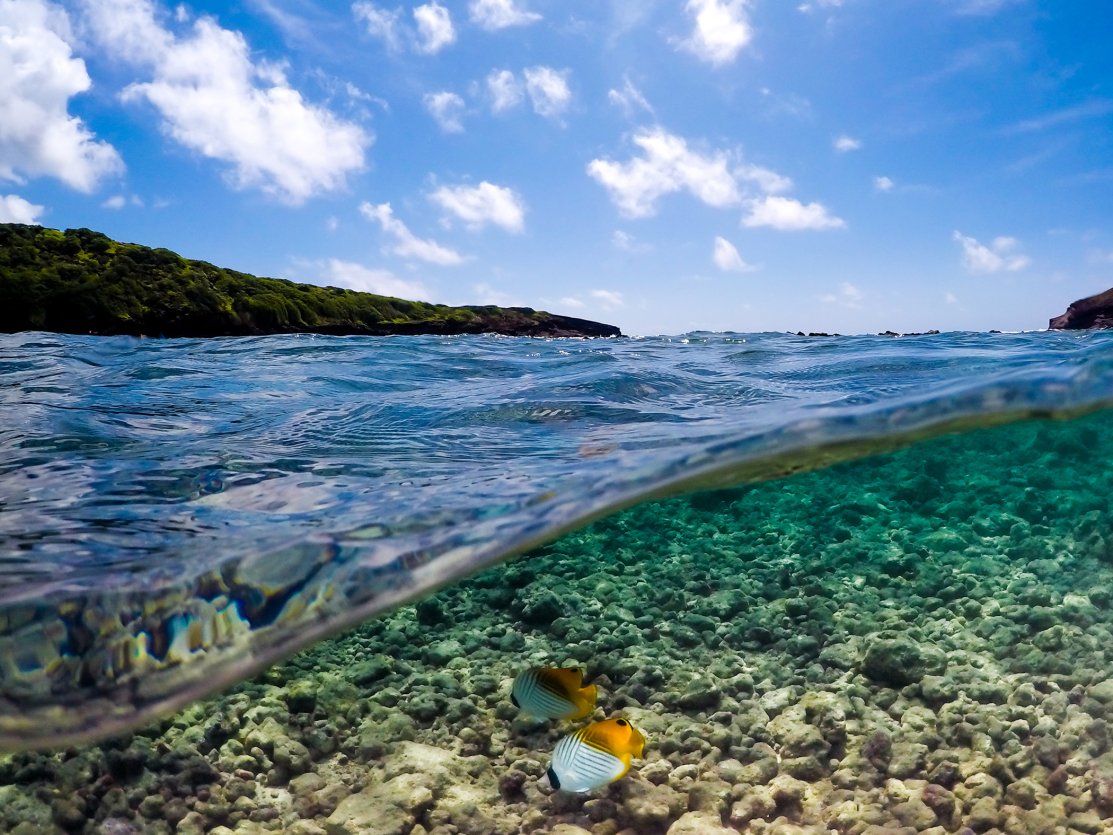
Hanauma Bay Nature Preserve. Reservation REQUIRED — gohanaumabay.org, released 48hr out, $25/adult non-resident + $3 parking, residents/military free, closed Mon+Tue. Mandatory 9-min orientation video before descent.
Approach Cue (~12-15 sec)Show transcript
Coming up on the makai side—Hanauma Bay Nature Preserve. You'll need an advance reservation; tickets release 48 hours out at gohanaumabay.org and go quickly. Closed Monday and Tuesday. If you don't have a reservation, the parking attendant will turn you around at the lot.Arrival Narration (~45-60 sec)Show transcript
You're looking at water so clear and blue it almost doesn't look real. That's because you're standing above Hanauma Bay, the inside of an ancient volcanic crater — mauka, toward the mountain. This isn't just a pretty beach. In 1967 it became a Marine Life Conservation District, which means no fishing, no feeding, strict reef protection. The water below is packed with yellow tangs, parrotfish, butterflyfish, moorish idols, and if you're patient, you might see a honu — a green sea turtle. Reef-safe sunscreen is mandatory and they enforce it. Before you head down the paved switchback to the beach — it's 200 vertical feet — you'll watch a nine-minute orientation video about reef etiquette and ocean safety. Plan three to four hours if you're snorkeling. There's a $2 tram ride back up. You'll need a reservation through gohanaumabay.org, released 48 hours ahead. Entry is $25 for non-resident adults plus $3 parking; residents and military are free. The bay closes Mondays and Tuesdays. The Halona Blowhole is two miles east when you're ready to move on. -
 7 min from previous stop · 2 mi72MILE10
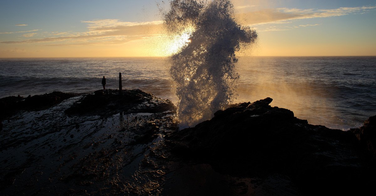
Halona Blowhole + Halona Cove ("Eternity Beach" from From Here to Eternity). Lava tube hole that geysers seawater on the right swell. Cove below is small, swimmable in summer, lethal in winter. Lookout is the parking pull-off.
Approach Cue (~12-15 sec)Show transcript
Coming up on the makai side—Halona Blowhole lookout. Pull in and watch the lava tube shoot seawater 20 to 30 feet in the air on a good south swell. Below it is Halona Cove, the small beach where they filmed "From Here to Eternity." Don't try to walk down—the descent is steep and dangerous.Arrival Narration (~45-60 sec)Show transcript
You're looking at a lava tube that meets the ocean—and when the swell lines up right, it becomes a geyser. That hollow channel was carved out long ago when lava cooled around flowing magma, and now seawater funnels through it. The blowhole works best on south or southeast swell, summer into fall, though it can sit flat for hours when the timing's off. Below you, that small cove is Eternity Beach—named for the 1953 film scene where Burt Lancaster and Deborah Kerr kissed as a wave rolled in. The descent is unmarked and treacherous, and people have been killed climbing down for closer photos. The cove itself is swimmable on calm summer days but gets cut off by the tide. Watch from up here behind the railing. If nothing's shooting today, Sandy Beach is half a mile makai ahead. -
 3 min from previous stop · 0.5 mi72MILE11
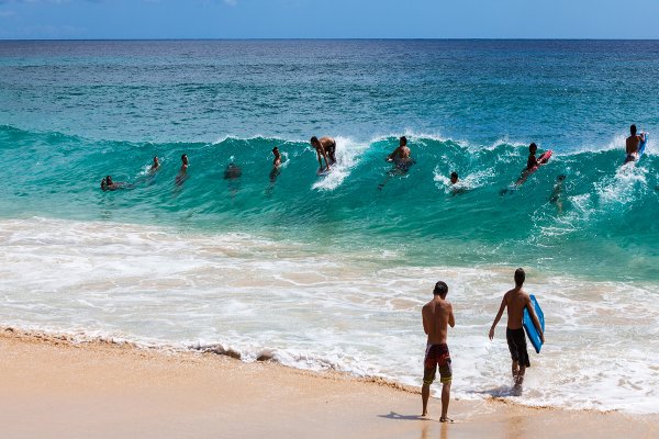
Sandy Beach Park. Famous shorebreak — neck-and-spine injury rate is one of the highest in the state. Local bodyboarders only in winter; flat-water beach in calm summer. President Obama's home beach.
Approach Cue (~12-15 sec)Show transcript
Coming up on the makai side in about half a mile—Sandy Beach Park. You'll see that hard, fast shorebreak from the road. It's one of the most famous shorebreak spots in the world, but also one of the most dangerous swimming beaches on Oahu. Watch from the sand, not the water. Pull-off parking's on the shoulder.Arrival Narration (~45-60 sec)Show transcript
You're standing at Sandy Beach, and that sound you hear—that hollow *boom* when the wave hits—that's the shorebreak. It breaks in less than two feet of water, right on the sand, and it hits hard. Local kids have been bodyboarding here since they were small; they read the closeouts, drop in, and get maybe two seconds before they wash out flat. This beach ranks in the top three most-injurious in the state. People who misjudge the shorebreak get hurt. Your move: walk the sand, watch from back, and don't go in the water unless it's genuinely flat and a lifeguard clears you. The tower at the south end is staffed daily—stop there and ask. The beach itself is wide and beautiful, a longtime favorite of locals who grew up in Honolulu. Makapuʻu Lookout is two miles ahead when you're ready to move on. -
6 min from previous stop · 2.4 mi72MILE13
Makapuʻu Point Lookout (highway pull-off, free, no walk required). The Makapuʻu Lighthouse Trail is a separate parking lot 0.5 mi back; 2-mile paved round trip, 500 ft gain, no shade — peak whale-watching spot Dec-Apr.
Approach Cue (~12-15 sec)Show transcript
Coming up on the makai side—Makapuʻu Lookout, a free pull-off with no walk required. The view spans the Windward Coast, two small islands offshore, Sea Life Park below, and Waimānalo Beach in the distance. If you have an hour, the Makapuʻu Lighthouse Trail parking lot is half a mile back—two-mile paved hike, 500 feet up, best for whales December through April.Arrival Narration (~45-60 sec)Show transcript
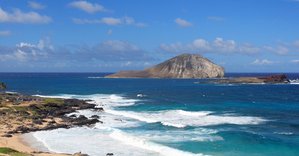
The view shifts here. Mauka — toward the mountain — the green Koʻolau ridgeline runs thirty miles north. Makai, nothing but Pacific and two small islands sitting offshore. The bigger one, Mānana, got called Rabbit Island because from this angle the silhouette looks exactly like a rabbit head with ears laid back. Both islands are seabird sanctuaries, closed to landing. That squat red-roofed building on the cliff is the Makapuʻu Lighthouse from 1909, automated since the 1970s. There's a paved trail that takes about 45 minutes round-trip and climbs 500 feet with almost no shade—bring water if you go that route. December through April, this is the best land-based whale-watching spot on Oʻahu; humpbacks come within a few hundred yards of the cliff. From here the road drops into Waimānalo. The beach is about three miles ahead. -
 12 min from previous stop · 4.9 mi72MILE16
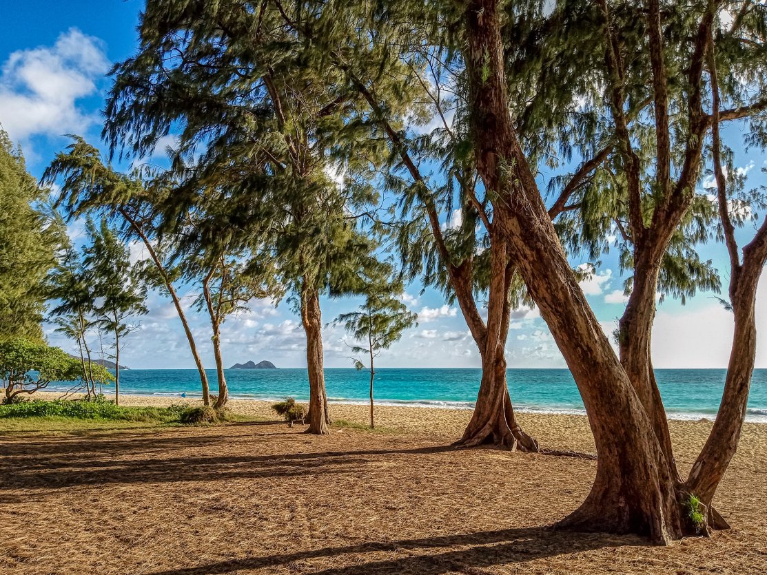
Waimanalo Beach is 3 miles of gentle white sand. Less crowded than Lanikai, swimmable year-round, lifeguarded. The "country" of Windward Oahu — many local-only feel restaurants in town.
Approach Cue (~12-15 sec)Show transcript
Coming up on the makai side—Waimānalo Beach. Three miles of soft white sand, less crowded than Lanikai, calmer than Sandy Beach, and lifeguarded at the main park. Any access point gets you onto the same stretch. Swimmable year-round.Arrival Narration (~45-60 sec)Show transcript
Feel that trade wind coming off the water—steady, warm, nothing forcing it. That's your first clue you're somewhere different. This is Waimānalo, the country part of Windward Oahu, and the beach stretches three miles of soft white sand backed by ironwood trees. The water here stays swimmable year-round. The shore break is much gentler than Sandy Beach, and the lifeguarded section in front of the park works for kids and average swimmers both. You can see Mānana Island to the south, the Mokulua islets dimly to the north. Walk back into town after—Keneke's Plate Lunch and Ono Steaks and Shrimp Shack are both on Kalanianaʻole Highway, cash only, big portions. Then head north on the highway toward Kailua. Lanikai's three miles ahead. -
 21 min from previous stop · 7.5 mi72MILE19
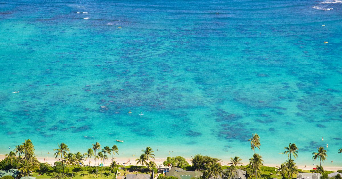
Lanikai. Residential-permit street parking. Park at Kailua Beach Park (free) and walk 10 min over Wailea Point. Beach has been losing sand to erosion since the 1990s — at high tide some stretches are seawall.
Approach Cue (~12-15 sec)Show transcript
Coming up makai—Lanicki Beach, the postcard view with those twin Mokulua Islets offshore. It's a residential neighborhood with permit-only parking, so skip the street and head to Kailua Beach Park instead. It's free, and a 10-minute walk over Wailea Point gets you to Lanikai's south end. The walk is the cost of admission.Arrival Narration (~45-60 sec)Show transcript
The water here is that striking turquoise, and it stays that way because of the angle — the Mokulua islets sit a half mile out like two stone sentries, makai (toward the ocean), anchoring the whole view. This is Lanikai, and the name's a fumbled translation from the 1920s that never got corrected. The beach itself has been losing sand steadily since the '90s. Climate change, rising seas, and seawalls built by homeowners have starved it of natural replenishment. At high tide, sections are now seawall and water instead of sand — at low tide, the south end still curves white and long. The morning sun hits the water at the perfect angle from about 7 to 10 AM; that's when you'll get the photograph. After that, head shade. You're done with the drive after this. Kailua town's a mile back the way you came if you need plate lunch or coffee before the H-3 back over the mountains — about 25 minutes to Waikīkī from there. -
Outro
Outro
Show transcript
You just drove the southeast side—Diamond Head around past Hanauma, Halona, Sandy Beach, and Makapuʻu, then up through Waimānalo to Lanikai. That's the shape of Oʻahu's windward edge. Heading back to Waikīkī, take the Pali Highway or H-3 through the Koʻolau Mountains via tunnel—25, 30 minutes depending which you choose. The Pali's slower, older, more scenic. H-3 is faster. If you've got an extra hour, the Pali Lookout is the historical site of the 1795 Battle of Nuʻuanu, where Kamehameha I unified the Hawaiian Islands. It's windy enough to lean against. Tomorrow, if you've still got energy, the North Shore drive is the other Oʻahu must-do. Completely different coast.
This tour is created with AI from HawaiiGuide route content and read by the computer-generated Mele and Kani voices. Hawaiian names and place names may occasionally be mispronounced — mahalo for your patience as we refine.

Need help planning?
Search & Planning Chat →

Hawaiʻi Weather Forecast
Today’s Weather Brief · Audio · ~45s
0:00
0:54
Read the transcript
Trades are breezy right now with scattered showers on the windward side and mountains; the leeward coast stays mostly dry. Tomorrow stays breezy with the same pattern.
A tropical disturbance southeast of the islands is likely to become a tropical storm by mid-week and approach the state Thursday through Saturday. The exact track is still uncertain. If it comes closer, expect heavier rain over a longer stretch; if it stays farther out, impacts will be shorter and lighter. Winds will increase late this week, with potential gusts over 70 miles per hour on the highest summits.
Plan your leeward beach time and snorkeling for today through Tuesday. Save summit drives and offshore water sports for after Saturday, and check updates daily as this develops.
Created with AI from the official NWS forecast discussion · verify with NWS before heading out
Loading forecast…
Temperature
Weather data by Open-Meteo.com
Current Time in Hawaiʻi
--:----
Hawaiʻi Standard Time · UTC−10 · No Daylight Saving
You’re on Hawaiʻi timeMainland US
International
Aloha Today daily podcast →
Full HST breakdown, FAQ & DST schedule →

Get Your Free Hawaii Visitor Guide
Enter your email and we'll send you instant access to our free 2026 Hawaii Starter Guide + Summary Guidesheets.