

Explore Crater Rim Drive
Hawaii Volcanoes National Park
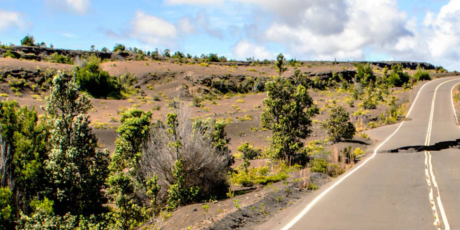
Crater Rim Drive is an 11-mile road that skirts the edge of the Kilauea Caldera in Hawaii Volcanoes National Park and contains several scenic views and hiking opportunities.
If you had to choose only one thing to do in HVNP (may that never occur!), this drive would be it. The Park entrance station is just off Hwy 11, 95 miles south-east of Kona and 30 miles south-west of Hilo. For current road and trail information, use the temporary Welcome Center at Kilauea Military Camp, a 1.25-mile drive beyond the entrance station. Kīlauea Visitor Center remains closed for renovation.
Special Notice
At this time, several attractions along Crater Rim Drive remain closed due to the most recent volcanic events & activity. Check with the ranger station for details about closures during your visit.
Book Tours & Activities on Big Island
Free cancellation on most tours. Real pricing and verified traveler reviews.
Check Availability & Pricing Browse all Big Island tours
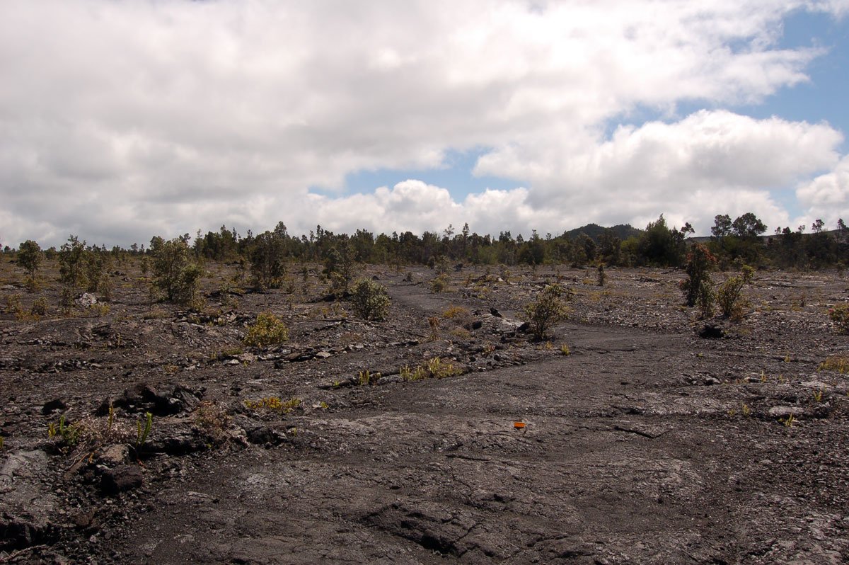
Pahoehoe Lava flow along Crater Rim Drive
Sights you will see along the Northwest drive
Listed in order driving clockwise around northwest Crater Rim Drive
Check current park access before following this route. Start with the temporary Welcome Center for current conditions and ranger-program information; the listings below describe sights around the rim, not a guarantee that every stop is open.
Temporary Welcome Center at Kilauea Military Camp
Kīlauea Visitor Center remains closed for renovation, including its restrooms, sidewalk, lānai and about half its parking area. NPS expects reopening in late 2026; this is a target, not confirmation that the building has reopened.
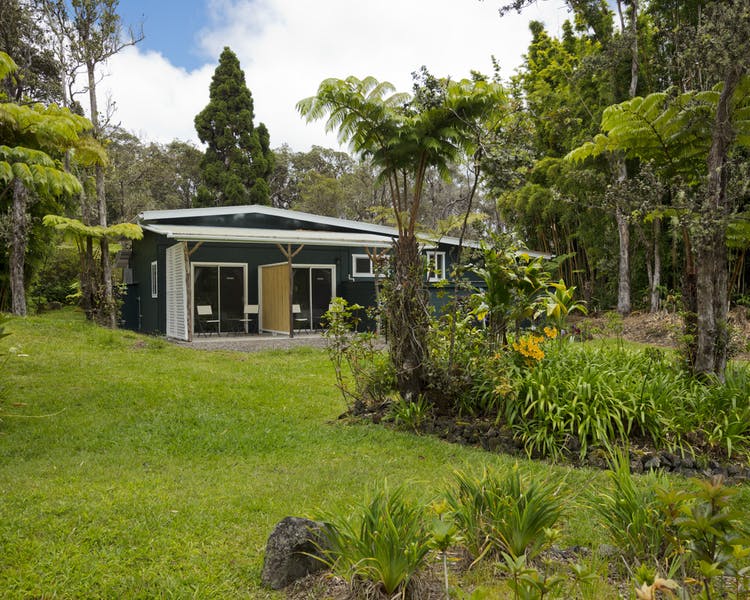
The temporary Welcome Center is at Kilauea Military Camp, a 1.25-mile drive beyond the entrance station on the right, near the U.S. flagpole. It is open daily from 9 a.m. to 4:45 p.m. Rangers and volunteers provide current conditions, hiking information and the daily ranger-program schedule. Park at the nearby ballfield; portable toilets are available behind the Welcome Center and at the ballfield parking lot.
For overnight backcountry camping, follow the NPS permit instructions. Permit pickup and the safety briefing are at the Backcountry Office, open daily from 8 a.m. to 4 p.m.
Volcano Art Center Gallery
The Volcano Art Center Gallery is near the closed Kīlauea Visitor Center. Use the gallery’s location, rather than the temporary Welcome Center at Kilauea Military Camp, when planning this stop. Inside is an remarkable collection of local artwork such as native wood carving, painting, pottery, and jewelry. Even if you aren't in the market for a souvenir, stop in anyway and marvel at the artistry.
The center is open from 9 a.m. to 5 p.m. daily. You can also visit their website and peruse the artwork online.
Get Your Free Big Island Guide
Instant access — opens immediately
- Beaches, activities & top spots
- Restaurant & dining recommendations
- Maps, itineraries & insider tips
Want the full offline version? Get the Complete Big Island Guidebook →
Volcano House
The ultimate room with a view, Volcano House, has been lodging park visitors since 1846. Perched on the edge of Kilauea Caldera, Volcano House has some superb views in the park. The building seen today is the grandchild of the original grass house built by Benjamin Pittman Sr. in 1846. In 1877 the first wooden building was erected only to be burned later on in 1940. George Lycurgus, who purchased the hotel in 1895, rebuilt it in 1941. Some notable guests of the Volcano House include Mark Twain and President Franklin D. Roosevelt. Even if you don't plan on sleeping here, go inside for a look around. The main showcase is the massive fireplace, which, according to legend, has been burning for 125 years (apparently some embers were salvaged from the 1940 fire). There is also a dining room, snack bar, and several gift shops.
Sulphur Banks
The trail to this very stinky place starts near the Volcano Art Center. The path will lead to an open area with banks covered in bright yellow sulfur deposits. Fissures in the earth allow Kilauea to release sulphuric gases. The rising gas allows the sulfur crystals to form. While fascinating to observe, the stench of rotten eggs can be a bit overwhelming. The volcanic gas also includes other toxins that should be avoided by people with heart or respiratory problems, young children, and pregnant women.
Steam Vents
It's easy to forget as we scoot along the Crater Rim Drive that the heart of a volcano is actively beating beneath our feet. You can feel its breath at this unique location on the side of the crater. On your left is the large parking lot with pathways to the steaming bank as well as fenced-off holes that belch warm, sulfur-free steam. When the rain falls, it seeps into the hot rocks below the ground, which produces the magnificent warm plumes. They are most stunning early in the morning when the air is cooler. Not to mention, there will be few people cramming around the vent for a facial. A small path begins from the parking lot and leads to the Crater Rim Trail, which provides smashing views of the caldera and a few more steam vents. Across the road from the parking lot is a small paved path that leads to the Sulphur Banks.
Kilauea Overlook
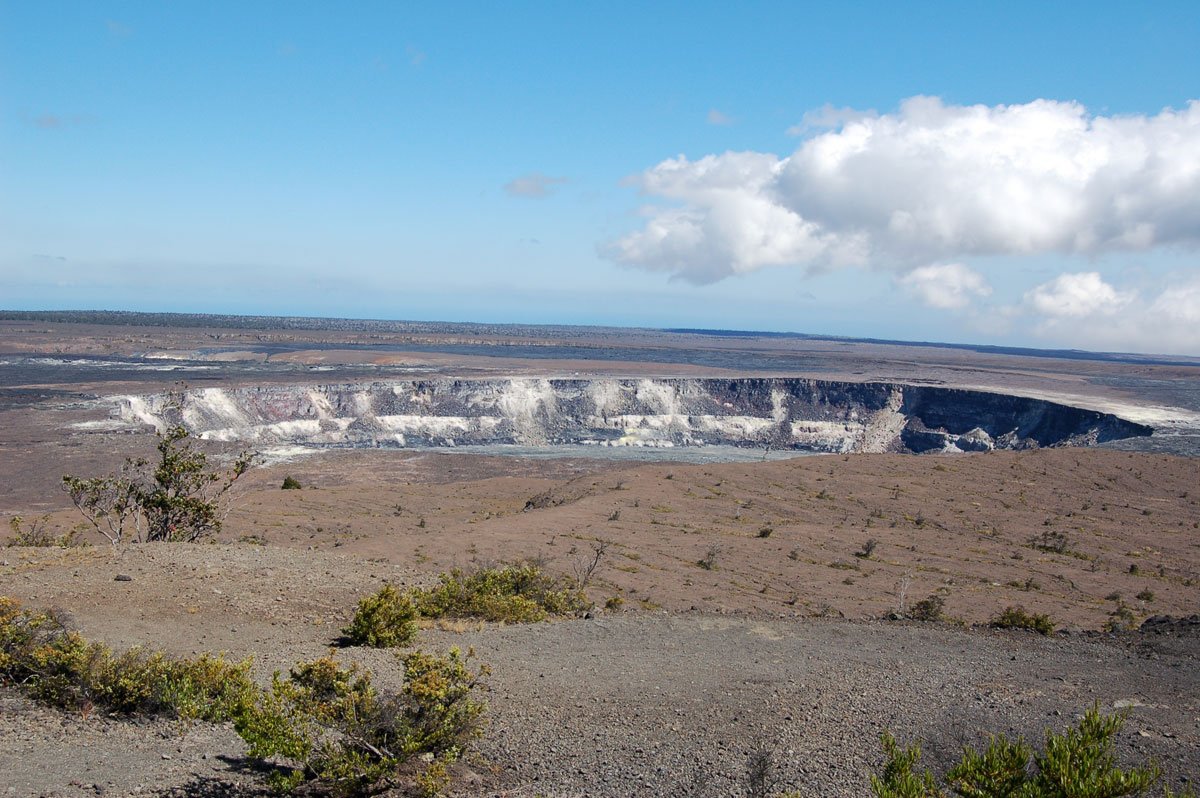
The parking lot for the lookout is on the left about .7 miles past the Steam Vents. From this vantage point, you can truly appreciate the magnitude of the Kilauea Caldera, which spans two miles and drops 400 feet. Imagine this vast space oozing with molten rock. A frightening and awe-inspiring thought for sure. Geologists now believe that the bubbling lake of lava exists 2 miles below the floor. In the distance to the right is a large depression. This is the famous Halema'uma'u Crater. Massive changes have occurred here since the 2018 eruption.
The road beyond this point is closed to vehicular traffic due to ongoing eruption hazards. To continue to the remainder of the attractions on Crater Rim Drive, head back near the park entrance, and turn right to continue onto the remainder of Crater Rim Drive. This used to be a large loop, but the eruption that began in 2008 changed things. Part of the road beyond this point disappeared into the crater during the 2018 eruption period.
Sights you will see along the Southeast drive
Listed in order driving counter-clockwise around southeast Crater Rim Drive
Starting back near the HVNP entrance, you can continue to visit the additional sites on Crater Rim Drive. We've updated the list below to include them as you'll encounter them making the drive. As you begin this portion of the drive, it is a gorgeous curvy road through lush vegetation.
Kilauea Iki Overlook and Hike
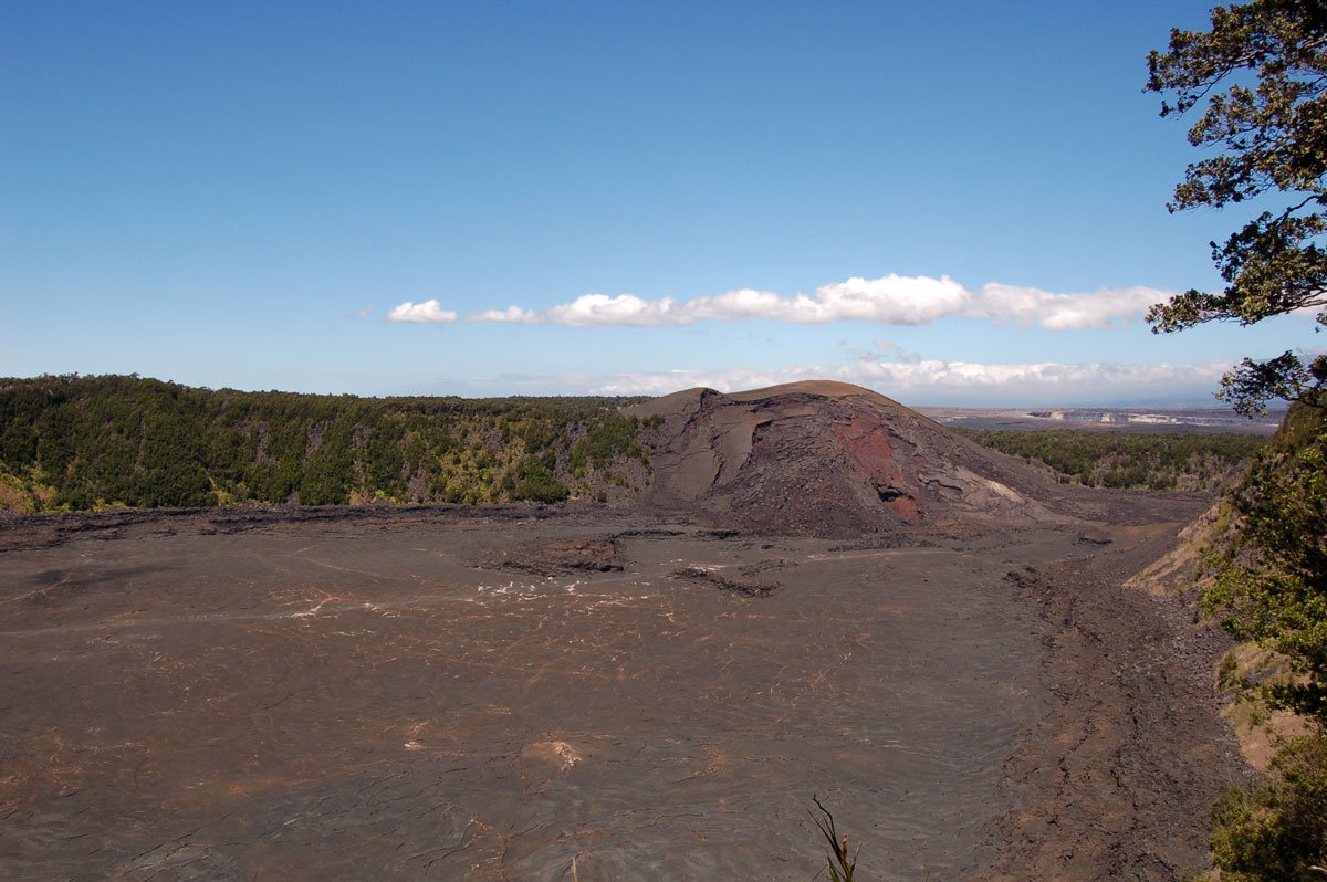
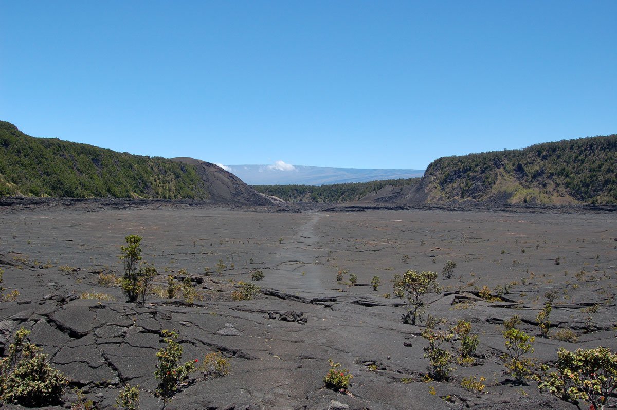
The first stop you'll come to, on the right, is the parking lot for Kilauea Iki Crater Overlook, home to one of the most amazing lava eruptions in the park's history. In November 1959, Kilauea Iki began gushing streams of incandescent orange lava. The glowing fountains of molten earth reached heights of 1,900 feet. At one point, Kilauea Iki was a 414 ft. Deep lake of bubbling lava. As you stand at the overlook, you can see a lightly-etched trail stretching across the crater floor. From your 400 ft high vantage point, you might be able to see little specks walking the path: those are people.
Kilauea Iki Trail is an approximately four-mile loop that takes 2-3 hours. It skirts the crater's rim, dips down and across the floor, and back up to the overlook. You can either take the Crater Rim Trail to the right around the rim of Kilauea Iki and then down to the crater floor, then back up the other side or go left and begin the hike with the descent into the crater. We prefer the first option simply because you can enjoy the beauty of the rim rainforest at the beginning of the hike, and the ascent is slightly less arduous. The portion of Crater Rim Trail that runs along the rim is a dense high-elevation jungle populated with flowering ohia trees and graceful ferns. If you are not in a hurry, take a few minutes to gaze overhead, and you may catch a glimpse of the apapane. They are one of the most common Hawaiian forest birds, but their deep red feathers and black beaks make them a beautiful sight. The apapane loves to flit from ohia blossom to ohia blossom drinking its nectar. Gaps in the jungle cover reveal breathtaking views of the black crater floor, a stark contrast to the thriving forest.
The trail descends into the crater with a mixture of stairs and steep terrain. Make sure you have applied plenty of sunblock because the sun seems much more intense on the exposed floor. Once you have reached the bottom, whole new alien landscape envelopes you. What looked like a pebble from the rim is now a massive pile of lava rock. Along the cliffs, you can see a high watermark or a lava ring in the crater. Although you are walking across solid land, just below you molten earth still stirs. If the elements are right, you may even see steam sneaking between the cracks and crevices - reminders that this volcano is still alive and breathing. The path back up the crater rim will branches off at to Thurston Lava Tube parking lot, or you can continue back to the Kilauea Iki overlook. Do not plan the visitor-center approach through the closed Halemaʻumaʻu/Byron Ledge caldera connection. For a longer approach, confirm the current Crater Rim Trail route and trailhead access with NPS before hiking.
Nahuku (Thurston Lava Tube)
Next is Nahuku (Thurston Lava Tube). The abundant rainfall in this region of the park feeds the tropical vegetation. Nahuku is one of the main attractions in the park, and congestion builds up from all the tour buses. If you get up early, you might have the chance to experience it in relative privacy.
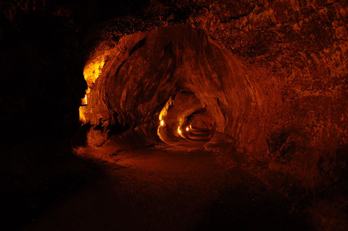
Like veins leading from the central "heart" of the volcano, lava tubes direct molten earth toward the ocean. As the lava flows, the outer crust begins to harden while the inner lava continues to flow. Once the flow stops, the tunnel formation remains. Thurston Lava Tube could date back some 350-500 years. You will take a short trail through lush vegetation replete with tropical ferns and singing honeycreeper birds called Apapane. Cross a short bridge, and you enter the damp, dark world of a lava tube. Lit for safety, the tube is a fascinating experience that ends too quickly. When you reach daylight, you have the opportunity to continue through a gated area into the un-lit portion of the cave if you so choose. Make sure to bring a strong flashlight! Restrooms are available near the entrance to the trail.

Nahuku (Thurston Lava Tubes)
Pu'u Pua'i Overlook
Pu'u Pua'i means "gushing hill" in Hawaiian, a name that is quite appropriate for this cinder cone. During a 1959 eruption in Kilauea Iki Crater, cinder and ash were shot into the air and blown to the southwest, where the cinder cone was formed. From this overlook, you can see into the Kilauea Iki crater and across to the Kilauea Iki Overlook.
Devastation Trail
Devastation Trail is a paved 1-mile round trip through a landscape buried by falling cinder during the 1959 Kīlauea Iki eruption. NPS estimates approximately one hour. The trail can be started from either Puʻupuaʻi or Devastation Trail parking, both off Crater Rim Drive; confirm current trail and parking access with NPS before setting out.
NPS describes the trail as wheelchair- and stroller-accessible, but some sections have grades greater than 8%. Consider those slopes when choosing the walk. Stay on the paved trail and do not climb Puʻupuaʻi cinder cone. Bring water, a hat, sunscreen and rain gear; watch for nēnē near parking areas and do not feed them. Return along the trail rather than planning a walking loop on Crater Rim Drive.
Keanakako' i Overlook
Current NPS alerts close old Crater Rim Drive, the overlooks near Keanakākoʻi crater and Crater Rim Trail to Keanakākoʻi crater because of volcanic unrest. Devastation parking remains open, but that does not authorize a walk into the closed area. Check NPS notices and follow posted barriers.
Keanakako'i is where ancient Hawaiians would visit this crater to harvest extremely hard stone for use in tools. In 1877 a lava flow covered the entire floor of the crater, shutting off access to the stone. Across the street from Keanakako'i is a fissure that erupted continuously from July 19, 23, 1974. The reddish coloration of the rock results from oxidation by the escaping gasses.
Chain of Craters Road
For a separate driving stop, check current NPS road access before planning Chain of Craters Road.