
Hawaiʻi Guide · Audio Driving Tour
Waimea Canyon Drive BETA
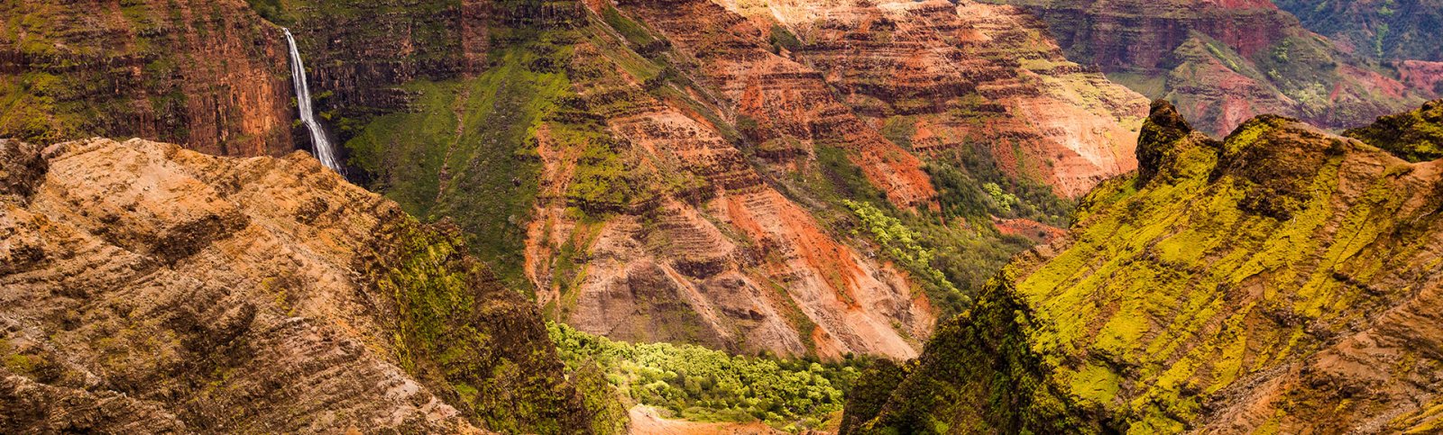
A 19-mile climb up Hawaii Route 550 from Waimea Town on the south coast to the Puʻu o Kila Lookout above the Kalalau Valley — the "Grand Canyon of the Pacific" overlook, Kokeʻe State Park, and the rim above Na Pali. ~7 curated segments. Free self-guided audio tour.
19 miles
~45 min driving
6 curated stops
Free self-guided audio tour
~45 min
total driving time
19 mi
total distance
6 stops
curated stops
3-4h
suggested day
We may link to trusted Hawaiʻi resources at no extra cost to you.
Build your own route
Pick a preset or tap the ✓ Include chip on any stop below to customize.
6
of 6 stops selected
-
Intro
Intro
Show transcript
You're about to drive nineteen miles straight up. Waimea Canyon climbs from sea level to four thousand feet, all paved but narrow and winding. Two to three hours one way if you stop at the main lookouts. Fill your tank before you start in town, and bring water, snacks, and a fleece. It gets fifteen to twenty degrees cooler at the top, and clouds roll in half the time. Take it slow on the curves, and we'll point out each lookout when you reach it. Let's go. -
 550MILE0Stop · mile 0 makai
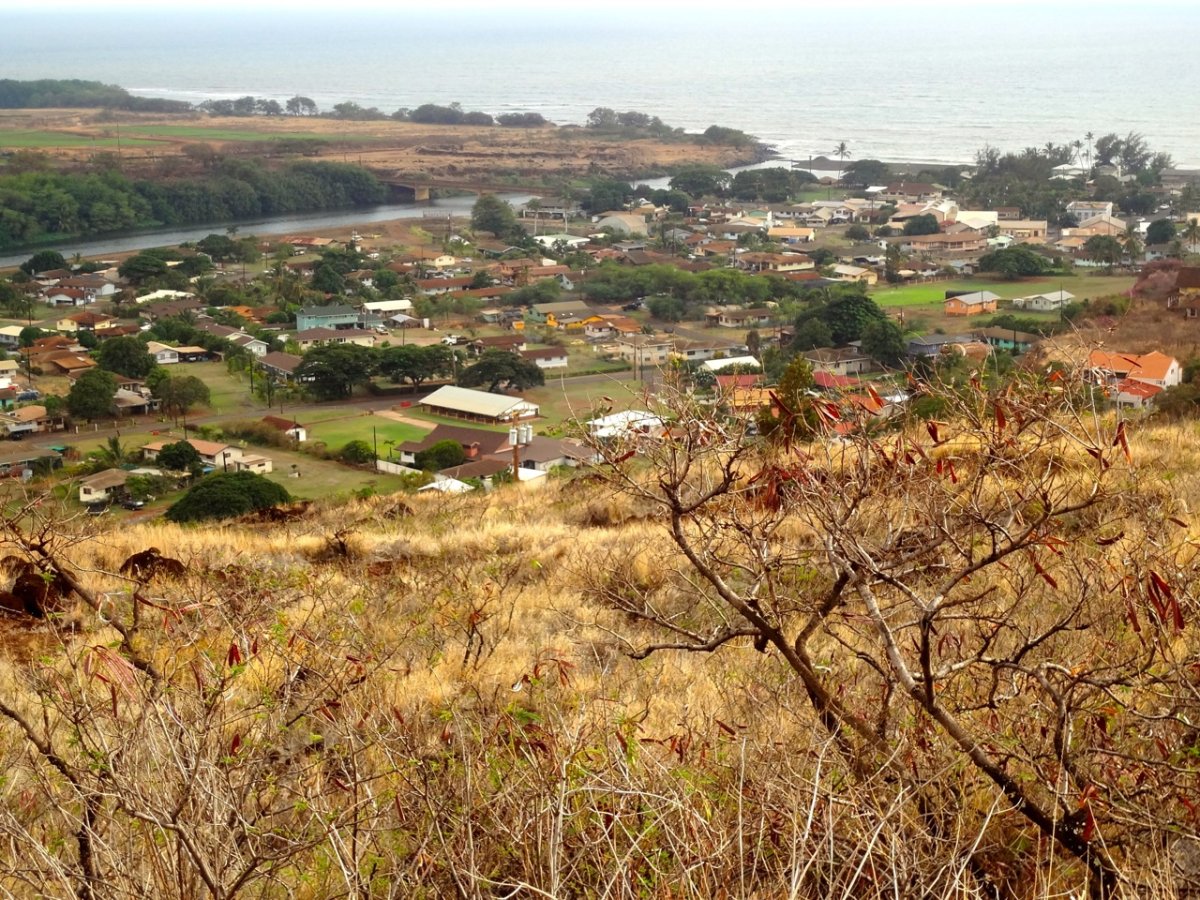
Waimea Town
Waimea Town is the gateway. Last gas, restrooms, restaurants. The turn-off for Hwy 550 (Waimea Canyon Drive) is on the mauka side from Hwy 50.
Approach Cue (~12-15 sec)Show transcript
Coming up on the makai side, Waimea Town—your last gas before heading into the canyon. Both Chevron and Shell are right on the highway. Fill up here, then look for the stoplight in town on the mauka side to turn onto Waimea Canyon Drive.Arrival Narration (~45-60 sec)Show transcript
You're standing in Waimea, and that salt-air breeze off the bay to the makai—toward the ocean—is real. This is where Captain Cook landed in 1778, the first European to set foot in the Hawaiian Islands. The town itself is tiny. A stoplight, a couple of restaurants, two gas stations. JoJo's Shave Ice has been serving Waimea since 1992, and they make their own syrups and cream toppings in house. For lunch, pick a currently open Waimea spot before you climb; don't rely on Pacific Pizza, which is closed. Fill your tank now. There's no gas in the canyon, and the next pump is back here when you come down. When you're ready, turn mauka onto Highway 550 and start climbing. The first canyon lookout sits about eight miles up. -
Connector · 550 24 min drive · 10.5 mi
Canyon Climb Connector
Show transcript
You're climbing now through dry forest and open red-dirt slopes. The road switchbacks up steady, and if visibility's good you'll catch the canyon opening to your right, ocean dropping away behind you. First few miles feel easy enough, but after mile three the grade picks up and the curves tighten up. You'll see two pull-offs—locals use those for bird hunting access, but they're not much of a stop. About a mile before you reach it, the canyon really starts to open on your right. Mile ten has the Waimea Canyon Lookout, the iconic one you see on postcards. Keep your speed reasonable on these curves. Trucks come up here too, and passing room's tight. -
 24 min from previous stop · 10.5 mi550MILE10
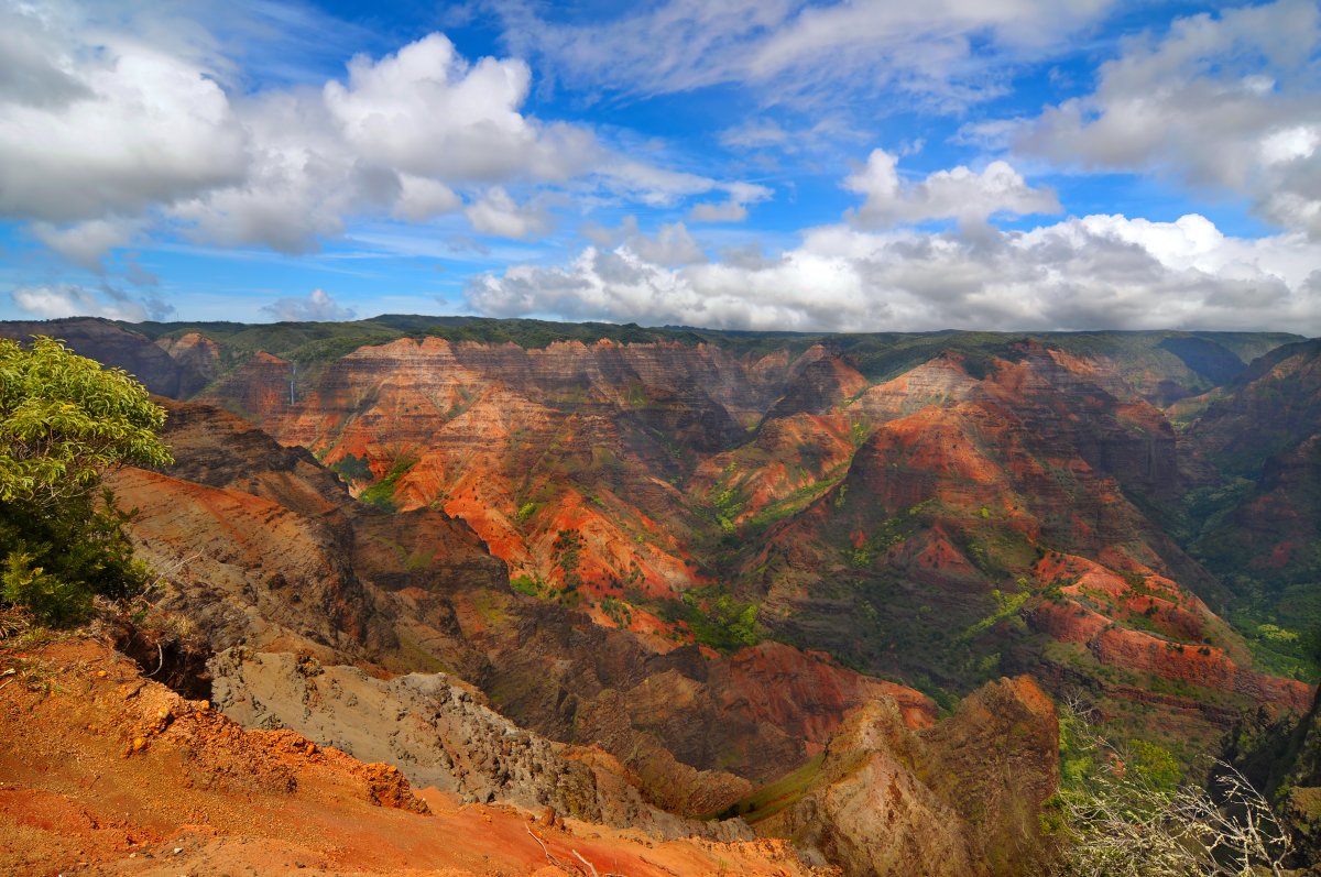
The headline lookout. ~10 miles up. Paid parking lot, restrooms, viewing platform. The "Grand Canyon of the Pacific" framing is widespread but the famous Mark Twain attribution is apocryphal — Twain never visited Waimea Canyon. Don't repeat the quote as fact.
Approach Cue (~12-15 sec)Show transcript
Coming up on the mauka side—Waimea Canyon Lookout, the main overlook. Check the current State Parks notice before counting on parking or restroom access here; construction has affected this lot. If it's open, state park fees apply: five dollars per non-resident person and ten dollars per non-resident vehicle.Arrival Narration (~45-60 sec)Show transcript
You're standing at the rim of a canyon carved over four million years by the Waimea River cutting through lava flows, and what catches you first is the color — those rust-red and orange walls are iron oxide, ancient lava weathering in real time. The canyon below runs roughly fourteen miles long, a mile wide, and thirty-six hundred feet deep. Greens cling to the cracks and wider ledges where vegetation has taken hold. On a clear morning the view reaches all the way makai to the ocean. By mid-afternoon, clouds roll in from the windward side and mist fills the gorge, draining slowly downslope — that's worth watching if you have time. You'll see "Grand Canyon of the Pacific" on every t-shirt and guidebook, commonly attributed to Mark Twain. Twain never visited Kauaʻi or saw this canyon. The phrase has circulated since the early nineteen hundreds, but no one knows who said it first. The view stands on its own. Spend ten or fifteen minutes here. There's a paid parking lot and restrooms. When you're ready, Puʻu Hinahina Lookout is about three miles ahead. -
 8 min from previous stop · 3.5 mi550MILE13Stop · mile 13 mauka
Puu Hinahina Lookout
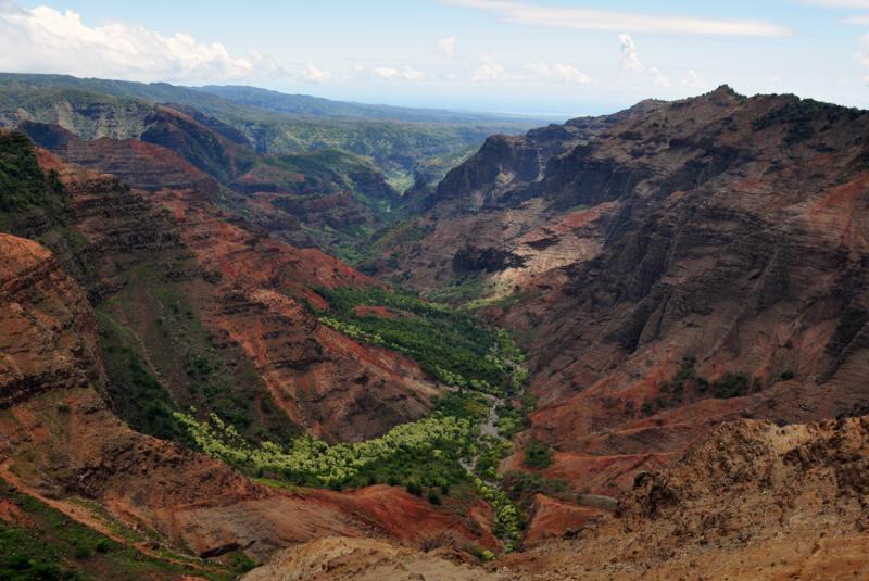
Two viewing platforms. The east platform looks down a side gorge of the canyon. The west platform looks toward Niʻihau, the Forbidden Isle, on a clear day.
Approach Cue (~12-15 sec)Show transcript
Coming up on the mauka side: Puʻu Hinahina Lookout. Two short walks from the parking lot give you different views—one looks into the canyon, the other faces west toward Niʻihau. On a clear day, that west platform is worth the stop.Arrival Narration (~45-60 sec)Show transcript
The silhouette of Niʻihau cuts across the southwestern horizon seventeen miles out—the Forbidden Isle, privately owned by the Robinson family since 1864 and closed to visitors. The small resident community there has declined in recent years, and Hawaiian remains central to Niʻihau identity. Outsiders arrive only by invitation or through hunting safaris the family operates. Two platforms sit here. The west platform gives you that distant island view on clear days. The east platform opens onto a side gorge of Waimea Canyon itself—a narrower chute of the same red-rock walls, carved tighter than the main lookout. Both are worth a few minutes each. The Kokeʻe State Park entrance and visitor center stand about two miles ahead on this road. -
 9 min from previous stop · 3.6 mi550MILE15
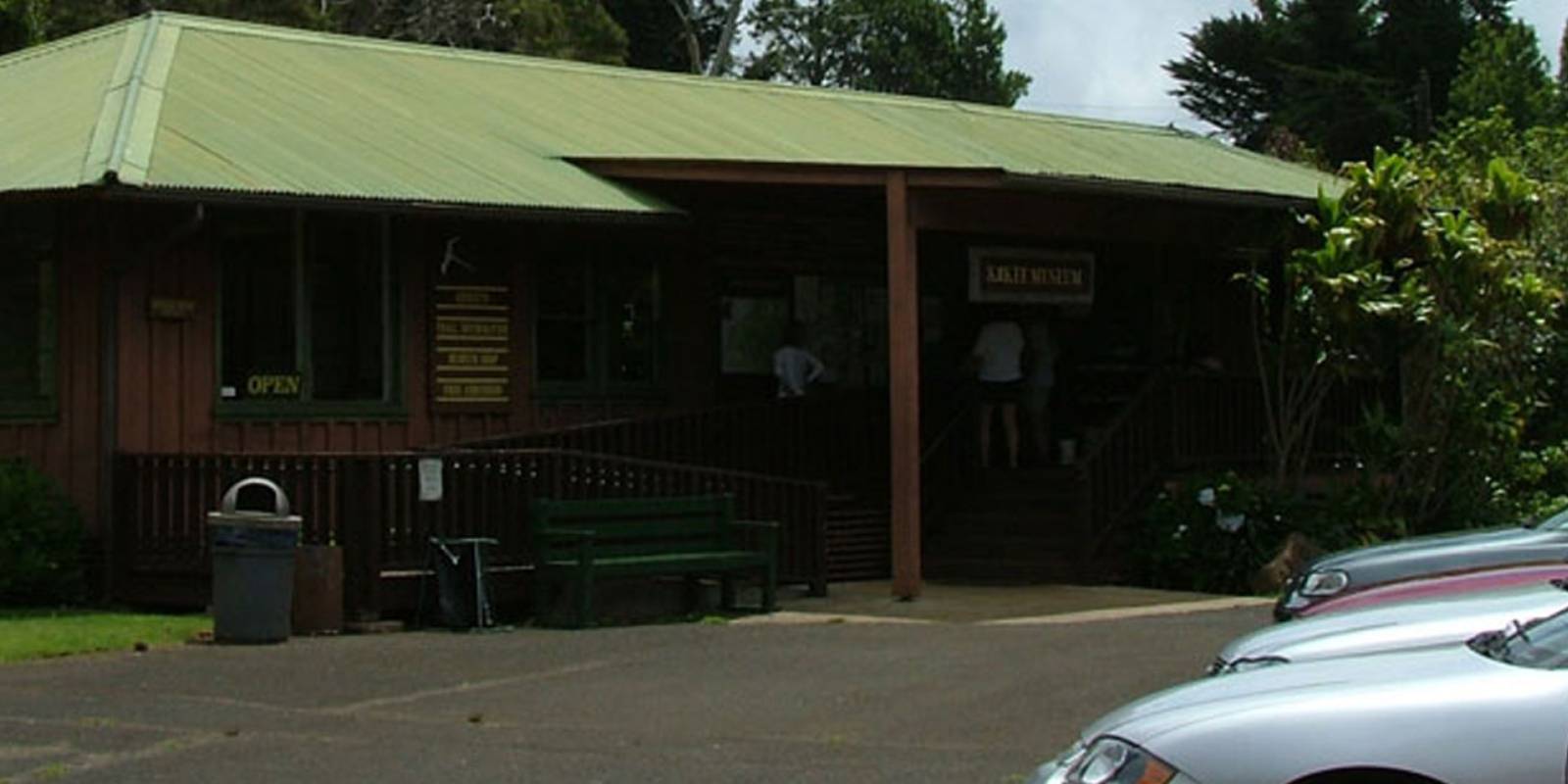
Kokeʻe State Park HQ. Free Natural History Museum, Lodge restaurant, trailheads for the Cliff/Canyon trails, Pihea, Awaʻawapuhi.
Approach Cue (~12-15 sec)Show transcript
Coming up on the mauka side—Kokeʻe State Park. Stop at the free Natural History Museum for a quick look at local ecology and to check posted weather and trail notes, or ask museum staff what they're hearing from hikers before you hike. The museum takes about 15 minutes, and there's a Lodge restaurant here too if you need food.Arrival Narration (~45-60 sec)Show transcript
You're standing around 3,600 feet at the Kōkeʻe park hub, where the air is cooler and the trail decisions start to matter. The Kokeʻe Natural History Museum is small, free, and worth your time. There's a weather forecast posted by the door — essential if you're thinking about hiking — and a docent who knows which trails are passable right now. The Lodge restaurant next door serves breakfast and lunch: pancakes, hot soup, sandwiches, hot coffee. On a cold morning at this elevation, it's exactly what you want. The trailheads for Awaʻawapuhi, Pihea, and the Cliff and Canyon trails branch from here. Awaʻawapuhi is a difficult 3.1-mile one-way trail with about 1,180 feet of elevation gain; stay behind the railing at the end, where the drop is over 2,000 feet. Kalalau Lookout is three miles ahead if you want to keep moving. -
 2 min from previous stop · 0.8 mi550MILE18
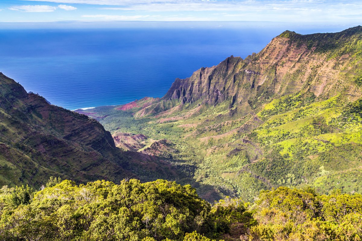
The Kalalau Valley overlook. Easier access than Puʻu o Kila one mile farther up. Often clouded in by 1pm. Best in early morning.
Approach Cue (~12-15 sec)Show transcript
Coming up on the makai side—Kalalau Lookout. The valley drops 2,000 feet below you, opening to the ocean. Get there early; clouds usually roll in by early afternoon and bury the view. If it's socked in when you arrive, wait ten minutes; the cloud bank often shifts.Arrival Narration (~45-60 sec)Show transcript
You're standing 4,000 feet up on the rim of the Kalalau Valley, and if the air is clear right now, you can see straight down 2,000 feet to a green hanging valley cradled between sheer cliffs — and another 1,000 feet beyond that to the ocean. This valley was home to Hawaiian families for over 800 years. They built lo'i, irrigated taro patches, and heiau, sacred structures, on that land below. The last people living here permanently left in 1919. Today it's part of Nāpali Coast State Wilderness Park. Access into Kalalau requires the right permits and open trail or ocean conditions; check DLNR before planning anything beyond this lookout. Warm wet air pushes up from the windward side and condenses right on this rim most afternoons, so clouds often sit here. If your view is white, wait ten minutes — the bank shifts, and you'll sometimes get a window where the valley opens up below you. On the clearest days you might spot hikers moving like specks on the cliffs. Puʻu o Kila, one more mile up the road, is the final lookout if you want a slightly different angle. -
 2 min from previous stop · 1 mi550MILE19Stop · mile 19 makai
Puu O Kila Lookout
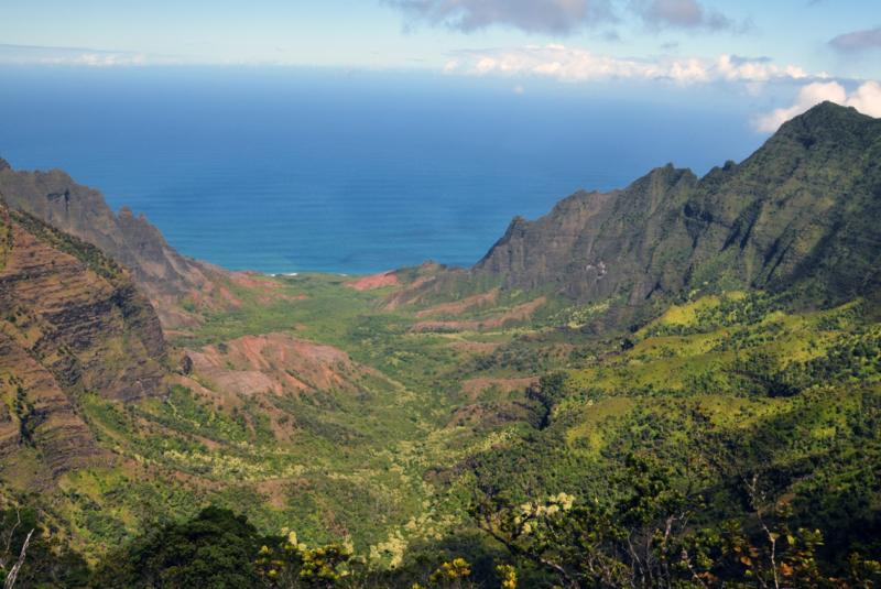
The end of paved Hwy 550. Higher elevation than Kalalau Lookout, slightly different viewing angle into Kalalau Valley. Trailhead for the Pihea Trail.
Approach Cue (~12-15 sec)Show transcript
Coming up on the makai side—Puʻu o Kila, the end of the paved road. The lookout gives you a different angle into Kalalau Valley than the main Kalalau Lookout, and it's where the Pihea Trail starts. The road turns to rough dirt past here; rental cars aren't allowed on it anyway.Arrival Narration (~45-60 sec)Show transcript
You're standing at the end of pavement on Kauaʻi—4,176 feet up, makai (toward the ocean/seaward), where Kōkeʻe Road stops. That view into Kalalau Valley in front of you is slightly different from the main lookout—you're a hundred feet higher, and the angle shifts just enough that on a clear day this one wins. The dirt track past the gate is unmaintained highway, off-limits to rental cars and rough within a quarter mile. The Pihea Trail starts here; DLNR lists it as 3.8 miles one way, often wet, slippery, and muddy, with a short spur to Pihea Overlook. Do not go beyond the overlook. You turn around here—there's no other way back. Linger if the clouds part. They clear and close fast up here, so catch the valley view when you can. -
Outro
Outro
Show transcript
You made it to Puʻu o Kila, the end of the road. Now take the hour back down — let the engine do the work on those steep sections rather than wearing out your brakes. Once you hit sea level, you have two directions. East takes you through Hanapepe and down to Poʻipū. West runs toward Polihale, on an unimproved dirt access road where four-wheel drive is recommended and rental companies may prohibit use. The North Shore drive to Hanalei and Kēʻē Beach is next. Same Nāpali rim you just saw, completely different angle. Check the site to plan it.
This tour is created with AI from HawaiiGuide route content and read by the computer-generated Mele and Kani voices. Hawaiian names and place names may occasionally be mispronounced — mahalo for your patience as we refine.

Need help planning?
Search & Planning Chat →

Hawaiʻi Weather Forecast
Today’s Weather Brief · Audio · ~45s
0:00
0:54
Read the transcript
Trades are breezy right now with scattered showers on the windward side and mountains; the leeward coast stays mostly dry. Tomorrow stays breezy with the same pattern.
A tropical disturbance southeast of the islands is likely to become a tropical storm by mid-week and approach the state Thursday through Saturday. The exact track is still uncertain. If it comes closer, expect heavier rain over a longer stretch; if it stays farther out, impacts will be shorter and lighter. Winds will increase late this week, with potential gusts over 70 miles per hour on the highest summits.
Plan your leeward beach time and snorkeling for today through Tuesday. Save summit drives and offshore water sports for after Saturday, and check updates daily as this develops.
Created with AI from the official NWS forecast discussion · verify with NWS before heading out
Loading forecast…
Temperature
Weather data by Open-Meteo.com
Current Time in Hawaiʻi
--:----
Hawaiʻi Standard Time · UTC−10 · No Daylight Saving
You’re on Hawaiʻi timeMainland US
International
Aloha Today daily podcast →
Full HST breakdown, FAQ & DST schedule →

Get Your Free Hawaii Visitor Guide
Enter your email and we'll send you instant access to our free 2026 Hawaii Starter Guide + Summary Guidesheets.