
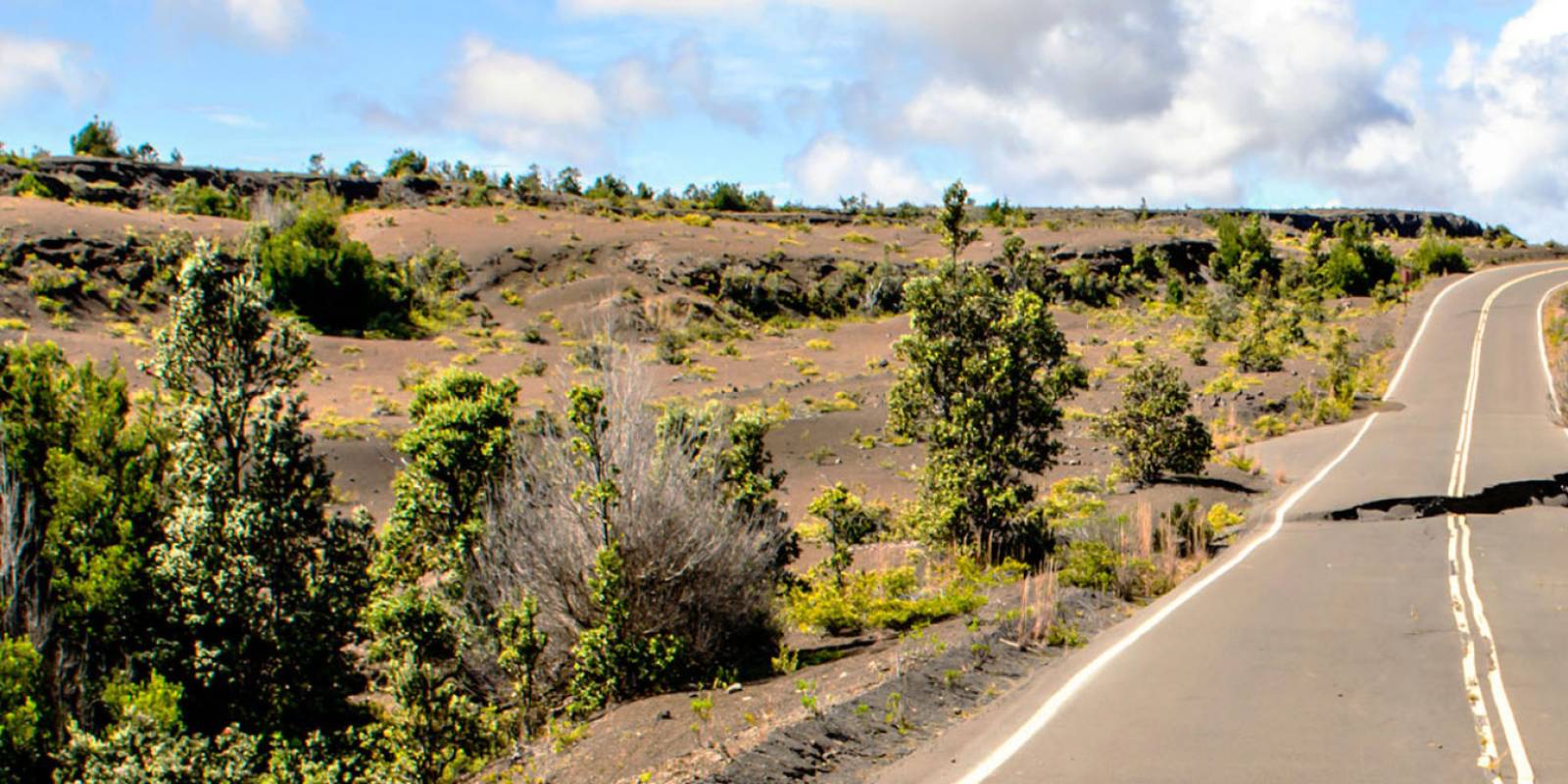
Hawaiʻi Guide · Audio Driving Tour
Crater Rim Drive BETA
A two-lobe drive along the rim of Kīlauea Caldera inside Hawaiʻi Volcanoes National Park. The south rim has been closed since the 2018 caldera collapse, so the route runs as two out-and-backs — west first to Volcano House, the Volcano Art Center, Sulphur Banks, Steam Vents, Kīlauea Overlook, and Uēkahuna; then east to Kīlauea Iki, Nāhuku, Devastation Trail, Puʻu Puaʻi, and Keanakākoʻi. Audio is evergreen — every stop is narrated as if open. Per-stop `currently_closed` flags drive the route page's closure chips. Update those flags as the park's conditions change (the rim closes and reopens on its own schedule).
13 miles
~30 min driving
12 curated stops
Free self-guided audio tour
~30 min
total driving time
13 mi
total distance
12 stops
curated stops
2-3h
suggested day
We may link to trusted Hawaiʻi resources at no extra cost to you.
Current park status:
The Kīlauea Visitor Center is closed for renovations through Summer 2026; the temporary Welcome Center is at Kilauea Military Camp. Following the March 2026 summit eruption, sections of the west side past KMC (including Steam Vents, Steaming Bluff, Kīlauea Overlook, and Uēkahuna) are also closed. Audio for those stops is included below for when the closures lift — for now, skip ahead to the east side after Sulphur Banks. Always confirm with rangers at the Welcome Center before driving. Check current park alerts →
Build your own route
Pick a preset or tap the ✓ Include chip on any stop below to customize.
12
of 12 stops selected
-
Intro
Intro
Show transcript
You're driving on the rim of an active volcano. Kīlauea had one major eruption that lasted thirty-five years, and since then it's erupted episodically at the summit. What you'll see is steam venting from the ground, a caldera floor that resurfaced less than a decade ago, forest growing back inside craters from eruptions people still remember. The south rim's been closed since 2018, so we're doing two out-and-backs from the welcome area. Plan two to three hours minimum, longer if you take your time. Hit the Welcome Center for today's map before you commit to a stop—conditions shift with earthquakes and eruptions. Let's go. -
0 min from previous stop · 0.1 miHAVOMILE0.1
1877 wood-frame structure, the SECOND Volcano House on this rim. Built by William H. Lentz to replace the 1866 lodge where Mark Twain stayed (now gone). Sawn off and relocated back from the cliff edge in 1921 when a bigger hotel went up; that bigger hotel burned in 1940, and the current Volcano House across the way is the 1941 Charles William Dickey replacement. Refurbished and converted to Volcano Art Center Gallery in the late 1970s. Sources verified via Wikipedia + volcanoartcenter.org/about/history.
Approach Cue (~12-15 sec)Show transcript
Coming up on the right in about a quarter mile, the Volcano Art Center. It's a restored 1877 wood-frame building that used to be the second Volcano House on this rim. Free to browse, and worth a few minutes inside. Small parking lot, brown wooden building set back from the road.Arrival Narration (~45-60 sec)Show transcript
The wooden building in front of you has wooden floors that creak under foot—old wood, walked on for generations. This is the 1877 Volcano House, built to replace an earlier lodge from 1866 where Mark Twain rode up by horseback to see Kīlauea and wrote about it in *Roughing It*. That earlier structure is gone. In 1921, this building was sawn apart and moved back from the cliff edge when a bigger hotel took over the original site makai—toward the ocean. That hotel burned in 1940, and the current Volcano House across the way opened in 1941. Today it functions as a gallery and shop run as a nonprofit, with rotating work by Hawaiian artists—paintings, prints, ceramics, pieces tied directly to Kīlauea and the park's natural history. The quiet here is different from anywhere else you'll stop. Volcano House is right ahead when you're ready. -
0 min from previous stop · 0.1 miHAVOMILE0.3
1941 Charles William Dickey building, fourth lodge on this rim. Best easy caldera view from the back lanai. Restrooms, coffee, gift shop. Optional drive-by — doesn't require a long stop.
Approach Cue (~12-15 sec)Show transcript
Coming up on the left in about a quarter mile—Volcano House, a historic lodge right on the caldera rim. Park out front, walk through the lobby to the lanai out back for a view of the crater. Restrooms and coffee inside. If you walked here from the Volcano Art Center, it's about five minutes back along the road.Arrival Narration (~45-60 sec)Show transcript
You're standing at a 1941 lodge pressed low against the rim of Kīlauea Caldera—Kaluapele in Hawaiian. This is the fourth building to occupy this spot; a 115-room lodge burned in a 1940 kitchen fire, and architect Charles William Dickey rebuilt it with that signature wide hipped roof that lets the structure settle into the landscape. Walk through the lobby to the lanai out back, and the caldera floor opens below you, with Halemaʻumaʻu—the active vent at the center of recent eruptions—nested inside. The name means "House of the ʻamaʻumaʻu fern." Depending on what the volcano is doing, you might see steam, glow at night, or nothing visible at all. The walk through takes three minutes. There are good restrooms and coffee here, and Sulphur Banks is just up the road. -
2 min from previous stop · 0.5 miHAVOMILE0.5
Boardwalk loop, Haʻakulamanu in Hawaiian. Hot fumaroles, sulfur deposits, hydrogen sulfide smell. NPS warns away pregnant visitors and those with respiratory/cardiac conditions. Wheelchair-accessible boardwalk.
Approach Cue (~12-15 sec)Show transcript
Coming up on the right in about a quarter mile—Sulphur Banks, or Haʻakulamanu. Short boardwalk loop with hot fumaroles and sulfur deposits. Easy, wheelchair-accessible walk. Hydrogen sulfide smells like rotten eggs. NPS warns away pregnant visitors and those with respiratory or cardiac conditions.Arrival Narration (~45-60 sec)Show transcript
You can smell it before you see it—that sharp rotten-egg bite of hydrogen sulfide rising from vents in the ground. What you're standing in is called Haʻakulamanu, Sulphur Banks, and this boardwalk crosses a patch of earth where volcanic gas is literally coming up through the soil right now. Hot acidic steam meets the air, drops sulfur out of suspension, and coats the rocks in pale yellow crystals. If you watch closely, you can see them forming. This is rainwater that seeped down through fractures, hit hot bedrock a few hundred feet below, turned to vapor, and came back up loaded with gases. The volcano isn't a thing that happened here. It's something happening. The boardwalk is wheelchair-accessible, but the park warns away anyone who's pregnant or has heart, lung, or breathing conditions. Stay on the planks. The ground off the path is fragile and hot. When you're done, Steam Vents is the next stop, a few minutes up the road. -
Currently closed1 min from previous stop · 0.4 miHAVOMILE0.8
Why closed: Past Kilauea Military Camp closure line; tephra fallout from March 2026 eruption.
Wahinekapu in Hawaiian — "sacred woman," referring to Pele. Roadside pullout, short walk to ground vents. Currently closed (April 2026) — sits past KMC in the closed zone. Authored for post-reopening use.
Approach Cue (~12-15 sec)Show transcript
Coming up on the left in about a quarter mile—Steam Vents pullout. Wahinekapu in Hawaiian, named for Pele. Short walk from the parking area to ground that's actively venting steam.Arrival Narration (~45-60 sec)Show transcript
You'll see steam rising straight out of the grass—just a few feet from where you're parked. That's the same physics as Sulphur Banks: rainwater seeps down into hot bedrock, vaporizes, and comes back up. Here the gas is clean water vapor with no sulfur, so there's no smell and no crystal buildup. You can stand right next to a crack and feel the heat pushing through your shoes. The Hawaiian name here is Wahinekapu—"sacred woman"—tied to Pele and the volcano's legend. Treat this as a sacred site. The vents have steamed as long as anyone has watched. This isn't temporary. It's what the ground does. A short paved path continues makai toward Steaming Bluff, a caldera-edge overlook about five minutes on foot. -
Currently closed7 min from previous stop · 1.8 miHAVOMILE0.9
Why closed: Past Kilauea Military Camp closure line; tephra fallout from March 2026 eruption.
Caldera-edge overlook, accessible from Steam Vents parking by a short rim walk. Currently closed (April 2026) — same closed zone as Steam Vents.
Approach Cue (~12-15 sec)Show transcript
Coming up on the left in about half a mile — Steaming Bluff, a caldera-edge overlook just past Steam Vents. It's a five-minute rim walk with no elevation gain, or drive to the next pullout for the same view. The site is closed as of April 2026.Arrival Narration (~45-60 sec)Show transcript
You're standing on the caldera rim, and the floor drops away in front of you. Kaluapele — Kīlauea Caldera — spreads out at your feet, with Halemaʻumaʻu Crater visible to the southwest as a darker ring inside it. Steam rises from the cliff face just below where you're standing, the same vents running along this whole makai edge — toward the ocean side of the rim. After the 2018 collapse, Halemaʻumaʻu more than doubled in width and the deepest part dropped over 1,500 feet. What you're looking at is essentially a brand-new caldera floor. The wind on the rim is steady and the view is open. Take your time. Kīlauea Overlook is about a mile up the road. -
Currently closedConnector · HAVO 10 min drive · 3.3 mi
Steaming Bluff to Kīlauea Overlook Connector
Why closed: Both ends of segment are past KMC closure line.
Show transcript
You're on the caldera rim now, cliff on your left. The road traces an active fault zone—steam comes up out of the ground all along this section, not just at the marked pullouts. You might see a thin column rising from the trees and wonder what it is. It's just the earth breathing. Watch for nēnē on the road. They're the state bird, endangered, and they have no traffic sense. They'll walk into the road without hesitation, so keep an eye out. -
Currently closed
 10 min from previous stop · 3.3 miHAVOMILE2
Why closed: Heaviest tephra fallout from the March 10, 2026 eruption. Closed indefinitely while NPS clears debris.
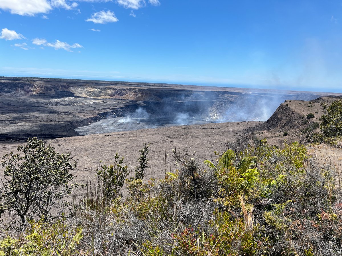
Main caldera overlook since the 2018 earthquakes condemned the Jaggar Museum. Big paved pullout, viewing platform with interpretive panels. Closest open viewpoint to Halemaʻumaʻu when accessible. Currently closed (April 2026).
Approach Cue (~12-15 sec)Show transcript
Coming up on the left in about half a mile—Kīlauea Overlook, the main caldera overlook. Big paved pullout with signs and railing along the edge. You'll see crowds.Arrival Narration (~45-60 sec)Show transcript
You're looking straight at Halemaʻumaʻu Crater—the active vent sitting inside Kīlauea Caldera—and the wind up here can grab your hat without warning. This is the main caldera overlook the park has open to the public now. After the 2018 earthquakes collapsed part of Halemaʻumaʻu, the crater widened to roughly a mile across, and when the volcano erupts, you're watching the lava lake directly from where you stand. The old Jaggar Museum used to sit closer to the rim south of here, but those same quakes cracked the buildings beyond repair. The new viewing platform with its interpretive panels replaced it. If you're here for sunset, the late-day light on the caldera wall is sharp and clear. Uēkahuna, the highest point on the rim, is just ahead—half a mile or so if you want to keep moving. -
Currently closed
 2 min from previous stop · 0.7 miHAVOMILE2.6
Why closed: Heavy tephra fallout from March 10, 2026 eruption + ongoing deconstruction and overlook repairs (NPS estimates two-year timeline).
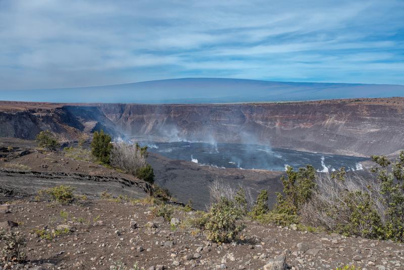
Highest point on the caldera rim (~4,090 ft). Closed for years after the 2018 collapse damaged the cliff edge; reopened in 2023 with new viewing area and railing; closed again after March 2026 eruption fallout. Cultural significance — wahi pana of Kaluapele, used for Native Hawaiian ritual and cultural practices. End of the open west section when accessible, turnaround point.
Approach Cue (~12-15 sec)Show transcript
Coming up on the left in about half a mile—Uēkahuna, the end of the open road on this side. Pull-through parking and a viewing platform. This is the turnaround point for the west section when it's open.Arrival Narration (~45-60 sec)Show transcript
You're at Uēkahuna, the highest point on the rim of Kaluapele, Kīlauea Caldera, at about 4,090 feet. The wind here is real. From this angle you see more of the caldera floor at once, more of the eastern wall stretching out. On a clear day Mauna Loa fills the western horizon. This is a wahi pana—a legendary place of deep cultural significance to Native Hawaiians. People made the climb to this rim for reasons that had nothing to do with tourism. Treat it accordingly. You're at the turnaround on the west side of Crater Rim Drive. Head back the way you came when you're ready, past Kīlauea Overlook, Steam Vents, Volcano House, and the welcome area. The east side picks up just beyond there. Linger here for the view and wind. -
Connector · HAVO 9 min drive · 4 mi
Uēkahuna to Kīlauea Iki Connector
Show transcript
You're heading back along the rim now, tracing the same caldera from the back side. Let your eyes adjust—shift from those volcanic blacks to the green and brown of the surrounding forest. You have about four miles before the east lobe picks up. When you pass the welcome area, keep going. The east side starts almost immediately after. You're heading toward Kīlauea Iki Overlook next, the crater that erupted in 1959. -
 9 min from previous stop · 4 miHAVOMILE6.4
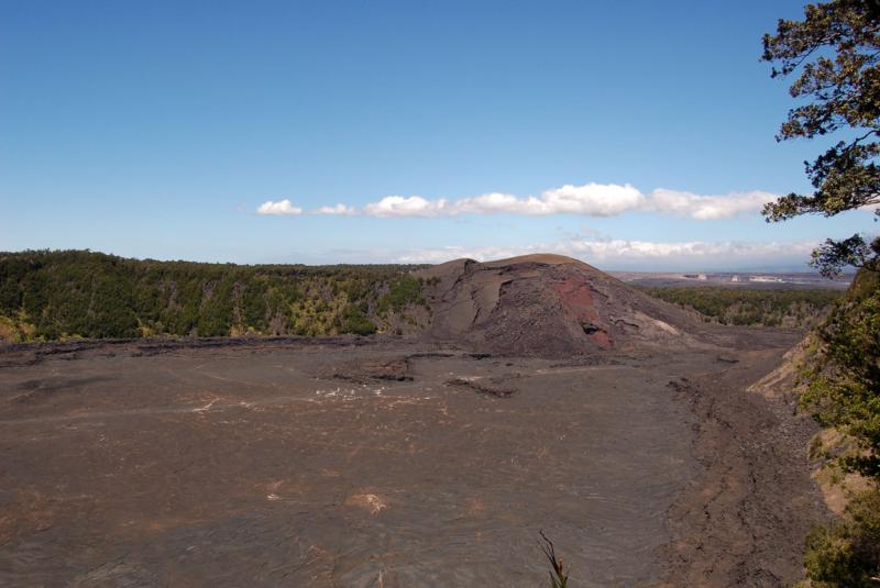
View into Kīlauea Iki Crater, the satellite crater that erupted spectacularly in November-December 1959. Trailhead for the Kīlauea Iki Trail (4-mile loop, descends to crater floor). Crater is roughly a mile long, ~3,000 ft across. Currently open (March 2026 reopening). 1959 eruption details verified via USGS — 17 episodes from Nov 14 to Dec 20, max fountain height 580 m / 1,900 ft on episode 15.
Approach Cue (~12-15 sec)Show transcript
Coming up on the right in about a quarter mile—Kīlauea Iki Overlook. Big paved pullout with a direct view into the crater that erupted in 1959. If you want to hike, the Kīlauea Iki Trail loops four miles down to the crater floor.Arrival Narration (~45-60 sec)Show transcript
That black crater floor below you is still hot underneath. You're looking at Kīlauea Ili, a satellite crater about a mile long and 3,000 feet across. What looks like solid ground erupted violently in late 1959. Lava fountains shot up seventeen times over 36 days, the highest reaching 1,900 feet into the air. That hardened surface you see is the lava lake that filled the crater during those weeks. Sensors buried in the crater wall picked up heat for decades after. The Kīlauea Ili Trail starts right here at the overlook — a 4-mile loop that descends to the crater floor and crosses it. If you have the time and legs, it's a serious hike worth doing. Otherwise, take in the scale and head mauka up the road to Nāhuku, the Thurston Lava Tube. -
 2 min from previous stop · 0.4 miHAVOMILE6.9
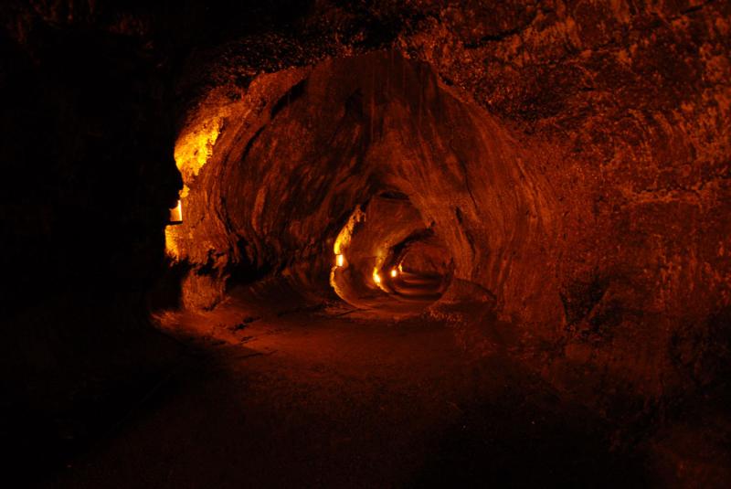
Nāhuku, also known as Thurston Lava Tube. Approachable from Crater Rim Drive East; Escape Road approach from Hwy 11 is currently closed (March 2026 storm/eruption damage). Short loop walk through tropical rainforest to the tube entrance. Tube is roughly 500 years old, ~600 ft long, walkable, lit. Wheelchair accessibility limited.
Approach Cue (~12-15 sec)Show transcript
Coming up on the right in about a quarter mile — Nāhuku, the Thurston Lava Tube. Short walk through rainforest takes you to a 500-year-old tube you can walk through. The Escape Road approach from Highway 11 is closed right now, so this is your only way in.Arrival Narration (~45-60 sec)Show transcript
You're standing in a fern forest — look up, and you'll see ʻōhiʻa lehua trees with red blossoms, maybe a native bird if you wait long enough. This is Nāhuku, also called Thurston Lava Tube. You're walking through lush rainforest on top of an active volcano, and that contrast is the point. The canopy is so dense that it's easy to forget you're standing on cooled lava. The tube itself is about five hundred years old — a hollow tunnel that formed when the surface of a lava flow crusted over while molten rock kept moving underneath. When the eruption stopped, the core drained out and left this empty passage. It's roughly six hundred feet long, lit with electric lights, and walkable, though the ceiling drops in places and the floor stays slick from constant drip. Watch your head. Take your time in here. When you head back up, Devastation Trail is the next stop. -
3 min from previous stop · 1.4 miHAVOMILE7.9
Combined stop. Cinder field from the 1959 Kīlauea Iki eruption. Puʻu Puaʻi ("gushing hill") is the cone built by those 1,900-foot fountains. Devastation Trail is a 1-mile out-and-back paved walk through the cinder field. Easy, accessible.
Approach Cue (~12-15 sec)Show transcript
Coming up on the right in about a quarter mile—Devastation Trail and Puʻu Puaʻi Overlook. Pull in to walk through the cinder field from the 1959 eruption. It's a paved mile out and back, easy and accessible.Arrival Narration (~45-60 sec)Show transcript
You're looking at Puʻu Puaʻi, the steep red-black cinder cone that rose makai—toward the mountain—during 36 days in 1959. The 1,900-foot lava fountains from Kīlauea Iki threw cinder and ash across the trade winds, burying the ʻōhiʻa rainforest under tens of feet of hot material. Every tree died where it stood. Walk the Devastation Trail, a mile out-and-back on pavement, and you'll see the bleached white skeletons still rising from the black cinder. The forest is returning now—ʻōhiʻa seedlings, ferns, and lichens colonizing the fresh ground. You're watching regrowth happen in real time. Head back to the car when you're ready. Keanakākoʻi is next. -
Connector · HAVO 2 min drive · 0.9 mi
Devastation Trail to Keanakākoʻi Connector
Show transcript
The road curves south now, leaving the cinder field behind—that dark volcanic sand that covered everything around Devastation Trail. Ahead is the caldera's south flank, where the landscape opens into the south rim. That's the side that collapsed in 2018. The ground fractured badly, and you can see the evidence in the cracks and drops along the rim. The park set the closure barrier because driving here became more dangerous than it used to be. Keep your eyes on the road; the terrain's less forgiving now. -
 2 min from previous stop · 0.9 miHAVOMILE9.4
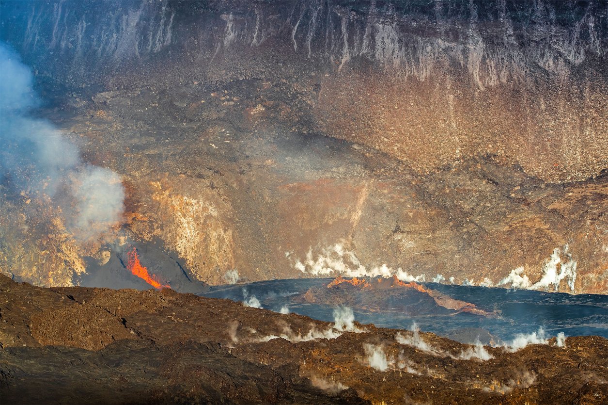
Pit crater on the south rim. Name means "the cave in which adzes were made" — references an ancient quarry of dense basalt used for Hawaiian stone tools. Newer overlook, post-2018 view into the active caldera from the south. Reopened to vehicles March 18, 2026 after eruption-related closure.
Approach Cue (~12-15 sec)Show transcript
Keanakākoʻi coming up on the right in about half a mile — pit crater overlook with views into Kīlauea Caldera from the south. Pull in; the overlook is a short walk from the parking area.Arrival Narration (~45-60 sec)Show transcript
You're standing on ground that cracked open in 2018. Those fissures around your feet are from the collapse that reshaped this entire rim. Keanakākoʻi, the cave where adzes were made, sits on a quarry of dense basalt that ancient Hawaiians carved into stone tools. Look mauka — toward the mountain — and what spreads before you is Kaluapele, Kīlauea Caldera, visible from this overlook for the first time since the 2018 event. Before the collapse, there was no viewpoint here. The south rim broke first, and this new vantage exists because the old terrain failed. Scan across two miles to the opposite rim where Kīlauea Overlook sits on the west side — that's the main caldera viewpoint when it's open. The ground between you and that rim is brand-new in geological time, less than a decade old in places. The road ends at a closure barrier just down from here. -
0 min from previous stop · 0.1 miHAVOMILE9.9
Permanent closure barrier on Crater Rim Drive East — south rim is impassable due to 2018 collapse damage. Pre-2018 the road continued around to connect with Chain of Craters Road at the Devastation/Mauna Ulu junction. That loop is gone.
Approach Cue (~12-15 sec)Show transcript
End of the open road coming up in about half a mile. There's a closure barrier and a small pullout where you can turn around. Park for a minute, then head back the way you came.Arrival Narration (~45-60 sec)Show transcript
You're standing at a metal barrier where pavement simply ends. In 2018, the south rim of Kīlauea caldera collapsed, taking the road with it. What used to loop around here, connecting back to Chain of Craters Road, is gone now. The park chose geology and safety over a convenient drive. The only way forward is back the way you came. Head mauka—toward the mountain—retracing Crater Rim Drive past Keanakākoʻi, Devastation Trail, Nāhuku, and Kīlauea Iki. You'll roll back into Volcano House and the welcome area, where we've got one more stop. If your day still has light, Chain of Craters Road starts just up that way—that's the half-day coastal descent we mentioned at the start. -
Outro
Outro
Show transcript
You've just seen what's open on Kīlauea's rim today. The rim changes constantly—closures reopen, open stops shut down without warning. The view is never the same twice, which means you should come back. What you experienced today is the most accessible look into an active volcano caldera anywhere. Steam rising from the ground. A caldera floor that resurfaced itself less than ten years ago. Forest reclaiming craters from eruptions people still remember. None of it's finished. If you've got more time, Chain of Craters Road drops toward the sea. Otherwise, the Volcano House lanai catches the late afternoon light perfectly. Sit there. Watch the caldera. The volcano isn't done.
This tour is created with AI from HawaiiGuide route content and read by the computer-generated Mele and Kani voices. Hawaiian names and place names may occasionally be mispronounced — mahalo for your patience as we refine.
Pair this drive with another
Routes weave together. When you're done with the rim, here's where to go next.
Big Island · 18 mi · 1-way
Chain of Craters Road →
The descent from Kīlauea summit to the sea — 3,700 feet down through pit craters, rift-zone lava, and a sea arch where the road dead-ends because lava buried it. Starts at the junction where Crater Rim Drive ends.
Start the audio tour »
Big Island · 82 mi · 1-way
Hilo to South Point →
The long-corridor drive from Hilo down Highway 11 to Ka Lae, the southernmost point in the U.S. Passes the HVNP gateway at Volcano Village — useful context for how this park fits into a wider Big Island trip.
Start the audio tour »
Need help planning?
Search & Planning Chat →

Hawaiʻi Weather Forecast
Today’s Weather Brief · Audio · ~45s
0:00
0:54
Read the transcript
Trades are breezy right now with scattered showers on the windward side and mountains; the leeward coast stays mostly dry. Tomorrow stays breezy with the same pattern.
A tropical disturbance southeast of the islands is likely to become a tropical storm by mid-week and approach the state Thursday through Saturday. The exact track is still uncertain. If it comes closer, expect heavier rain over a longer stretch; if it stays farther out, impacts will be shorter and lighter. Winds will increase late this week, with potential gusts over 70 miles per hour on the highest summits.
Plan your leeward beach time and snorkeling for today through Tuesday. Save summit drives and offshore water sports for after Saturday, and check updates daily as this develops.
Created with AI from the official NWS forecast discussion · verify with NWS before heading out
Loading forecast…
Temperature
Weather data by Open-Meteo.com
Current Time in Hawaiʻi
--:----
Hawaiʻi Standard Time · UTC−10 · No Daylight Saving
You’re on Hawaiʻi timeMainland US
International
Aloha Today daily podcast →
Full HST breakdown, FAQ & DST schedule →

Get Your Free Hawaii Visitor Guide
Enter your email and we'll send you instant access to our free 2026 Hawaii Starter Guide + Summary Guidesheets.