
Hawaiʻi Guide · Audio Driving Tour
Hilo to South Point BETA
A long-corridor drive down the Hawaiʻi Belt Road from Hilo through Volcano, Pāhala, and Naʻalehu to the southernmost point in the United States. Big climate shifts — rainforest to upland to lava country to the dry south coast. Passes the gateway to Hawaiʻi Volcanoes National Park at Volcano Village, where you can pivot onto Crater Rim Drive or Chain of Craters as separate audio tours. Ends at the Papakōlea / Green Sand Beach parking lot — from there it's a 2.5-mile hike each way to the actual beach.
82 miles
~2h 15min driving
9 curated stops
Free self-guided audio tour
~2h 15min
total driving time
82 mi
total distance
9 stops
curated stops
5-7h
suggested day
We may link to trusted Hawaiʻi resources at no extra cost to you.
Before you drive:
Some rental car contracts prohibit South Point Road — the pavement is fine, but check yours. You pass the Hawaiʻi Volcanoes National Park entrance near Volcano Village midway along this route; treat the park as its own day, not a side trip on this drive. At the Green Sand Beach parking lot, ignore informal "shuttle" offers and follow posted DHHL (Hawaiian Home Lands) access rules. The legal route to the beach is a long, hot, exposed hike from the parking lot.
Build your own route
Pick a preset or tap the ✓ Include chip on any stop below to customize.
9
of 9 stops selected
-
Intro
Intro
Show transcript
You're driving eighty miles today, from Hilo down to Ka Lae — the southernmost point in the fifty states. Plan a full day. This isn't a checklist drive. You'll cross rainforest, volcano country, desert, and dry coast. The road's Highway 11, two lanes the whole way, paved and straightforward. One thing: gas up here in Hilo or at Volcano. After that, Naʻalehu's your next reliable stop, sixty miles in. The road curves plenty — take your time with the corners. Watch for nēnē out there. Let's go. -
 HI 11MILE5
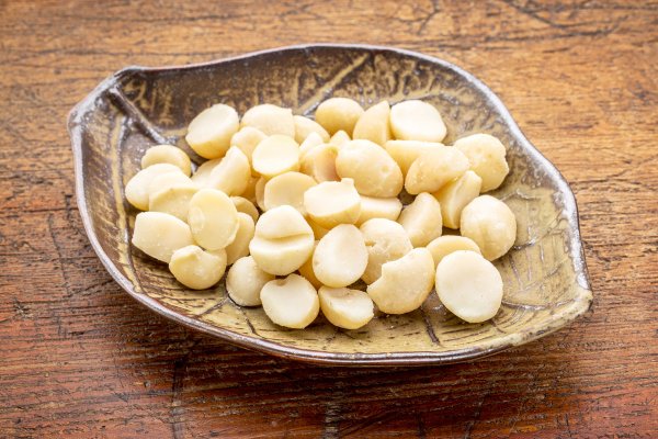
Mauna Loa Macadamia Nut Visitor Center, on Macadamia Rd off Hwy 11 in Keaau. Self-guided factory floor view (windows over the assembly line), free samples, short native-plant nature walk, gift shop. Open Mon-Sat 9-4, closed Sundays. Verified via Hawaiian Host (parent co) site.
Approach Cue (~12-15 sec)Show transcript
Coming up on the left in about a mile—Mauna Loa Macadamia Nut Visitor Center. Macadamia Road turns off Highway 11 in Keaau; look for the brown sign. Watch the factory floor through windows, grab free samples, take a quick nature walk. Closed Sundays.Arrival Narration (~45-60 sec)Show transcript
You're standing at a working macadamia nut factory. If you're quiet, you'll hear the machinery running inside—thousands of nuts tumbling through the line at once. This isn't a museum. The Mauna Loa Macadamia Nut Visitor Center processes the actual crop; those nuts you've bought with the Mauna Loa label probably came through this building. A glass-walled mezzanine lets you watch the whole operation without a formal tour guide. You move at your own pace. Mauka—toward the mountain—there's a short paved walk through the macadamia orchard itself, with signs identifying native plants and invasive species. The gift shop inside offers free samples. Plan twenty minutes if you're stopping. Restrooms are inside. Volcano Village lies about twenty-five miles further up Highway 11. -
Connector · HI 11 34 min drive · 23.9 mi
Hilo to Volcano Connector
Show transcript
The road's climbing now, and you'll notice the air getting cooler every couple miles. Highway 11 takes you from sea level up to about 4,000 feet, and the land shifts as you go. The Hilo side gets more rainfall than almost anywhere else in the United States—hāpuʻu ferns, ʻōhiʻa lehua trees, thick canopy overhead. The towns coming up—Kurtistown, Mountain View, Glenwood—they're old logging and farming communities, mostly quiet residential now. Take your speed down through the towns. You're heading toward Volcano Village, which sits right at the gateway to Hawaiʻi Volcanoes National Park. -
 34 min from previous stop · 23.9 miHI 11MILE28
HVNP gateway stop. The park entrance is just south of Volcano Village on Hwy 11, at MM 28. This is the cross-route CTA hub — point listeners at Crater Rim Drive and Chain of Craters as separate audio tours. Volcano Village itself has restaurants (The Rim, Tuk-Tuk Thai, Lava Rock Café), a small grocery (Volcano Store), and lodging (Volcano House inside the park, plus B&Bs in the village). Last gas before South Point.
Approach Cue (~12-15 sec)Show transcript
Coming up on your left in about a mile: Volcano Village, then the main entrance to Hawaiʻi Volcanoes National Park. This is your last gas for sixty miles. If you need a meal, grab one of the village restaurants or the small grocery. Park entrance is thirty dollars per vehicle, valid for seven days.Arrival Narration (~45-60 sec)Show transcript
You're standing at the gateway to Hawaiʻi Volcanoes National Park, and the main entrance sits just ahead on the left. The park covers more than three hundred thousand acres—Kīlauea Caldera, Mauna Loa's south flank, lava fields running all the way to the coast. It's geologically active and one of the most visited national parks in the country, but what catches people off guard is the time commitment. Most visitors spend half a day minimum inside. We have two separate audio tours for the main drives: Crater Rim Drive hugs the caldera rim and takes about three hours; Chain of Craters Road descends thirty-seven hundred feet to the coast and needs a half day with stops. If you want to explore today, pull up the Hawaii Guide page for the route you want. If not, Highway 11 curves south from here and drops into Kaʻū—Pāhala's about twenty-five miles ahead. Last gas before then is right here in Volcano Village. -
Connector · HI 11 29 min drive · 25 mi
Volcano to Pāhala Connector
Show transcript
You're on the south flank of Mauna Loa now, coming down out of the rainforest into the Kaʻū Desert. The change happens gradually but you'll see it. The trees thin. The rainfall drops. The sky opens. Black lava fields show up on both sides of the road. Most of what surrounds you came up out of the ground in the last few thousand years. Kaʻū is the largest of the Big Island's six districts and the least populated. A single road runs through it. Sugar dominated the economy for a hundred years and then it didn't. The Pāhala Sugar Mill closed in 1996. The towns down here have a quieter, sparser feel than what you left behind—old plantation communities figuring out what comes next. -
 29 min from previous stop · 25 miHI 11MILE56
Pāhala. Old sugar plantation town, mill closed 1996. Population ~1,300. Has a school, post office, gas station, market. Edmund C. Olson Trust bought much of the former sugar lands and now grows Kaʻū coffee here. Wood Valley Road turns mauka from town and goes up to the Kaʻū Coffee Mill (separate stop).
Approach Cue (~12-15 sec)Show transcript
Pāhala's coming up—an old sugar plantation town where the mill closed in 1996. You'll see the turnoff to the right just past Punaluʻu Stream. Pull in if you want to see the town itself, or stay on Highway 11 and head straight to Kaʻū Coffee Mill, which is your next stop up Wood Valley Road from there.Arrival Narration (~45-60 sec)Show transcript
The mill closed in 1996, but Pāhala stayed—about thirteen hundred people, a school, a post office, a gas station, a market, and rows of old plantation housing arranged the way sugar towns were built. You can still see how the community organized itself around where the mill used to stand. The land kept working. Edmund Olson took over much of the former sugar acreage and now grows Kaʻū coffee in the same dirt that once held cane. The coffee has won international cuppings repeatedly over the last fifteen years and is becoming competitive with Kona. If you're hungry or need a break, stop here. Otherwise, Wood Valley Road turns mauka—toward the mountain—from town. That's where the Kaʻū Coffee Mill is, and that's your next stop. -
 5 min from previous stop · 2.6 miHI 11MILE58
Kaʻū Coffee Mill, 96-2694 Wood Valley Rd, Pāhala. Open daily 9-4. Free tours Mon-Fri at 11 a.m. and 1 p.m. Tasting bar with multiple Kaʻū roasts. Owned by Edmund C. Olson Trust (the former sugar landholder). Rare Hawaiian Coffee branding.
Approach Cue (~12-15 sec)Show transcript
Coming up on the mauka side—Wood Valley Road turnoff for Kaʻū Coffee Mill. Free tours Monday through Friday at 11 a.m. and 1 p.m., or stop by the tasting bar to sample their roasts.Arrival Narration (~45-60 sec)Show transcript
You can smell the roast from the parking area — that deep, caramel-dark aroma that hits different when it's coming from a working mill. You're standing at Kaʻū Coffee Mill, a processing facility for one of Hawaiʻi's quietly serious coffee origins. Kaʻū flies under the radar compared to Kona, but in the last fifteen years it's been winning international specialty-coffee competitions. The volcanic soil, the elevation on Mauna Loa's slope, the rainfall — conditions are nearly identical to Kona's. Sugar collapsed here first, though. Kaʻū only became a coffee region after that shift. The mill runs free guided tours weekday mornings and early afternoons. You'll walk the whole chain from cherry to bagged bean. There's a tasting bar inside where you can sample three or four different roasts. Spend thirty to forty-five minutes if you do the tour, less if you're tasting only. When you're done, Punaluʻu Black Sand Beach is about five miles south on Highway 11. -
 13 min from previous stop · 8.5 miHI 11MILE63
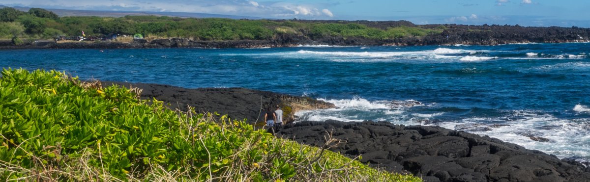
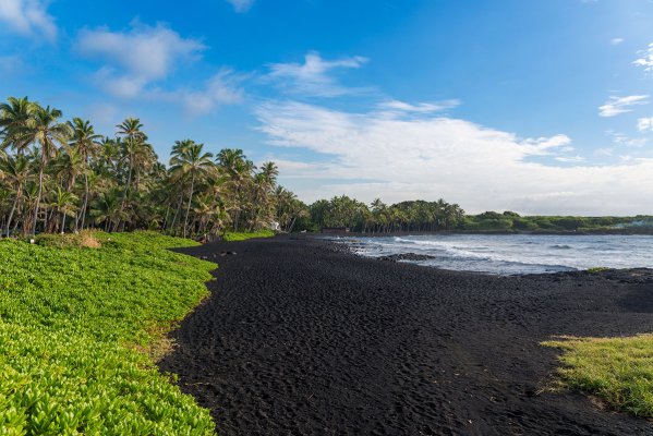
Punaluʻu Black Sand Beach, off Hwy 11 via Ninole Loop Rd. Honu (green sea turtle) and occasionally hawksbill bask on the sand. Sacred site to Native Hawaiians — burial ground in the area. Lifeguarded park, restrooms, picnic tables. Strong currents and rip — swimming generally not recommended. Treat the turtles with respect — federal law requires 10-foot distance, no touching, no flash photography.
Approach Cue (~12-15 sec)Show transcript
Coming up on the makai side in about a mile—Punaluʻu Black Sand Beach, via Ninole Loop Road. Honu bask here regularly, and it's a sacred site to Native Hawaiians. Easy paved access, parking lot right there. Strong currents mean swimming's not safe, but the black sand and turtles make it worth seeing. Keep ten feet back, no flash photography.Arrival Narration (~45-60 sec)Show transcript
Feel that heat radiating off the black sand beneath your feet. That's real lava, broken down grain by grain by the ocean. The white foam, the coal-dark beach, coconut palms behind it all—it's the view that stops every visitor. What you're really here for is the honu. Hawaiian green sea turtles haul out on this sand to bask, sometimes a dozen or more at once. They're protected by federal law—you need to stay ten feet back, no touching, no flash photography. Lifeguards will enforce it. This is also sacred ground. There are Native Hawaiian burial sites here and heiau remains visible at the north end of the beach. Don't take rocks or sand, don't move anything that looks intentional. Swimming isn't the move—currents are strong and rips run parallel to shore. Watch the turtles, respect the place. When you're ready, head back to Highway 11. Punaluʻu Bake Shop is about a mile further on the highway in Naʻalehu. -
 13 min from previous stop · 9 miHI 11MILE65
Punaluʻu Bake Shop, 95-5642 Mamalahoa Hwy, Naʻalehu. Self-described "southernmost bakery in the U.S.A." at latitude 19°4'. Famous for malasadas (Portuguese doughnuts) and Hawaiian sweetbread. Naʻalehu is the southernmost town in the 50 states. Open daily ~8:30-5:00. Verified via bakeshophawaii.com and Yelp.
Approach Cue (~12-15 sec)Show transcript
Coming up on the makai side in about a quarter mile—Punaluʻu Bake Shop in Naʻalehu, the southernmost bakery in the U.S. Pink building with a big sign. They're famous for malasadas, those Portuguese doughnuts. Parking fills up fast.Arrival Narration (~45-60 sec)Show transcript
You're standing at the southernmost bakery in the United States. That fact—latitude 19°4'—is framed on the wall inside, and it matters because you're in Naʻalehu, the southernmost town in all fifty states. What you actually came for is a malasada, the Portuguese fried dough rolled in sugar that plantation workers brought here in the eighteen seventies. Punaluʻu does them in the original sugar version or filled with guava, lilikoi, custard, or haupia. They also make Hawaiian sweetbread—that soft, eggy loaf you've had at luaus—and it travels home well if you want it. There's coffee, sandwiches, lunch plates if you need something heavier. Bathrooms are in the back. This is the last food stop before South Point. The road out to Ka Lae is empty, and Green Sand Beach requires a five-mile round-trip hike if you do it the legal way. Eat now, fill your water bottle, use the bathroom, then head south. The turnoff is about five miles ahead. -
Connector · HI 11 10 min drive · 5.7 mi
Naʻalehu to South Point Road Connector
Show transcript
The land's opening up now—grassland, dry, that feeling you get moving into leeward country. This is ranch land. The wind's going to pick up noticeably as you head south. One of the windiest places in the islands. You'll see the wind turbines soon, fourteen of them on the upper slope, capable of twenty megawatts. When you hit South Point Road—a left turn marked between mile markers sixty-nine and seventy—that's your exit. Twelve miles down from Highway Eleven on a paved one-lane road. We'll pick up at the turnoff. -
 10 min from previous stop · 5.7 miHI 11MILE70
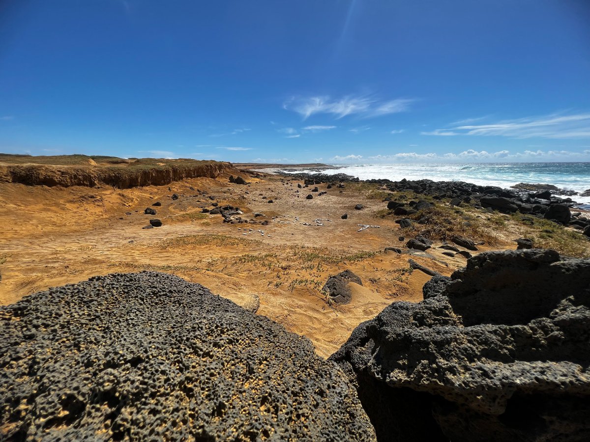
South Point Road junction with Hwy 11, between mile markers 69 and 70. Road is 12 miles, paved one-lane with frequent passing pulloffs. Pakini Nui Wind Farm is visible from the descent — 14 turbines, 20.5 MW, operational since 2007. Some rental car contracts prohibit South Point Road; verify before driving. The road is paved (not gravel) but narrow.
Approach Cue (~12-15 sec)Show transcript
Coming up on the left in about half a mile—South Point Road turnoff, marked with a green sign. The road is paved but narrow, one lane with passing pulloffs. Twelve miles down to the parking lot at the end. Some rental car contracts prohibit this road, so verify yours first.Arrival Narration (~45-60 sec)Show transcript
You'll feel the wind hit almost immediately. South Point Road drops twelve miles to the southernmost point in the United States, and the trade winds pick up fast. In about two miles you'll spot the Pakini Nui Wind Farm on the slope mauka—fourteen turbines, 20.5 megawatts, running since 2007. There was an older farm here called Kamaoa in the eighties that fell apart in the wind it was built to harvest. The road is paved one-lane all the way, with passing pulloffs every quarter mile. When you meet oncoming traffic, somebody pulls in and waves. It's slow going, especially near the bottom where cattle cross the pavement. Check your rental car contract first—some prohibit this road. Take it easy on the descent and you'll reach Ka Lae at the end of the pavement. -
18 min from previous stop · 10.7 miHI 11MILE79
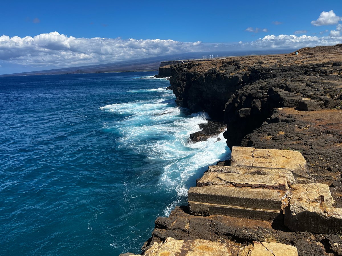
Ka Lae, southernmost point of the United States (excluding territories). Believed to be one of the first landing sites of Polynesians, possibly from the Marquesas around 400 CE. Ancient mooring holes carved into the cliff edge — small holes in the rock used to anchor canoes. WWII Morse Field airstrip ruins on the way to the point. Cliff jumping is a thing here (~40 feet) but not endorsed — drowning deaths every year. National Historic Landmark.
Approach Cue (~12-15 sec)Show transcript
Coming up on the makai side in about half a mile—Ka Lae, the southernmost point of the United States. Park near the cliff edge where the pavement runs out, walk to the rail, and look down at the cliff face where the land meets the sea. You'll see mooring holes carved into the rock, used to anchor canoes. Wind's fierce out here, so stay back from unfenced edges.Arrival Narration (~45-60 sec)Show transcript
You're standing at Ka Lae, the southernmost point in the fifty states. Look makai—toward the ocean—and that cliff drops forty feet straight into the Pacific. Nothing south of here except Antarctica. Polynesian voyagers from the Marquesas likely landed here in the third or fourth century, navigating by stars and ocean swells across thousands of miles of open ocean. If you look near the cliff edge, you'll spot the mooring holes—small hand-drilled pockets in the basalt where they tied their canoes. Some are over a thousand years old and still work. Inland a short walk is Kalalea, a fishing shrine local fishermen still use. The concrete pads and foundations scattered around are what's left of WWII Morse Field, built in 1943 and abandoned after the war. Cliff jumping happens here, and people drown doing it every year. The currents are strong, the swell changes fast, and the ladder back up is corroded. Linger with the mooring holes if the light is good, then take the dirt access road about a mile and a half east to Green Sand Beach Parking Lot. -
 3 min from previous stop · 1.5 miHI 11MILE82
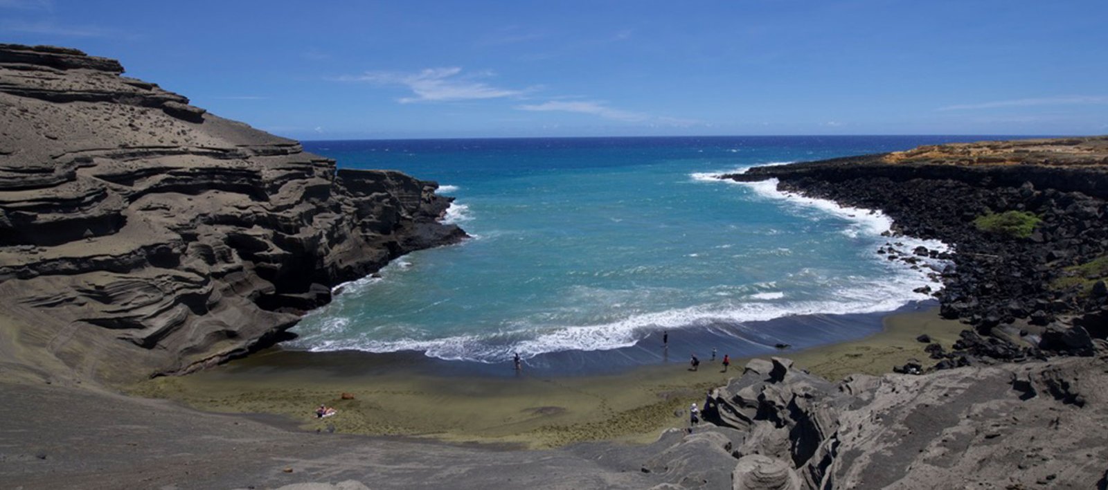
Papakōlea / Green Sand Beach Parking Lot. The route's terminus. The actual beach is 2.5 miles each way from here on a dirt 4WD track that doubles as the hiking trail (5 miles round trip). The "shuttles" offered by individuals at the parking lot are NOT permitted by DHHL (Hawaiian Home Lands) — they operate without authorization, contribute to land degradation, and are illegal. Only the legal hike is endorsed here. Beach is one of four green sand beaches in the world; the green is olivine crystals weathered out of the cinder cone.
Approach Cue (~12-15 sec)Show transcript
Coming up ahead—the parking lot for Papakōlea Green Sand Beach, where this route ends. Park in the official lot, not the shoulder. The beach itself is 2.5 miles down a dirt track, five miles round trip on foot. The sand gets its green color from olivine crystals weathered out of the cinder cone.Arrival Narration (~45-60 sec)Show transcript
You're standing at the end of this road. The parking lot you're in is the official, legal access point for Papakōlea — Green Sand Beach — and the actual beach sits two and a half miles due makai (toward the ocean), along a dirt track that doubles as the hiking trail. Five miles round trip on foot, two to three hours total if you're hiking. Within minutes, individuals will approach you offering rides in flatbed pickups for fifteen or twenty dollars round trip. That land is Hawaiian Home Lands, administered by DHHL. Those rides operate without permission. The off-road traffic actively damages a culturally significant site. The legal way to reach the beach is to hike. The trail is exposed — almost no shade, lots of wind and dust. Bring at least two liters of water per person, sunscreen, a hat, sturdy shoes. The beach is one of four green sand beaches in the world. The green is olivine crystals weathered out of an old cinder cone called Puʻu Mahana, sitting right above the bay. Swimming is possible, but the shore break is rough and the cliffs around the bay get dangerous in big swell. -
Outro
Outro
Show transcript
You've just driven eighty miles across some wild terrain—rainforest, volcano country, lava plains, grasslands, and a green sand beach. That's the shape of this drive. If you're heading back to Hilo, you're looking at ninety minutes from here. Kona is another hour and a half if that's your next stop. And if you skipped Hawaiʻi Volcanoes National Park on the way down, plan a separate day for it. Crater Rim Drive on the rim of the caldera is a three-hour out-and-back. Chain of Craters Road descends from the summit to the sea—about a half day. Check the site for what's next. Thanks for riding along.
This tour is created with AI from HawaiiGuide route content and read by the computer-generated Mele and Kani voices. Hawaiian names and place names may occasionally be mispronounced — mahalo for your patience as we refine.
Pair this drive with the park
You pass the Hawaiʻi Volcanoes National Park entrance near Volcano Village midway along this route. Both park drives are their own commitments — best on a separate day from this one.
Big Island · out-and-back
Crater Rim Drive →
The two-lobe drive along the rim of Kīlauea Caldera. Steam vents, caldera overlooks, the 1959 Kīlauea Iki eruption site, the Volcano Art Center in the original 1877 lodge. About three hours with stops.
Start the audio tour »
Big Island · ~19 mi · 1-way
Chain of Craters Road →
The 3,700-foot descent from Kīlauea summit to the sea, ending where a 2003 lava flow buried the road. Pit craters, rift-zone lava fields, the Hōlei Pali switchbacks, Puʻuloa petroglyphs, sea arch.
Start the audio tour »
Need help planning?
Search & Planning Chat →

Hawaiʻi Weather Forecast
Today’s Weather Brief · Audio · ~45s
0:00
0:54
Read the transcript
Trades are breezy right now with scattered showers on the windward side and mountains; the leeward coast stays mostly dry. Tomorrow stays breezy with the same pattern.
A tropical disturbance southeast of the islands is likely to become a tropical storm by mid-week and approach the state Thursday through Saturday. The exact track is still uncertain. If it comes closer, expect heavier rain over a longer stretch; if it stays farther out, impacts will be shorter and lighter. Winds will increase late this week, with potential gusts over 70 miles per hour on the highest summits.
Plan your leeward beach time and snorkeling for today through Tuesday. Save summit drives and offshore water sports for after Saturday, and check updates daily as this develops.
Created with AI from the official NWS forecast discussion · verify with NWS before heading out
Loading forecast…
Temperature
Weather data by Open-Meteo.com
Current Time in Hawaiʻi
--:----
Hawaiʻi Standard Time · UTC−10 · No Daylight Saving
You’re on Hawaiʻi timeMainland US
International
Aloha Today daily podcast →
Full HST breakdown, FAQ & DST schedule →

Get Your Free Hawaii Visitor Guide
Enter your email and we'll send you instant access to our free 2026 Hawaii Starter Guide + Summary Guidesheets.